

Section 1. Pre-Trek Days in Quito (June 26–28, 2025)
Acclimatisation, Exploration, and Getting Into the Mountain Spirit
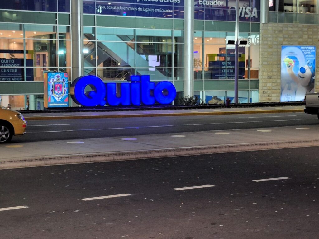
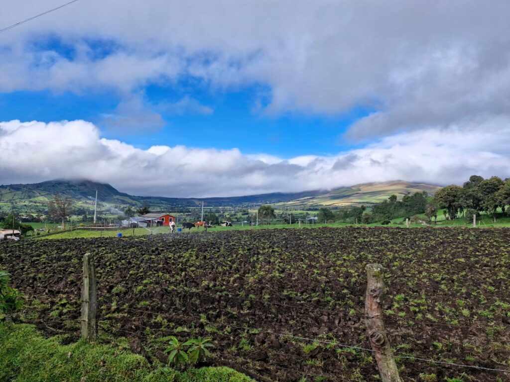
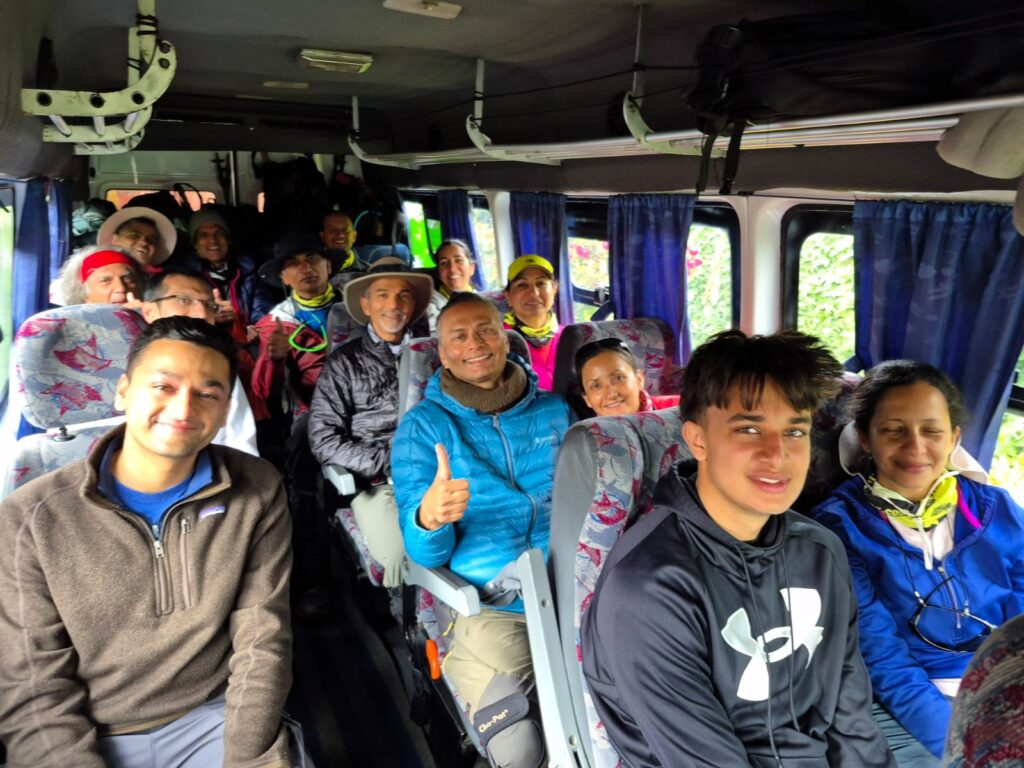
Our Ecuador adventure began with three calm yet purposeful days in Quito — a high-altitude capital city nestled in the Andes at 9,350 ft. Our team of 15 trekkers had come together from different parts of the world, all set to challenge ourselves across six breathtaking peaks ranging from 15,000 to nearly 21,000 ft: Rucu Pichincha, Corazón, Illiniza Norte, Cayambe, Cotopaxi, and Chimborazo.
Our group included:
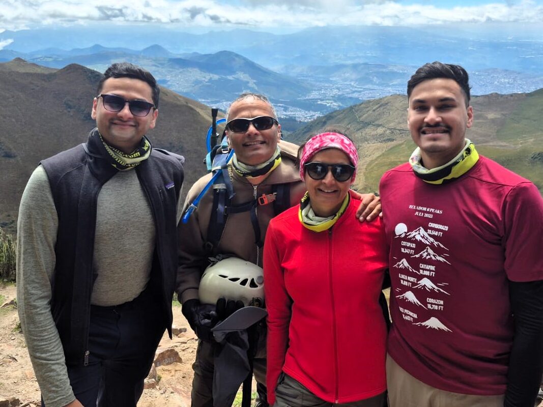
Samir Palnitkar, Anu Palnitkar, Aditya Palnitkar, Sahil Palnitkar, Arun Kumar, Priti Gairola, Srikanth Nandyala, Divya Yeraguntla, Jai Rawat, Gautam Vashist, Sushil Ranjan, Ashutosh Chauhan, Meenal Patwardhan, Neel Patwardhan, and Sagar Chivate.
We arrived in Quito between June 26 and 28, using these initial days to acclimate, explore, and mentally prepare for the adventure ahead.
Staying in the Heart of History
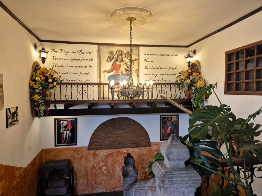
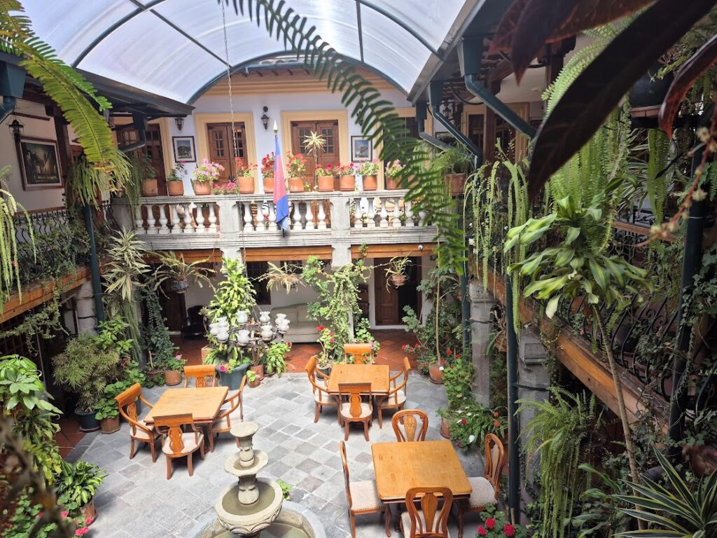
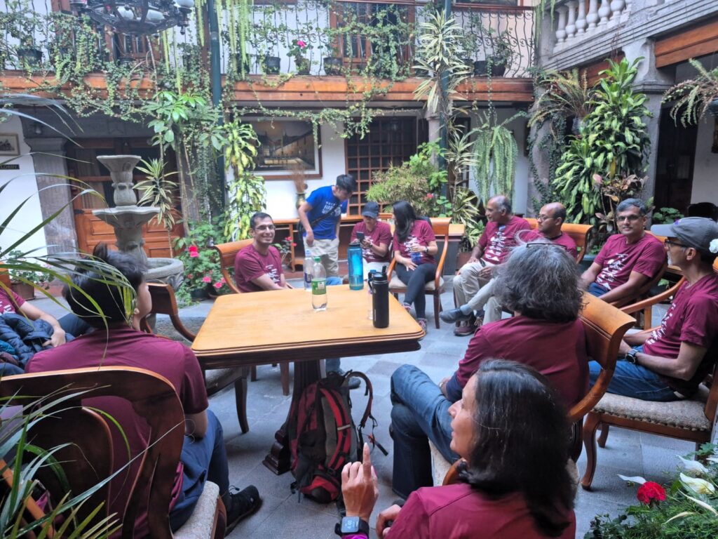
Our base was Hotel San Francisco de Quito, a charming colonial-era boutique hotel located in the city’s historic center. Originally built in 1698 and refurbished in 1989, it blends centuries-old architecture with modern comfort. One of the most memorable features? The breakfast room is located in what used to be a dungeon during the Spanish Inquisition — a chilling reminder of Quito’s deep and layered past. Despite its age, the hotel is extremely clean and comfortable. Highly recommended for anyone staying in the old town.
Acclimatization with Altitude and Culture
We spent much of our time getting our bodies used to higher altitudes, especially since our first trek was just around the corner.
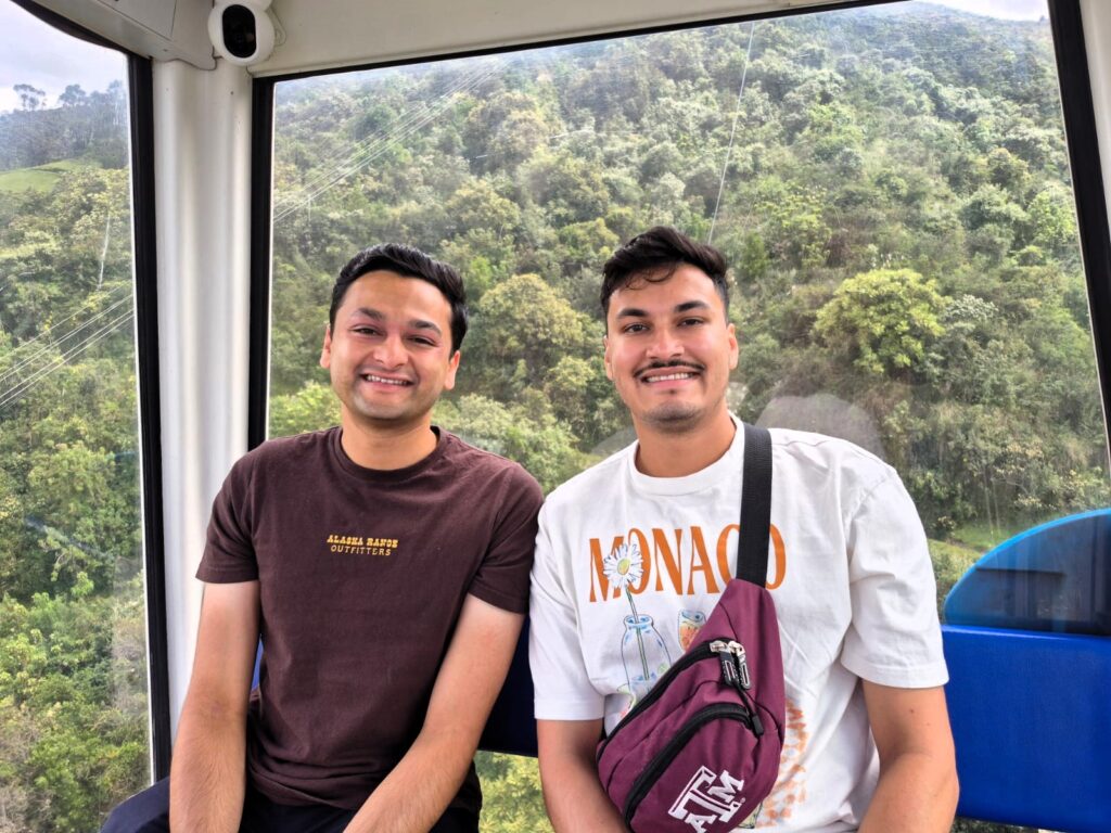
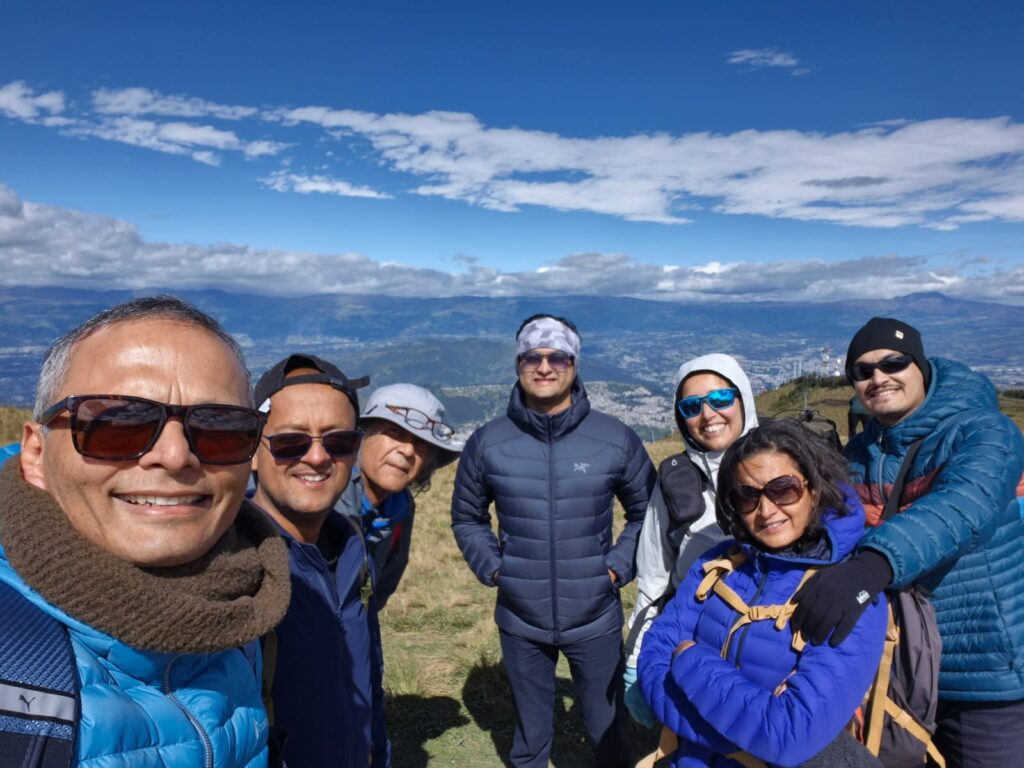
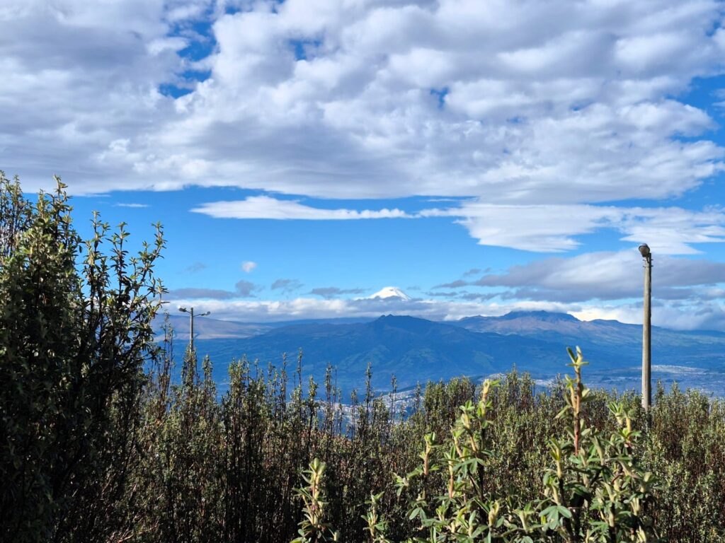
TelefériQo Rides to 13,400 ft: Each day, we took the TelefériQo, Quito’s famous gondola, to the Mirador de Los Volcanes (Volcano Viewpoint) at 13,400 ft. On clear days, the views were spectacular — sweeping panoramas that included Rucu Pichincha, Corazón, Rumiñahui, Cotopaxi, Cayambe, and Chimborazo.
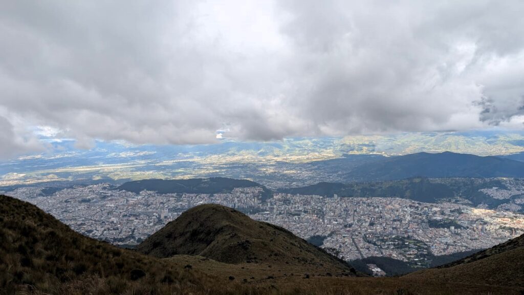
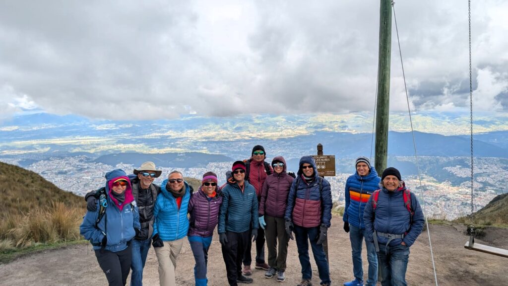
We stayed at altitude for 2–3 hours each day, letting our bodies slowly begin the process of acclimatisation. The reduced oxygen levels can trigger headaches, nausea, and fatigue, so spending time up high before trekking is essential.
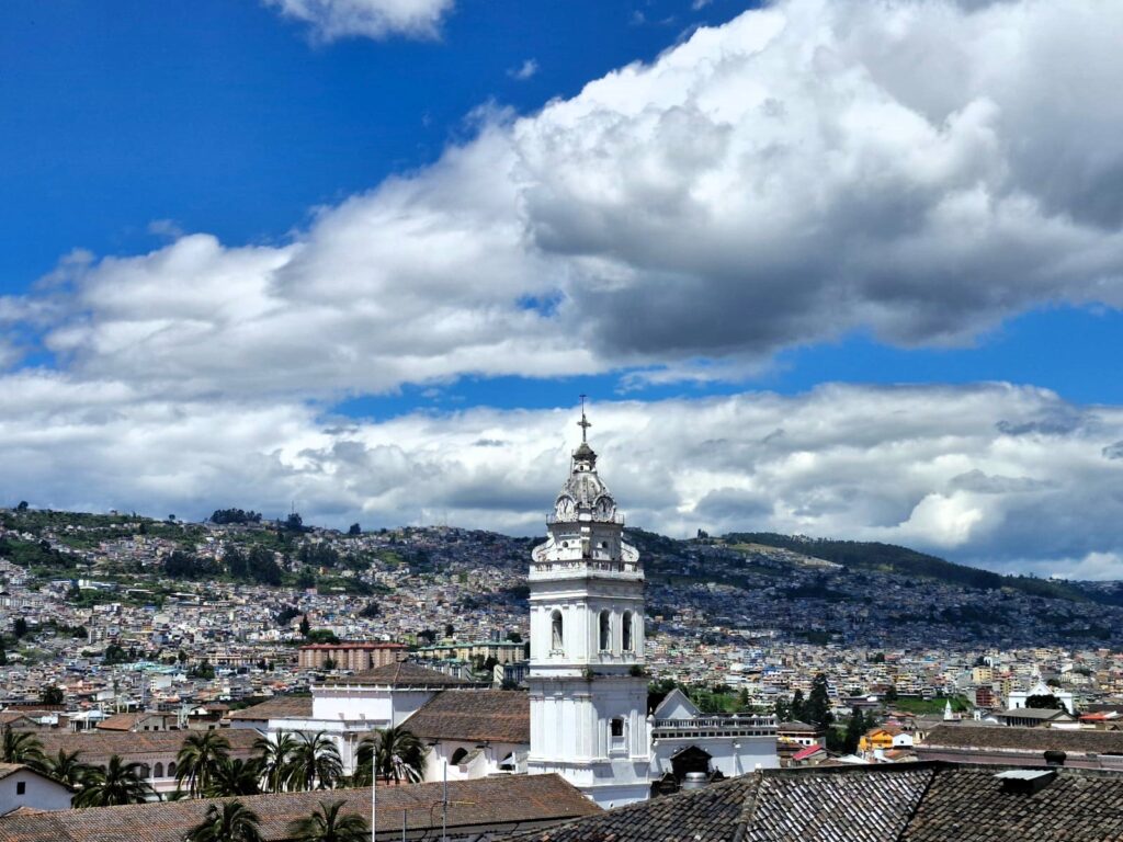
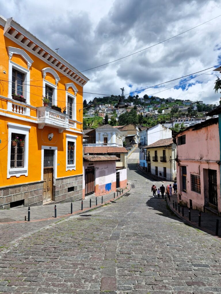
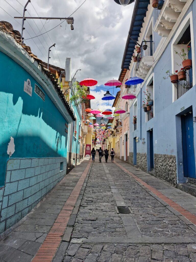
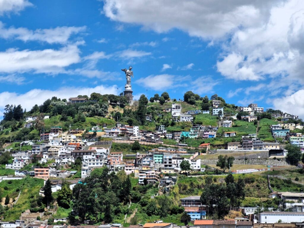
Exploring Quito: Even though many of us had visited Quito before — some as recently as May 2022 — the city’s vibrant charm pulled us in again. We explored the historic center on foot, revisited the iconic Virgin Mary statue, and spent time at the Mitad del Mundo (Equator Museum). Quito remains colorful, full of culture, and always inviting.
The Briefing: Gearing Up for the Peaks
On the evening of Saturday, June 28 at 4 PM, we gathered at the hotel for our official trek briefing, led by Diego, our local trek coordinator. There was a sense of excitement and camaraderie as everyone put on the maroon dry-fit t-shirts specially designed for this expedition — a visual symbol of our unity and shared purpose.
With our gear packed, spirits high, and lungs getting used to the thin air, we were ready. The mountains awaited. The adventure was about to begin.
Section 2. Rucu Pichincha – Into the Clouds (15,400 ft – June 29, 2025)
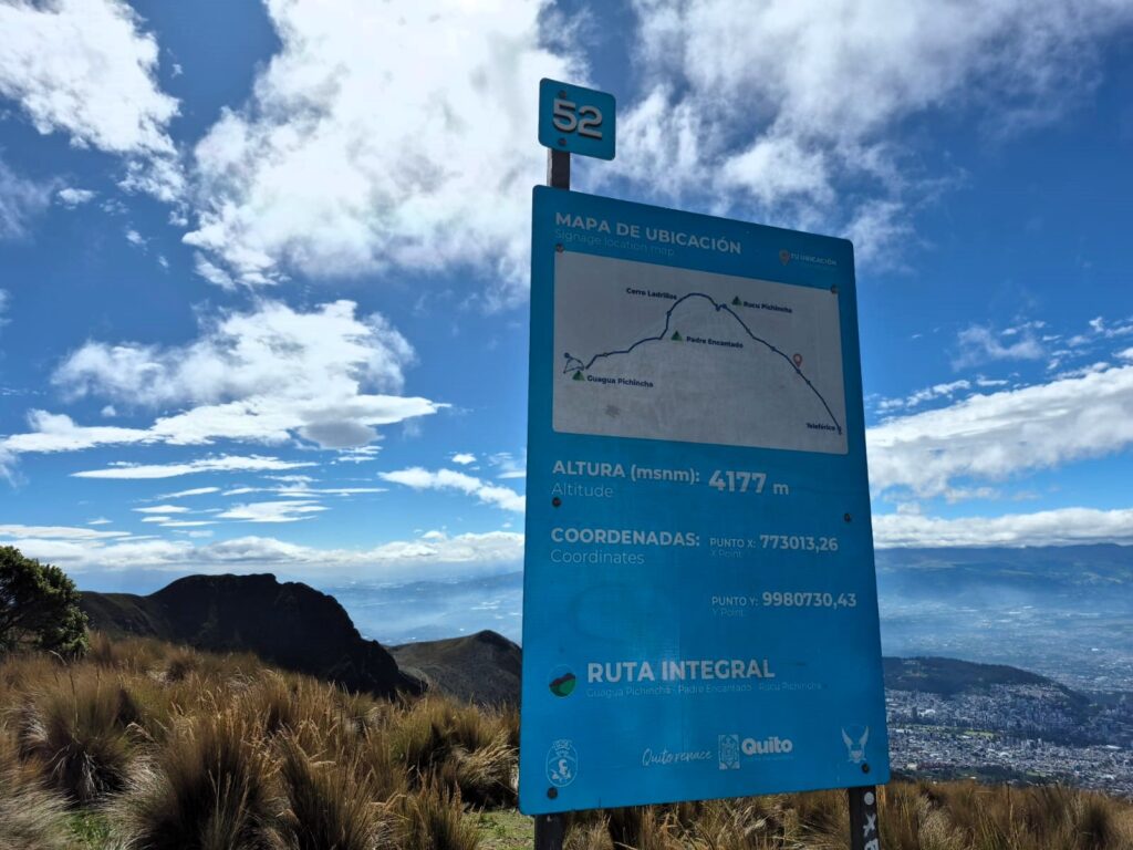
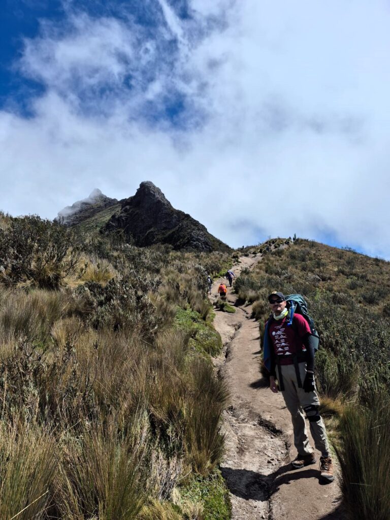
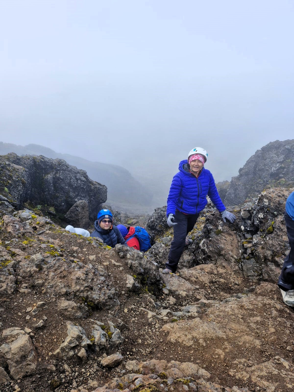
Rucu Pichincha is a dormant stratovolcano that rises to an elevation of approximately 15,413 feet (4,698 meters) just west of Ecuador’s capital city, Quito. It forms part of the Pichincha volcanic complex, which includes its younger sibling, Guagua Pichincha (pronounced Wawa Pichincha). The name “Rucu” means “old” in Kichwa, distinguishing it from “Guagua,” meaning “child.” Though it hasn’t erupted in over a millennium, Rucu Pichincha is geologically linked to the more active Guagua peak. The mountain is popular among hikers and acclimatization trekkers due to its proximity to Quito and the accessibility of its trail, which begins from the top of the TelefériQo cable car. The ascent involves a mix of high-altitude hiking, scrambling over volcanic rock, and occasional steep sand slopes, all while offering sweeping views of the city below and surrounding Andean ranges.
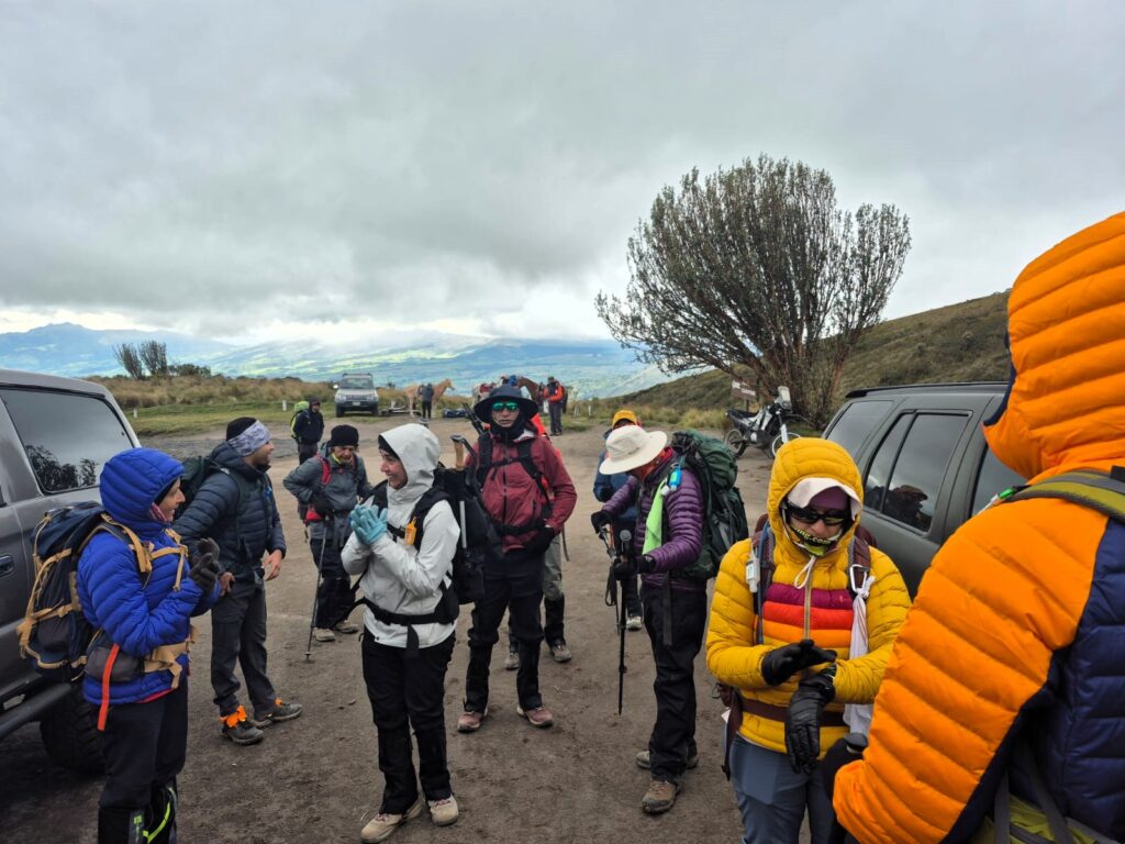
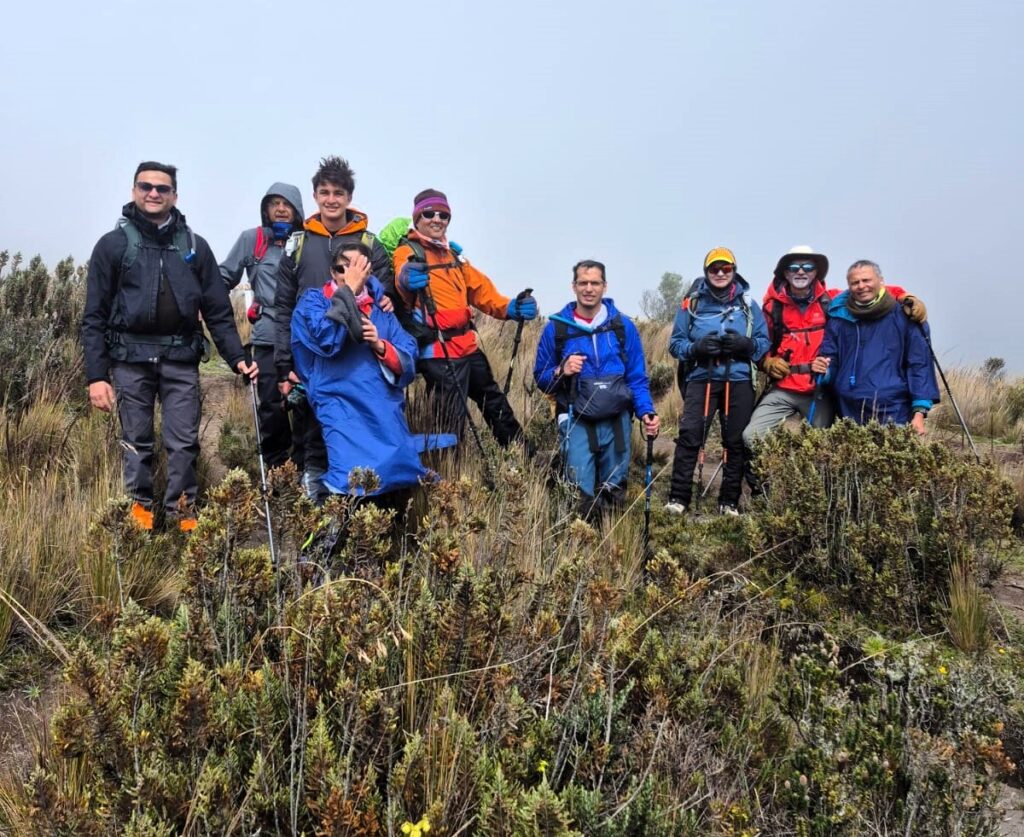
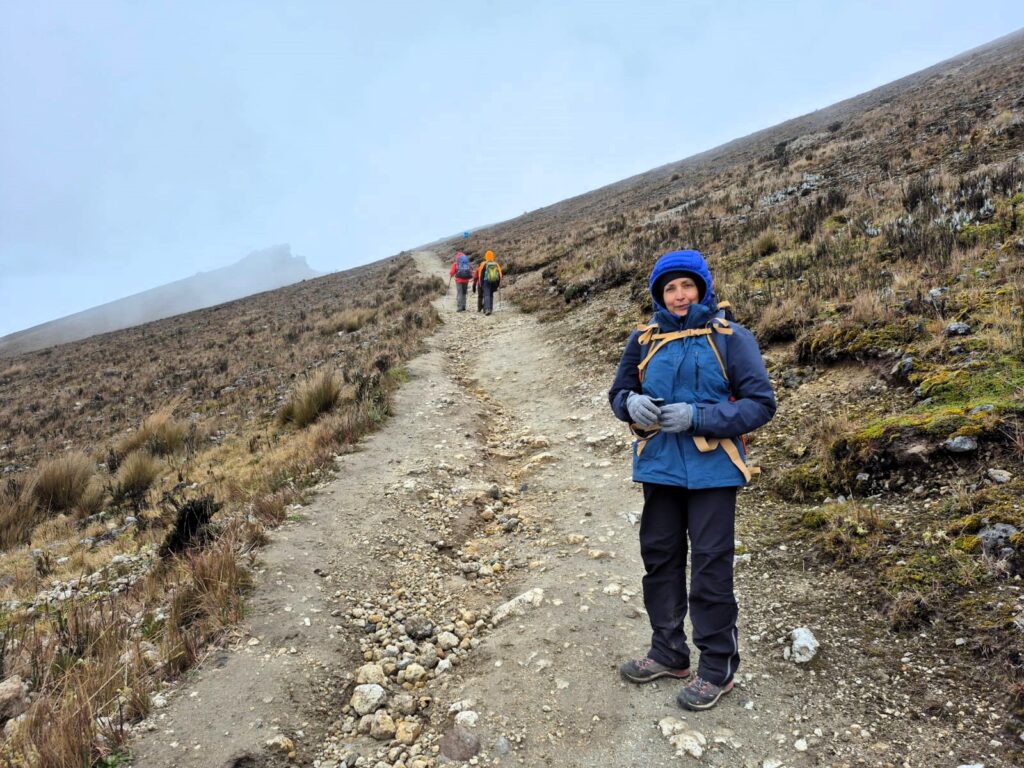
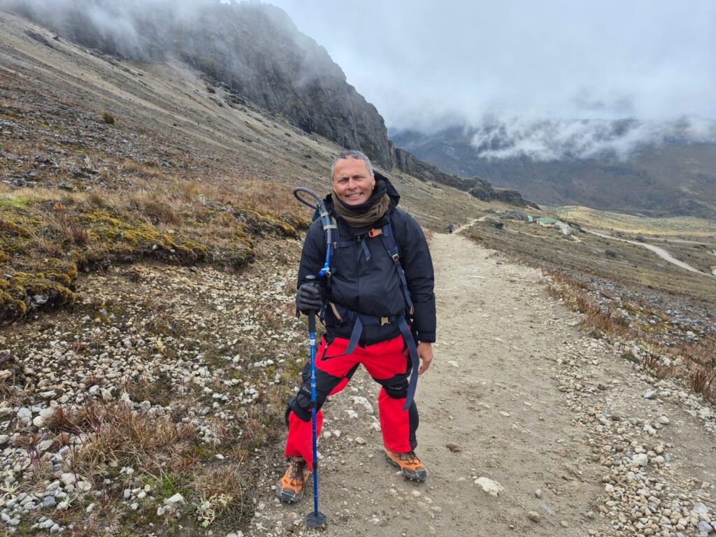
Our trekking adventure officially began on Sunday, June 29, with our first summit: Rucu Pichincha, standing at 15,400 ft. This peak, whose name means “Old Pichincha” in Kichwa, is one of two summits of the Pichincha volcano massif — the other being the more famous Guagua Pichincha (or the Wawa Pichincha), an active stratovolcano that looms west of Quito. Rucu, though dormant, offers a perfect introduction to high-altitude trekking in the Ecuadorian Andes.
An Early Start and a Scenic Ascent
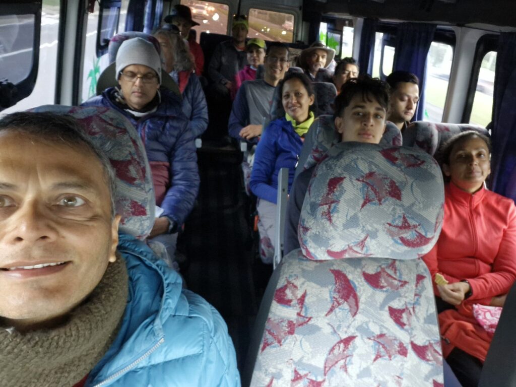
We kicked off our day early, leaving at 7:30 AM and arriving at TelefériQo Quito around 8:00 AM. Being a Sunday, the ticket line was long, but thankfully, our guide had already secured tickets for all 14 of us. By 8:15 AM, we were at the top terminal, ready to take our first real steps into the mountains.
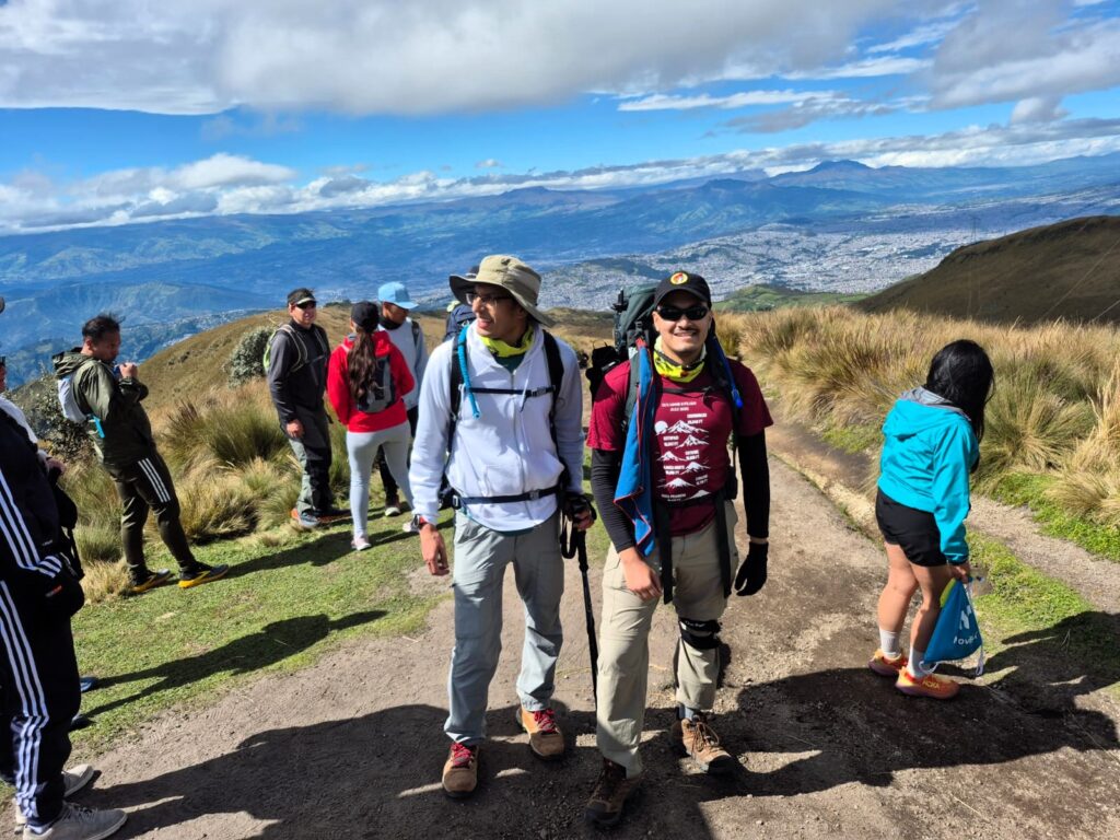
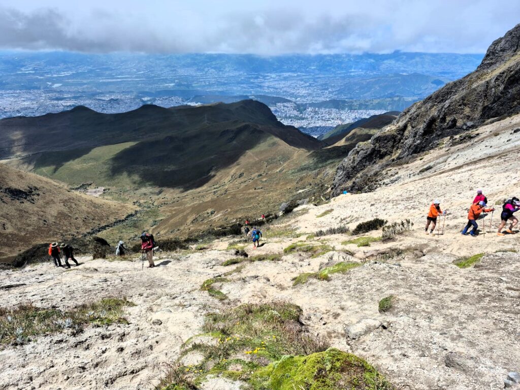
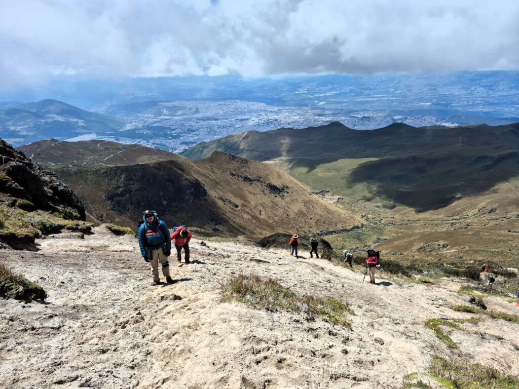
The trail from the TelefériQo is well-defined and familiar to many acclimatising trekkers and hikers from Quito. The weather was on our side — cool, but stable — and we layered up with jackets to keep warm against the alpine breeze.
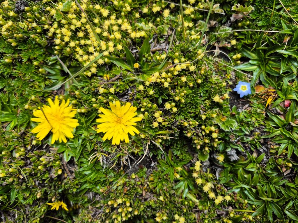
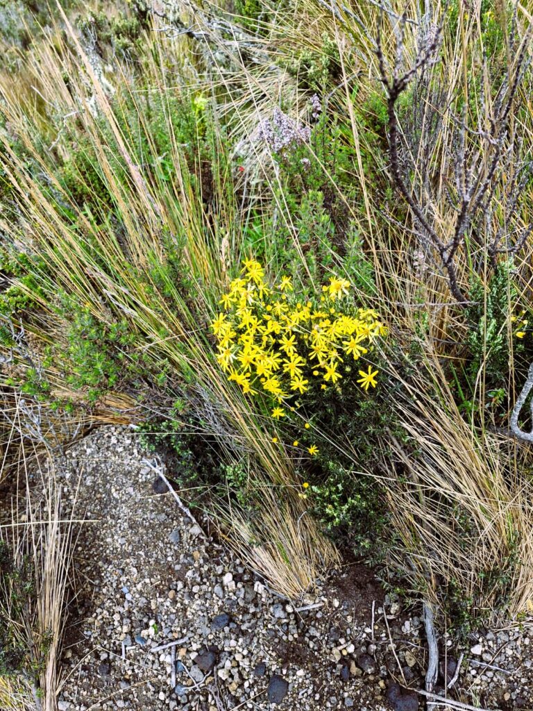
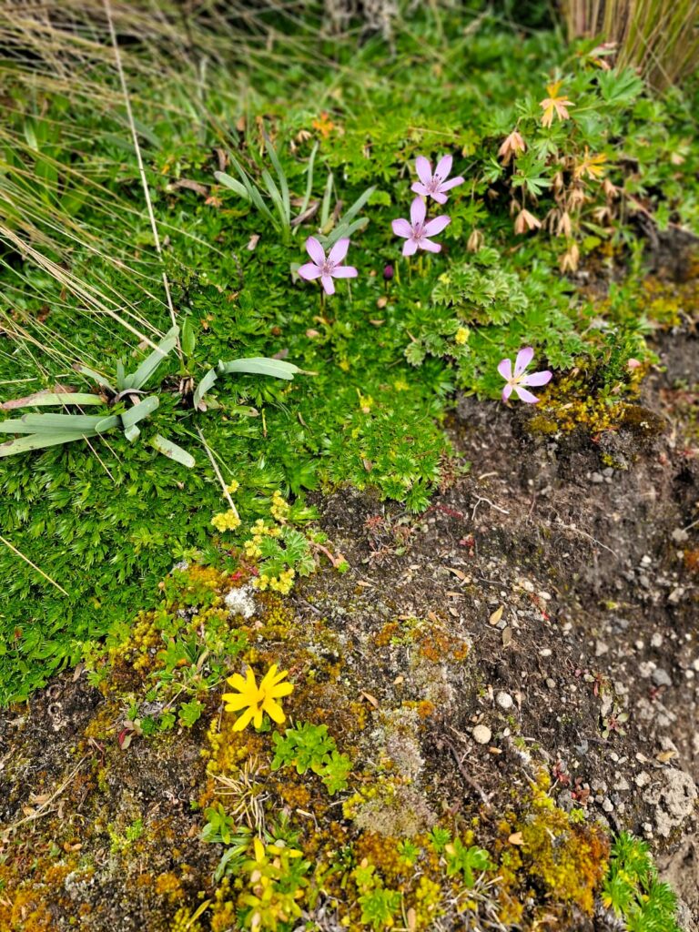
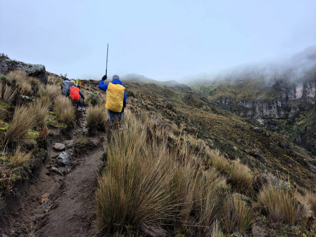
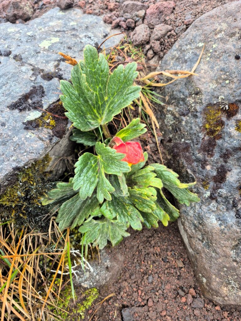
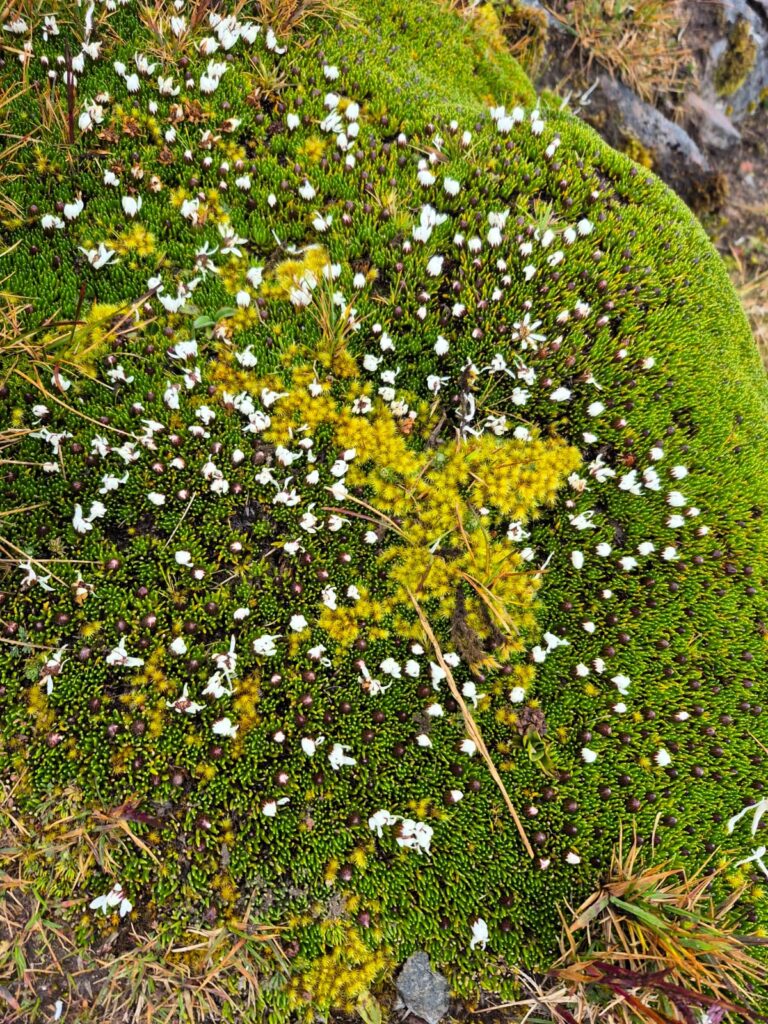
The route offered a gentle start. Bright wildflowers bordered much of the path, as if nature had laid out a colorful carpet for us.
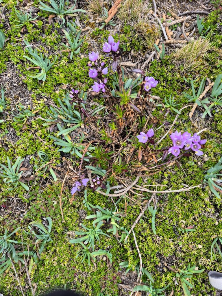
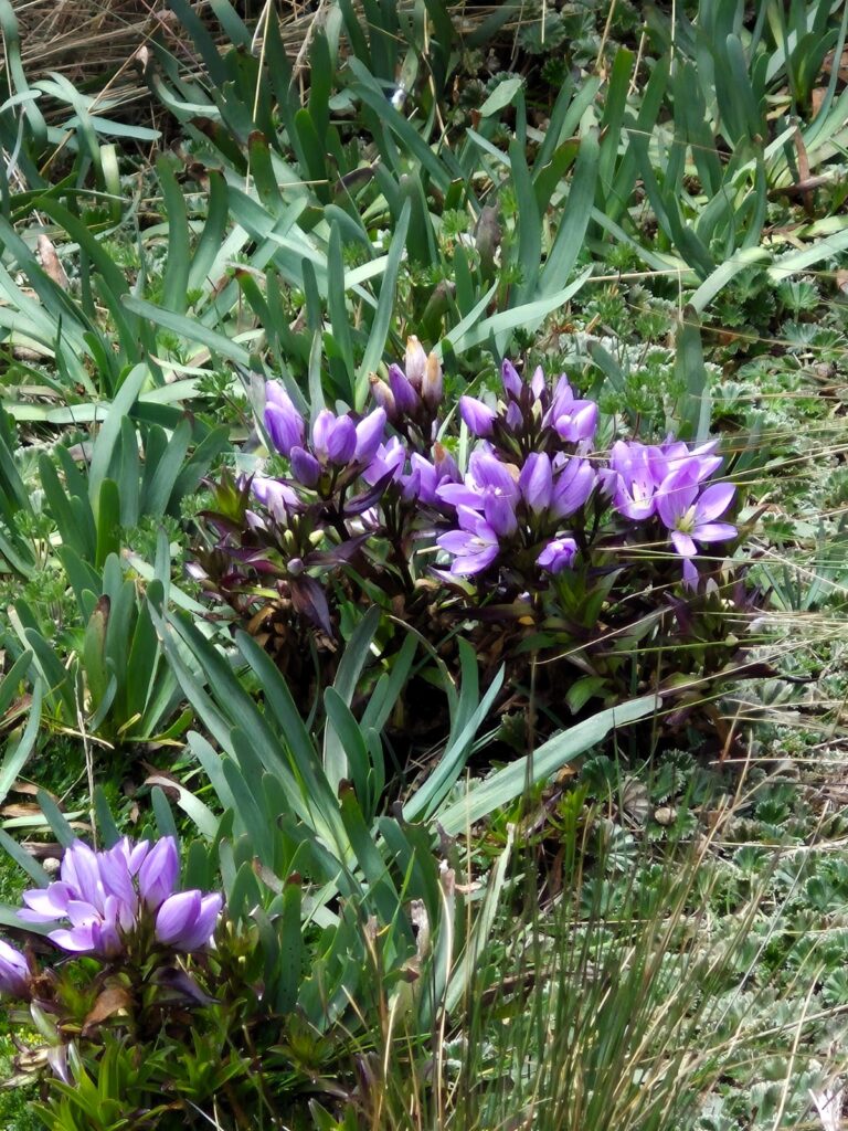
The equatorial location of the Andes allows vegetation to grow at surprisingly high altitudes, so the trail felt more like a walk through a mountain garden than a volcanic climb.
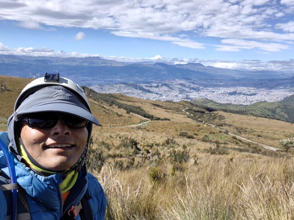
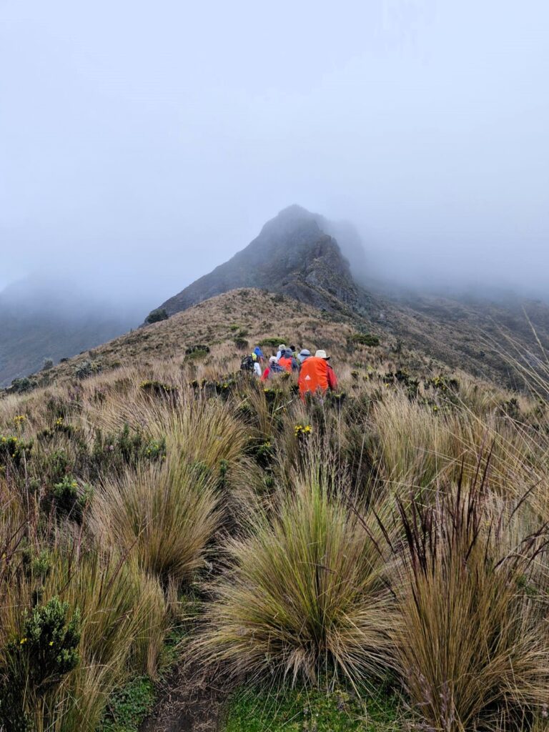
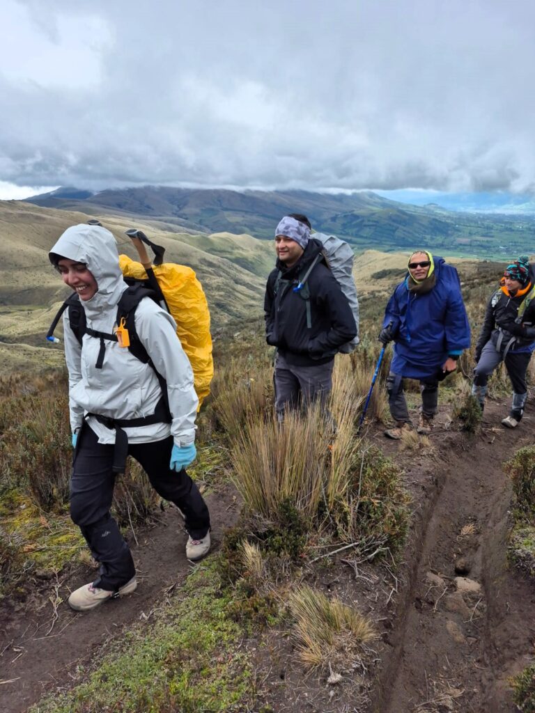
As we walked, the views opened up into rolling green hills and misty ridgelines. We were literally walking into the clouds.
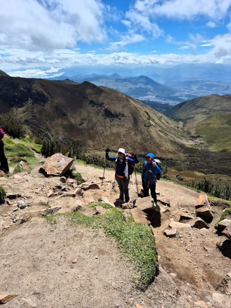
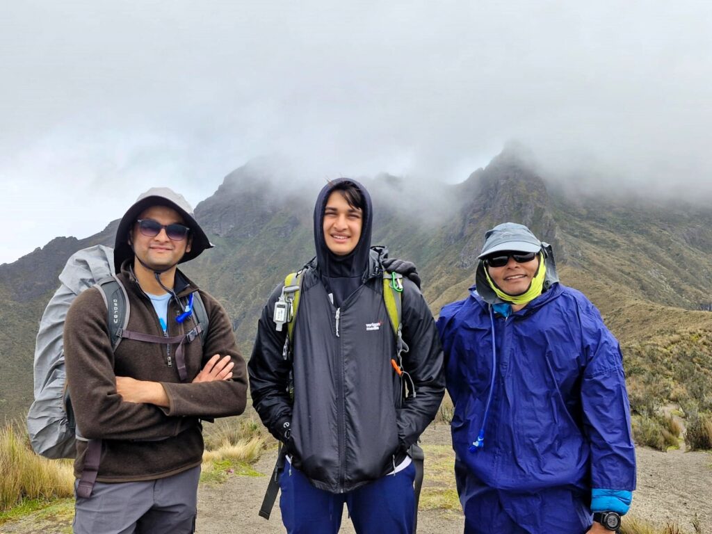
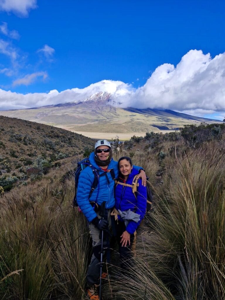
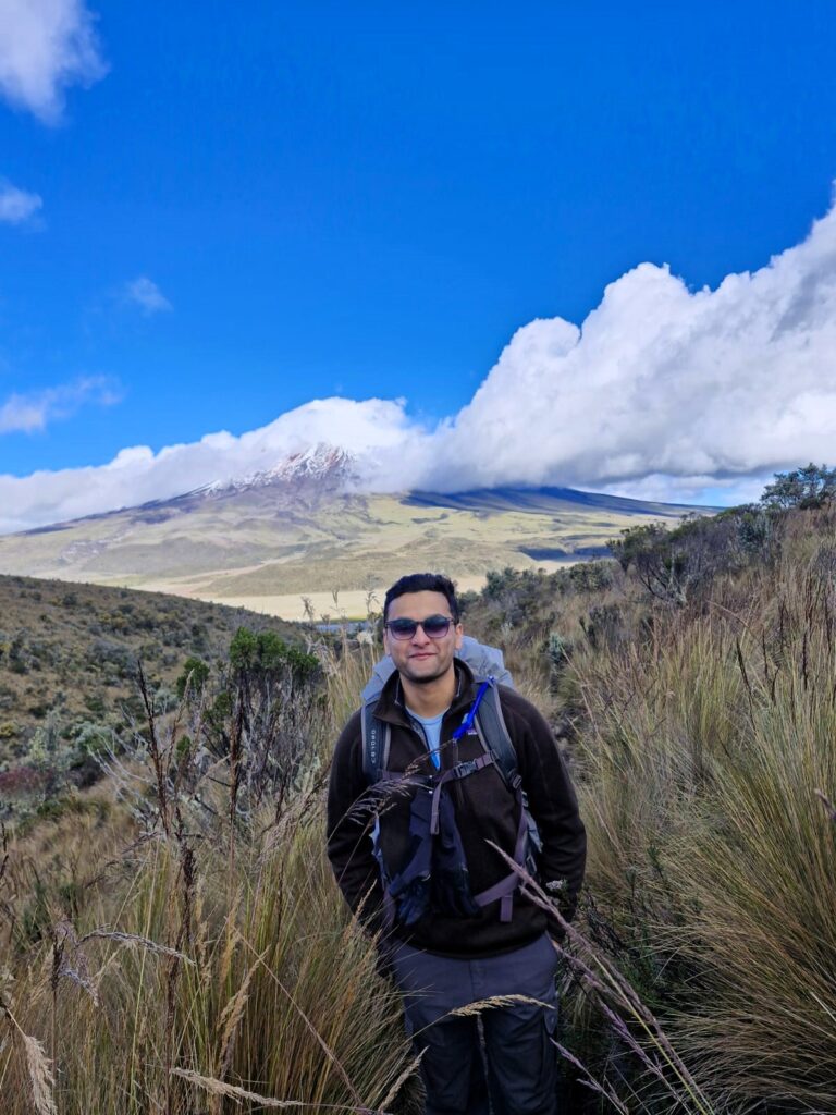
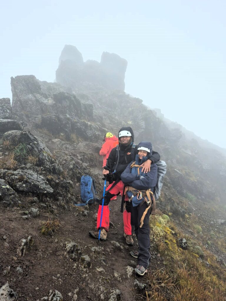
Climbing together with Anu, Aditya, and Sahil made the experience even more meaningful. Trekking with family turned this challenge into a shared adventure — one filled with laughter, encouragement, and moments we knew we’d remember long after the trek was over.
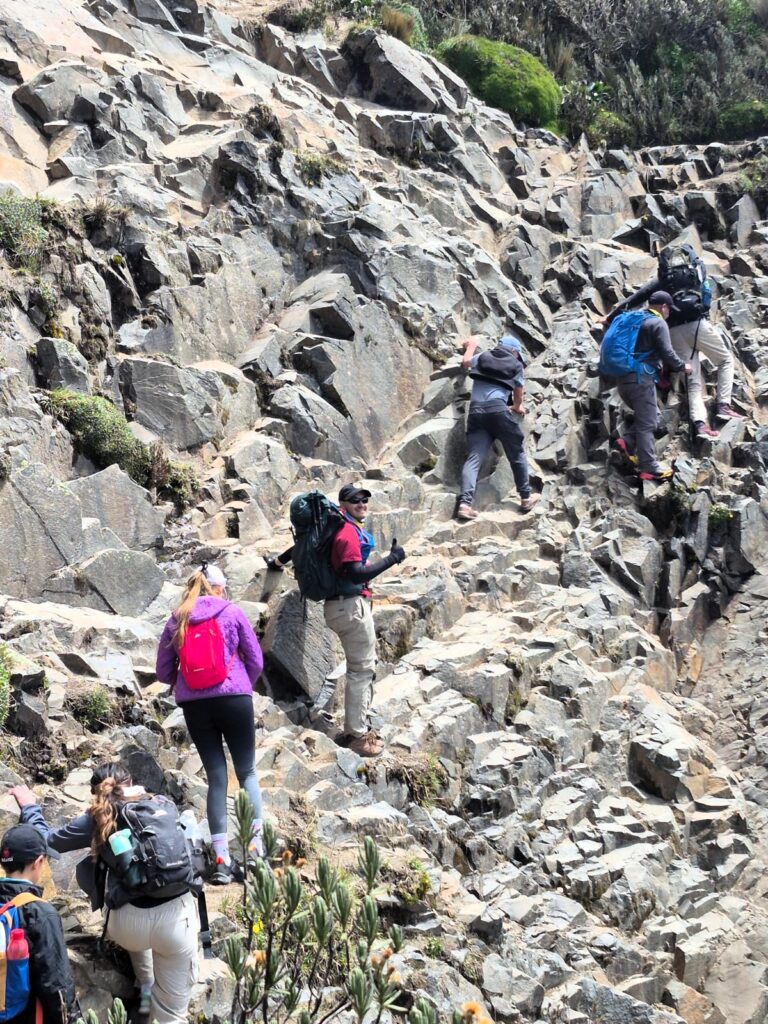
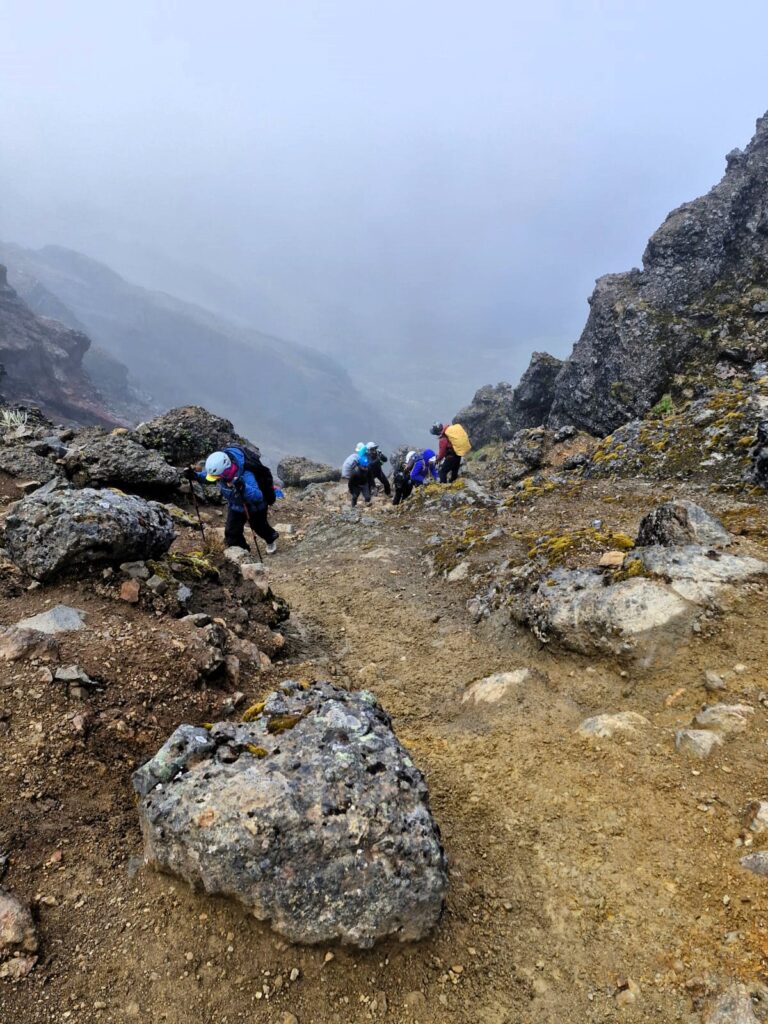
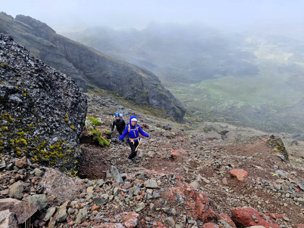
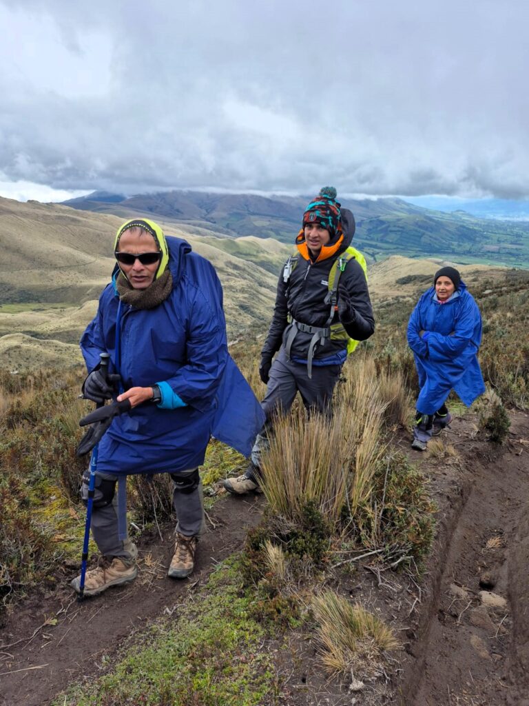
As we climbed higher, the trail became rockier and steeper.
The final push to the summit was tough — slow-going, slippery in places, and quite exposed. But that’s part of what makes mountain climbing so satisfying: you earn the summit one step at a time.
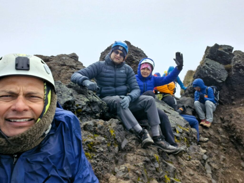
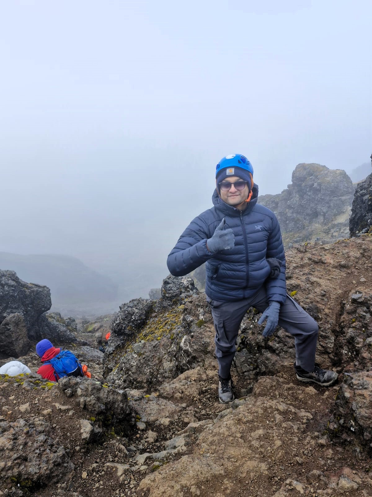
Summit at 15,400 ft
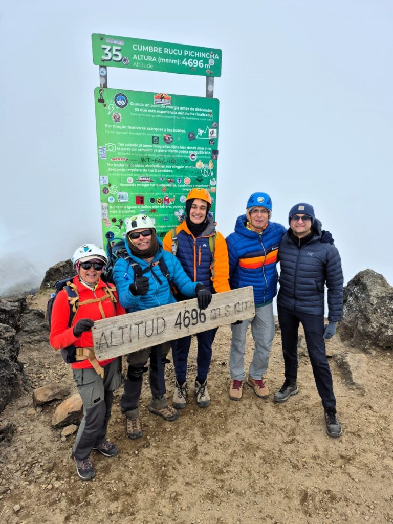
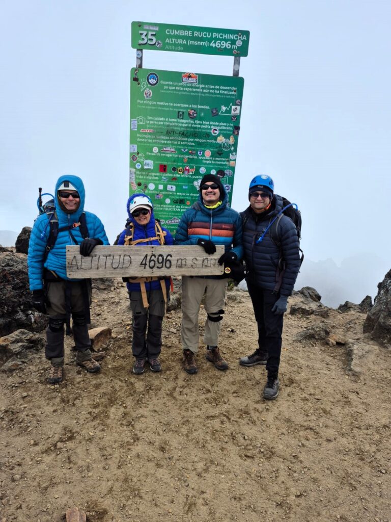
We reached the summit of Rucu Pichincha around 1:30 PM, standing at 15,400 ft above sea level. The wind was fierce and the temperatures had dropped sharply, so we didn’t linger long. Just enough time for a few photos and the quiet satisfaction of reaching our first peak.
The descent began with care, especially in the initial steep section. Due to high winds and the slope, some members of our group had to rope up for safety. But soon we were back on the main trail, retracing our steps through the scenic terrain.
By 4:00 PM, we were back at the top terminal of the TelefériQo. After a brief rest, we descended using the gondola around 5:30 PM, bringing an end to a long but fulfilling first day.
From the base of the TelefériQo, we boarded a bus that took us south to Machachi, a small town about 50 kilometers from Quito. Our lodging for the night was Casa del Montañero, a cozy bed-and-breakfast owned by Diego, our trek coordinator and the founder of Andes Climbing, the local agency managing our expedition. The warmth of the place — and the hot showers — were deeply appreciated.
We had conquered our first summit, tested our lungs and legs, and were feeling confident. One peak down, five more to go. Tomorrow onwards, the journey would continue.
Section 3. Rumiñahui – A Change in Plans, A Beautiful Ascent (15,400 ft – June 30, 2025)
Rumiñahui is a rugged, extinct volcano located in the Cotopaxi National Park, just west of the iconic Cotopaxi volcano. Standing at approximately 15,489 feet (4,721 meters), the peak is named after the Inca general Rumiñahui, a legendary figure who led indigenous resistance against the Spanish conquest in the 16th century. The mountain is characterized by its jagged ridges and three distinct summits: North, Central, and South, with the Central summit being the highest and most commonly climbed. The trek to Rumiñahui offers a moderately challenging route, featuring grassy paramo, volcanic rock sections, and panoramic views of the surrounding Andes, including Cotopaxi on clear days. Its location and elevation make it a popular acclimatization peak for climbers preparing for higher ascents in the region. Despite its relatively accessible nature, changing weather and wind conditions can add an element of unpredictability to the climb.
The day began with a curveball. We had originally set out to climb Corazón — a heart-shaped mountain whose name means exactly that in Spanish. At 15,700 ft, Corazón is a popular acclimatization peak in Illinizas Ecological Reserve, known for its grassy ridges and sweeping views. But as we drove out from Machachi that morning, heavy rain greeted us at the trailhead.
Visibility was poor, and the skies gave no sign of clearing. After much deliberation, we made the tough but necessary decision to abandon the Corazón climb.
A Quick Pivot: Rumiñahui Beckons
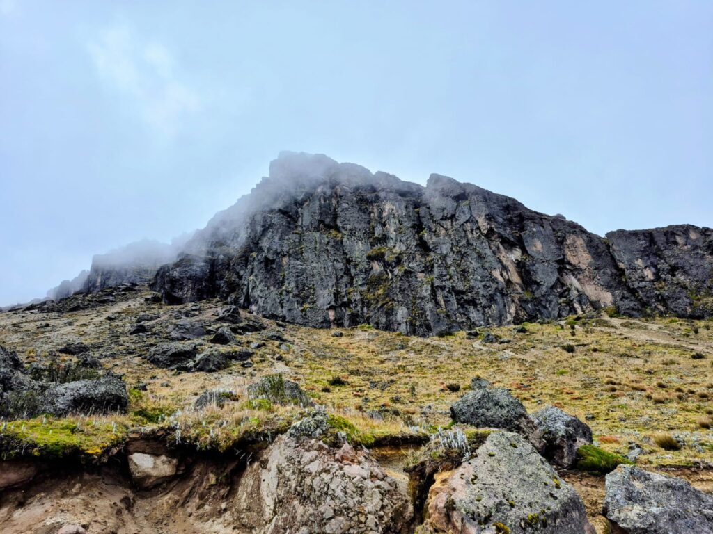
Instead, we pivoted to Rumiñahui, a rugged, lesser-travelled peak inside Cotopaxi National Park. At 15,400 ft, it’s comparable in height to Rucu Pichincha and offers a quiet, dramatic alternative. Named after the legendary Inca general Rumiñawi, who led resistance against Spanish conquistadors in the 16th century, this extinct volcano is layered with both history and mystique. Its jagged silhouette dominates the northern edge of the park — raw, unglaciated, and rarely crowded.
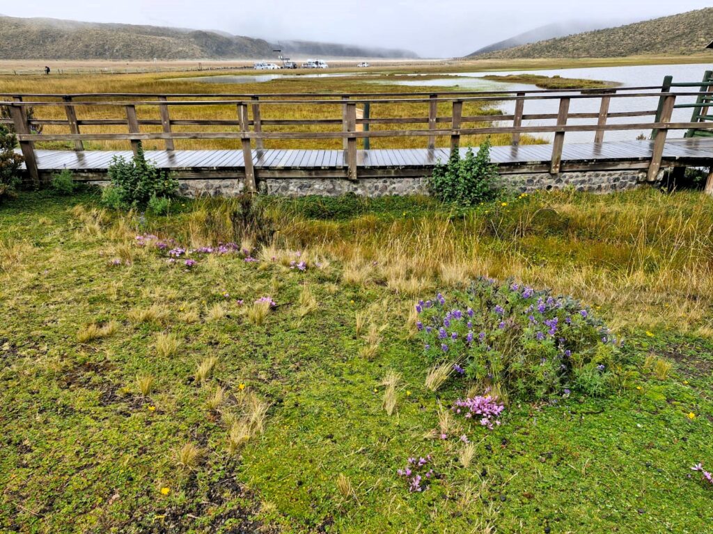
Starting at Lake Limpiopungo
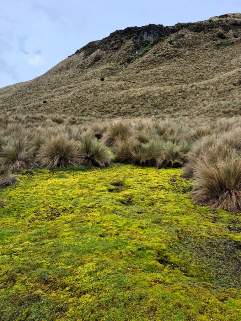
Our hike began at Lake Limpiopungo, a picturesque high-altitude lagoon located at around 12,800 ft. The lake sits at the foot of Cotopaxi and offers mirror-like reflections of the volcano on calm days. Surrounded by páramo grasslands and frequented by Andean waterfowl, it’s also a popular spot for nature lovers and birdwatchers. For us, it was the gateway to Rumiñahui.
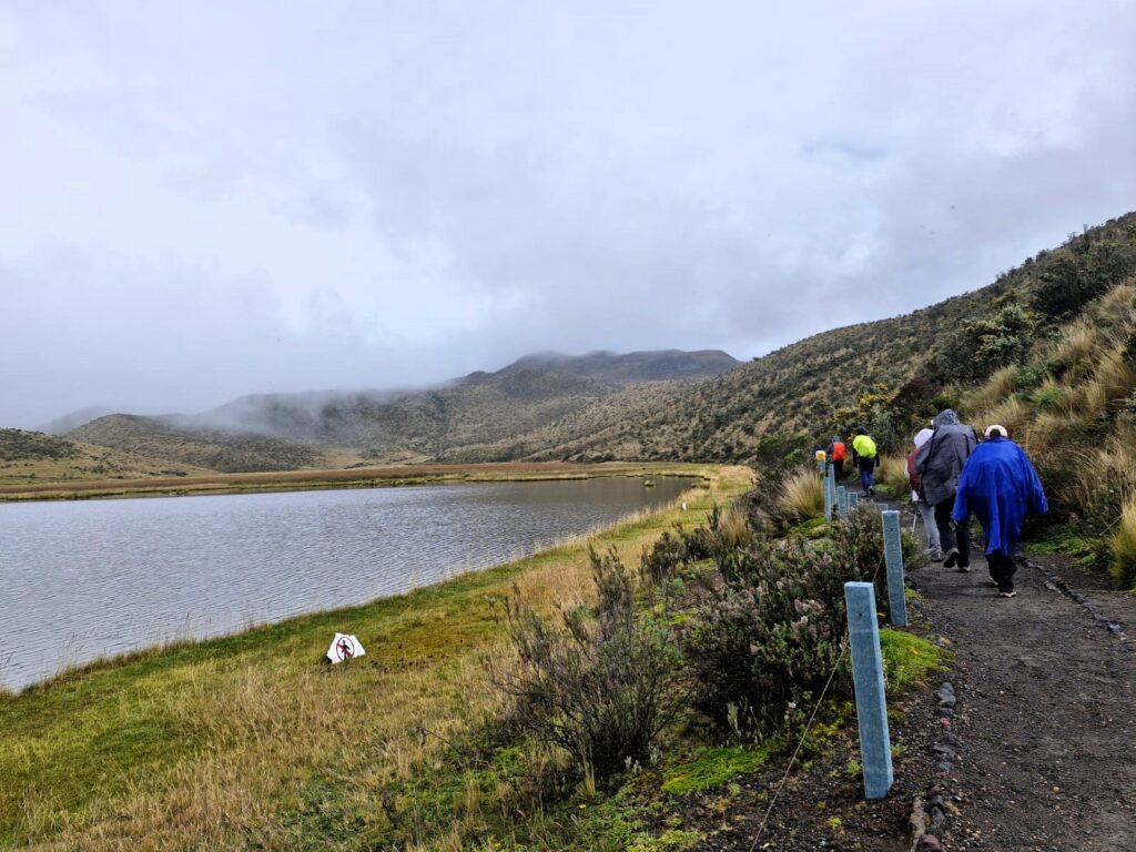
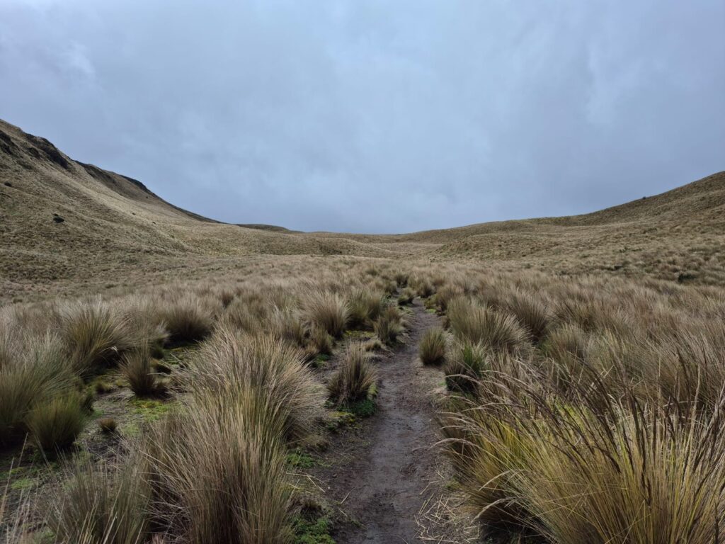
We began our trek at 9:30 AM, moving through tall páramo grass that often brushed against our arms and legs.
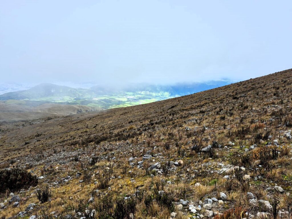
The landscape was open and expansive — a visual treat, especially as the fog began to lift and faint outlines of surrounding peaks became visible.
Into the Steeps
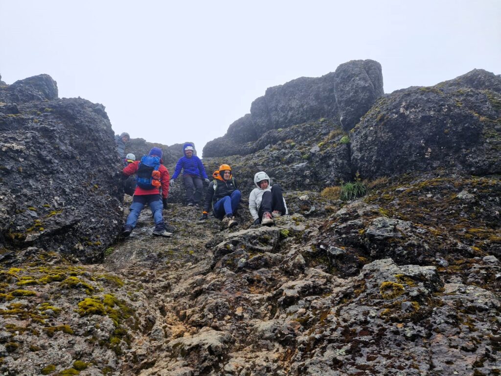
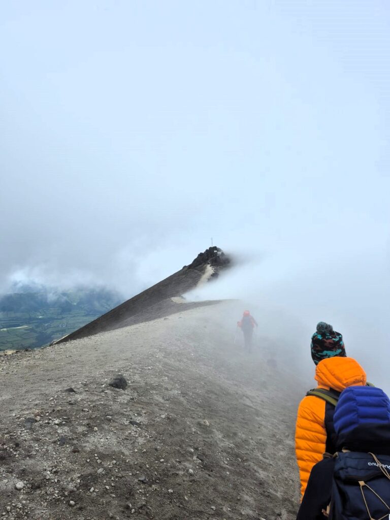
As we climbed, the trail became steeper and more challenging. The final stretch was particularly intense — a nearly 37% incline that forced us to dig deep.
We dropped our backpacks near a rocky outcrop and scrambled the final 30 feet up, using both hands and feet to navigate the rugged volcanic rock. The wind howled, threatening to knock us off balance. It was one of the most physically demanding moments of the day.
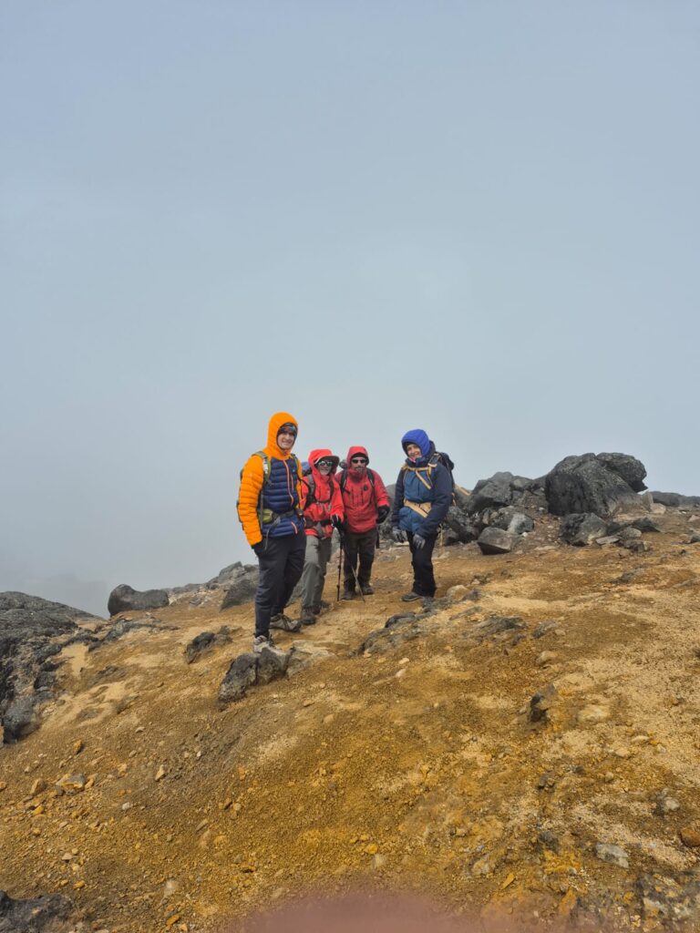
We summited at 1:30 PM, exactly four hours after starting. The wind was so fierce at the summit that we could only stay for a brief five minutes. But we had made it — Rumiñahui was ours.
The Descent – With Caution and Joy
Descending from the summit was no easy task. The initial steep section was loose and exposed, so many of us scrambled down on all fours for stability.
As we descended below the rocky slope, the terrain gentled out into rolling páramo again.
We passed Meenal and Sushil still making their way up — a testament to their determination to finish the climb.
The descent took 2.5 hours, and we arrived back at Lake Limpiopungo at 4:00 PM, tired but deeply satisfied.

Back to Machachi
When we returned to Casa del Montañero, the clouds finally cleared completely, giving us the best view yet of Rumiñahui’s rugged summit — the very peak we had just climbed, but from the comfort of Casa del Montanero.
But the day ended on a bittersweet note. Sahil, my son and our trekking team member, made the difficult decision to leave the expedition. The descents had begun to aggravate the surgical screws in his knee from an ACL operation in 2024. With courage and maturity, he chose to prioritize long-term recovery over short-term adventure. He left that night on the 11:30 PM flight to Dallas. We missed his presence for the rest of the trek.
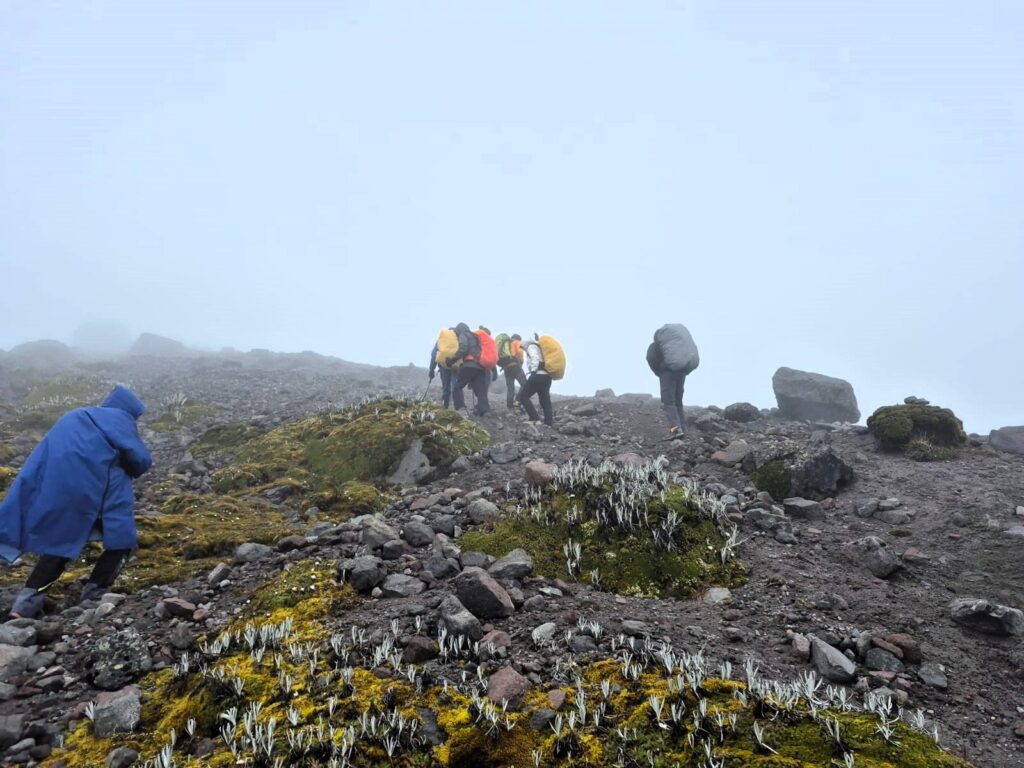
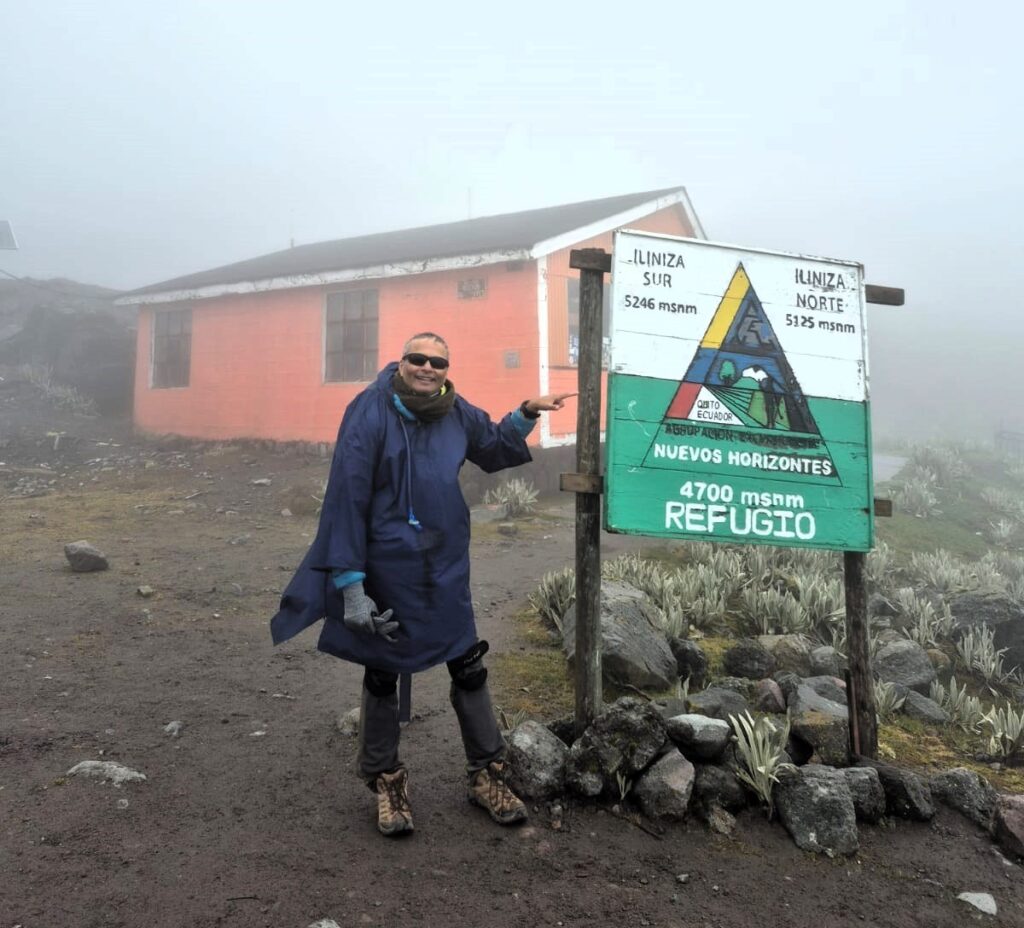
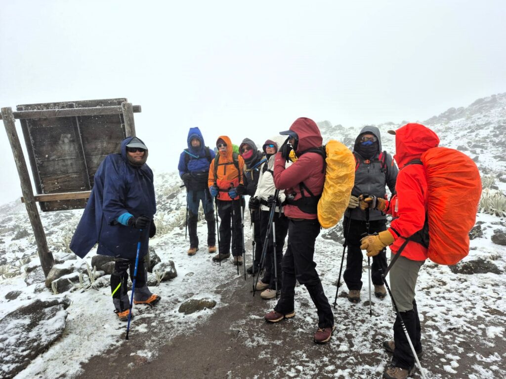
Section 4. Illiniza Norte – To the Refuge and an Unexpected Return (15,400 ft – July 1–2, 2025)
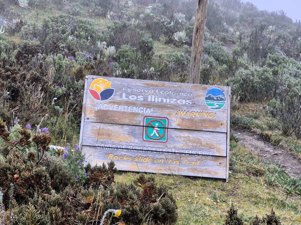
Illiniza Norte is one of the two dramatic peaks of the Illinizas, a twin-volcano complex located about 55 kilometers southwest of Quito in the Western Cordillera of the Ecuadorian Andes. At 16,818 feet (5,126 meters), Illiniza Norte is slightly lower than its sister, Illiniza Sur, but it is far more accessible for climbers. Unlike the glaciated Illiniza Sur, which requires technical mountaineering gear, Illiniza Norte can typically be reached with a high-altitude hike and some moderate rock scrambling, making it a popular objective for acclimatization before tackling Ecuador’s higher peaks like Cotopaxi or Chimborazo.
The trek usually begins from La Virgen trailhead and passes through paramo grasslands before reaching Refugio Nuevos Horizontes at 15,400 ft — a rustic mountain hut that serves as base camp. From there, climbers follow a steep and rocky route to the summit, navigating sections like the exposed “Paso de la Muerte” (Pass of the Dead), which can be treacherous in poor weather. The views from the summit, on a clear day, are breathtaking — with Cotopaxi, Rumiñahui, and Corazón in full view. However, weather conditions can change rapidly, with snow, wind, and fog posing frequent challenges. Despite these obstacles, Illiniza Norte remains a rewarding and memorable climb for trekkers seeking a taste of high-altitude mountaineering.
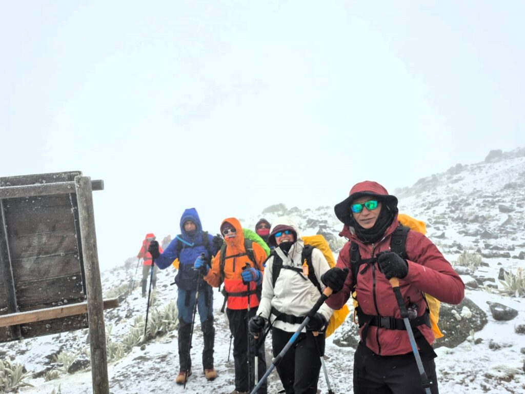
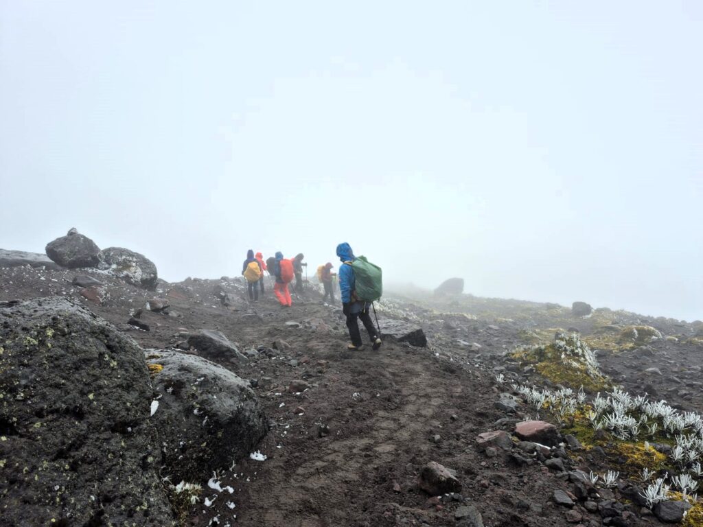
We left Machachi at 9:20 AM and reached the La Virgen trailhead by 10:50 AM. The trek began on a gentle upslope through high páramo grasslands, but the landscape quickly turned steep and exposed.
Winds grew stronger and snowfall began as we gained altitude, making the climb physically demanding.
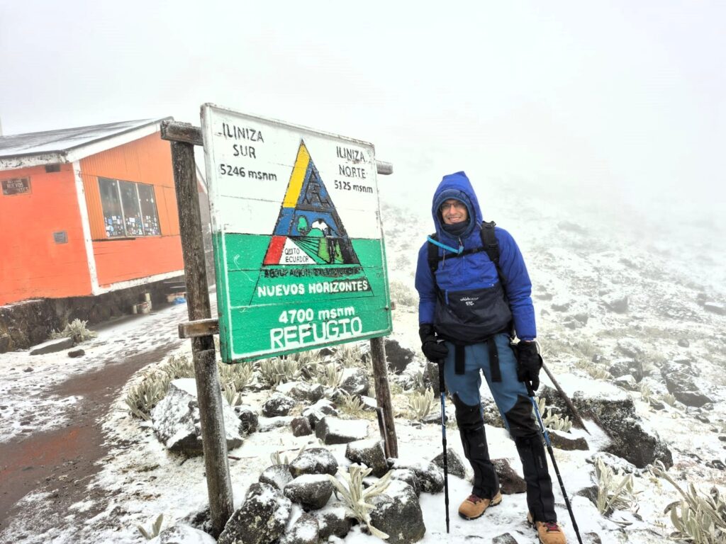
At 2:00 PM, we arrived at Refugio Nuevos Horizontes — a small, rustic stone hut at 15,400 ft, nestled in a saddle between the twin peaks.
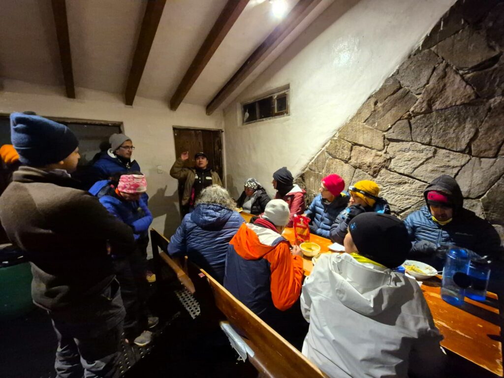
Inside, we were welcomed by Freddie, the refuge caretaker, who served popcorn, hot soup, and what many of us considered the best pesto pasta of the trek — hearty and comforting in the freezing conditions.
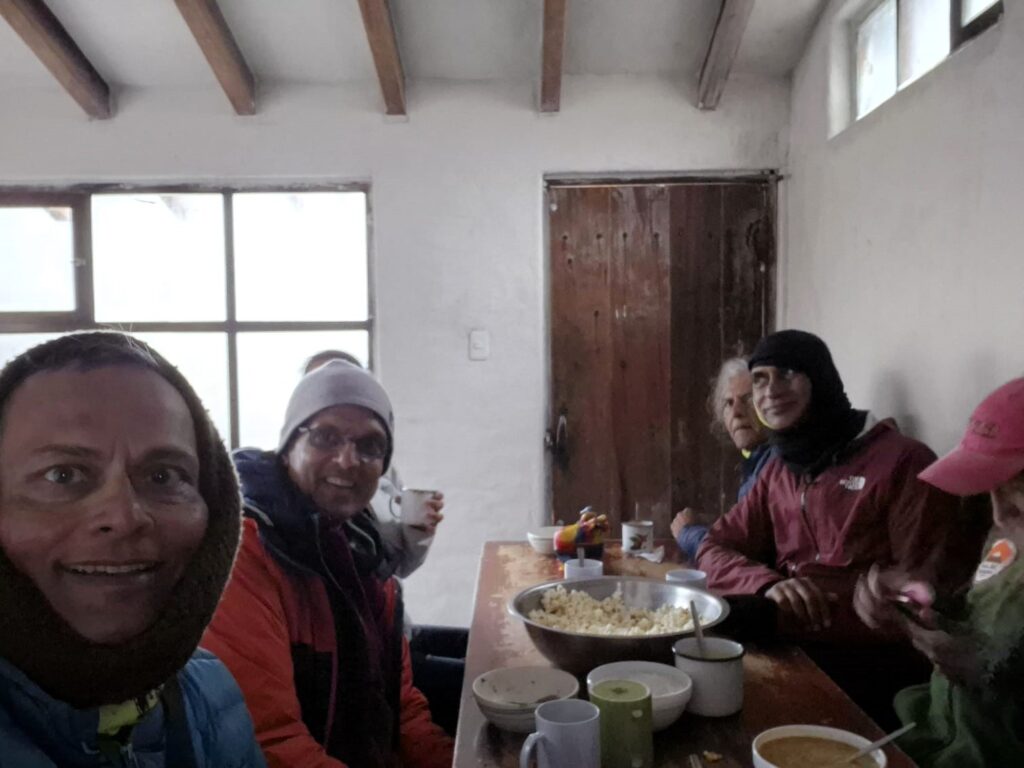
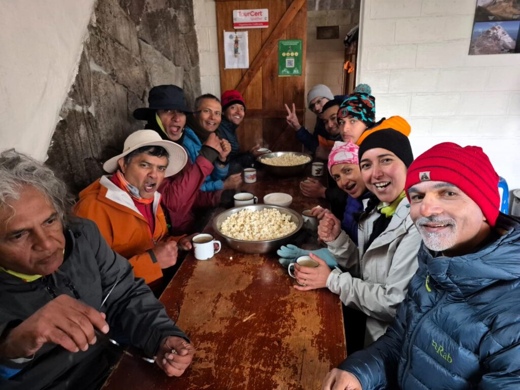
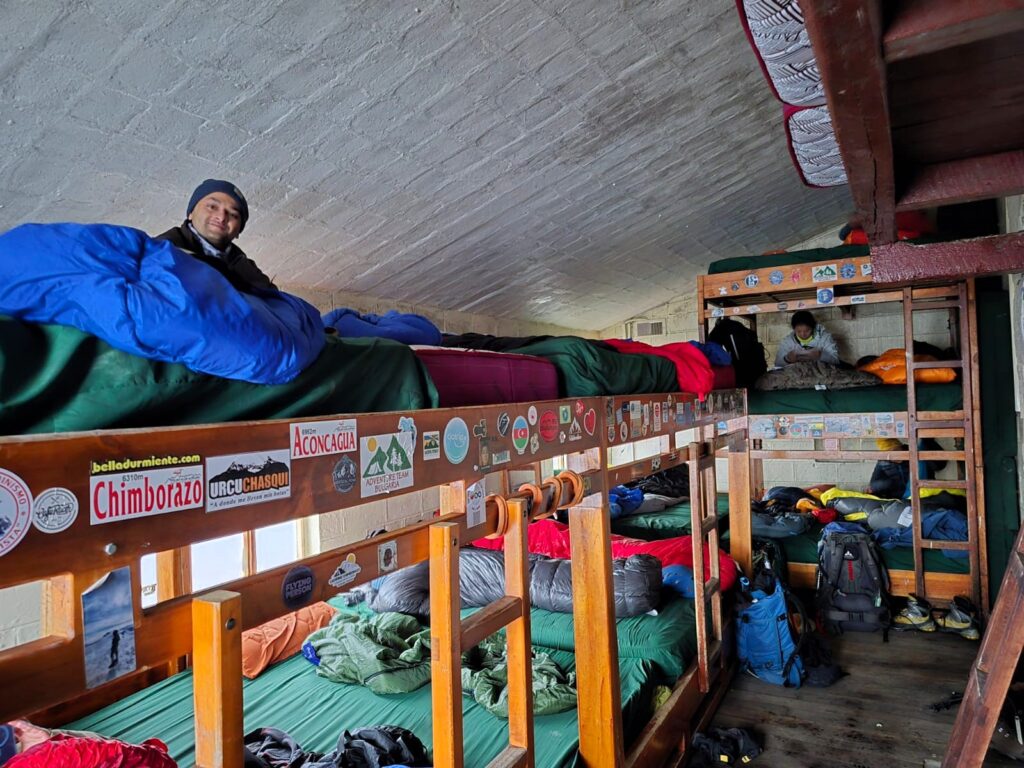
Sleeping arrangements were tight — dormitory-style bunks and no heating — but the camaraderie and the mountain setting made the stay special. We just lay on our beds talking to other team members through the day.
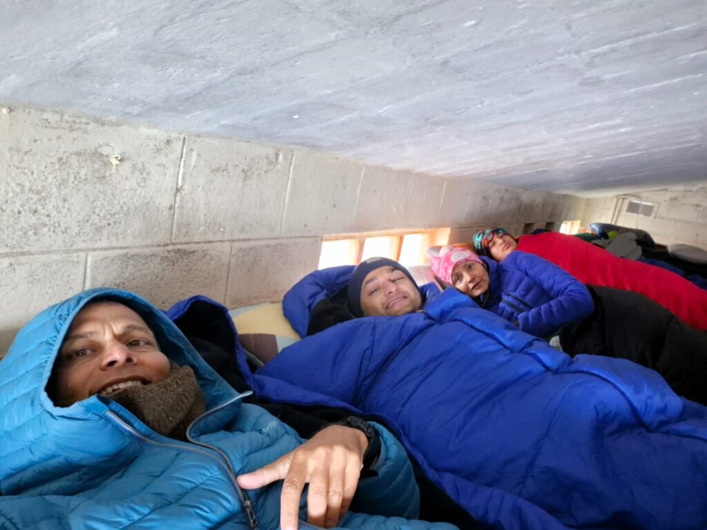
We turned in early, eager for our summit attempt the next morning.
However, by 7:00 AM on July 2, it was clear we wouldn’t be going any higher. Snow had fallen heavily overnight, and the route beyond was buried under fresh powder.
Visibility was near zero, and strong winds swept the slope. The final stretch — an exposed scramble known as the Paso de la Muerte (Pass of the Dead) — was far too dangerous under icy conditions.
After assessing the risks, our guides made the tough but necessary decision to call off the Illiniza Norte summit push.
At 8:50 AM, we began our descent in snowy conditions. The steep upper portion demanded caution, but as we lost elevation, snow turned to light rain, and the terrain eased.
The last part of the walk was very simple and gradual. We could descend very quickly to the parking lot. The weather was dreary and cloudy with a little bit of rain.
We reached the parking lot by 10:15 AM and were back in Machachi by noon.
Though we didn’t reach the summit, the journey to the refuge at Nuevos Horizontes was a challenging experience. It introduced us to the vagaries of the weather in Ecuador which could change at any minute.
In the evening at around 7 pm, we went out for dinner to Chifa China, a Chinese place with lots of vegetarian food options. We walked to that restaurant. It turned out to be a great option with tasty food.
Section 5: Cotopaxi – Into the Ice and Sky (Up to 18,200 ft – July 8, 2025)
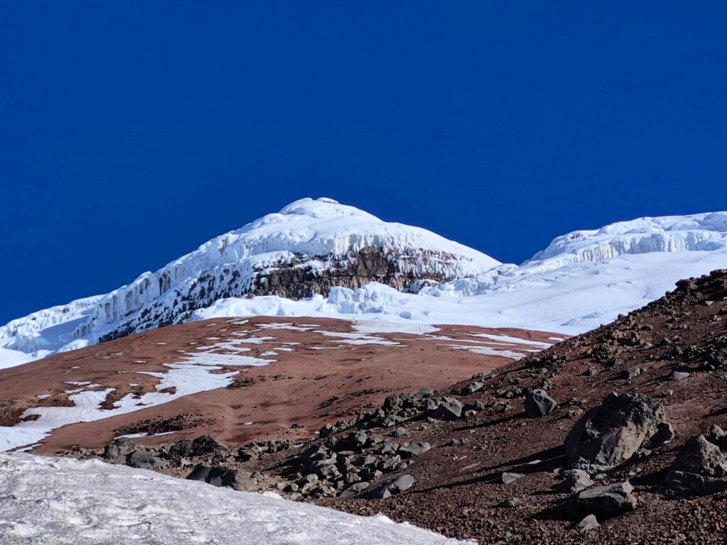
Cotopaxi is one of the most iconic and active stratovolcanoes in the world, located about 50 kilometers south of Quito in the Eastern Cordillera of the Andes. Rising to an elevation of 19,347 feet (5,897 meters), it is Ecuador’s second-highest peak and among the highest active volcanoes globally. Cotopaxi is renowned for its nearly symmetrical, snow-capped cone and massive glacier that begins just above the refuge level, making it a dramatic sight from both near and far.
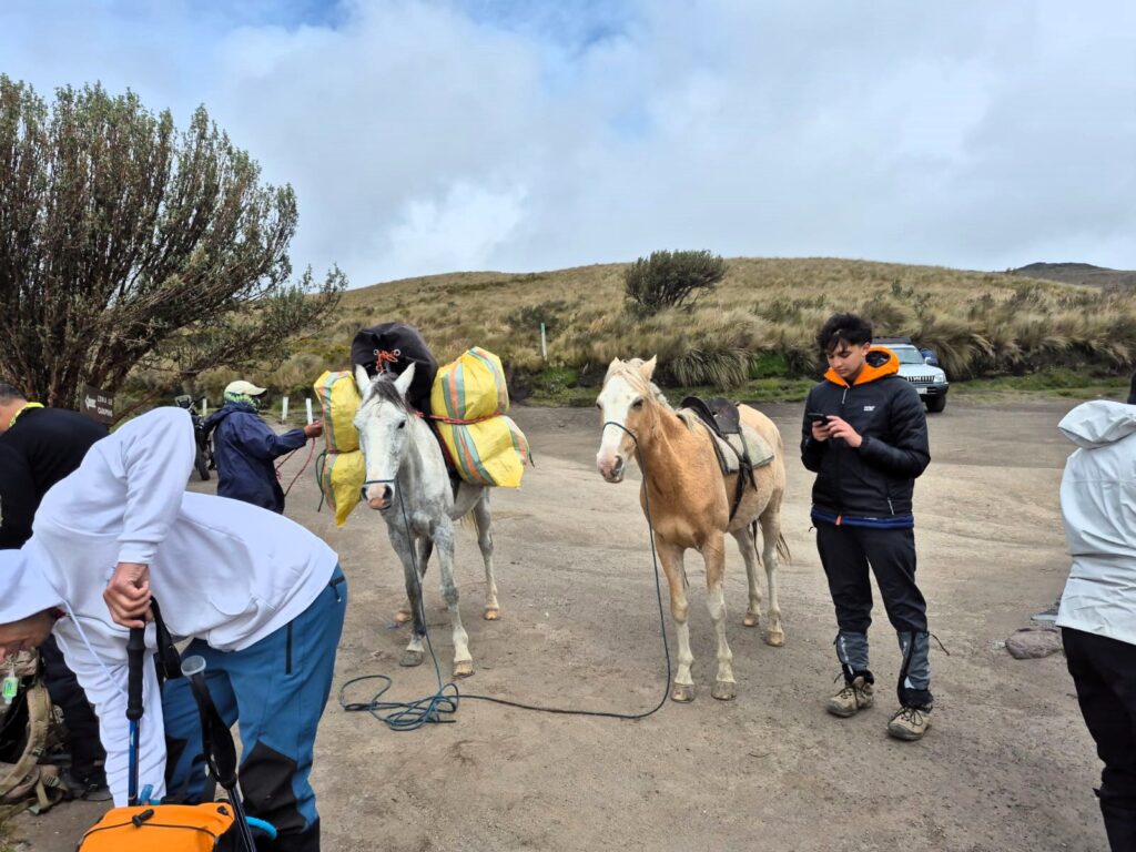
The volcano sits within Cotopaxi National Park, a protected area known for its high-altitude grasslands, wild horses, and sweeping views of the surrounding Andean landscape. The standard climbing route begins at the José Rivas Refuge, located at about 15,950 feet (4,864 meters). From there, climbers typically begin their summit attempt just after midnight, roped up and equipped with crampons, ice axes, and other glacier gear. The ascent takes about 6 to 8 hours and includes travel across snowfields, crevasses, and steep icy slopes.
Weather on Cotopaxi is notoriously unpredictable, with high winds, snow, and sudden whiteouts being common — conditions that can turn an otherwise manageable climb into a serious mountaineering challenge. Despite this, Cotopaxi remains a popular and rewarding peak for experienced hikers and climbers, offering a stunning sunrise above the clouds and expansive views from the summit crater on a clear day. It is a true test of endurance and preparation, and a crown jewel in Ecuador’s mountaineering landscape.
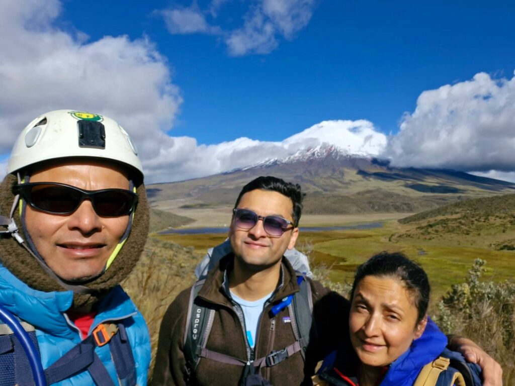
Cotopaxi had been looming in our imagination since 2021 when we had visited Quito, Ecuador. We had visited the Cotopaxi Refuge. I had made a promise to myself that we would come back some day to climb mountains in Ecuador.
At 19,347 ft, Cotopaxi is one of the highest active volcanoes in the world and a coveted summit for mountaineers across the globe. We had attempted it once a few days ago, but snow and high winds had forced us to turn back. Now, we were back for another chance — and this time, the skies looked promising.
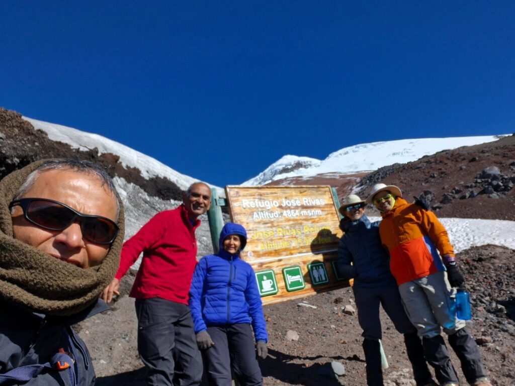
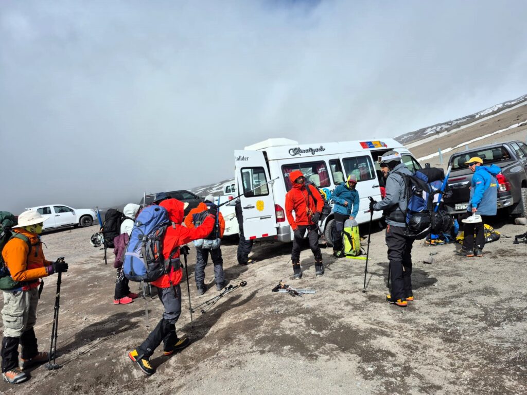
Arrival at Refugio José Rivas (15,950 ft)
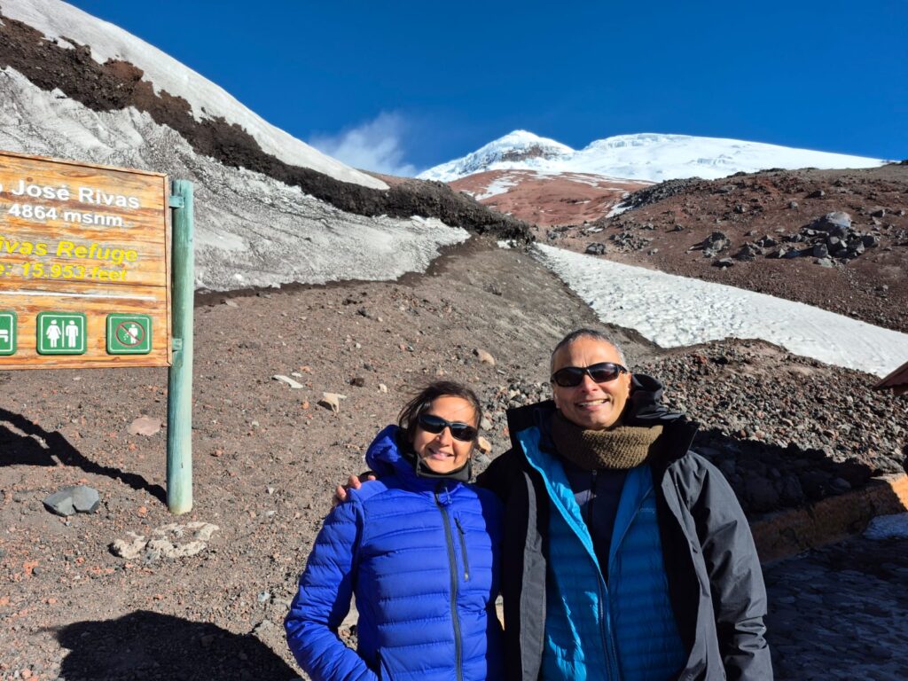
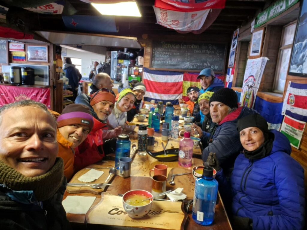
We reached the José Rivas Refuge, perched at 15,950 ft, in the late afternoon around 4:00 PM. The wind howled across the slopes, but the skies were relatively clear — a hopeful sign.
From the refuge, we caught breathtaking views of Cotopaxi’s perfectly conical snow-covered peak glowing in the afternoon light. Spirits were high. We knew the mountain could be temperamental, but for now, it looked welcoming.
After settling in, we had an early, simple dinner of hot soup and dessert. The evening routine was brief — no time to linger. The real climb would begin in a few short hours. We caught some sleep after dinner.
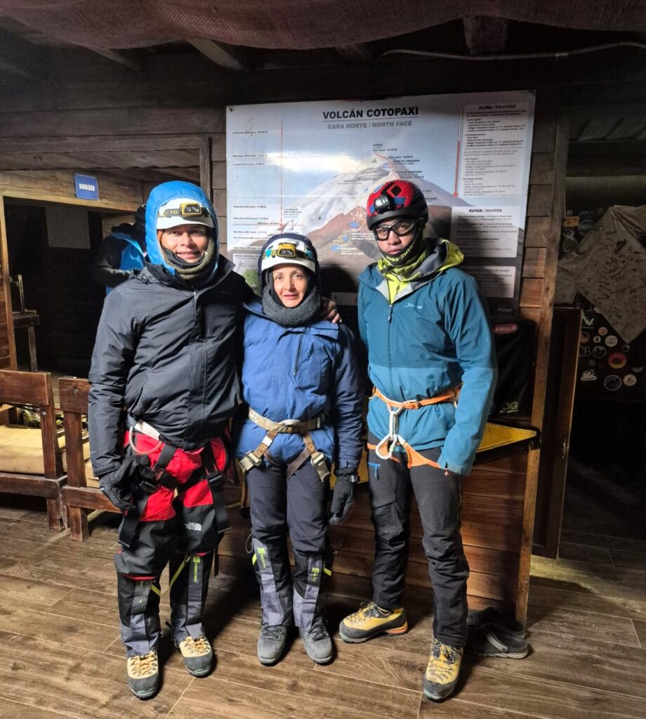
Midnight Push for the Summit
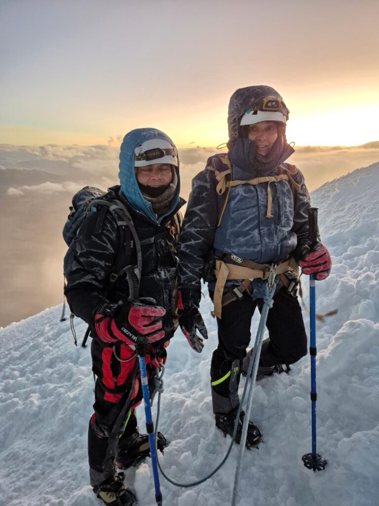
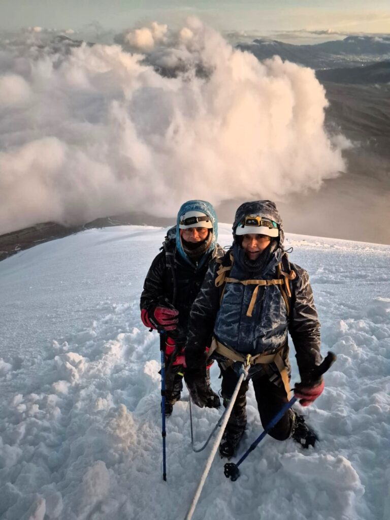
At 12:05 AM on Tuesday, July 8, we geared up and stepped into the darkness. It was bitterly cold, our headlamps lighting a narrow path of snow and ice.
Our guide Raul, a seasoned climber, tied us into ropes for safety — a critical precaution on Cotopaxi’s glaciated slopes, riddled with hidden crevasses and sharp drops.
The climb was relentless — six hours of steady ascent in the pitch dark, the crunch of crampons on ice our only rhythm.
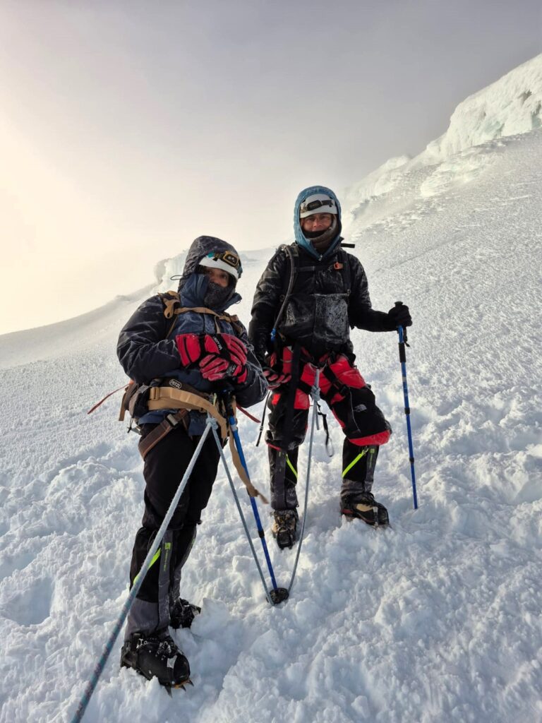
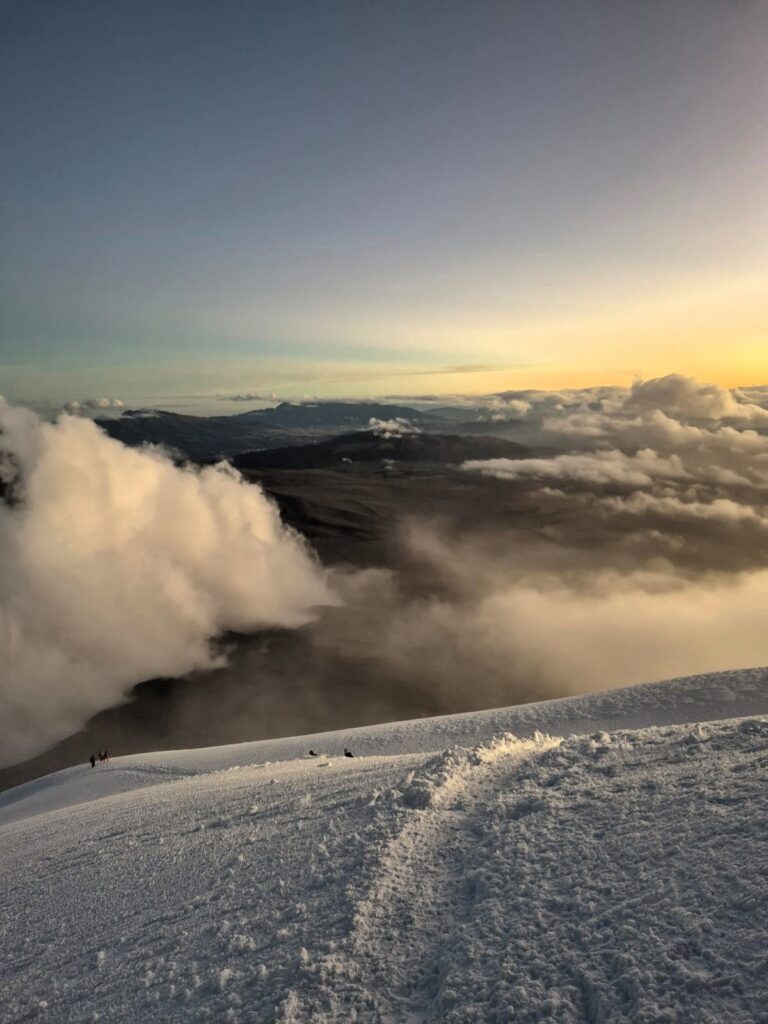
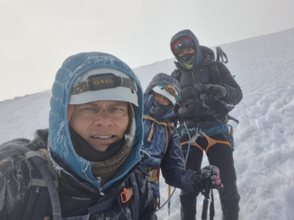
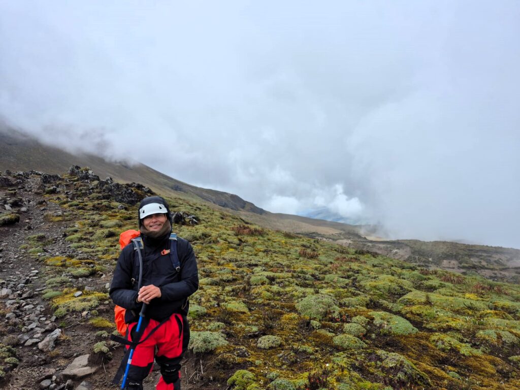
At around 18,200 ft, the sun finally began to rise behind us, painting the sky with streaks of orange and pink. We were above the clouds, watching dawn unfold from the heart of a volcano. It was a moment of pure awe — cold, quiet, and completely unforgettable.
This photo was taken at 6 am on Cotopaxi…
A Difficult Decision at 18,200 ft
But as we climbed higher, the weather began to turn. Wind speeds picked up, and the cold intensified. Our jackets were crusted with ice. Raul, constantly monitoring conditions, made a tough call. He had seen other climbers already turning back due to worsening visibility, high winds and unstable snow conditions. For safety reasons, he recommended we retreat as well.
We were just 1,100 ft from the summit, but when the mountain says no, you listen. Disappointed but understanding, we turned back.
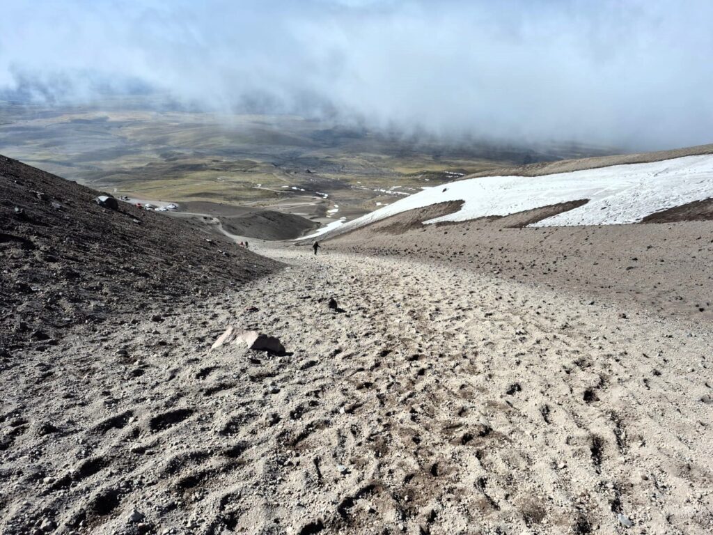
The Descent and Reflection
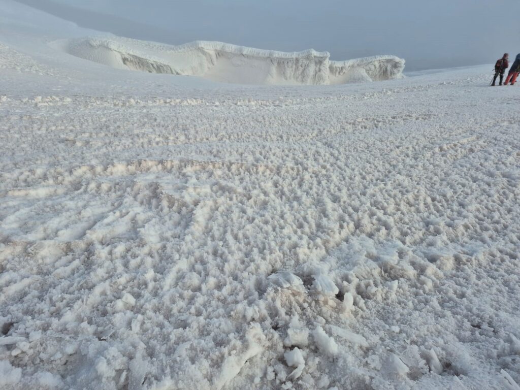
The descent, though easier on the lungs, was far from simple. We made our way down over dazzling glacial formations — deep blue crevasses, smooth ice ridges, and fields of white that seemed endless.
Despite the summit remaining just out of reach, the journey itself was spectacular. Every step on Cotopaxi had demanded strength, focus, and humility.
We returned to the Refugio José Rivas by around 9:00 AM, exhausted but proud. After a warm breakfast, we made our way back to the Cotopaxi parking lot and finally returned to Machachi by 12:00 noon.
We hadn’t reached the very top, but we had experienced Cotopaxi in all its raw, glacial beauty. The climb taught us that sometimes, the journey is the summit.
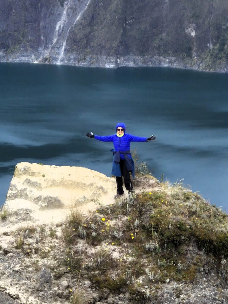
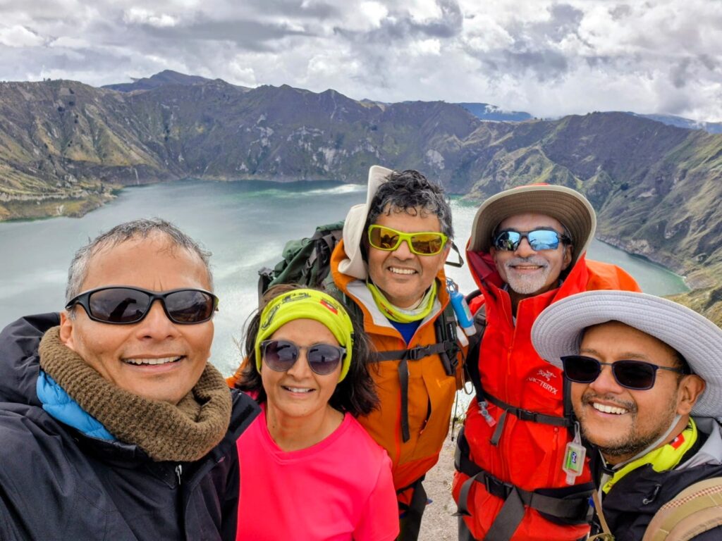
Section 6: Quilotoa – Walking the Rim of a Volcanic Crater (July 9, 2025)
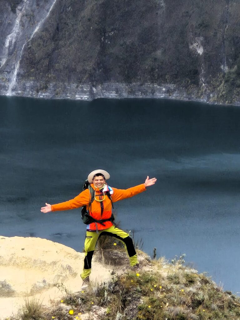
Quilotoa is a stunning volcanic crater lake located in the Andes of central Ecuador, approximately 3,914 meters (12,841 feet) above sea level. The lake was formed about 800 years ago following a catastrophic eruption of the Quilotoa volcano, which led to the collapse of its summit and the creation of a 3-kilometer-wide caldera. Over time, the crater filled with water, resulting in the breathtaking turquoise lake that draws trekkers and nature lovers from around the world.
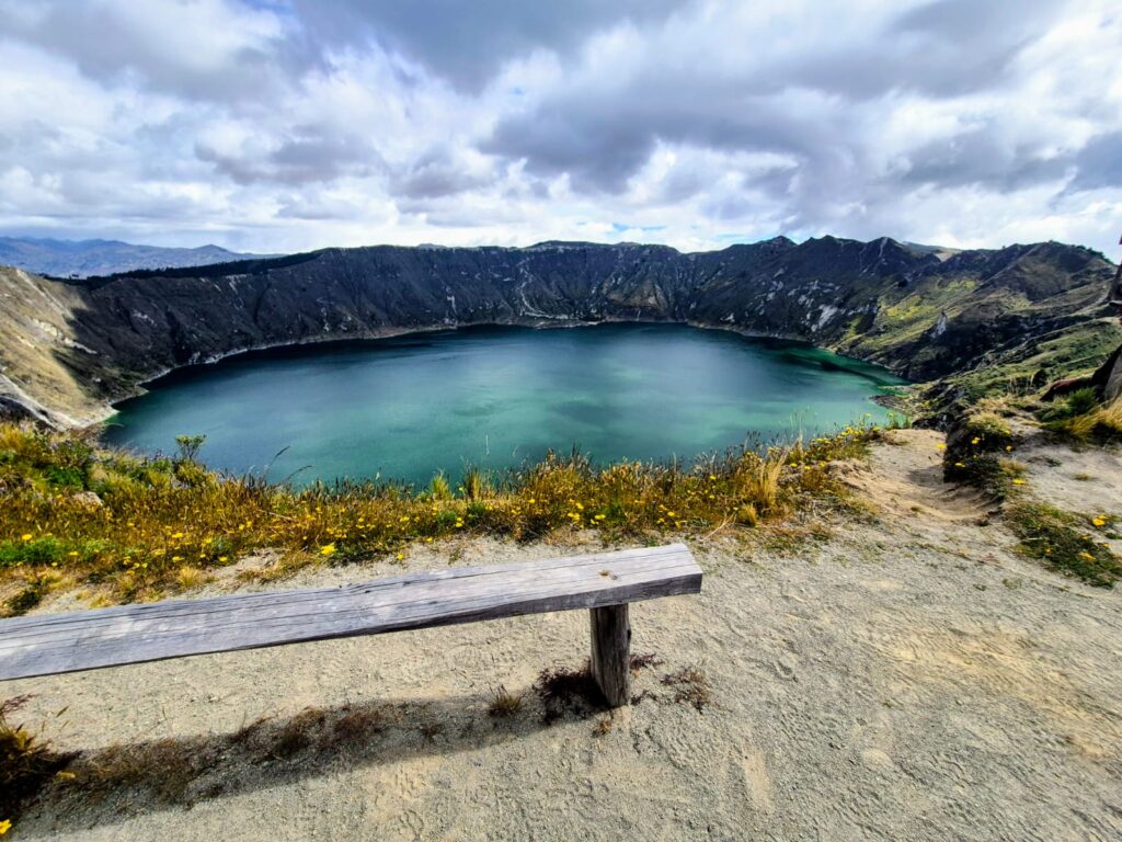
The lake’s vibrant greenish-blue color comes from dissolved minerals and fluctuates slightly with sunlight and weather conditions, adding to its mystique. While the volcano is considered dormant today, the area is still geologically active, with hot springs and gas bubbles occasionally visible near the lake’s surface.
One of the most popular activities at Quilotoa is the circuit hike around the rim of the caldera — a 10–11 km (6.5–7 mile) trek that offers panoramic views of both the lake and the surrounding Andean highlands. The trail features steep ascents and descents, narrow ridge paths, and wildflower-dotted slopes. On a clear day, hikers can see several nearby volcanoes, including Cotopaxi and Iliniza.
Quilotoa is part of the larger Quilotoa Loop, a famous multi-day trekking route that passes through indigenous villages, deep valleys, and remote farmlands. Whether done as a day hike or part of a longer journey, the Quilotoa experience blends raw natural beauty, local culture, and high-altitude adventure.
Midway through our Ecuador trek, we found ourselves standing at the edge of one of the country’s most breathtaking natural landmarks — Quilotoa, a deep, turquoise volcanic crater lake formed over 800 years ago. This otherworldly landscape was born from the collapse of a volcano in a cataclysmic eruption, leaving behind a jagged caldera now filled with mineral-rich water. Today, Quilotoa is both a geological wonder and a dream destination for trekkers. A car took us from Machachi in the morning to Quilotoa lake.
The Crater Lake Circuit – A Trek Like No Other
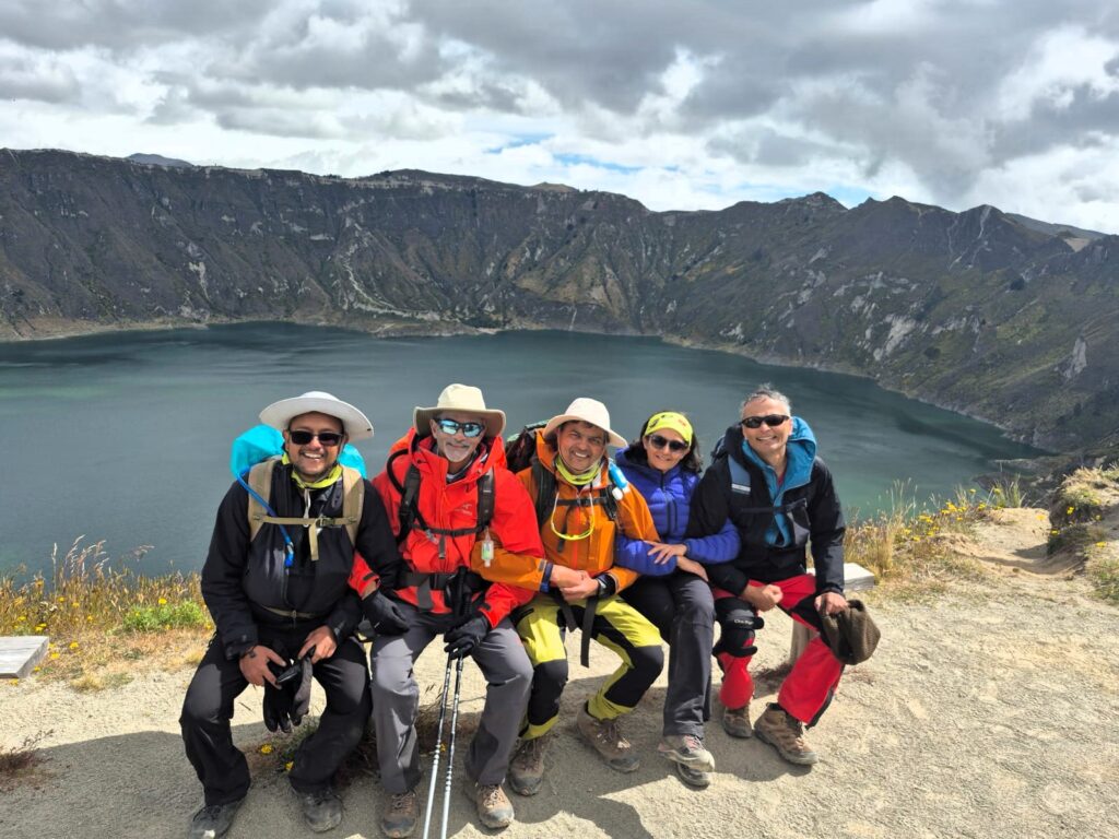
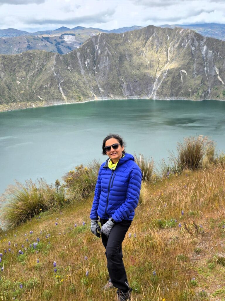
On Wednesday, July 9, five of us — Ashu, Arun, Jai, Anu, and Samir — set out to complete the 11 km (6.5-mile) circuit trek that loops around the rim of the Quilotoa crater.
The trail is known for its raw beauty, high-altitude challenge, and constantly shifting views of both the lake and the Andean countryside below.
The trek took us approximately 4 hours and 30 minutes, and every step along the rim was spectacular.
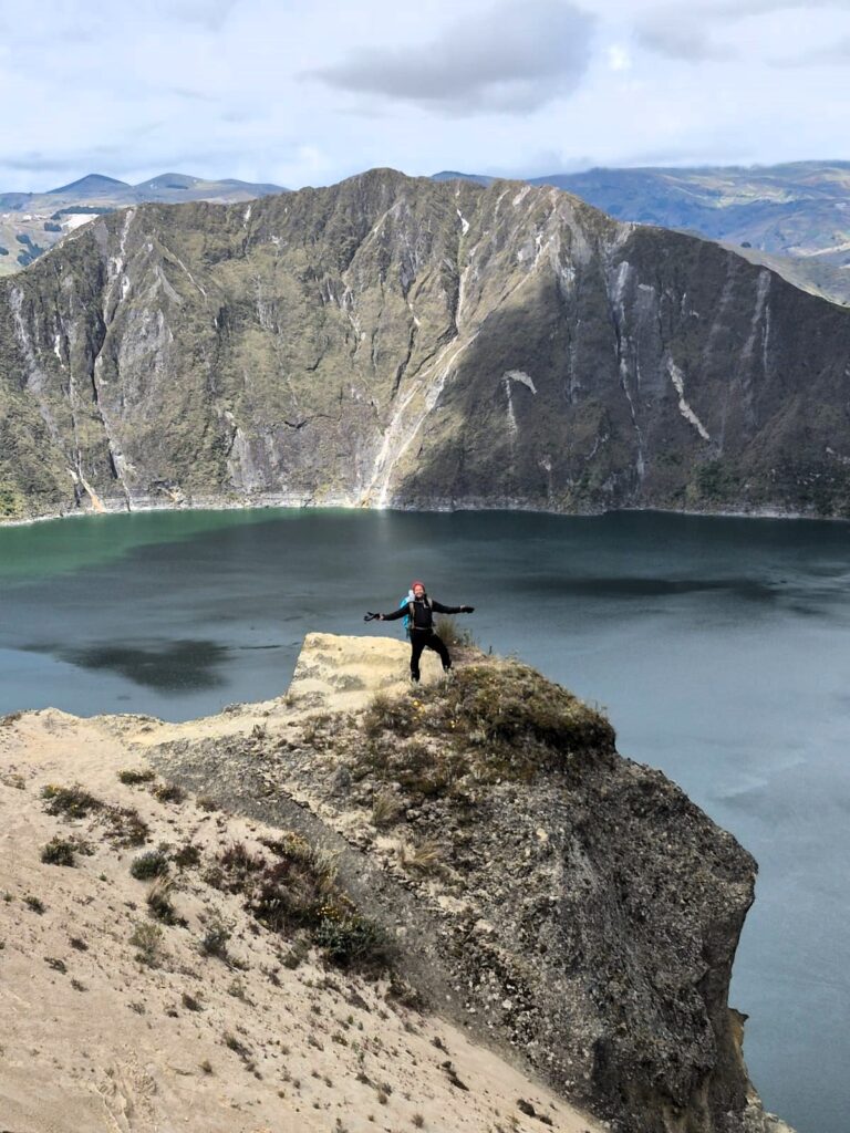
On one side, the emerald-green lake shimmered under the sun; on the other, wide vistas of rugged mountains, deep valleys, and remote Andean villages unfolded like a painting. We had not done a crater circuit trek with views on both sides of the ridge. It was a unique experience.
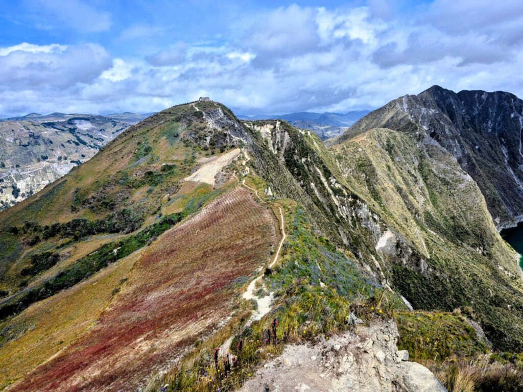
The weather was ideal — sunny and calm, with none of the rain that had been forecast. Along the rim, we followed a narrow ridgeline trail edged with wildflowers and steep drop-offs.
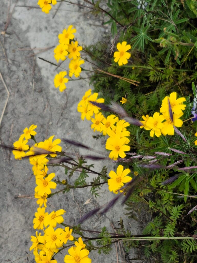
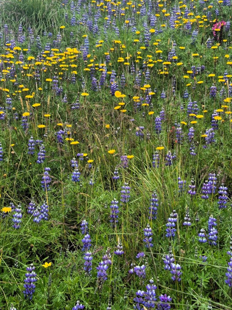
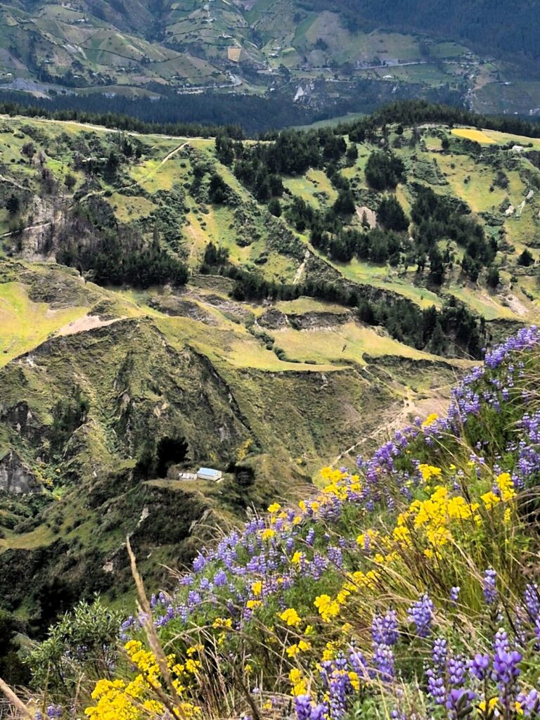
In many ways, it was one of the most unique and visually stunning treks we had ever done. It was as if we were walking in a wildflower garden.
A Warm Ending to a Cool Day
By 4:45 PM, we completed the full circuit, legs tired but spirits soaring. The crisp mountain air, the dramatic landscape, and the shared adventure left us all with lasting memories. Before leaving, we picked up some hot chocolate from a local stand — a simple pleasure that felt richly earned.
We departed Quilotoa at 5:15 PM, arriving back in Machachi by 7:45 PM. That evening, we also bid farewell to Sri and Divya, who were headed back to the San Francisco Bay Area.
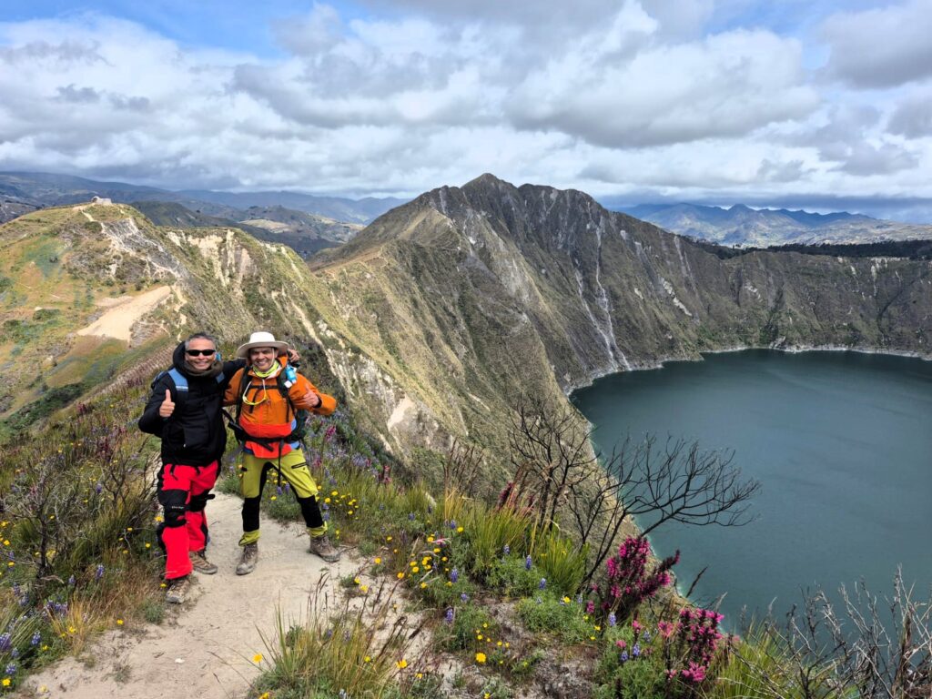
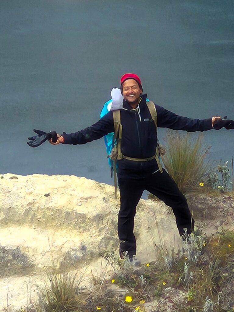
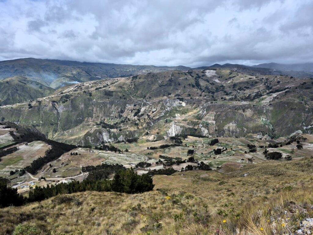
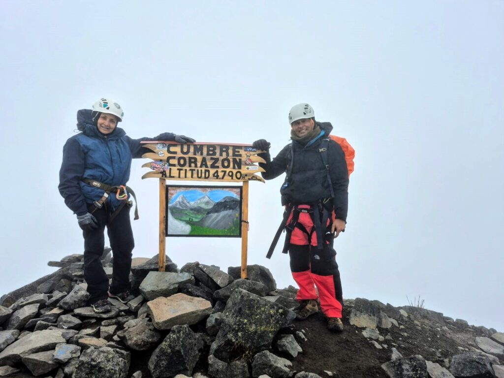
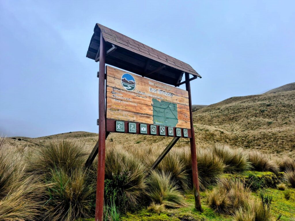
Section 7: Corazón – A Ridge, a Summit, and the Joy of the Climb (15,720 ft – July 10, 2025)
Corazón, also known as Volcán Corazón, is a dormant stratovolcano located in the Western Cordillera of the Ecuadorian Andes, about 40 km southwest of Quito. It reaches an elevation of approximately 4,786 meters (15,702 feet) and is named “Corazón” — Spanish for “heart” — because some believe its profile resembles the shape of a heart when viewed from certain angles.
Though it hasn’t erupted in recent geological history, Corazón is part of Ecuador’s volcanic chain and offers trekkers a classic high-altitude climb. The ascent is non-technical but physically demanding, featuring grassy páramo landscapes at the base, leading to rocky ridgelines and moderate scrambling closer to the summit. On clear days, hikers are rewarded with spectacular views of surrounding giants such as Cotopaxi, Rumiñahui, and the Illinizas.
What makes Corazón particularly appealing is its relative solitude — it’s less frequented than peaks like Cotopaxi or Cayambe, offering a more peaceful and intimate mountain experience. It’s also an excellent acclimatization peak for those preparing to climb higher elevations.
The route to the summit typically takes 3–4 hours up and 1.5–2 hours down, depending on weather and trail conditions. Though not known for technical challenges, the climb can be affected by fog, wind, and cold temperatures — all typical of the Andean highlands. Corazón stands as a rewarding trek for anyone seeking to immerse themselves in the rugged beauty of Ecuador’s mountains.
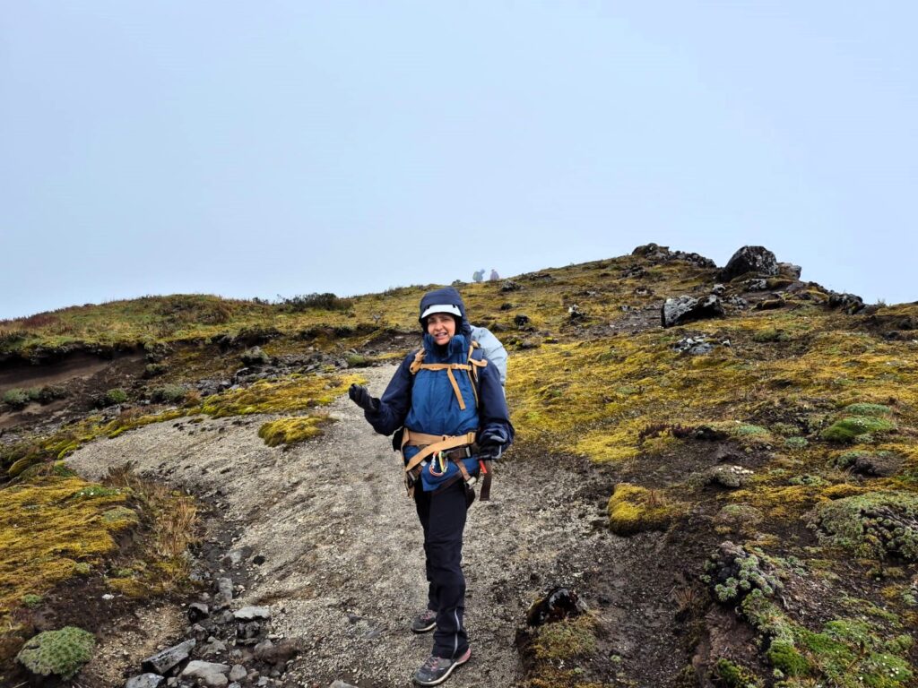
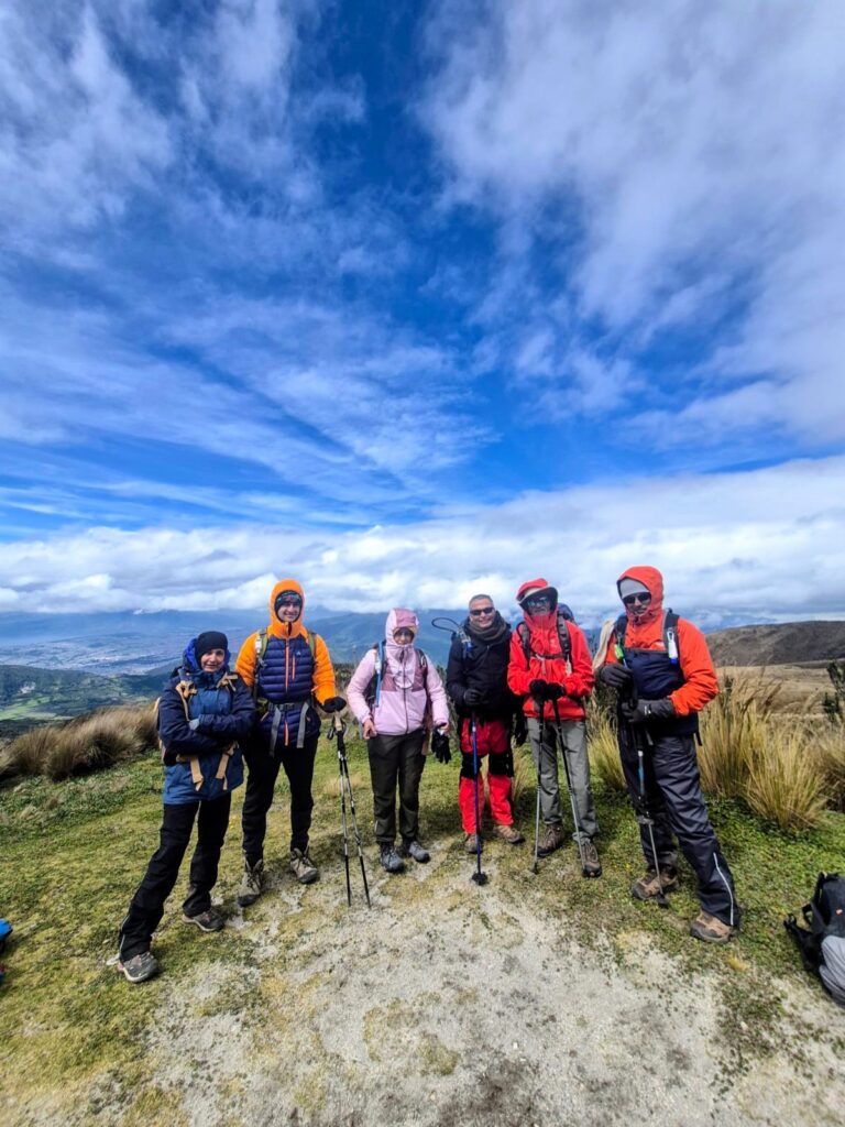
On Friday, July 11, five of us — Arun, Sushil, Ashutosh, Anu, and Samir — set our sights on Corazón, a dormant stratovolcano in the western Andes, named for its heart-like shape when viewed from certain angles. Standing at 15,720 ft, Corazón isn’t the highest peak we attempted, but it proved to be one of the most rewarding.
Starting in the Mist
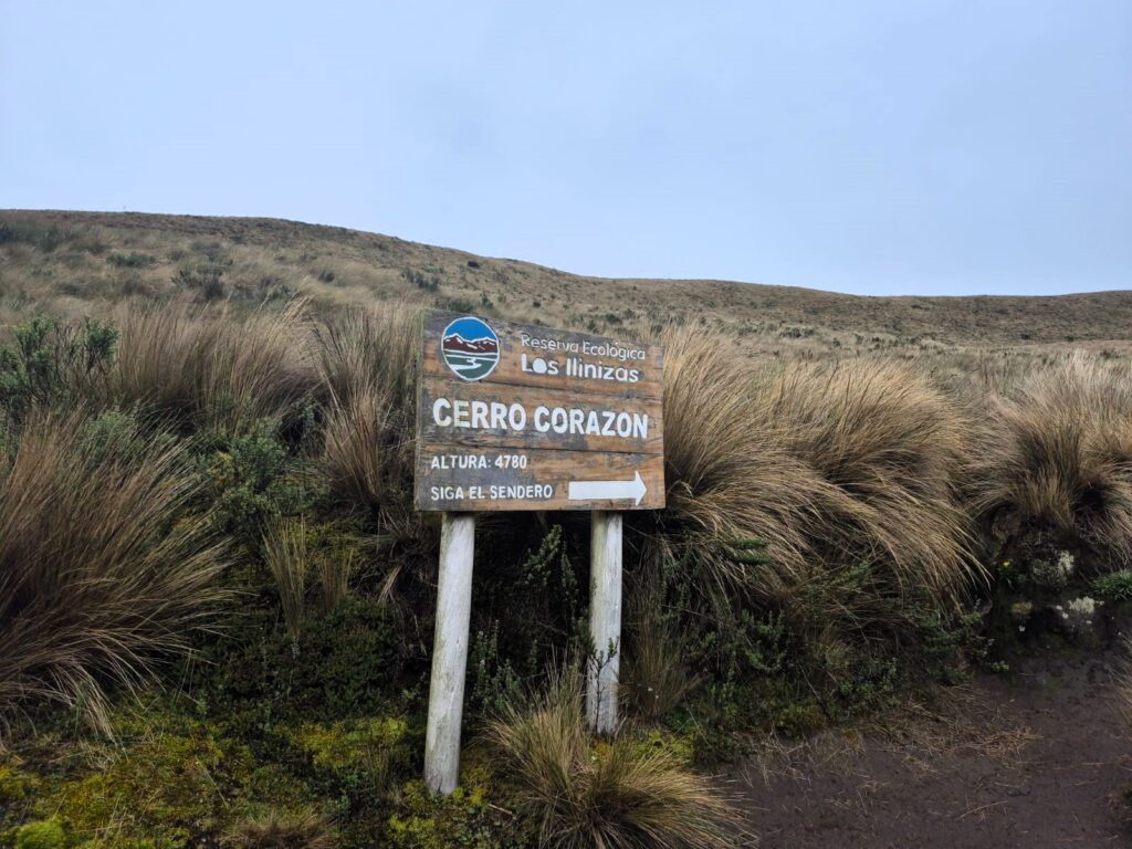
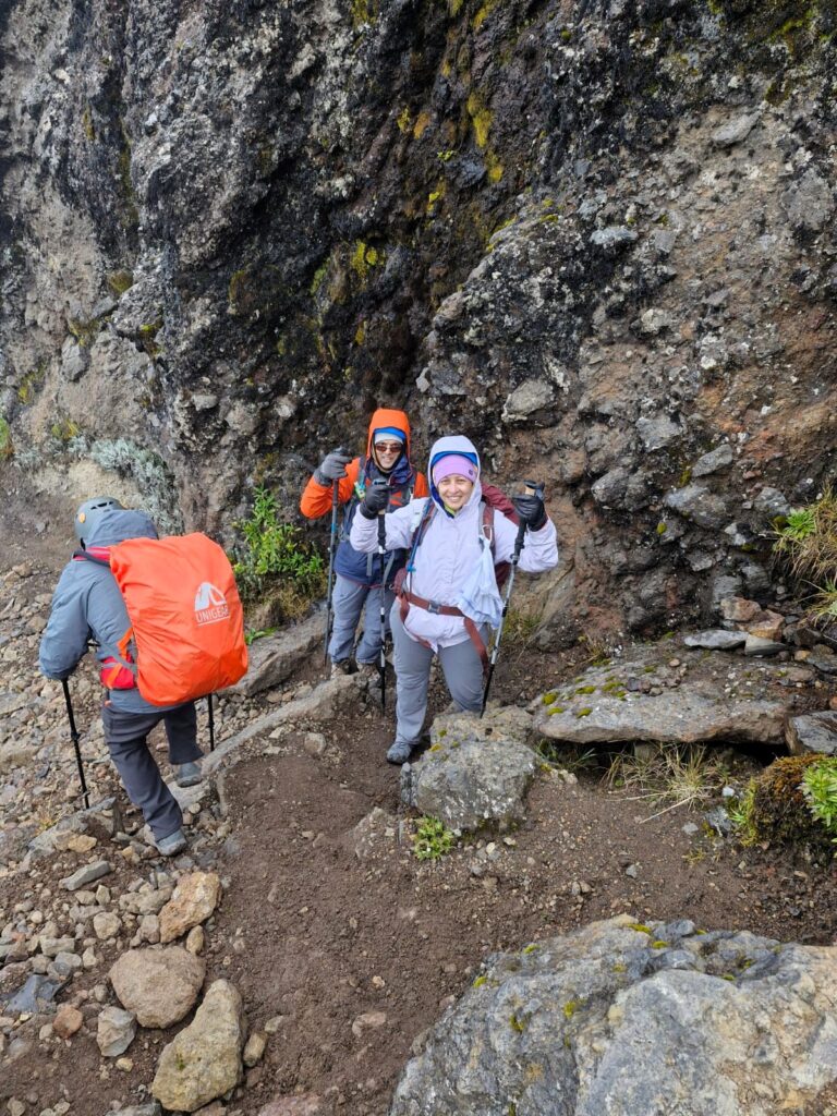
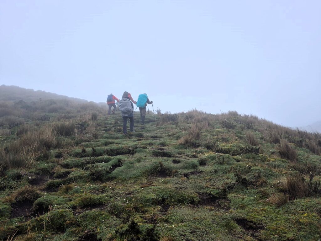
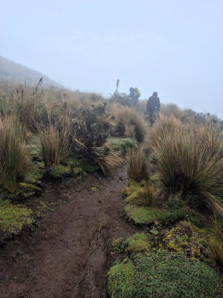
We began our trek around 9:45 AM from the trailhead. The weather was overcast, and visibility was low, with thick clouds cloaking much of the trail. Our path began with a gentle ascent through grassy slopes, a peaceful lead-in to what would become a more intense and technical climb.
Ridge Walk and Rock Scrambles
After about 1.5 hours, we reached a stunning mountain ridge, narrow and exposed, with steep drop-offs on both sides. Despite the foggy conditions, walking this section was a surreal experience — like treading a line between two worlds.
A trail sign pointing to the legendary Illinizas in the distance —>
The next stretch was both beautiful and demanding. For nearly another 1.5 hours, we scrambled up through rocky terrain, doing 10 to 15 rock scrambles. At one point, we had to rope up with our guide.
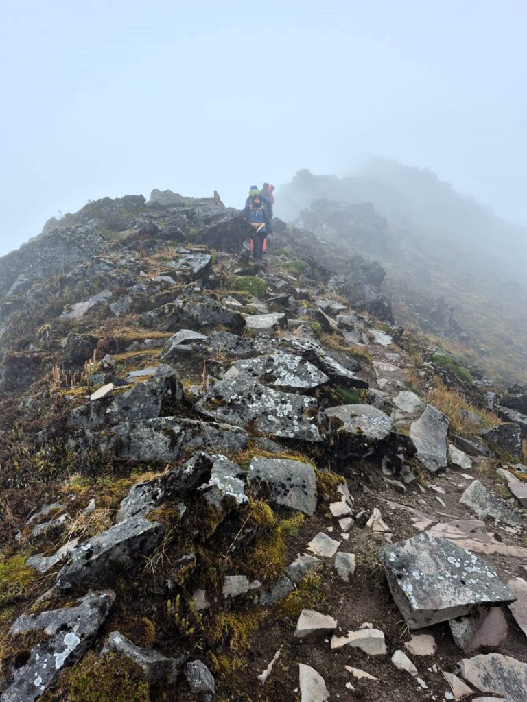
The rocks were stable but required focused effort, turning the trek into a hands-and-feet adventure.
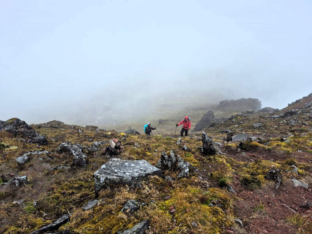
Interestingly, the final approach to the summit came as a surprise — after all the scrambles, the trail suddenly leveled out and led gently to the top.
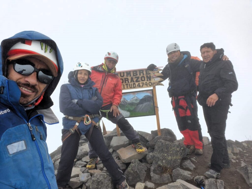
Around 3 hours and 15 minutes after starting, Anu and I (Samir) reached the summit, with the others close behind.
Nature, Quiet, and Satisfaction
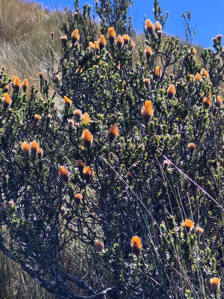
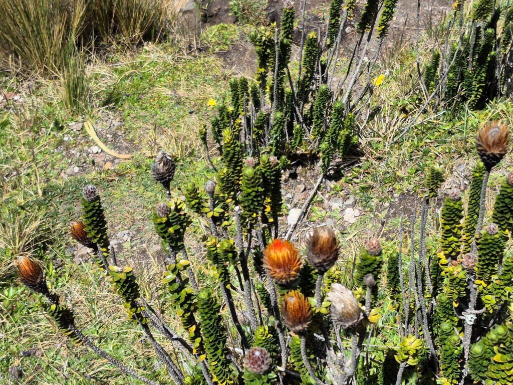
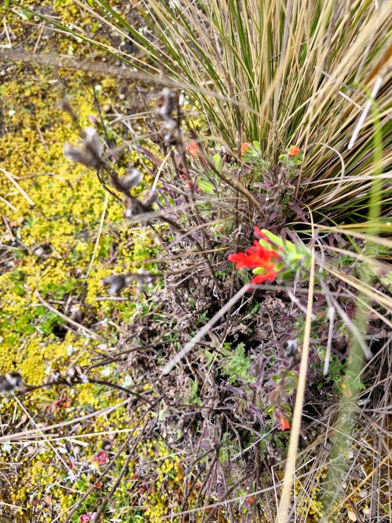
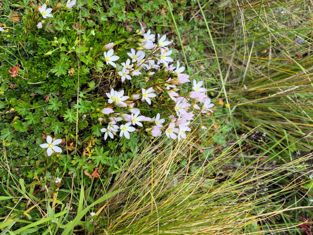
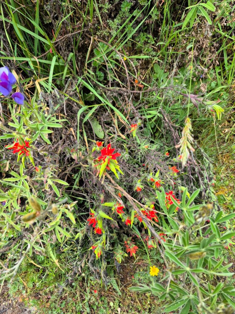
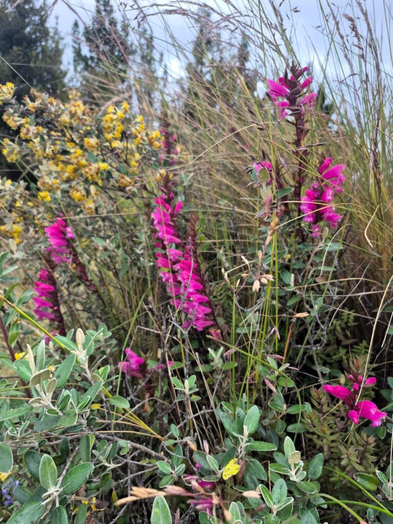
Although the cloudy skies hid the panoramic views Corazón is known for, the trail had its own quiet charm. We spotted a few wildflowers with unusual patterns, adding color to the otherwise muted landscape.
On the descent, we had to wade through tall, coarse grass — so dense that we could use it for balance when the trail became slick.
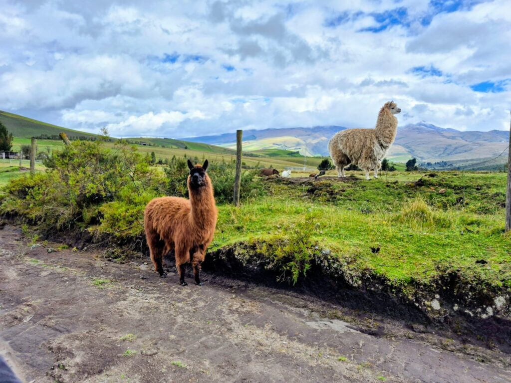
On the way back, we had a bonus wildlife sighting — a llama and an alpaca grazing peacefully. For the untrained eye, they’re easy to confuse, but we learned the difference: llamas have longer necks and leaner faces, while alpacas have shorter necks and more rounded, woolly features.
We returned to Machachi by around 5:15 PM, tired but thrilled. Climbing Corazón was a perfect combination of challenge, camaraderie, and quiet triumph.
Section 8: Wawa Pichincha – A Windy Ascent to an Active Crater (15,700 ft – July 11, 2025)
Wawa Pichincha, more commonly spelled Guagua Pichincha (with “wawa” meaning “child” in Quechua), is one of two major peaks in the Pichincha volcanic massif overlooking Ecuador’s capital, Quito. It rises to an elevation of 4,784 meters (15,696 feet) and is classified as an active stratovolcano, with its most recent eruption occurring in 1999, when it blanketed parts of Quito in volcanic ash.
The peak is known for its dramatic volcanic crater, rugged terrain, and relatively accessible summit, making it a favorite among local hikers and acclimatizing mountaineers. The hike begins from a mountain refuge located just below the main trail and usually takes about 2–3 hours to summit, depending on conditions.
The trail is straightforward initially but becomes more challenging with rock scrambles and narrow ridgelines as climbers approach the crater. Hikers often catch sulfuric smells rising from the caldera — a reminder of the mountain’s volcanic nature. Though the crater is often obscured by clouds, on clear days the views into its depths are stunning and eerie.
Because of its proximity to Quito and relatively short duration, Guagua Pichincha is often used as a warm-up climb for more technical peaks. However, it can still pose challenges due to its high winds, rapid weather changes, and the exposed terrain near the summit.
It is also culturally and geologically significant, forming part of the “Avenue of Volcanoes” and providing insight into the dynamic tectonic forces that shape the Ecuadorian Andes.
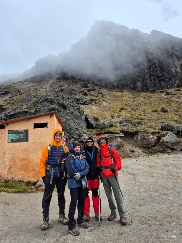
For our final trek in Ecuador, six of us — including Robin, our guide — set out to summit Wawa Pichincha (also spelled Guagua Pichincha), a 15,700 ft peak just west of Quito. “Wawa” means child in the Ecuadorian native language, and this volcano is indeed the younger sibling to Rucu Pichincha, which we had climbed earlier in the trip.
We began our hike with brisk winds blowing at 30–40 miles per hour, a reminder that mountain weather in Ecuador doesn’t believe in easing you in. From the trailhead, it took about 45 minutes to reach the refuge hut, with Wawa Pichincha’s peak looming in and out of the clouds.
The trail started off gently, but soon evolved into a more demanding path.
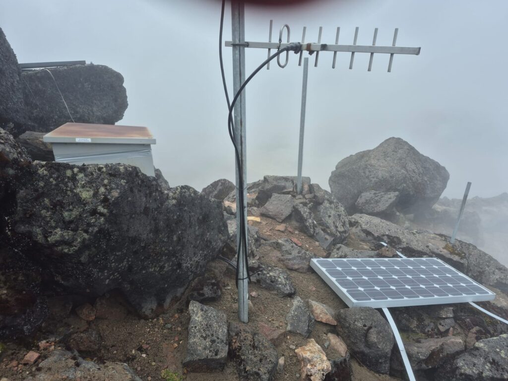
We scrambled across volcanic rock sections and skirted along the edge of the Pichincha Crater, an active volcanic formation whose last significant eruption occurred in 1999. We saw a seismic listening device on the way. It measures volcanic and seismic activity at the edge of the crate.
At times, we could smell faint sulfur fumes rising from the crater, although thick clouds kept the interior mostly hidden from view. Though we could not see the crater, the sulfur fume smell reminded us that were on the edge of an active volcanic crater.
Summit in the Wind
The final push to the summit was challenging— not just because of the terrain, but because of the relentless wind. Wawa Pichincha was visible at intervals, framed dramatically by rolling mist. We reached the summit in about 2 hours, climbing nearly 2,000 ft from our starting point.
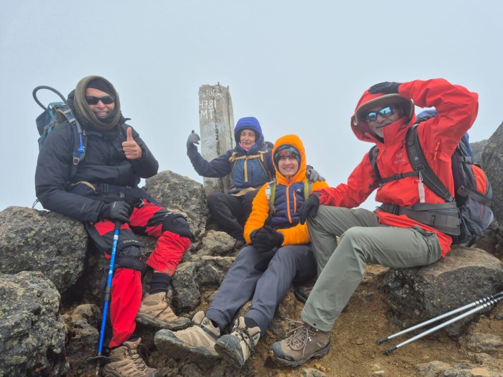
At the top, we were greeted by howling gusts and fleeting views. We quickly captured a few group photos, soaking in the accomplishment and the volcanic energy of the place. Then, given the wind and the shifting clouds, we could not stay much longer and we began our descent.
A Quick Descent, a Memorable Finish
It took just 30 minutes to return to the base, a rapid drop compared to our steady climb up. Along the way, the weather danced between clear skies and sudden fog, the wind ever-present.
Wawa Pichincha was a perfect finale — short, challenging, scenic, and full of character. After days of hiking across Ecuador’s stunning mountains, this last climb offered a strong, symbolic close: a young peak, an active volcano, and a reminder that the mountains are always alive.
We descended not just from a summit, but from a remarkable journey through Ecuador’s Andean wonders. The adventure was nearly complete — but its memories, etched in wind and stone, would stay with us for a long time.
Section 9: Learnings from the Andes
After nearly two weeks of trekking through Ecuador’s majestic mountains, we came away not just with memories and summit attempts, but also with valuable lessons — practical, cultural, and personal. Here are a few key insights from our journey:
1. Equator ≠ Tropical Warmth
Although Ecuador straddles the equator, the high altitude of the Andes means the weather is anything but tropical. Cold, windy, and unpredictable conditions are the norm, especially above 12,000 ft. Warm layers, windproof gear, and technical clothing are essential — don’t let the latitude fool you.
2. The Mountains Have the Final Say
Peaks like Cotopaxi, Chimborazo, and Cayambe may look inviting in photos, but in reality, they are often subject to strong winds, sudden snowstorms, and whiteout conditions. Even experienced mountaineers can find these climbs much harder than equivalent peaks in calmer weather. Success depends as much on weather windows as it does on preparation.
3. Time Is More of a Suggestion
Culturally, Ecuador — like much of South America — operates on a more relaxed relationship with time. Tours, transportation, and schedules may not always begin exactly on the dot. This laid-back approach can be refreshing if you’re flexible, but it’s worth adjusting expectations if you’re used to strict punctuality.
4. Booking Refuges Is Easier Than Expected
Getting a spot at mountain refuges like José Rivas (Cotopaxi), Nuevos Horizontes (Illiniza), or Whymper (Chimborazo) is generally not difficult. Many accommodations can be arranged just a few days in advance, allowing for greater spontaneity in your trekking plans.
5. Don’t Over-Plan — Let the Weather Guide You
This might be the most important takeaway: avoid booking all your treks in advance. Ecuador’s mountain weather is highly unpredictable, and committing to a rigid itinerary can lead to missed summits and sunk costs. Instead, it’s best to arrive, watch the forecasts, and book climbs one at a time based on conditions. Flexibility is your greatest asset in the Andes.
6. Budget-Friendly Adventure
Ecuador is an extremely affordable destination, especially compared to the U.S. We found that most things — from food and transportation to accommodations and guides — cost about one-third of U.S. prices. For mountaineers and trekkers seeking high adventure without high expenses, Ecuador offers outstanding value.
Section 10: Summary — A Journey Through the Andes
Our Ecuador expedition was a deeply rewarding and memorable experience.
While we had originally planned for a few more summit attempts, the harsh mountain weather — marked by snowstorms, strong winds, and low visibility — meant we had to adjust our plans along the way. Still, we completed an exceptional lineup of treks through some of the most rugged and beautiful landscapes in the Andes.
Over the course of two weeks, we accomplished:
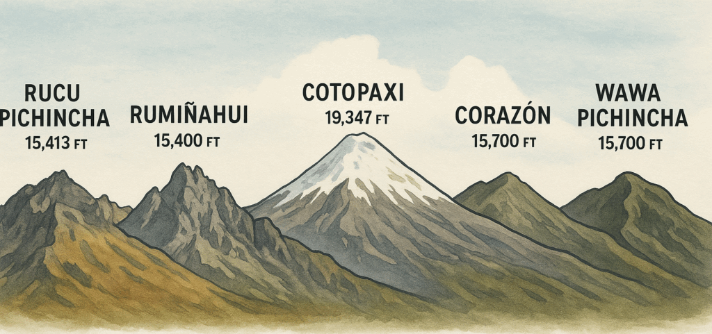
Five major peaks
- Rucu Pichincha – 15,400 ft
- Rumiñahui – 15,400 ft
- Corazón – 15,700 ft
- Wawa Pichincha – 15,700 ft
- Cotopaxi – Reached 18,200 ft before turning back due to weather conditions
One high-altitude refuge stay
- Illiniza Norte Refuge (Nuevos Horizontes) – 15,400 ft
One remarkable crater lake circuit
- Quilotoa Loop – 11 km (6.5 miles) around the rim at approximately 13,000 ft
Each trek brought its own set of challenges — from rock scrambles to narrow ridgelines, from freezing wind chills to steep descents through tall grass. Along the way, we experienced unforgettable views, moments of quiet awe, and the camaraderie that only grows stronger in the mountains.
While not every planned summit was reached, the overall journey was a success by every measure that truly counts — effort, spirit, teamwork, and safety. The Ecuadorian Andes tested us, inspired us, and left us with stories we’ll carry for a long time.
This was not just a series of treks, but a meaningful expedition that connected us more deeply with nature, and with each other. We left with gratitude and a quiet resolve — knowing that some day we’ll be back.


Oh my goodness! Awewsome article dude! Thanks, However I am
encountering difficulties with your RSS. I don’t
know why I can’t join it. Is there anybody else getting similar RSS issues?
Anyone that knows the answer can you kindly respond?
Thanx!!
Thanks for your marvelous posting! I genuinely enjoyed reading it, you will be a great author.
I will always bookmark your blkog and may come back in the foreseeable future.
I want to encourage continue your great posts, have a nice holiday weekend!