

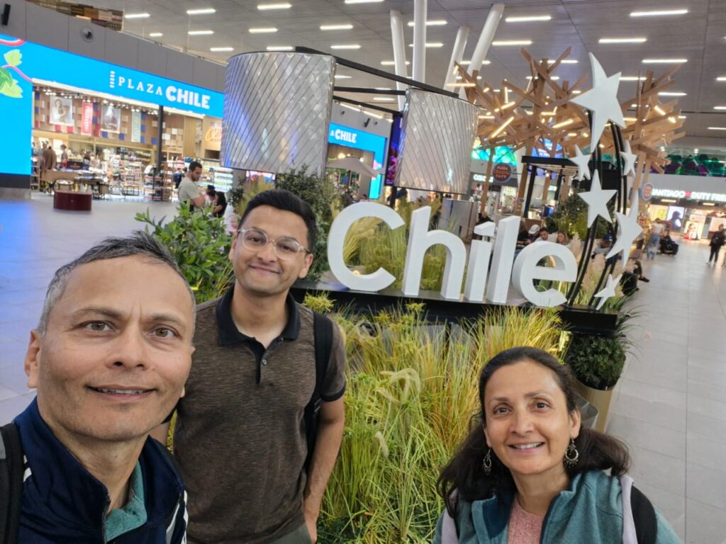
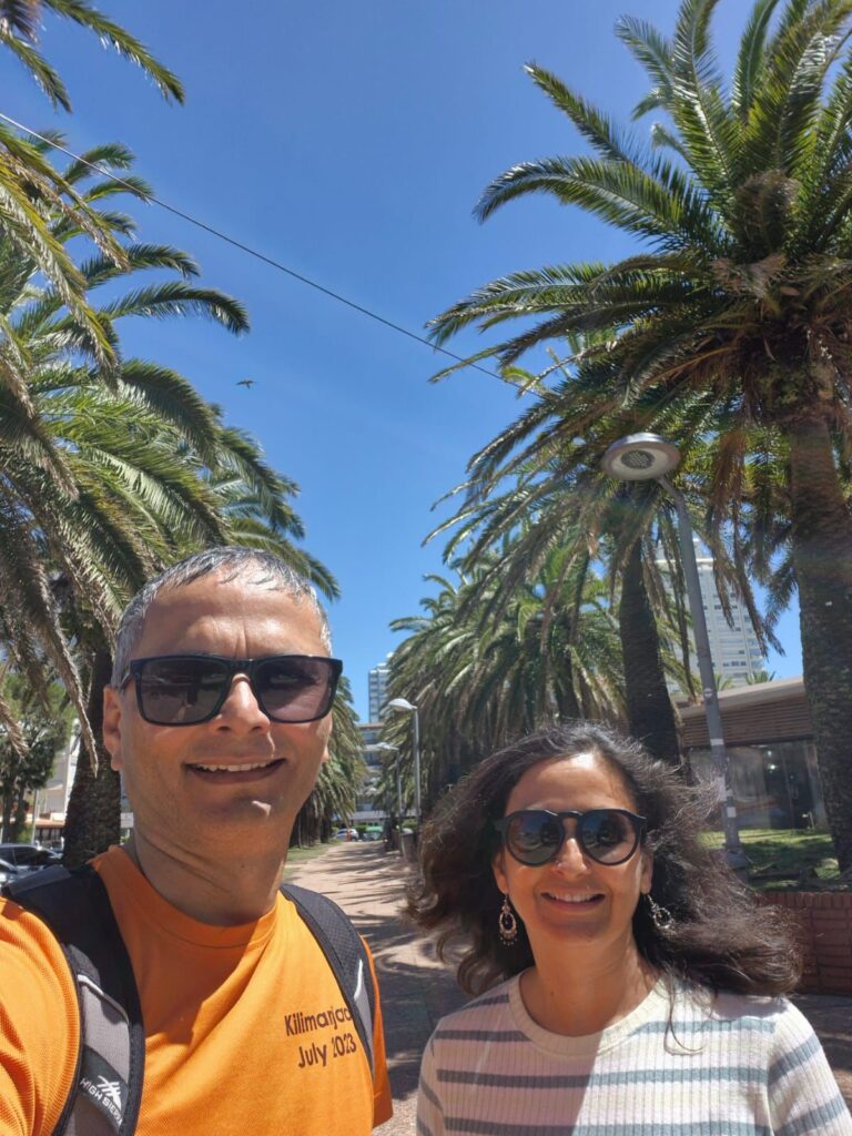
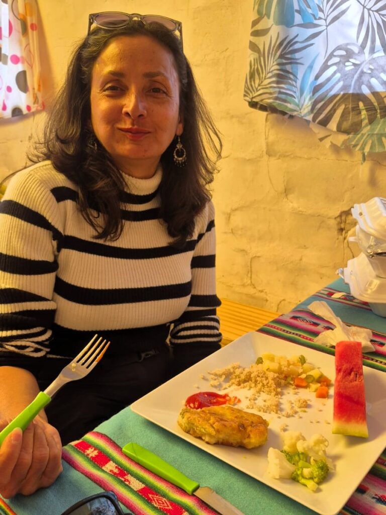
Between December 26, 2025 and January 31, 2026, we journeyed across Chile, Argentina, Uruguay, Paraguay, Bolivia, and Costa Rica on what turned out to be one of our most diverse and memorable trips. The adventure began in Chile on Dec 26–27, followed by the spectacular W-Trek in Patagonia from Dec 28 to Jan 3. We then set sail for our Antarctica expedition from Jan 8 to Jan 18, crossing the legendary Drake Passage and exploring the White Continent. Returning to South America on Jan 18, we continued onward through Argentina, Uruguay, Paraguay, Bolivia, and finally Costa Rica, wrapping up the journey on Jan 31 — a month filled with dramatic landscapes, vibrant cities, rich history, and unforgettable experiences. We had already visited Peru, Ecuador, Colombia, Brazil, Panama in the past, so we did not visit those countries this time.
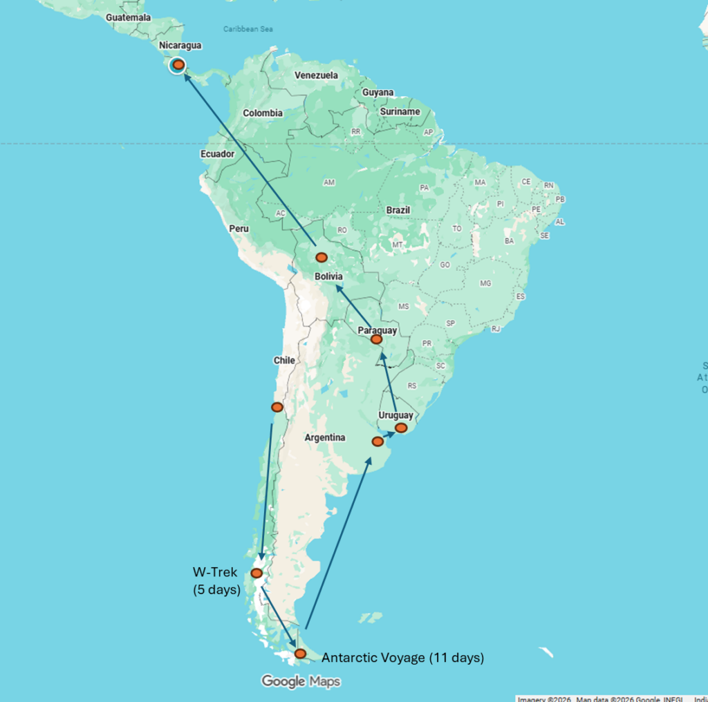
Here is a day by day itinerary of our trip.
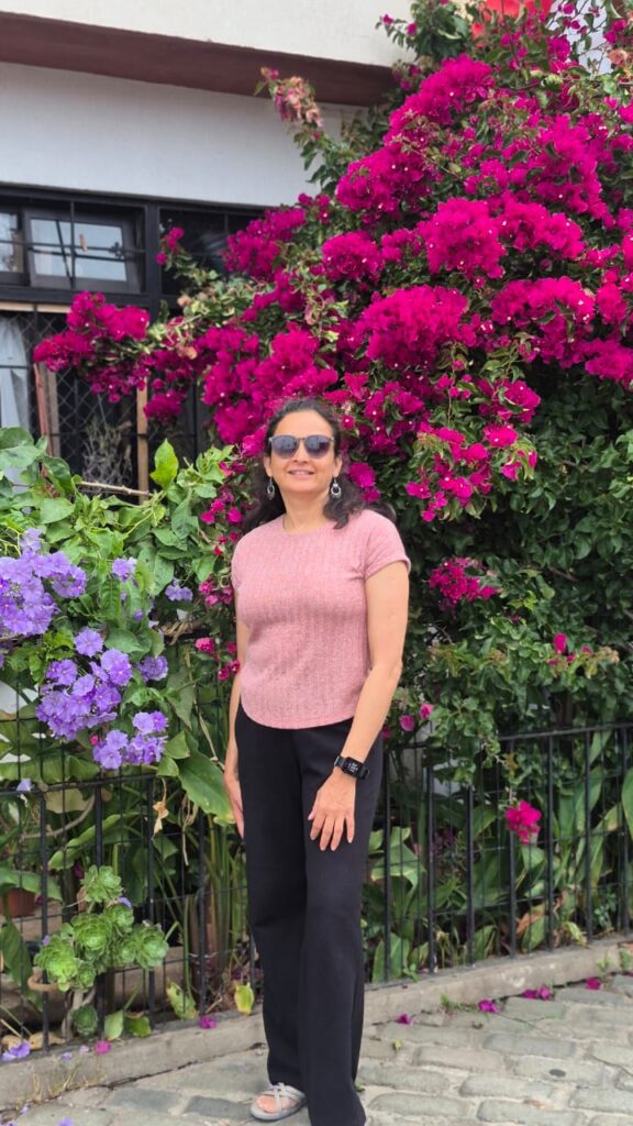
Friday, Dec 26, 2025 – Santiago, Chile
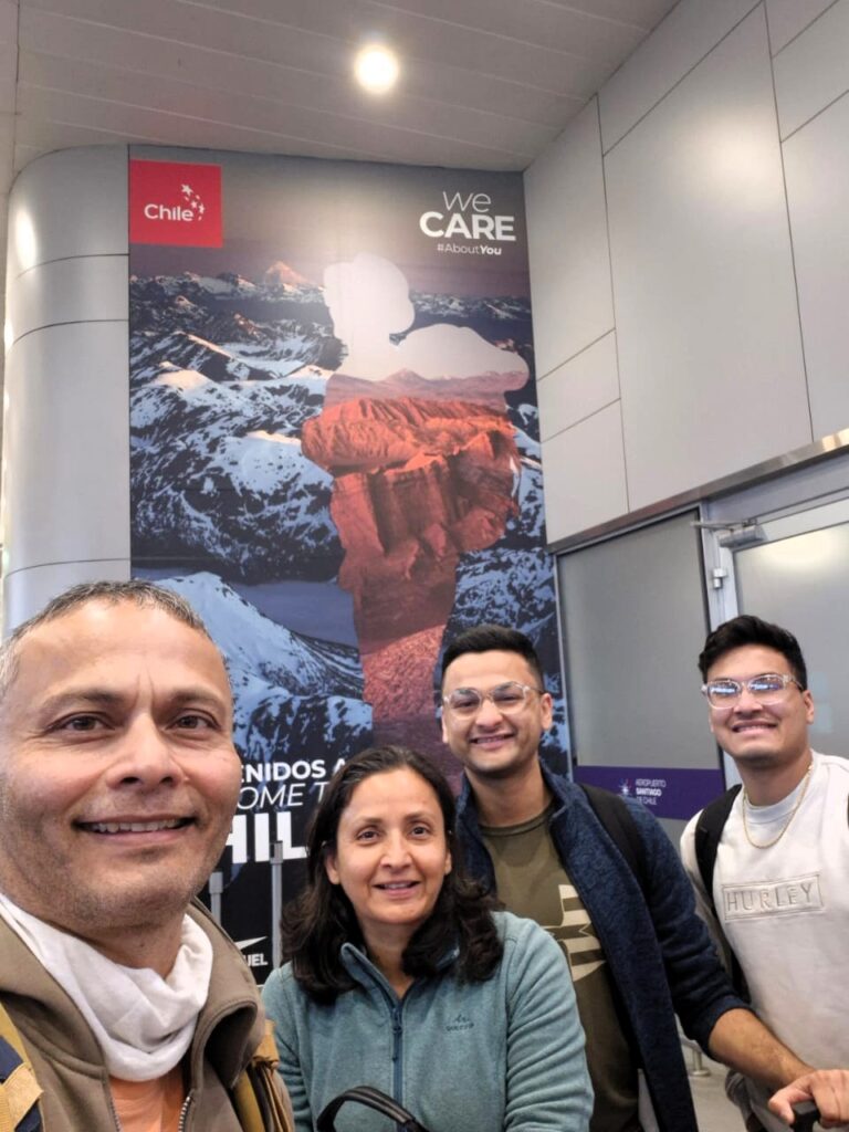
We flew from Mumbai via Frankfurt and Houston. We spent the day exploring Santiago.
Immigration was smooth, and our bags arrived in a timely manner. We took an Uber from Santiago airport to our hotel, DoubleTree Hilton, in the Vitacura area of Santiago. It took us about 30 minutes to reach the hotel. Luckily, the hotel allowed us an early check-in, and we were able to freshen up after a long journey.
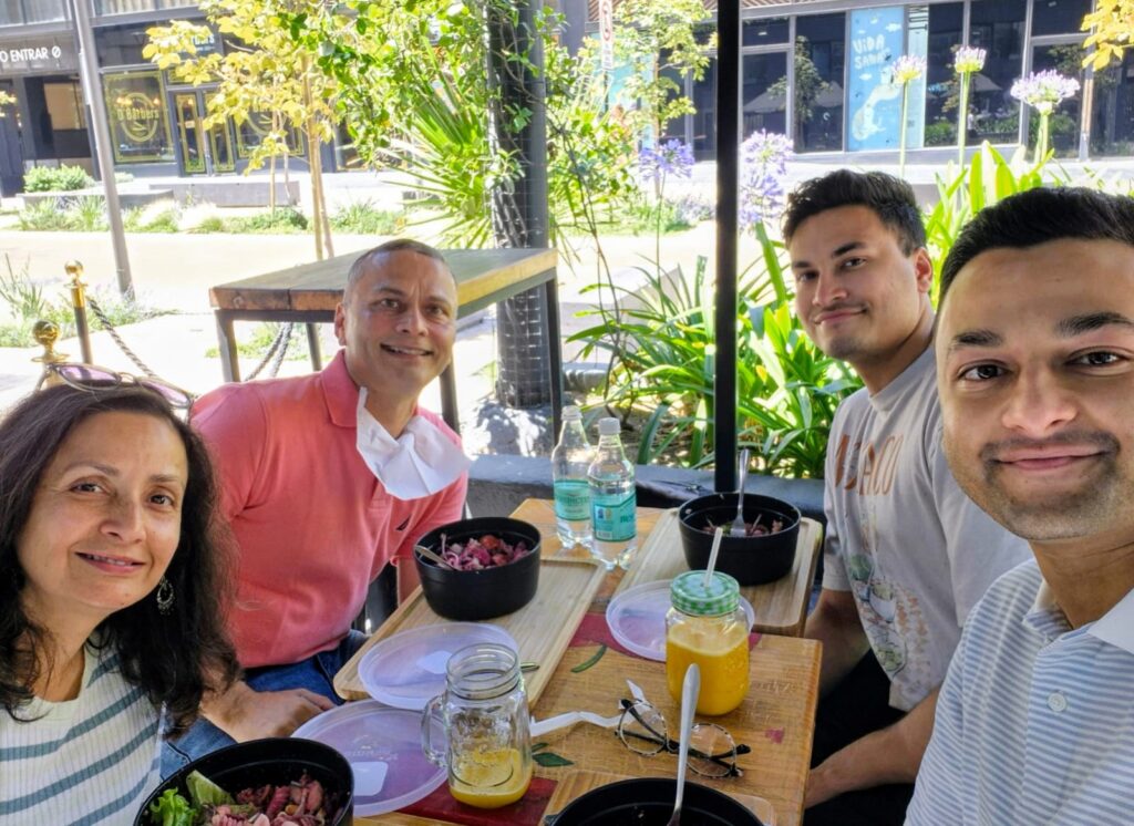
We went to Wenappetit, a nearby restaurant, for lunch around 11:30 am. The name of the restaurant had changed, so we had some trouble locating it. They served salad bowls and juice, and the food was very good.
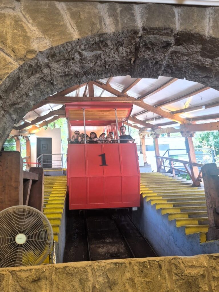
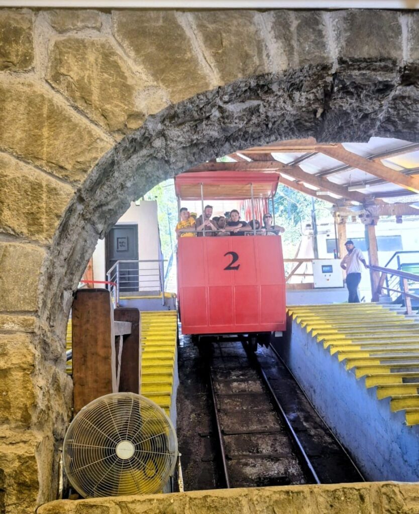
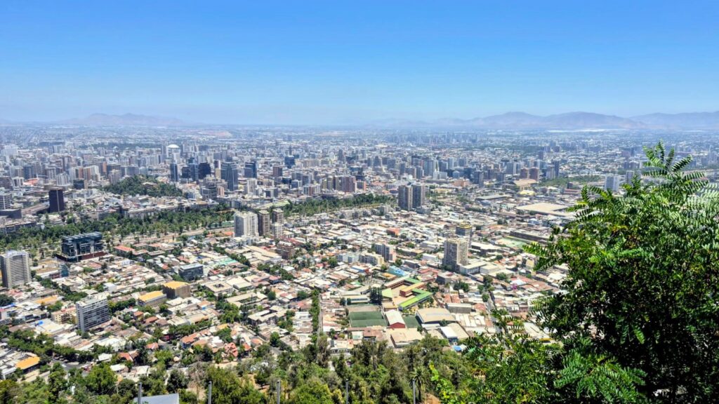
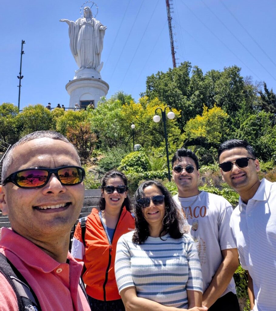
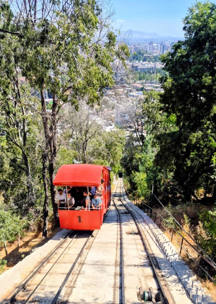
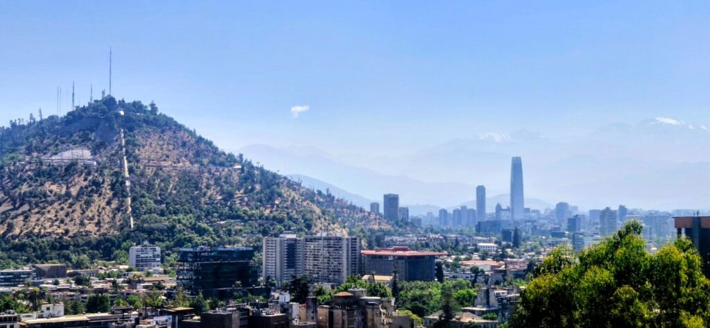
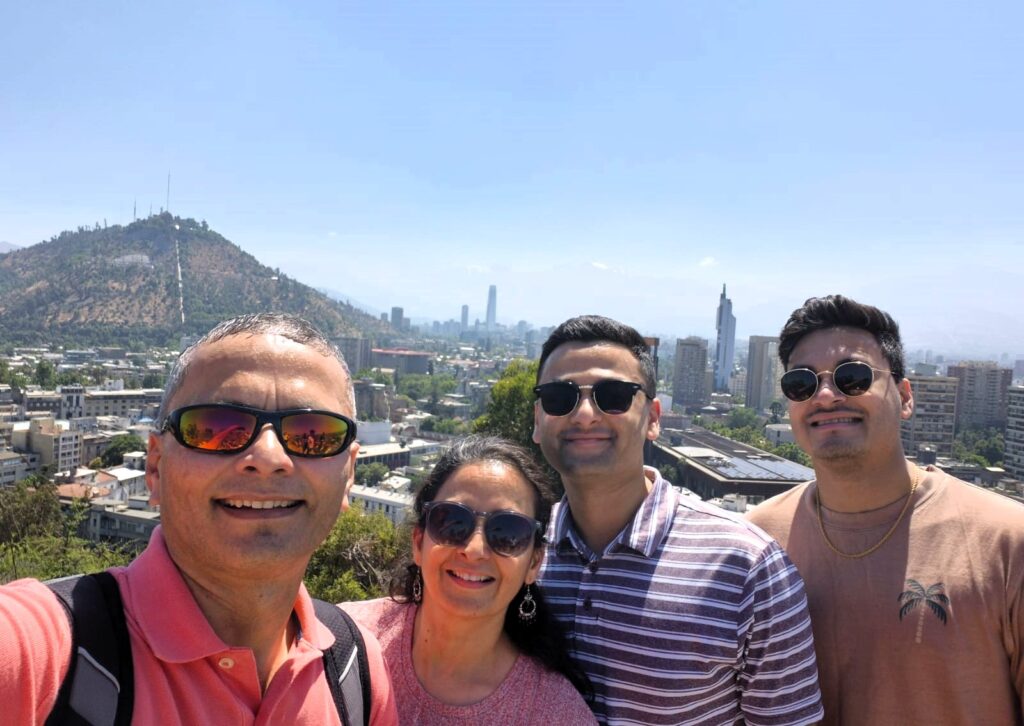
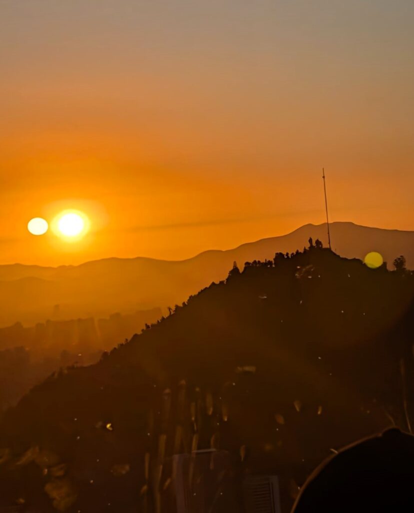
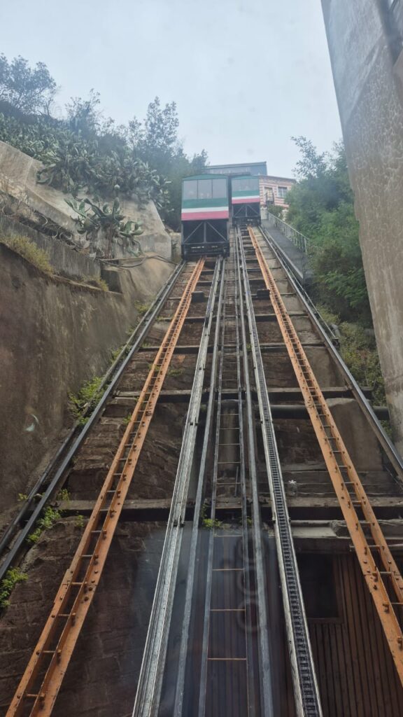
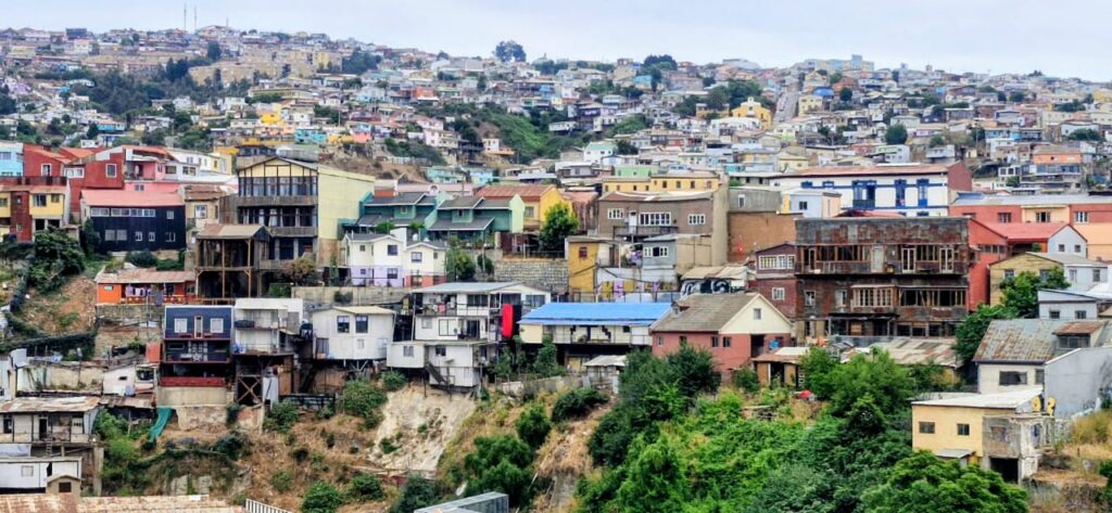
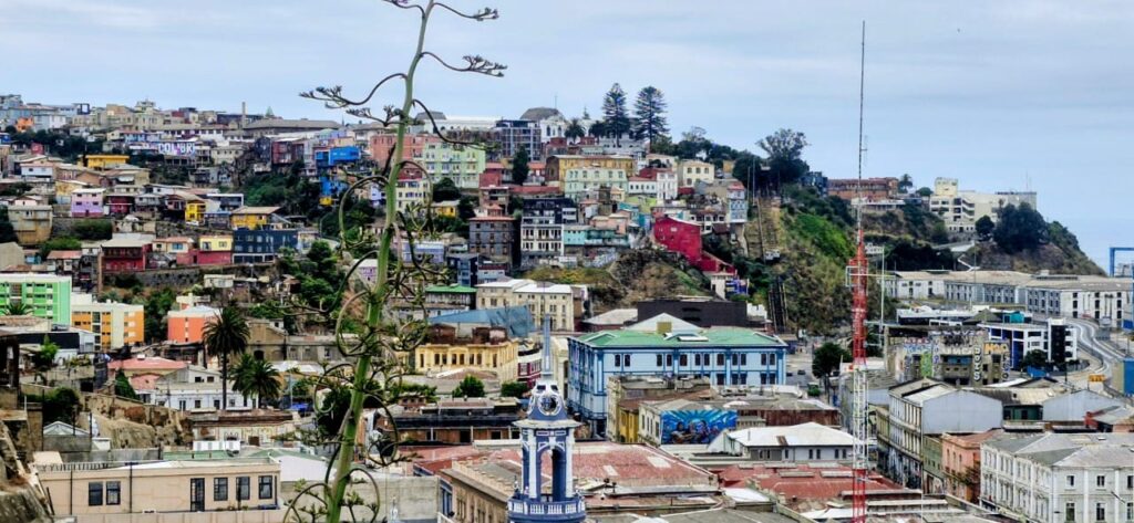
After lunch, we proceeded to the Pío Nono Funicular Station in the Bellavista area to visit San Cristóbal Hill, which rises about 1,000 ft above the rest of Santiago. It provides amazing views of the city and is a must-visit location in Santiago.
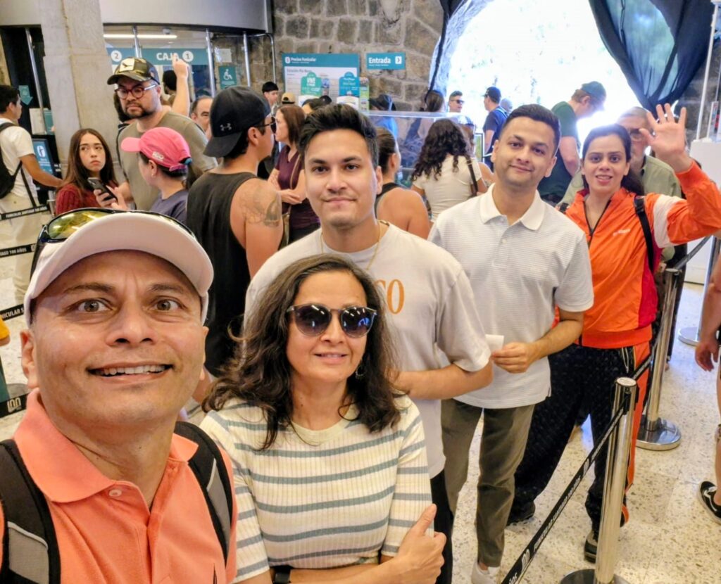
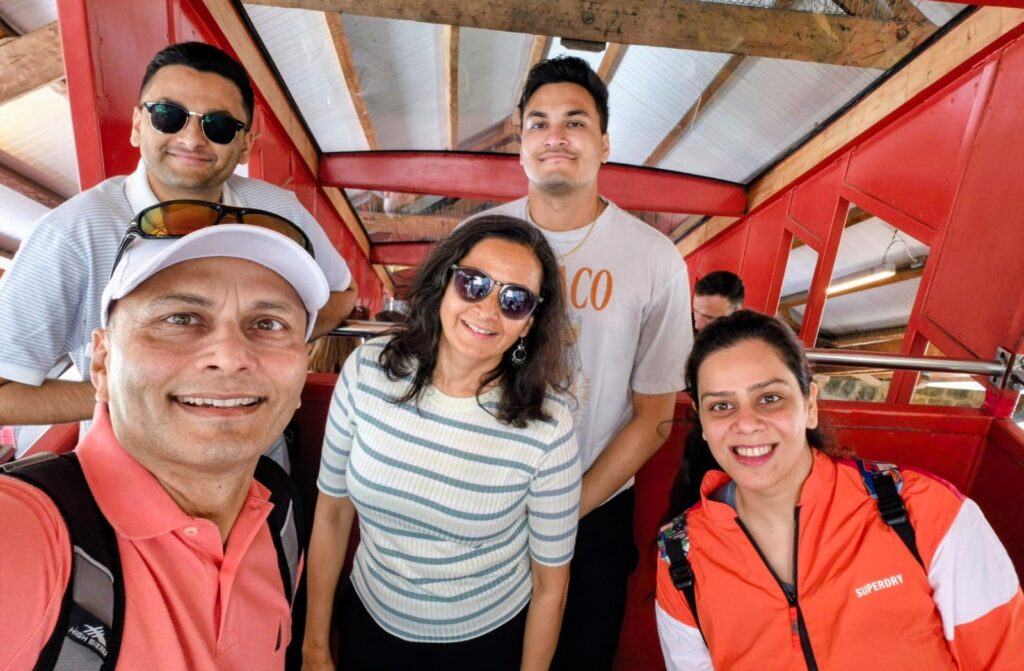
San Cristóbal Hill is part of the Metropolitan Park of Santiago, one of the largest urban parks in the world. The funicular railway to the hill was originally built in 1925 and completed 100 years in 2025.
The views of the city of Santiago from San Cristóbal Hill were excellent.
At the summit, there is a sanctuary dedicated to the Immaculate Conception, featuring a large statue of the Blessed Virgin Mary, along with an amphitheater and a chapel.
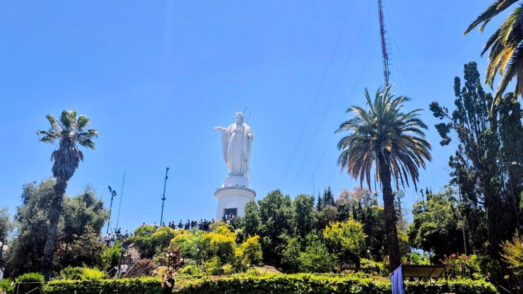
The statue of the Immaculate Conception is 14 meters tall, placed on an 8.3-meter pedestal, making the total height 22 meters.
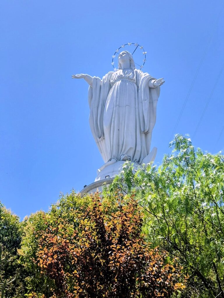
The statue weighs 36,610 kilograms.
Inside the pedestal is a small chapel where Pope John Paul II prayed and blessed the city of Santiago on April 1, 1987.
We then took the cable car from San Cristóbal Hill across two hills to the Oasis Station.
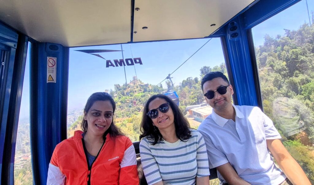
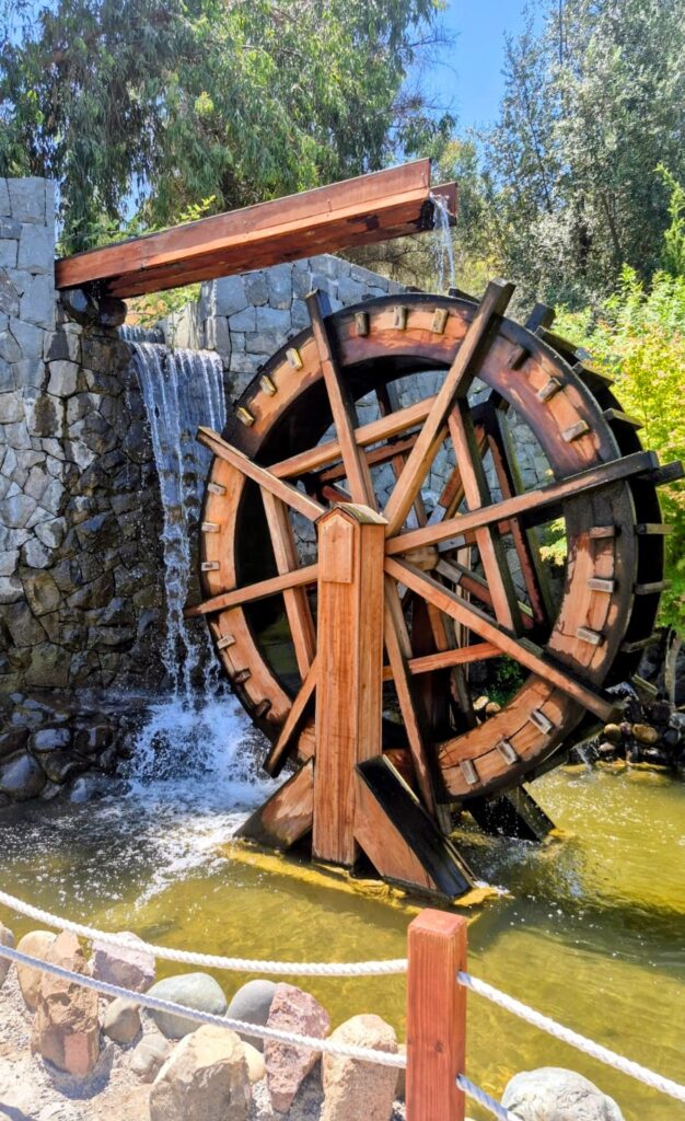
At the Oasis Station, there is a Japanese Garden that was built in 1978 and later visited by the Japanese royal family to commemorate 100 years of diplomatic relations between Chile and Japan.
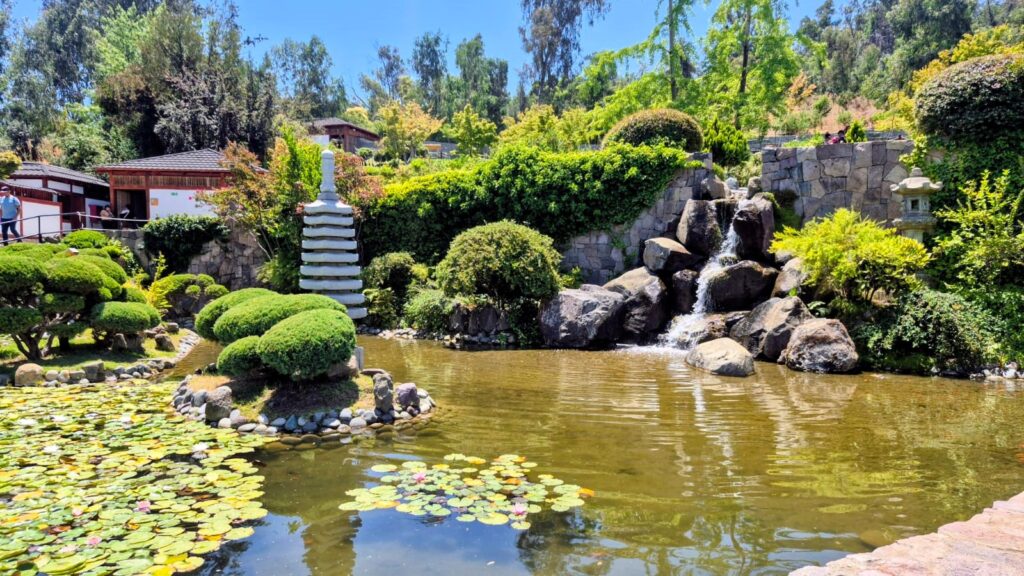
The garden reflects the long-standing cultural exchange between Chile and Japan, symbolizing diplomatic goodwill beyond just trade or politics. It stands as a reminder of how immigrant communities have shaped Chile’s multicultural identity.
The Japanese Garden is located on the slopes of San Cristóbal Hill and offers elevated views of Santiago while still feeling enclosed and intimate. From certain points inside the garden, the skyline of the city appears framed by trees and curved pathways.
Unlike the busy viewpoints of San Cristóbal Hill, the Japanese Garden felt quieter and more contemplative.
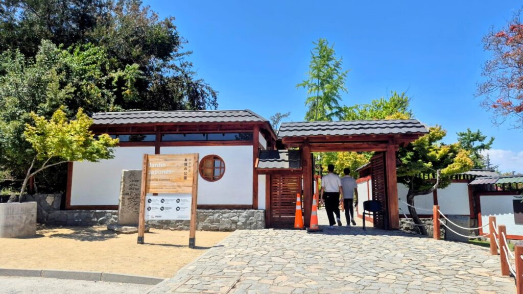
The contrast between the modern skyline of Santiago and the traditional design elements of the garden made the experience interesting. It felt like stepping briefly into a different cultural space within the same city. The garden offers a peaceful setting with carefully designed landscaping.
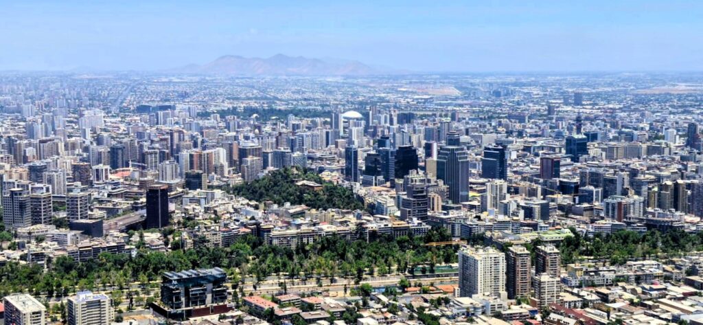
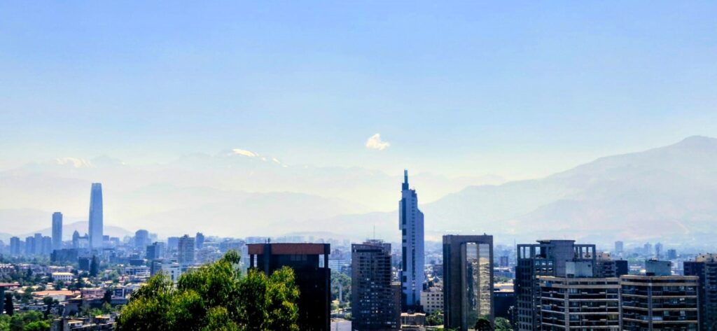
From here, we also got a nice view of Gran Torre Costanera, a building that rises about 1,000 ft above the city of Santiago. It is the tallest building in South America and a prominent part of Santiago’s skyline.
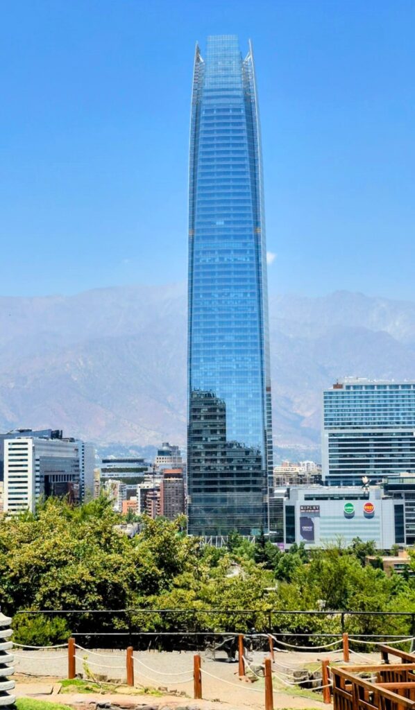
It is part of the larger Costanera Center complex, which includes offices, a shopping mall, and an observation deck at the top. The tower was completed in 2014 and has since become a modern symbol of Santiago’s growth.
The sleek glass structure stands in sharp contrast to the colonial architecture seen in other parts of the city. It reflects the snow-capped Andes on clear days. Designed by Argentine architect César Pelli, the tower dominates the skyline and can be seen from various parts of Santiago.
The building represents the economic development of Chile in recent decades and gives the city a distinctly contemporary feel.
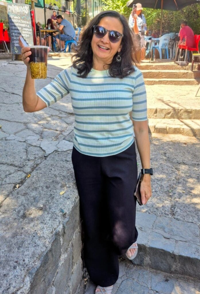
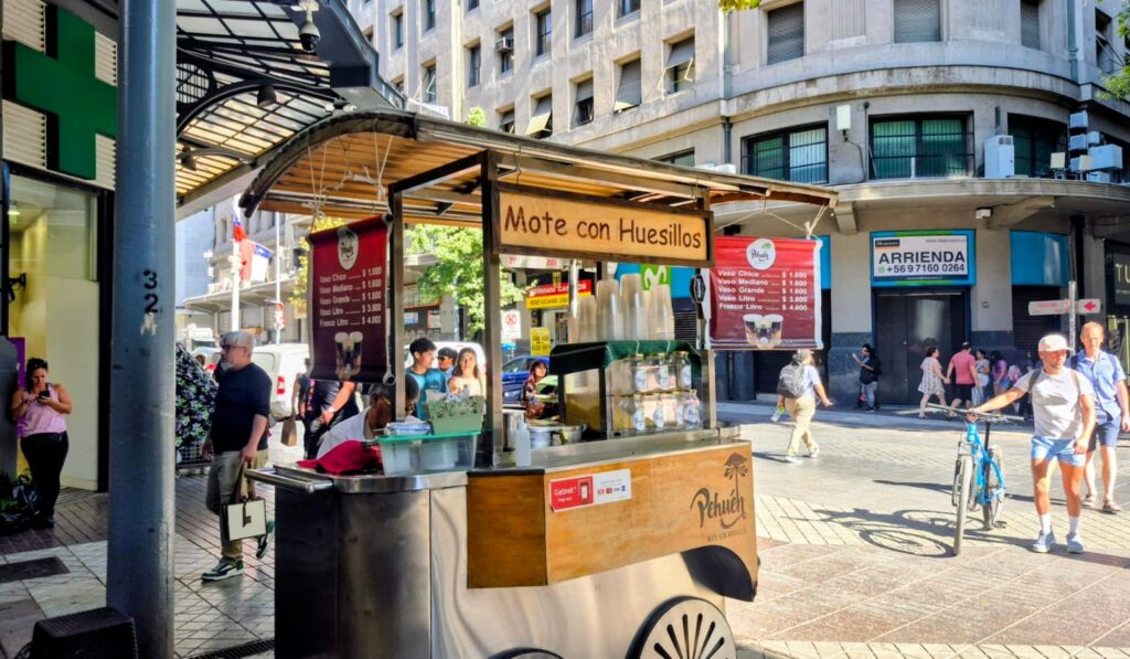
On our way back, Anu had Mote con Huesillo, a very popular Chilean drink that is sold everywhere.
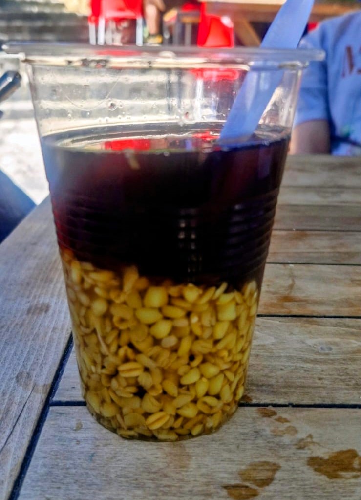
It features cooked husked wheat berries (mote) and sweet, syrup-soaked dried peaches (huesillos) in a sweet, spiced juice.
It is a refreshing, non-alcoholic beverage and a popular summer street food.
We came back down from San Cristóbal Hill on the funicular.
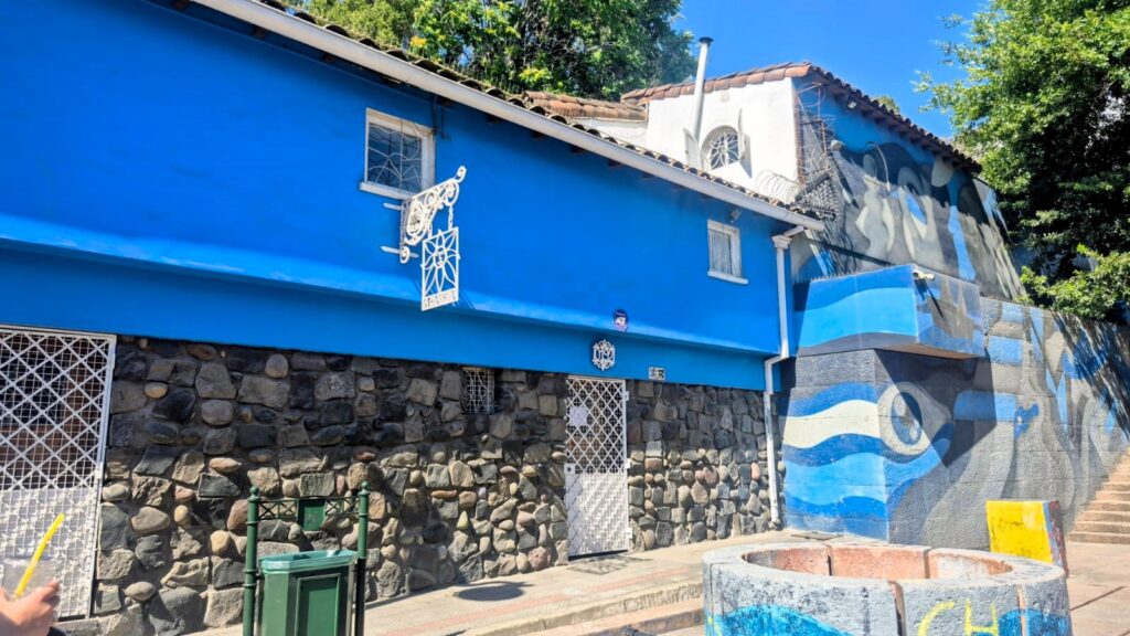
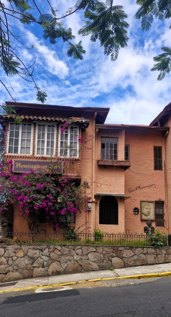
We noticed a really nice home in the Bellavista neighborhood as we walked around.
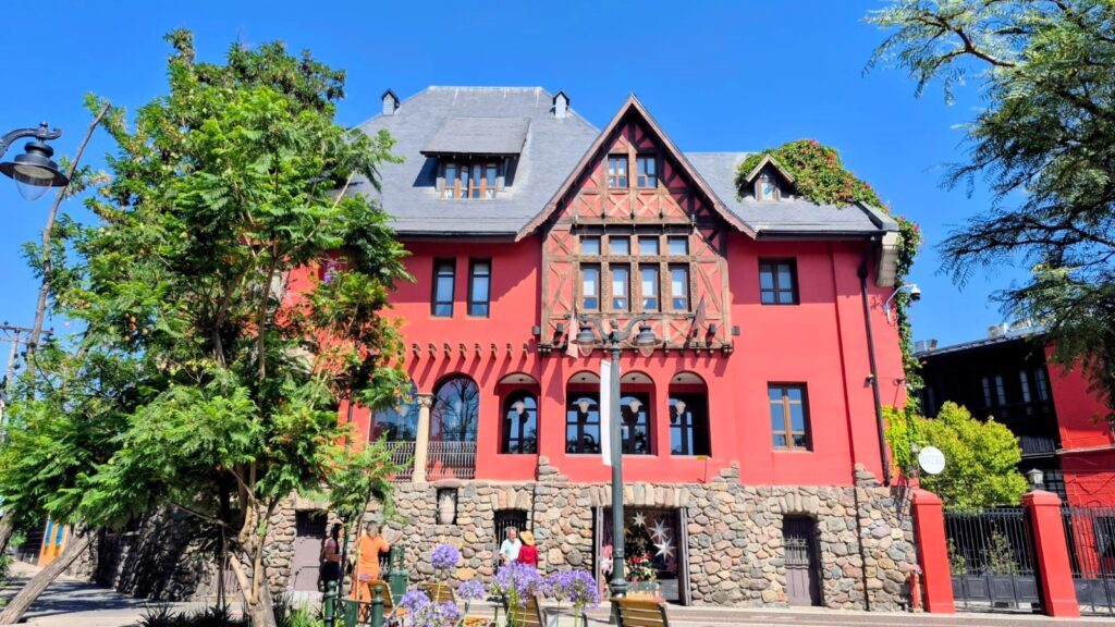
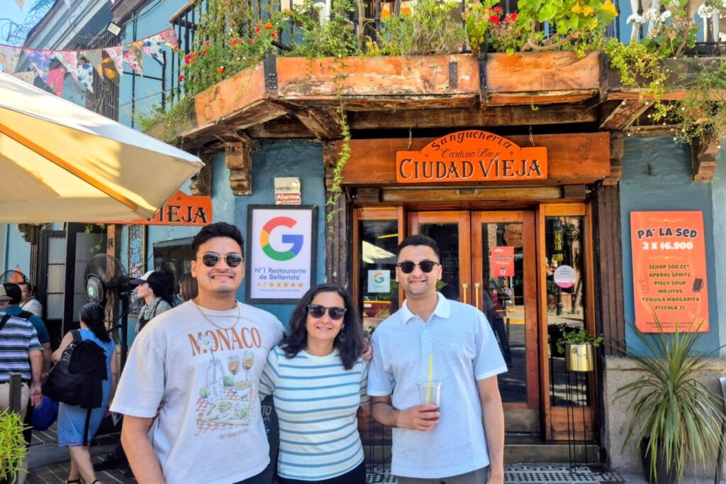
Barrio Bellavista is a neighborhood dating back to around 1900. It lies between the Mapocho River and San Cristóbal Hill, spanning the communes of Providencia and Recoleta. It is known as Santiago’s bohemian quarter, with numerous restaurants, boutiques, galleries, bars, and clubs.
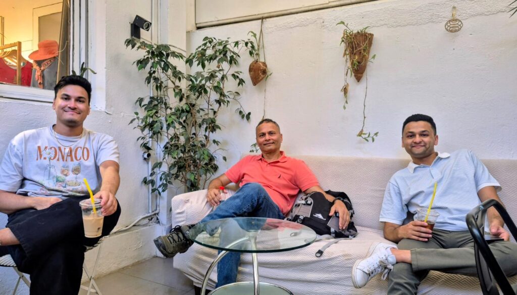
We stopped for coffee at a cozy café in the Bellavista neighborhood.
We also stopped at Pablo Neruda’s home in Santiago.
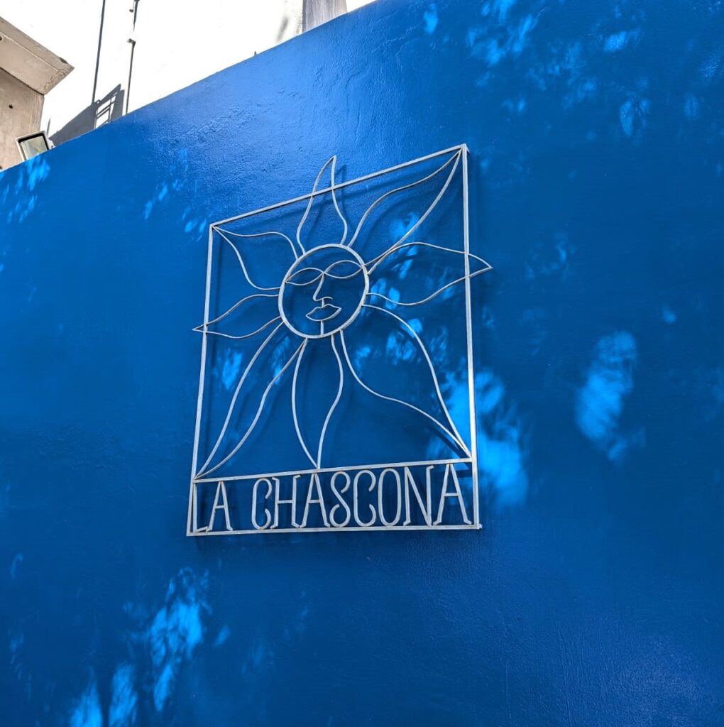
Pablo Neruda was a Chilean poet, diplomat, and politician who won the 1971 Nobel Prize in Literature. He became known as a poet at the age of 13 and wrote in a wide range of styles, including surrealist poetry, political works, historical epics, autobiographical prose, and love poems.

One of his most famous works is Twenty Love Poems and a Song of Despair.
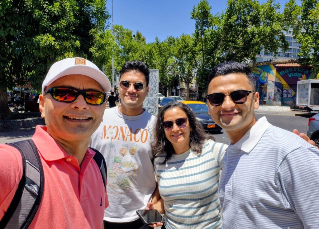
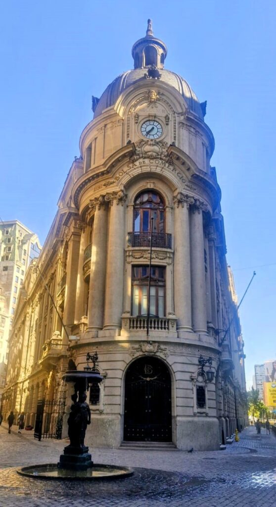
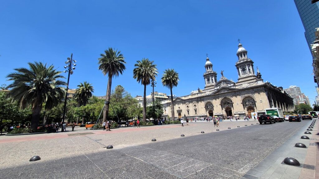
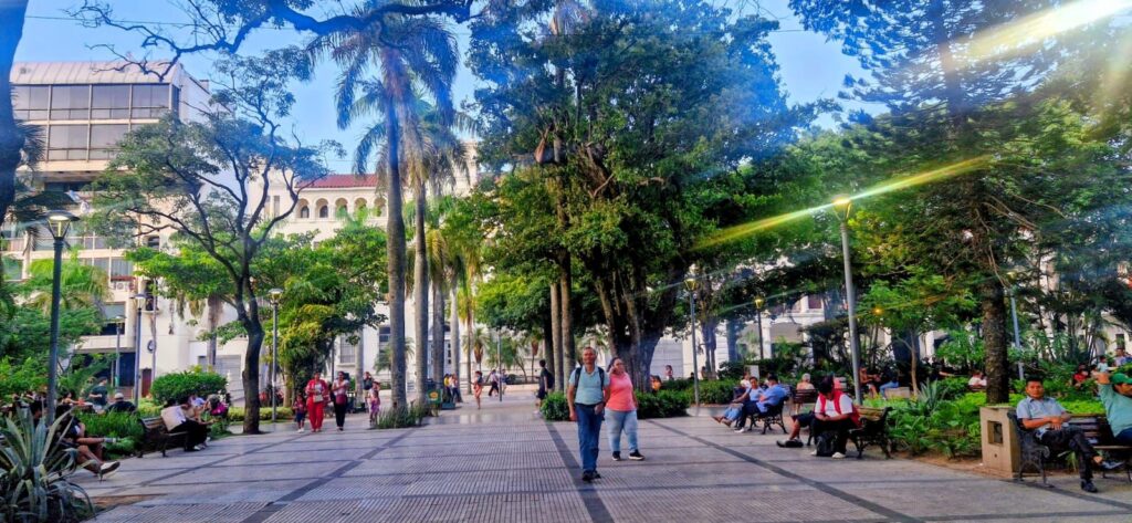
We continued walking around the Bellavista area and then decided to go to Plaza de Armas, the main square in Santiago.
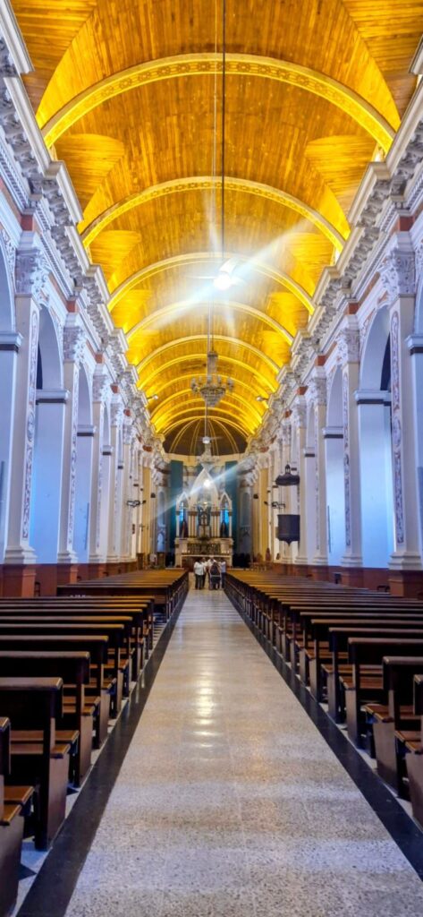
Plaza de Armas is surrounded by several historic buildings, including the Metropolitan Cathedral of Santiago, the Central Post Office Building, the Palacio de la Real Audiencia de Santiago, and the building that serves as the seat of local government for the city.
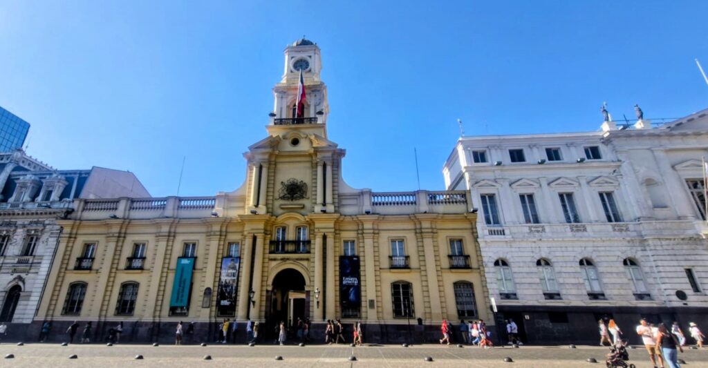
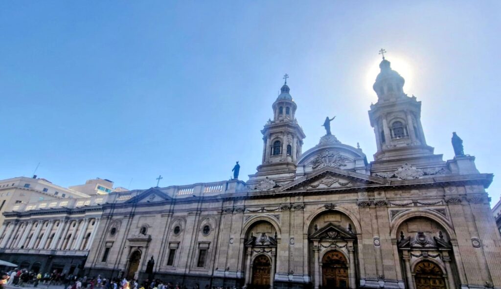
The Central Post Office Building, located on the northern edge of the plaza, is a historic structure that was built in 1908.
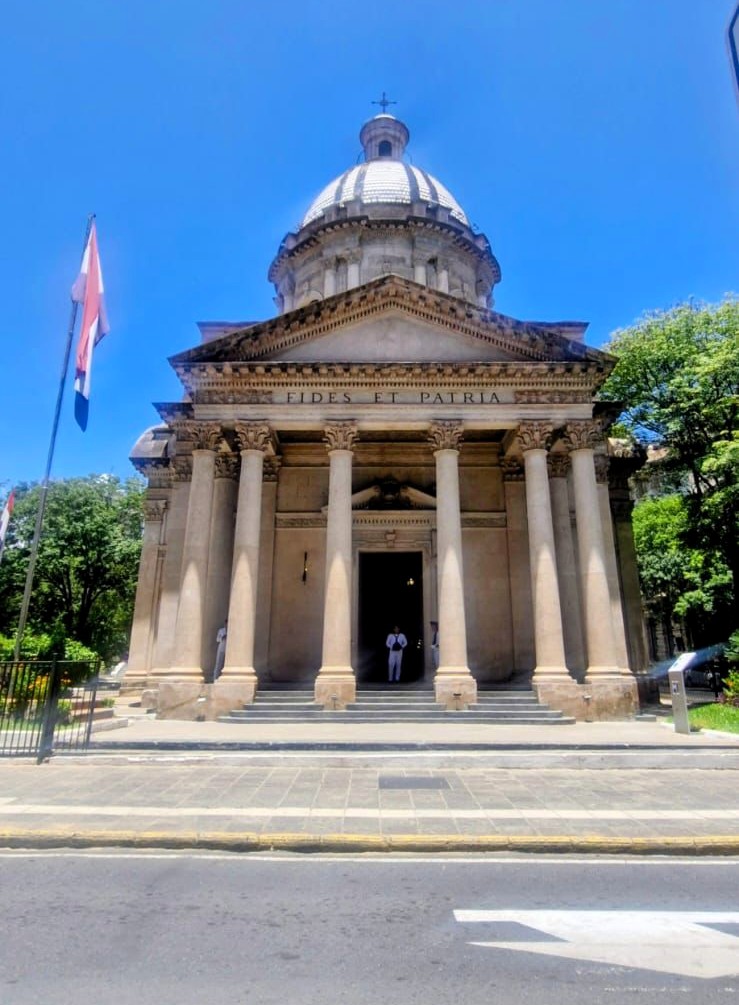
We then visited La Moneda Palace, the seat of the President of the Republic of Chile.
Built in the late 18th century as a colonial mint (hence the name “La Moneda,” meaning “The Mint”), it later became the presidential palace. Today, it houses the offices of the President and key government ministries and stands as a symbol of Chile’s political history.
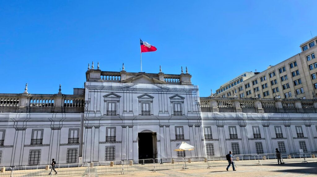
It also houses the offices of three cabinet ministers: Interior, General Secretariat of the Presidency, and General Secretariat of the Government.
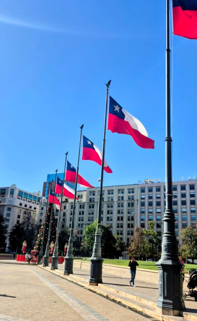
We spent some time relaxing on the lawns in front of the palace.
Our feet were tired, so it was nice to just sit and rest for a while.
In the evening, we went out for dinner.
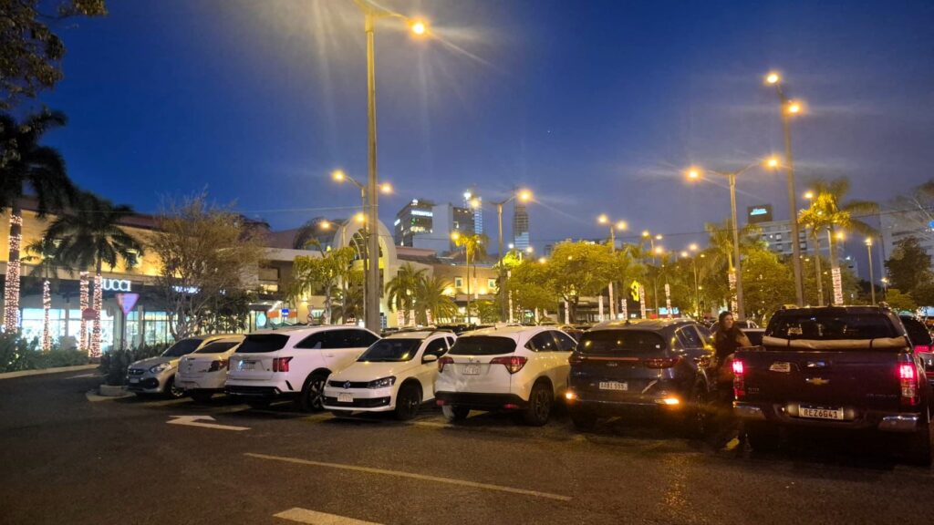
The Vitacura area of Santiago has many interesting eateries and food courts.
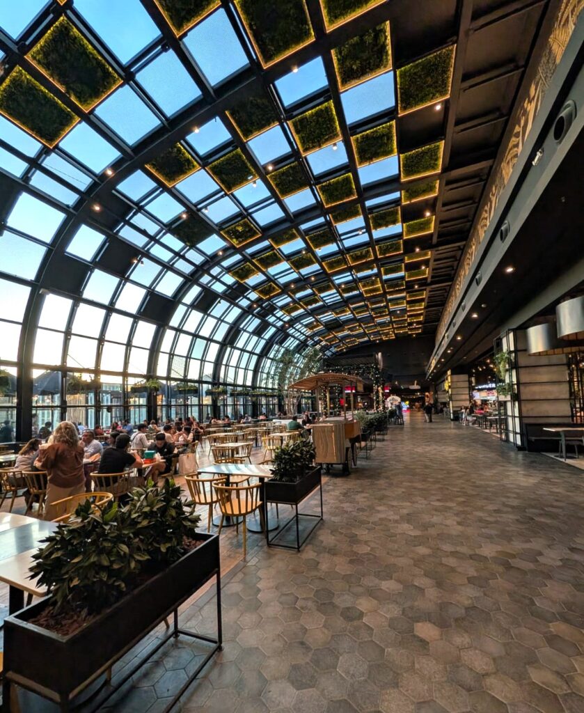
There was a great food court at the local metro station as well as one at a nearby mall.
Saturday, Dec 27, 2025 – Santiago, Chile
We started our day with a sumptuous breakfast at the Hilton, a relaxed beginning before another full day of sightseeing.
Our first stop was Santa Lucía Hill. The hill is the remnant of a volcano that is about 15 million years old.
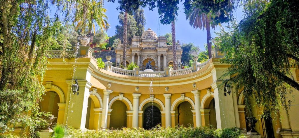
It comprises a 65,300 square metre park adorned with ornate facades, stairways, and fountains.
At its highest point, there is a viewpoint that is popular with tourists visiting the city and also serves as a common meeting point.
The hill is located in the heart of Santiago and offers great views of the city.
It was definitely worth a visit.
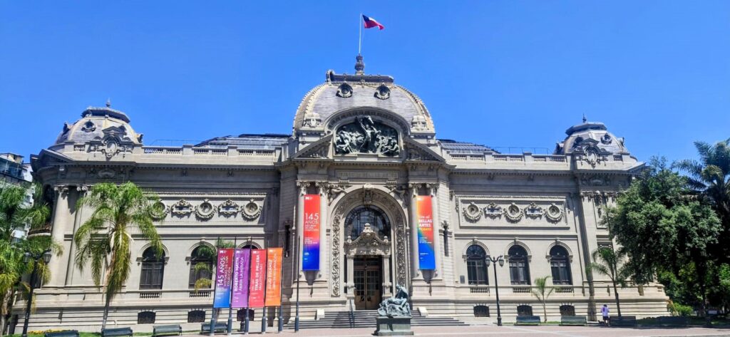
On our way from Santa Lucía Hill to the city center, we passed by the Museum of Fine Arts, an extremely ornate and impressive building.
We also noticed shops selling “Ganpati” idols, which was quite interesting to see so far from home.
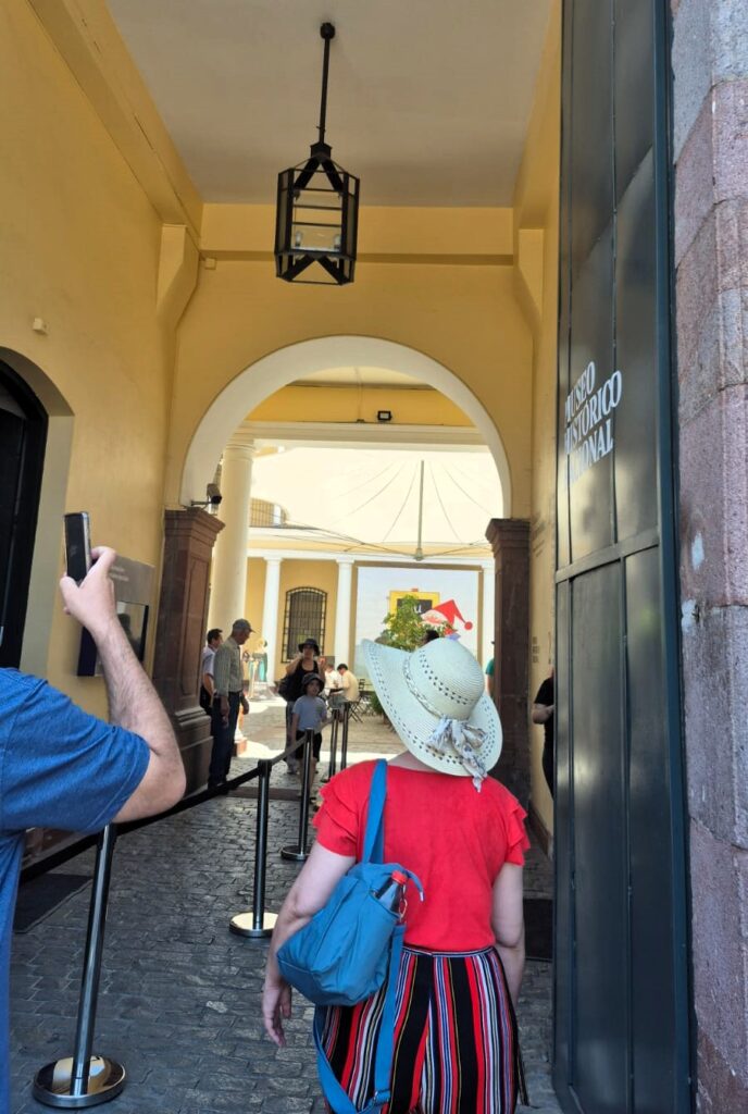
Our next stop was the National History Museum of Chile.
Most museums in Santiago have free admission. We spent about 1.5 hours exploring this museum.
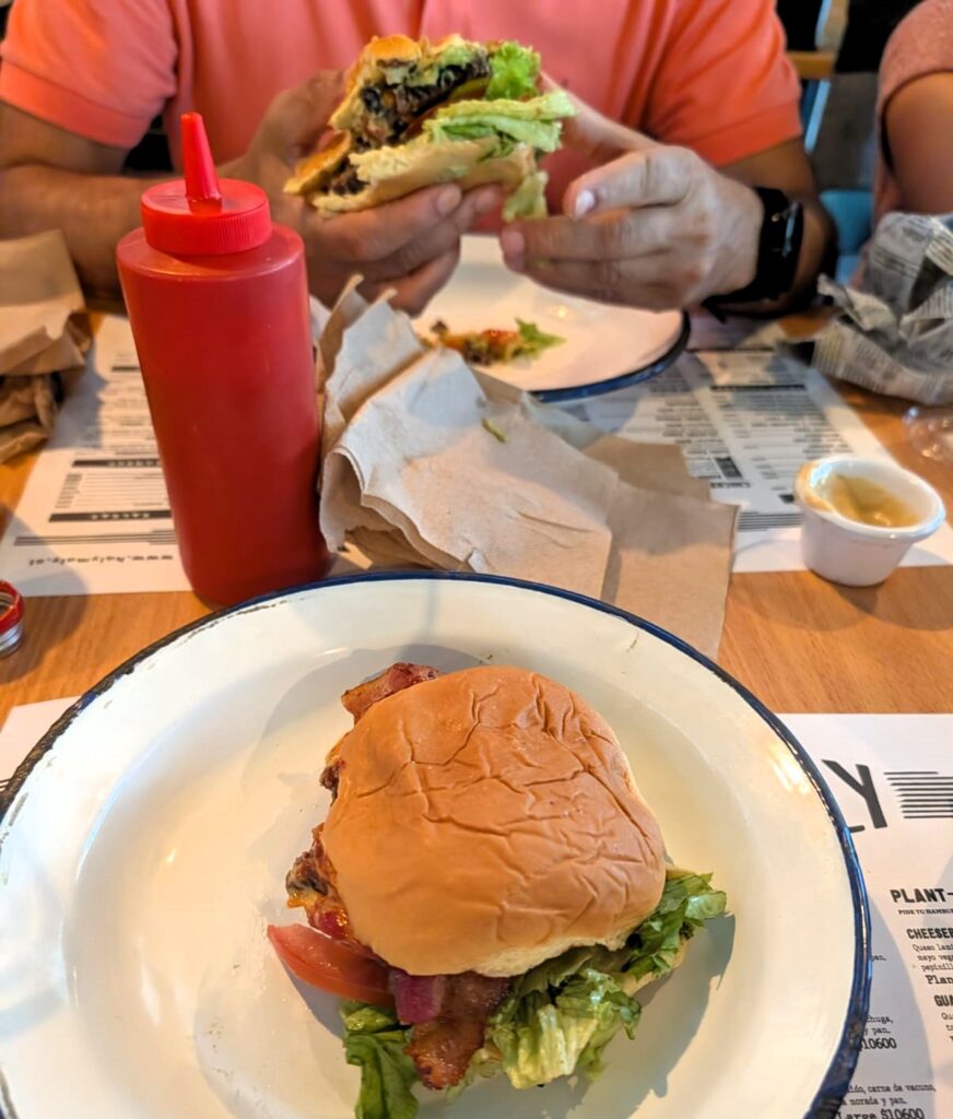
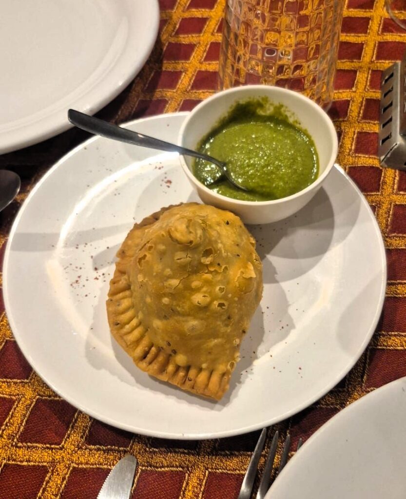
For lunch, we ate at a small restaurant called Holy Moly.
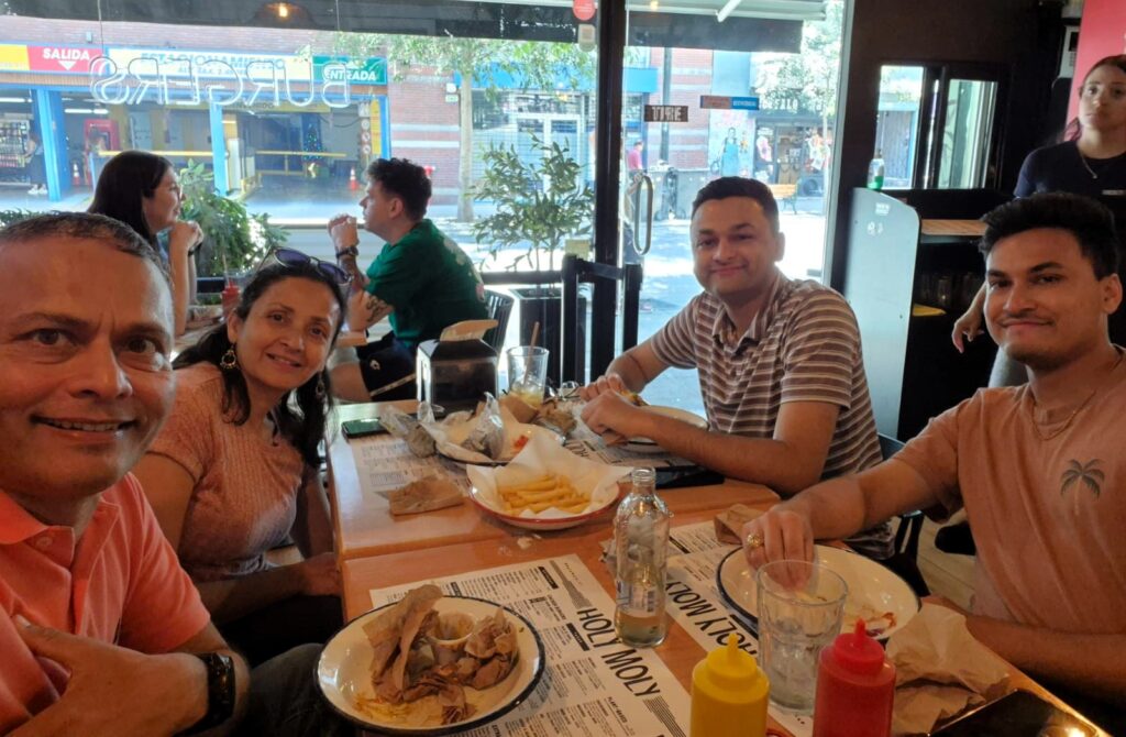
The burgers were quite substantial and very tasty, and they also had vegetarian burger options.
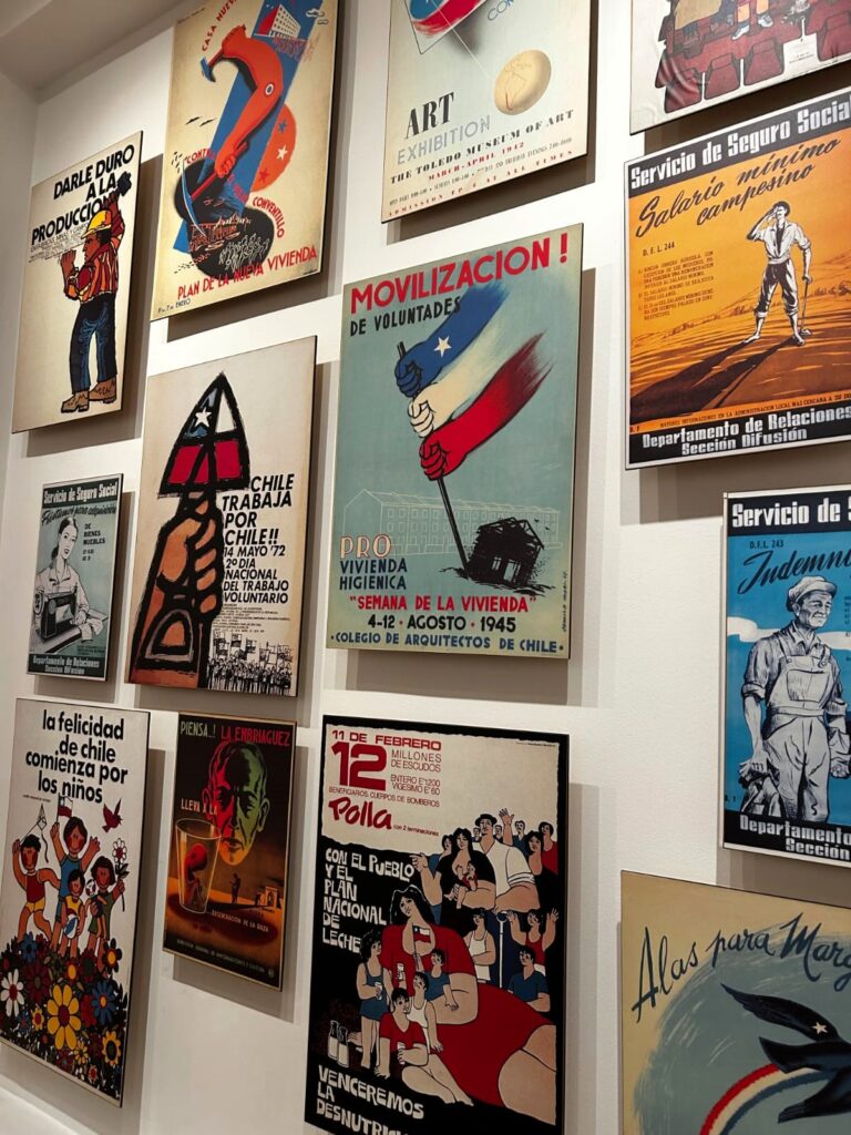
After lunch, we visited the Museum of Memory and Human Rights.
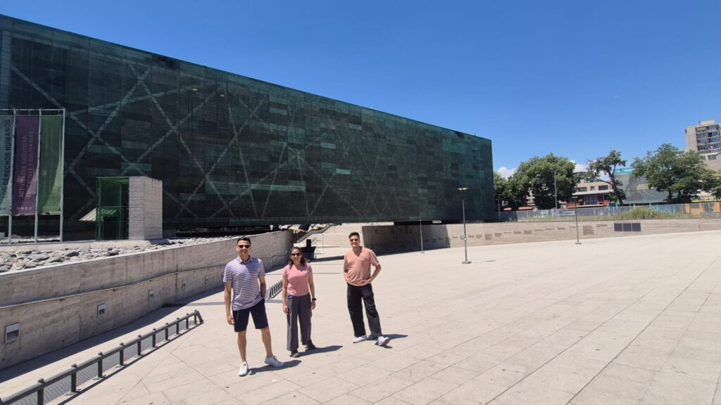
The museum commemorates the victims of human rights violations during the military dictatorship led by Augusto Pinochet between 1973 and 1990.
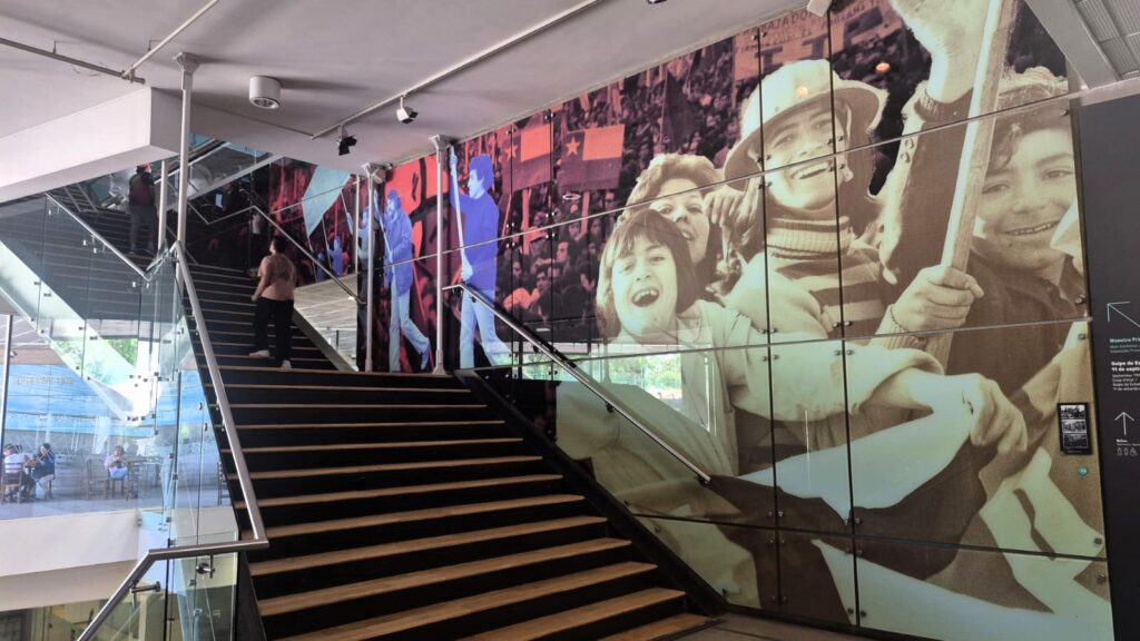
The museum documents stories of detention, exile, torture, and disappearance, preserving testimonies and historical records to ensure that this difficult period in Chile’s history is neither forgotten nor repeated.
Chile regained its democracy in 1990 after a popular referendum, following significant international pressure.
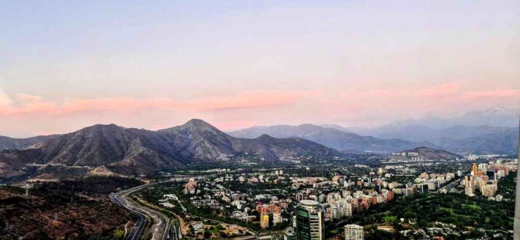
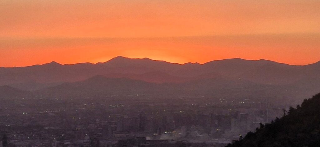
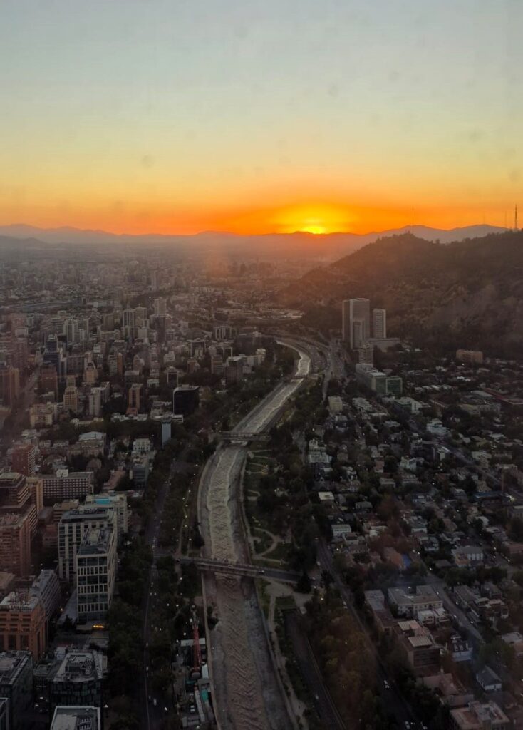
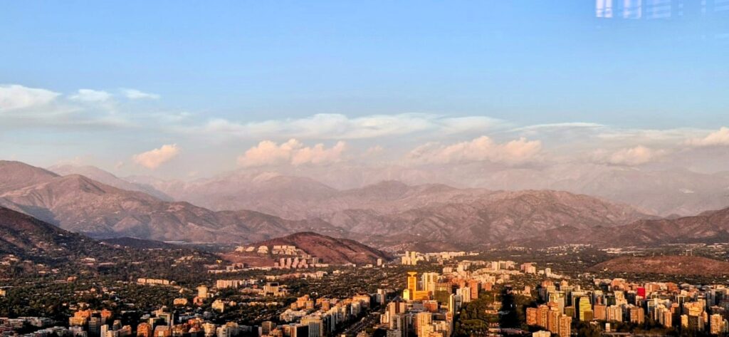
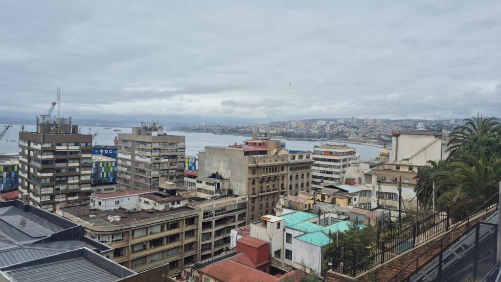
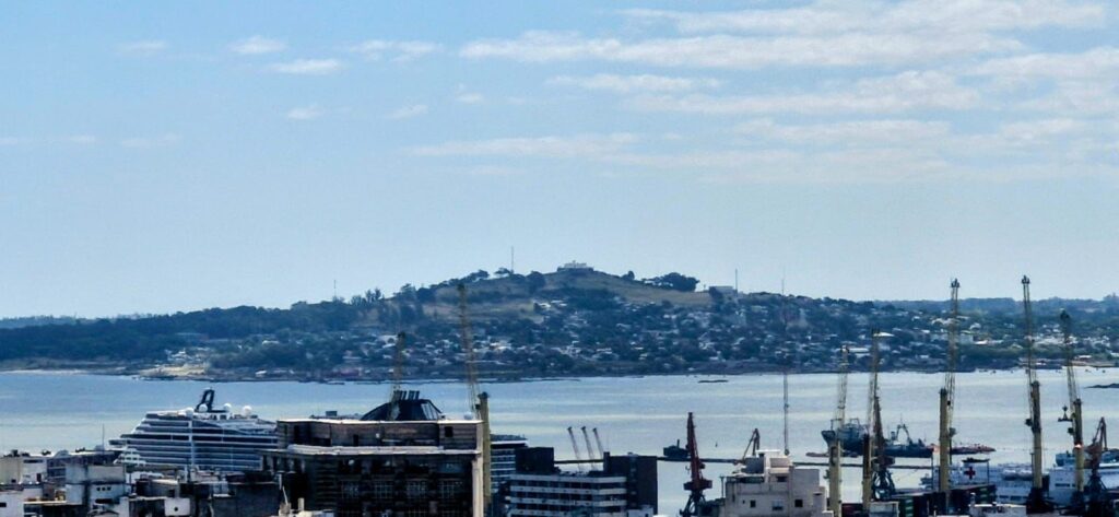
Our last stop for the day was the Sky Costanera Tower, a 300-meter-high tower with observation decks on the 61st and 62nd floors.
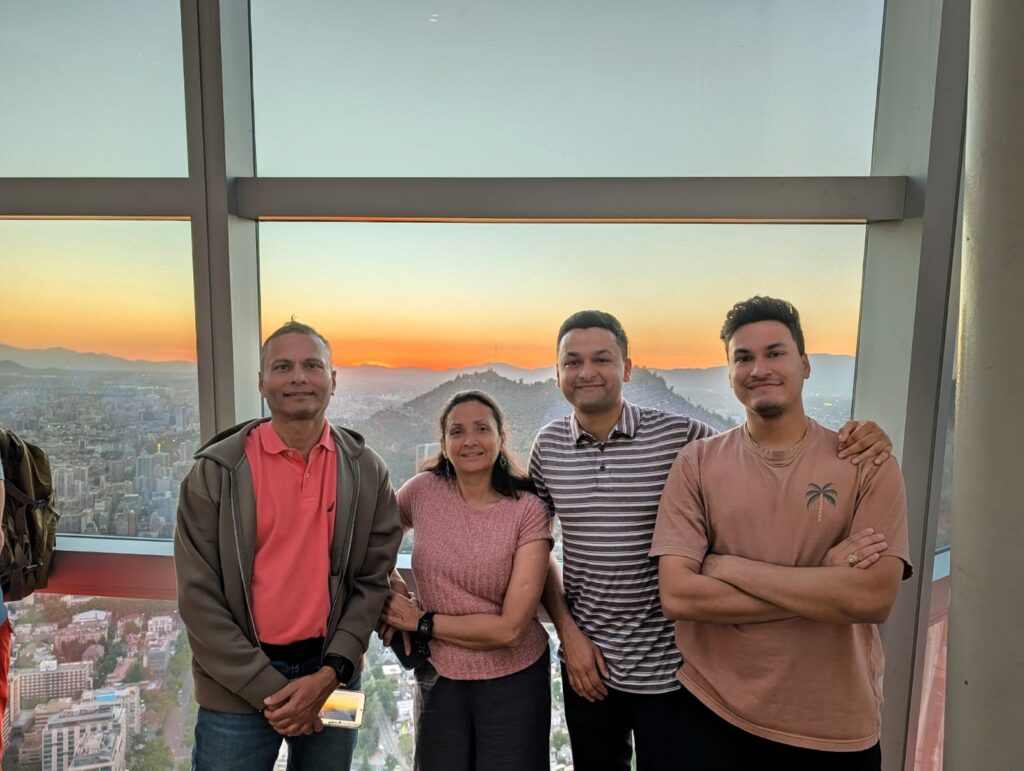
Normally, we do not go to tall observation decks, but we decided to try this one.
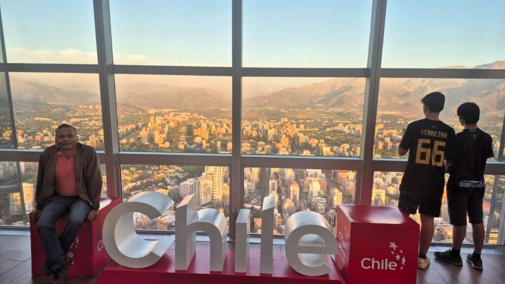
The observation decks are fully glass-clad, with no steel beams obstructing the views.
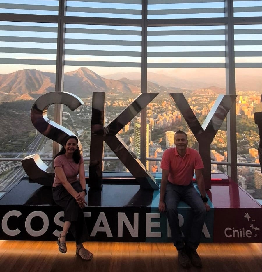
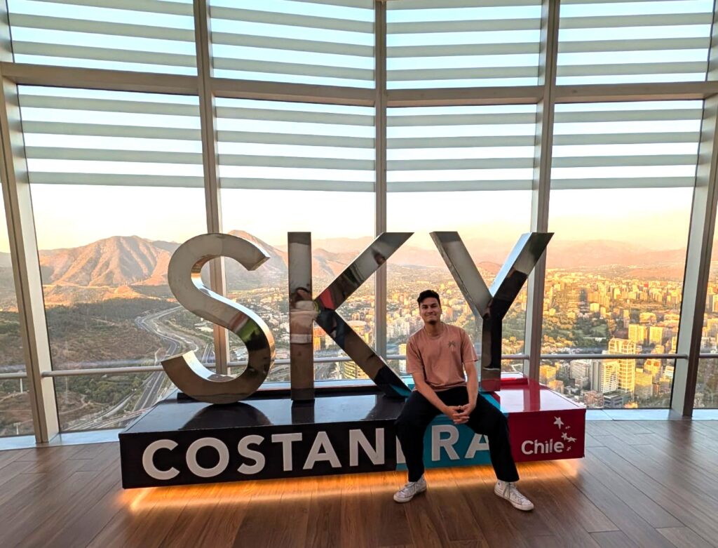
The views were fantastic—over the city of Santiago, the Mapocho River, Aconcagua (the tallest peak in the Andes), and the Andes mountain range itself.
The cost was about $22 per person, but the views were worth it. We spent about 1.5 hours at the top before heading back.
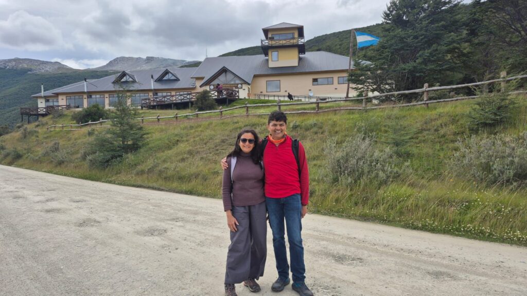
From Sun, Dec 28, 2025 to Saturday, Jan 3, we visited Puerto Natales in Patagonia (southern part of South America) for the W Trek in Torres del Paine National Park. After the trip, we came back to Santiago and our South America trip continued.
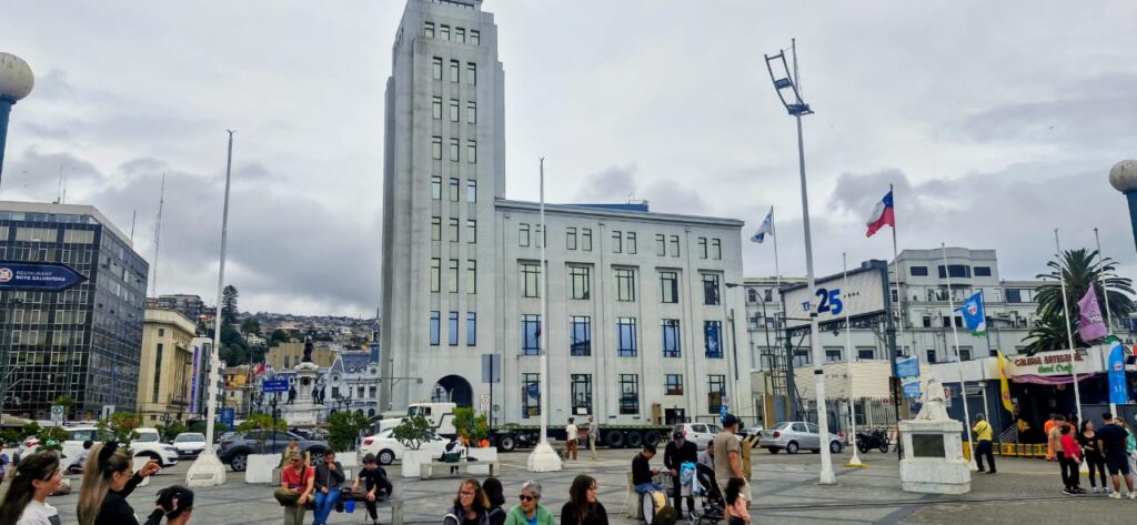
Sunday, Jan 4, 2026 – Valparaíso and Viña del Mar, Chile
We had arrived back in Santiago after completing the W Trek. We decided to visit the coastal city of Valparaíso, located about 120 km west of Santiago.
We started the day a bit late, around 11 am, from our hotel and first headed to the Santiago bus station. We were hoping to catch a bus to Valparaíso for about $2.50, but the bus prices were closer to $10 per person. Given that, it made more sense to book an Uber for the four of us and travel comfortably.
We reached Valparaíso around 1:50 pm.
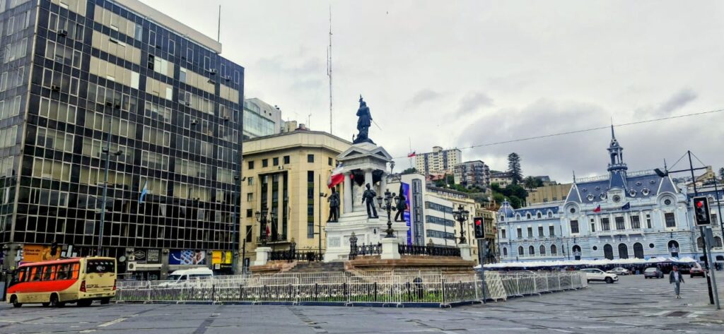
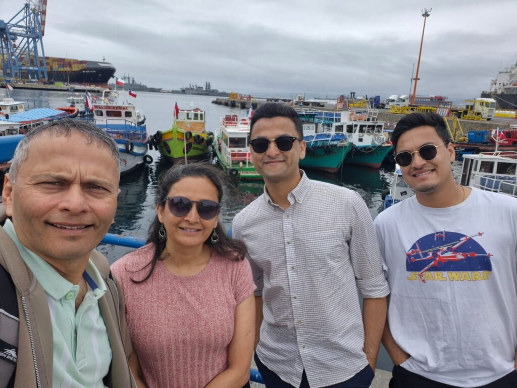
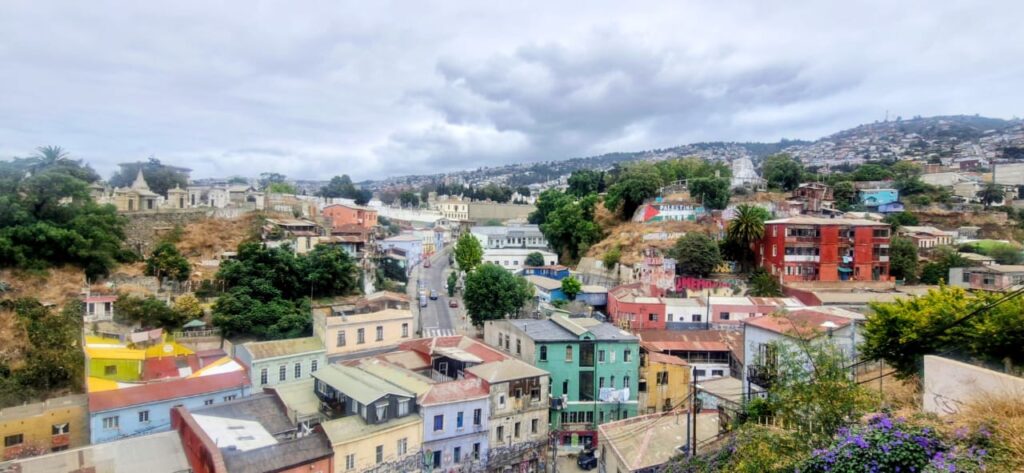
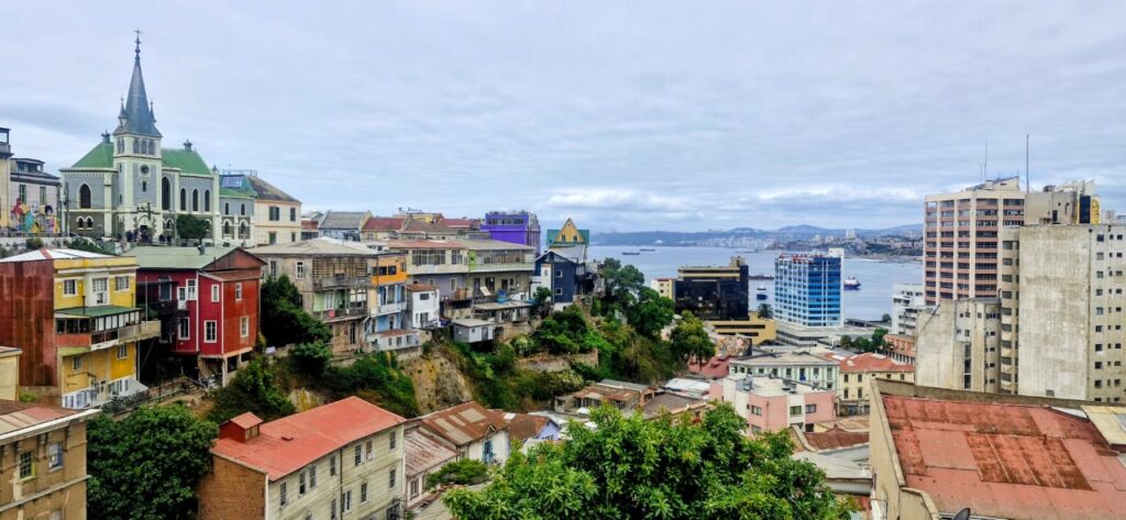
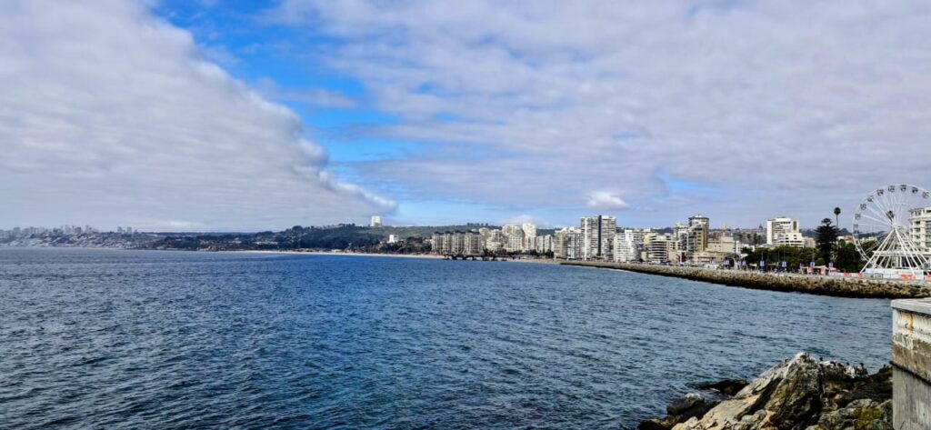
Our first stop was the port of Valparaíso, a very colorful harbor with small boats, merchant ships, and navy destroyers.
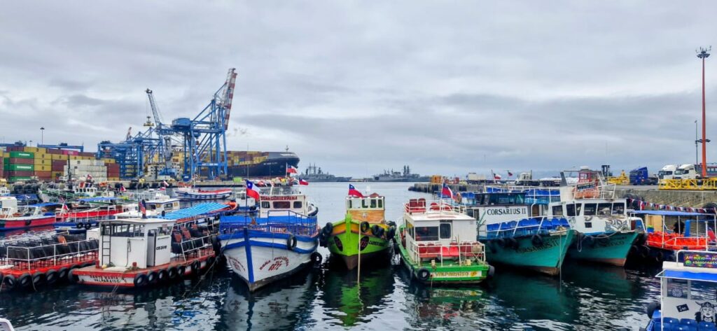
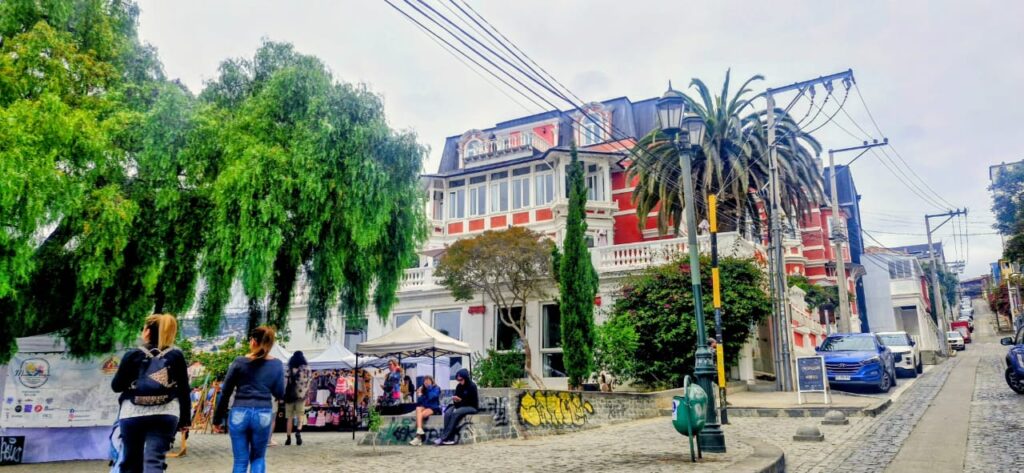
Valparaíso is the second-biggest city in Chile. It played an important geopolitical role in the second half of the 19th century, serving as a major stopover for ships traveling between the Atlantic and Pacific Oceans via the Straits of Magellan. During its golden age, the city experienced rapid growth as a magnet for European immigrants and was known among international sailors as “Little San Francisco” and the “Jewel of the Pacific.”
We took a funicular from Plaza Justicia to the top of Paseo Yugoslavia. Paseo Yugoslavo is a scenic terrace and viewpoint located on Cerro Alegre in Valparaíso.
Built in the early 20th century and named in honor of Croatian immigrants, it offers sweeping views of the port, the bay, and the colorful hills of the city. It is also home to the historic Palacio Baburizza and remains one of the most photographed viewpoints in Valparaíso.
One of the most visited areas, Cerro Alegre is one of the first viewpoints of the city, offering sweeping views across Valparaíso.

Palacio Baburizza, the former residence of Croatian businessman Pascual Baburizza, is located here as well.
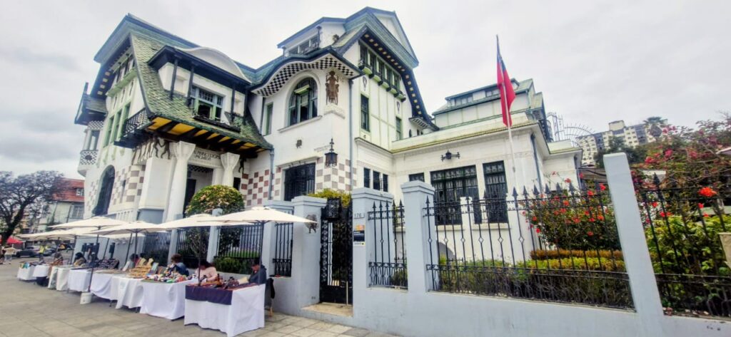
It was built in 1916 by Italian architects, later converted into a museum in 1971, and declared a historic monument in 1976.
As we walked through the area, we saw singing and dancing on the streets.
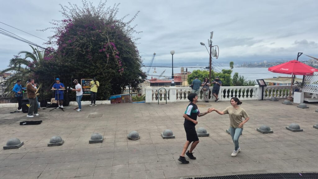
There was a couple dancing in a South American style, possibly salsa or rumba, adding to the vibrant atmosphere.
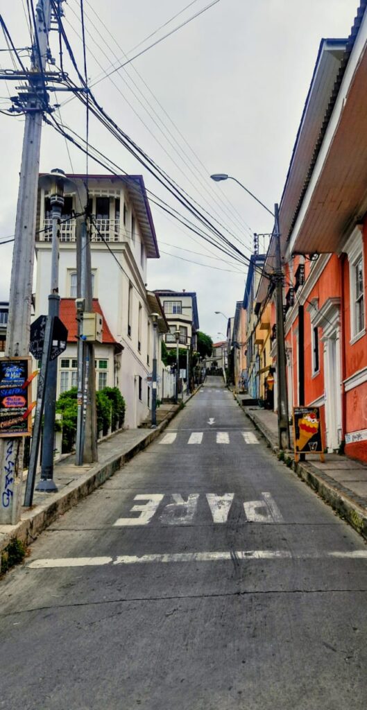
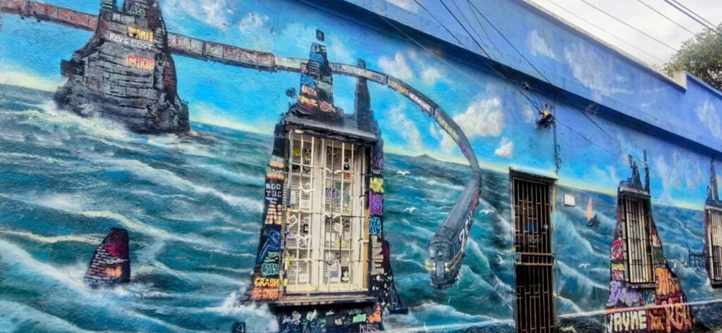
Valparaíso is known for its colorful murals.
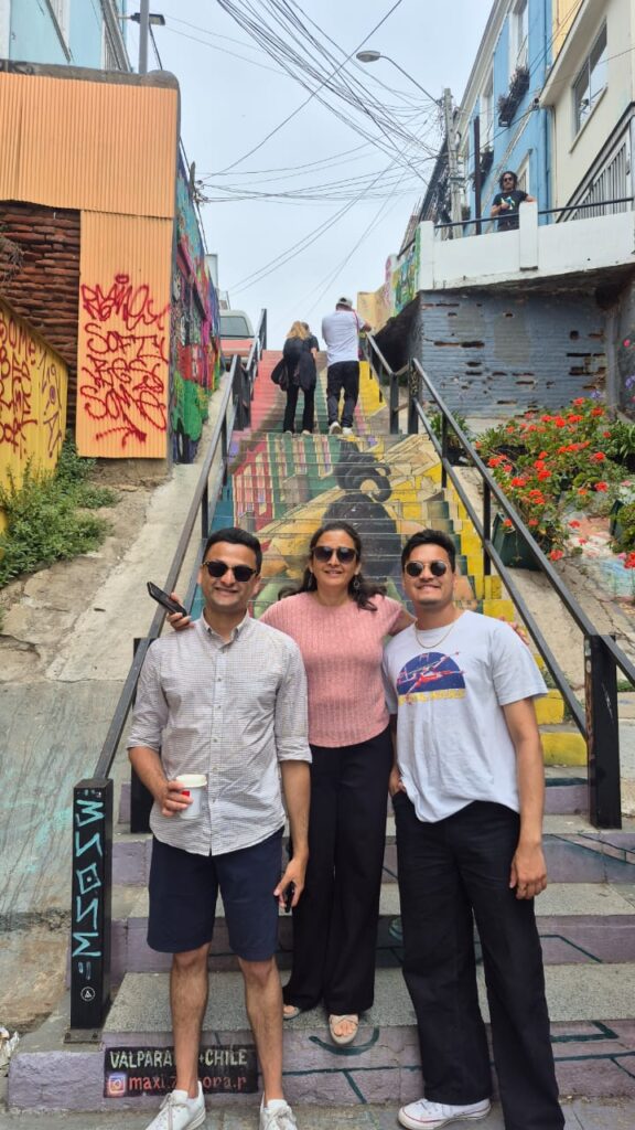
Walls are brightly painted, and there is even a famous staircase painting where each stair holds part of an image, but from the bottom it appears as one complete artwork.
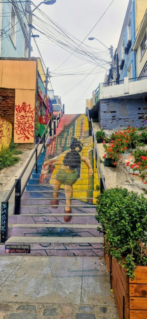


The city has many street paintings like these, and some paths were lined with beautiful flowers.
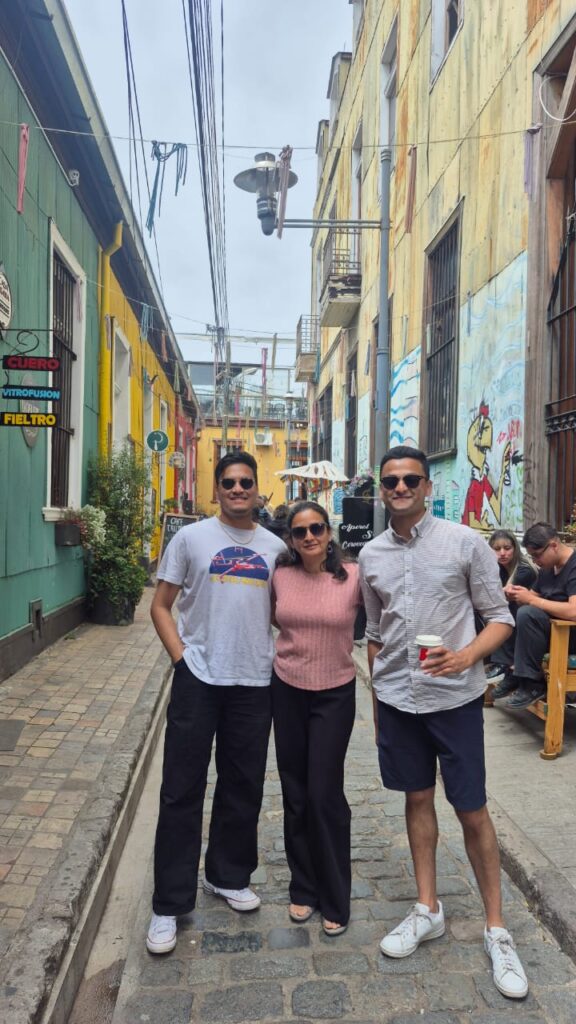
We walked through the streets of Cerro Alegre, exploring many colorful and lively spots. Cerro means peak.
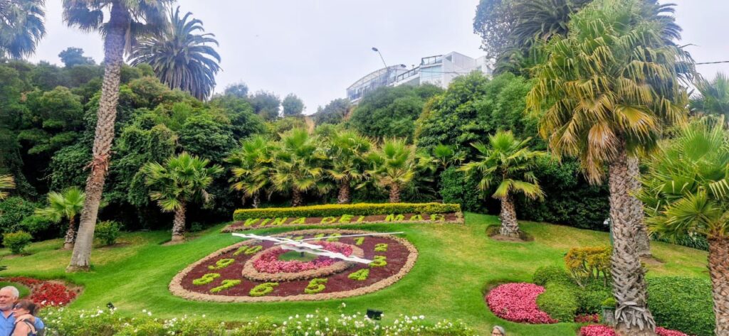
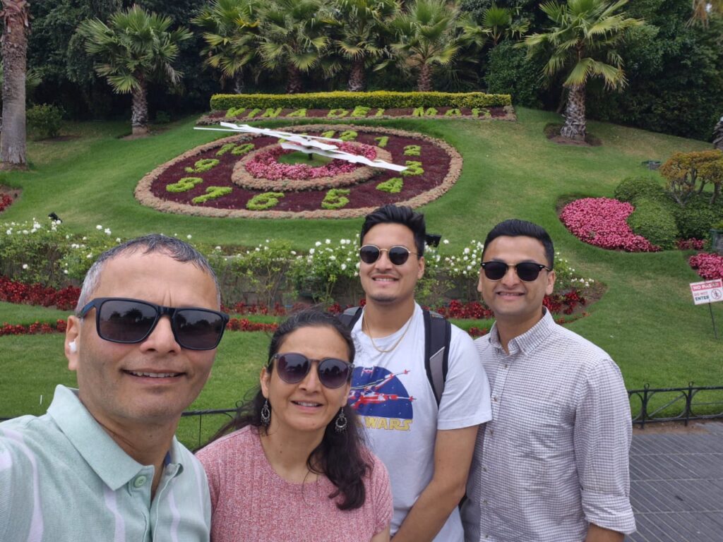
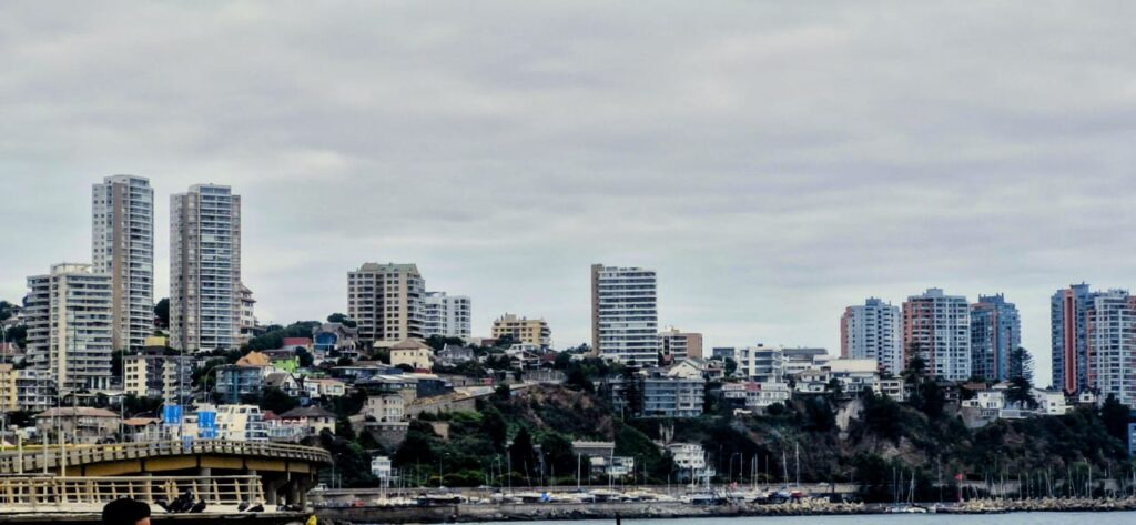
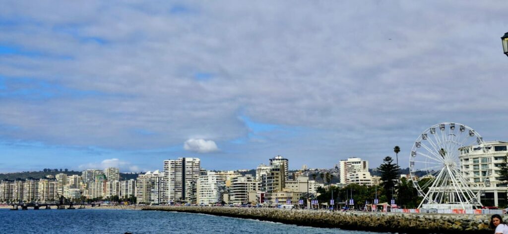
Our next destination was the famous Flower Clock in Viña del Mar, a city about 15 minutes north of Valparaíso.
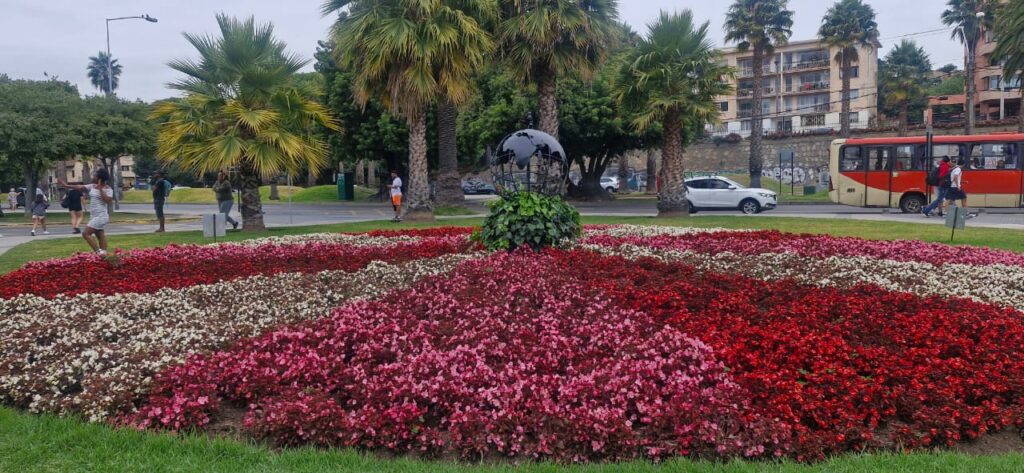
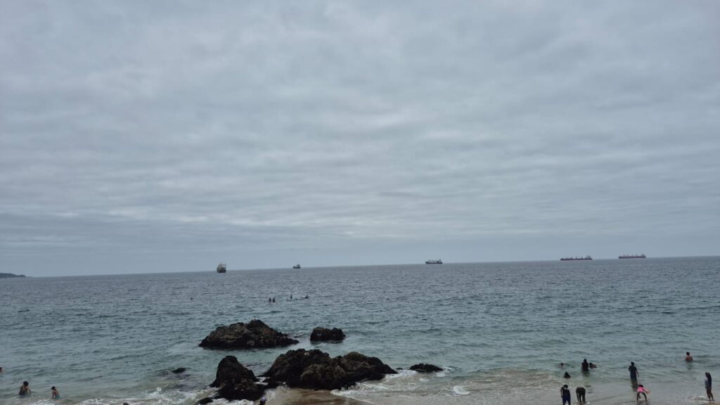
We then explored the beach at Viña del Mar.
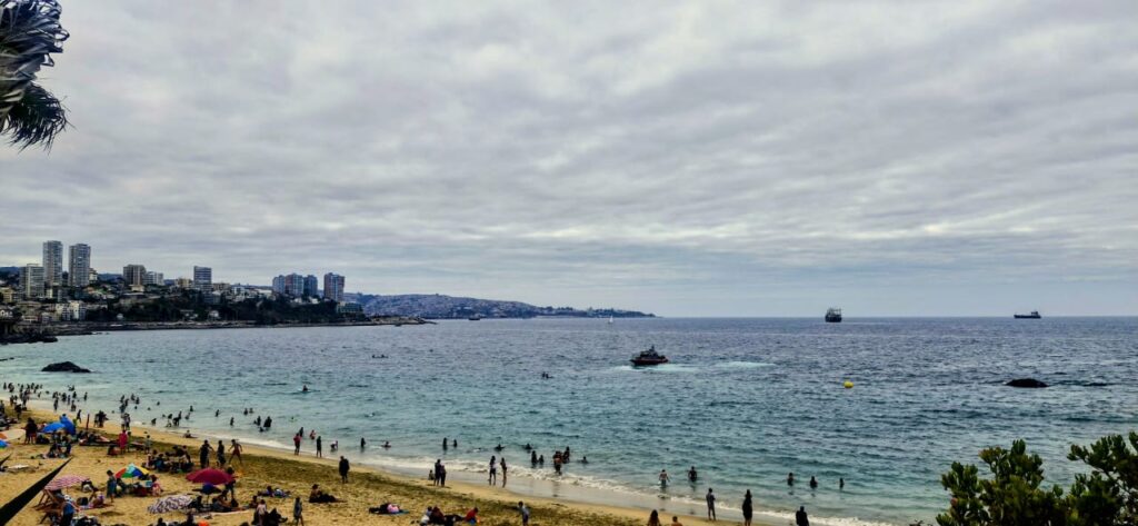
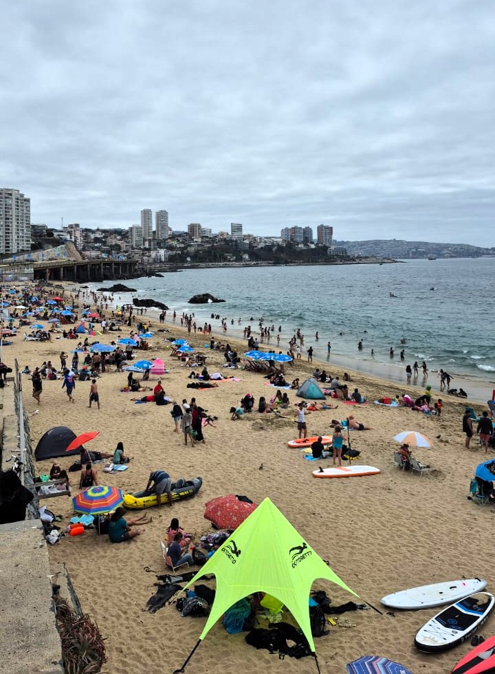
The beach was extremely crowded, and the Pacific Ocean water was cold, even though it was summer in the southern hemisphere.
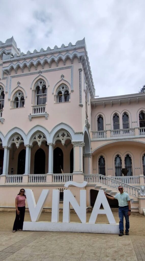
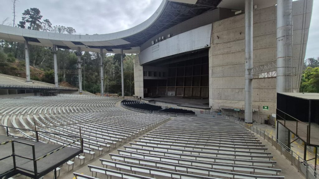
We proceeded to Quinta Vergara Park, a large park in the city. The park has an amphitheater and a palace.
Quinta Vergara is a historic cultural park and one of Viña del Mar’s most iconic attractions. Originally the estate of the Vergara family, the park’s grounds include gardens, historic buildings, and the Quinta Vergara Amphitheatre, which has hosted the annual Viña del Mar International Song Festival since 1960. The beautifully landscaped grounds combine nature, culture, and Chilean heritage in one scenic spot
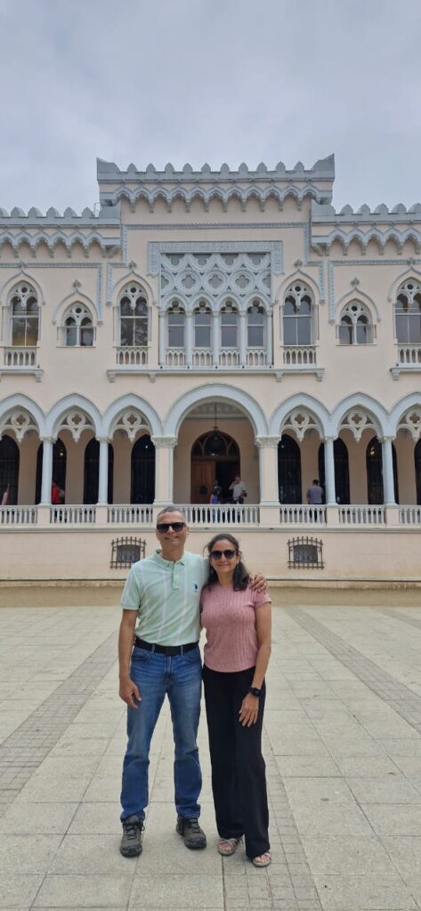
Our next stop was Castillo Wulff. Wulff Castle is a historic castle overlooking the sea in Viña del Mar, built in 1906 for the Wulff family.
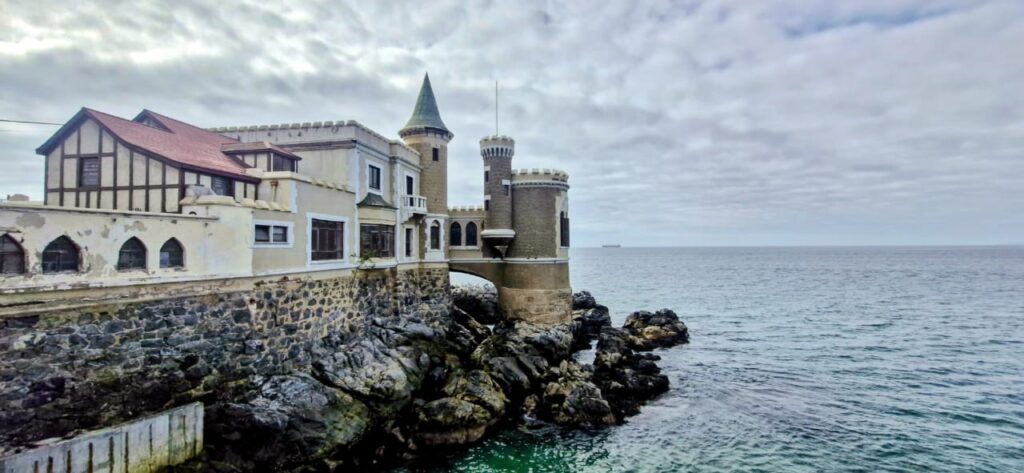
Castillo Wulff was built in 1906 by German businessman Gustavo Wulff and later expanded with stone walls and towers that give it a fairytale-like appearance.
Perched dramatically over the Pacific Ocean, the castle offers sweeping coastal views and is one of Viña del Mar’s most photographed landmarks. Today, it serves as the headquarters of the city’s heritage center.
The views of Viña del Mar from the castle were excellent.
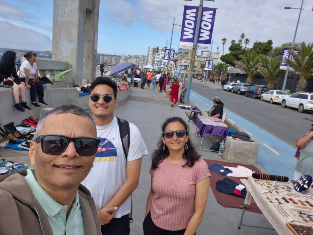
Our last stop in Viña del Mar was Avenida Perú, a coastal promenade similar to Marine Drive in Mumbai.
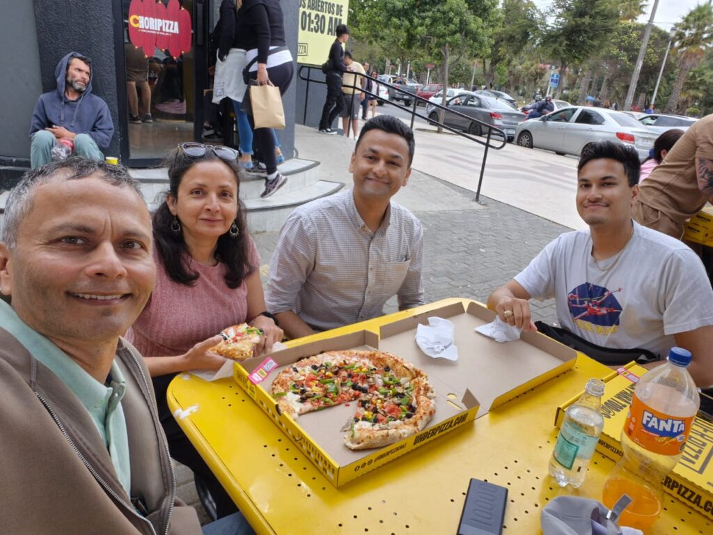
It is a bustling street filled with vendors, food stalls, performers, and tourists. We walked around and spent some time along Avenida Perú before having pizza at Under Pizza.
Around 8 pm, we took a taxi from Viña del Mar and reached our hotel in Santiago by 10 pm. It was a very good visit to Valparaíso and Viña del Mar.
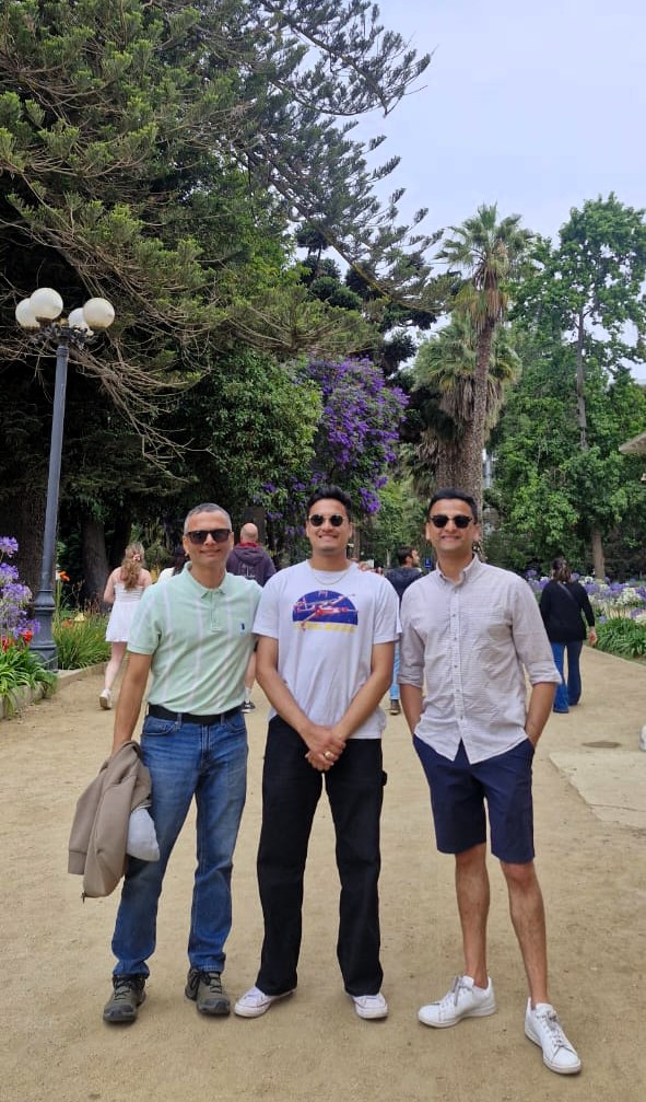
Tuesday, Jan 6, 2026 – Cajón del Maipo, Chile
We decided to take a day trip southeast of Santiago to a place called Cajón del Maipo, which translates to “Maipo Canyon” or the “canyons around the Maipo River.”
We joined a guided tour and started early, leaving our hotel around 6:40 am. Our first stop was a viewpoint on the way to Cajón del Maipo, which we reached after traveling for about 1 hour and 20 minutes.
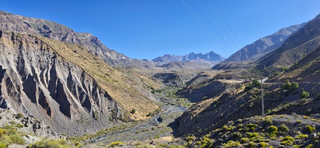
Cajón del Maipo refers to a dramatic mountain valley and canyon system in the Andes near Santiago. It is known for its stunning landscapes, including glaciers, rivers such as the Maipo, Yeso, and Volcán, waterfalls, hot springs, and hiking trails. It is a popular natural escape for outdoor activities.
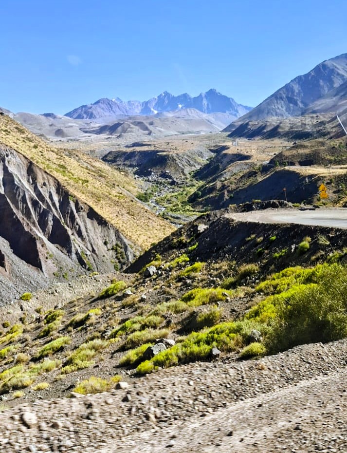
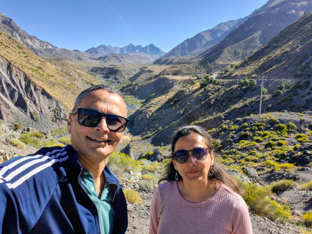
We had climbed from about 1,800 ft above sea level in Santiago to nearly 9,000 ft above sea level.
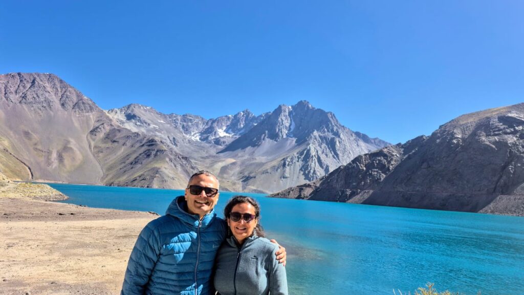
From there, we proceeded toward our main destination, the El Yeso Reservoir.
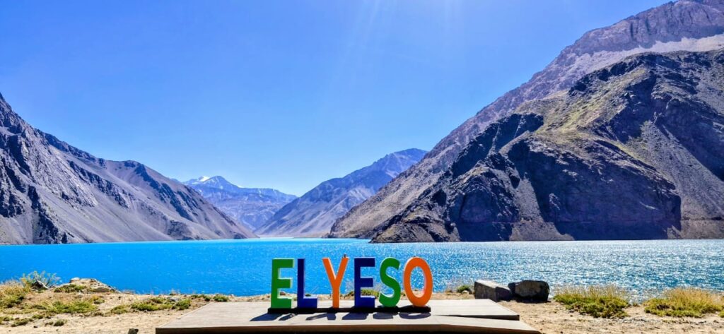
El Yeso Reservoir was built in 1964 by damming the Yeso River – a river in Chile that runs 4 miles (~6km) and is one of the main tributaries of the Maipo River.
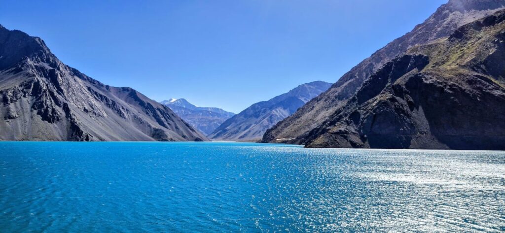
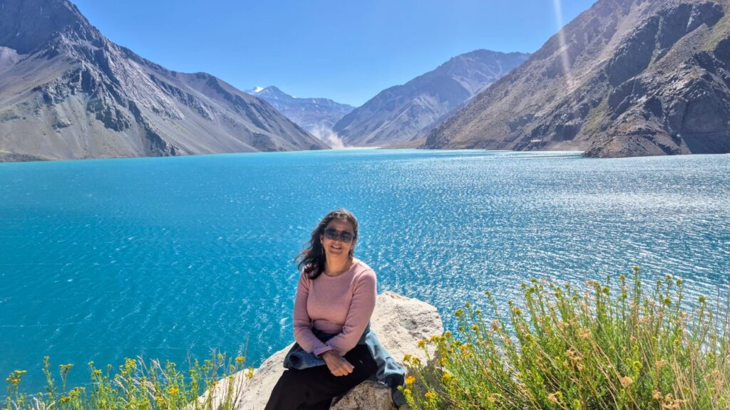
Although we had seen many spectacular views on the W Trek, this place was also very impressive in its own way.
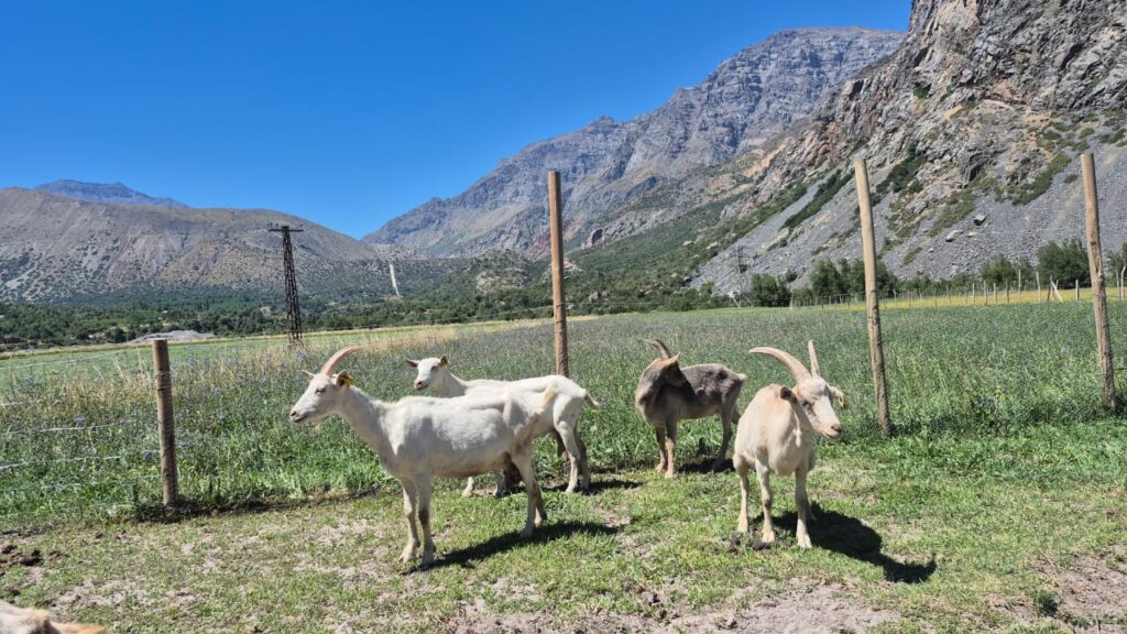
After spending time at the reservoir, we proceeded to a goat farm, where we were served goat cheese products.
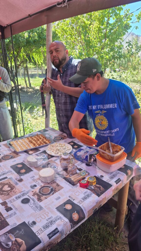
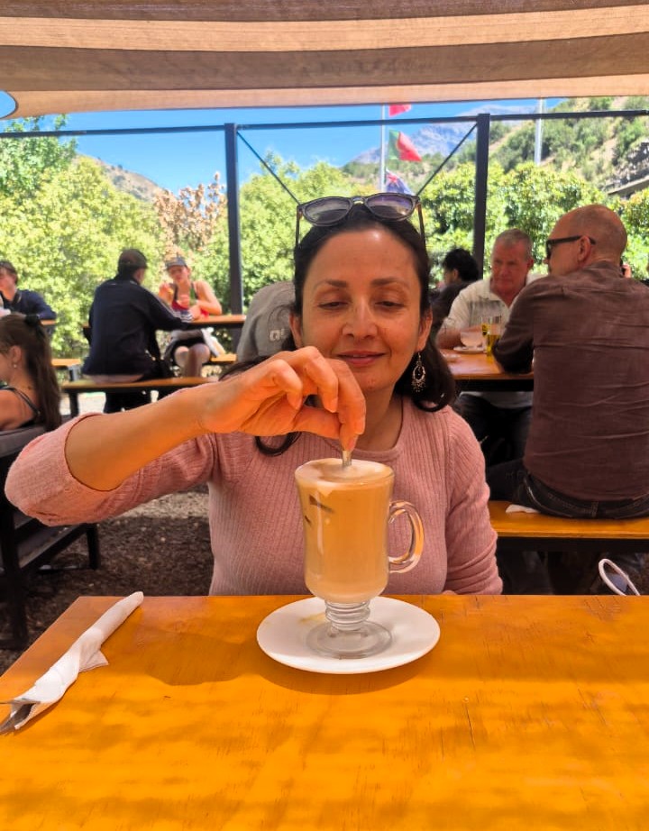
We had a light lunch around noon, while Anu just had some coffee.
We then stopped at Casa Chocolate, a chocolate shop along the way near San José del Maipo.
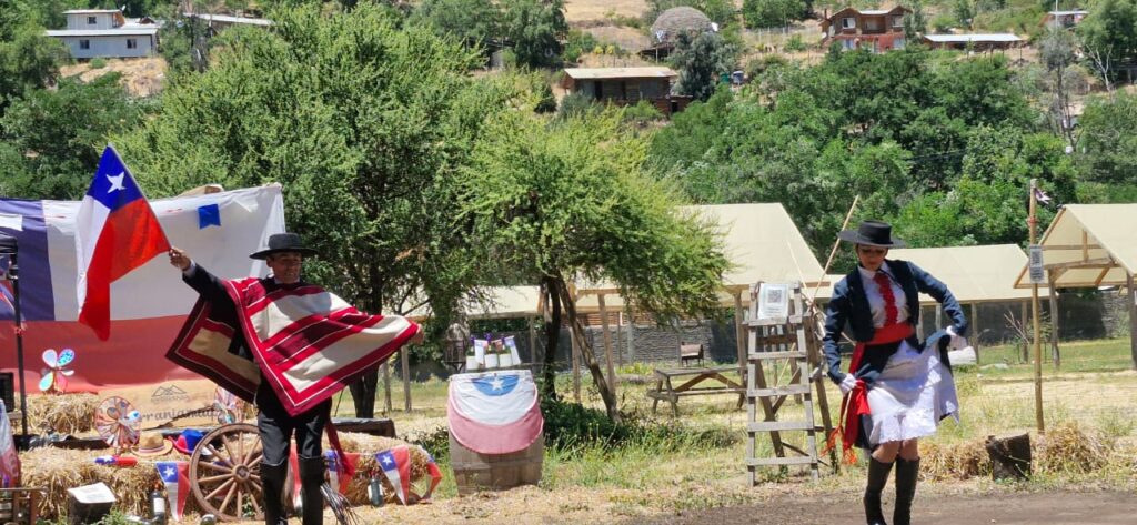
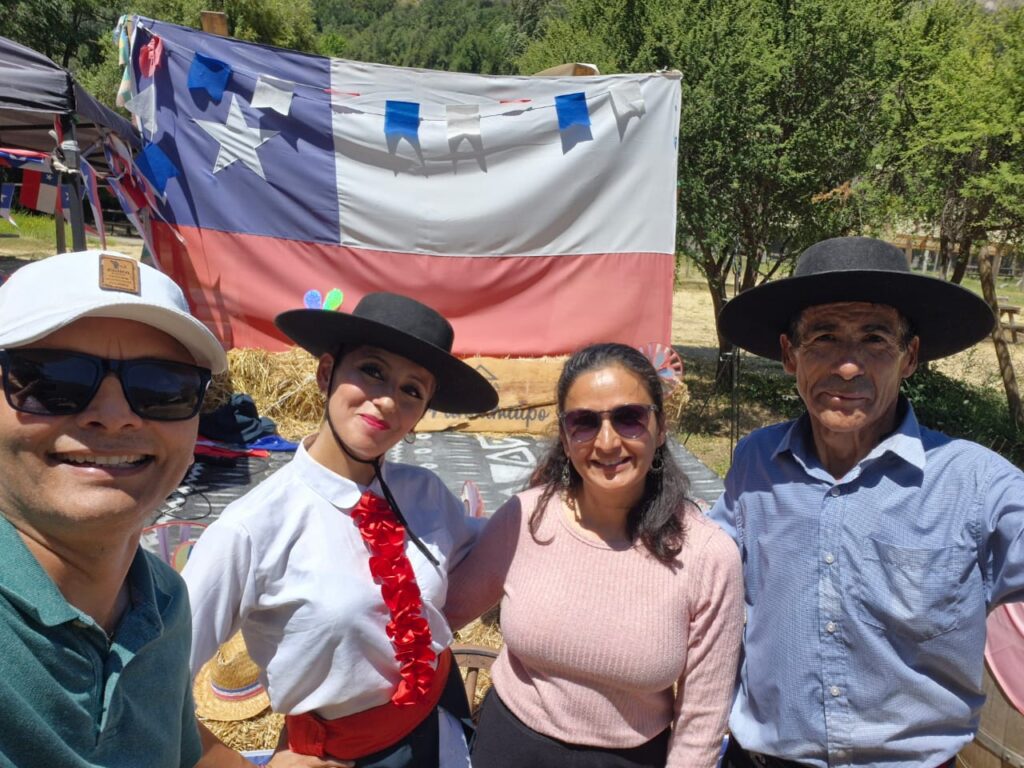
Our final stop was a picnic at a local winery, where they served red wine, apple juice, and cheese.
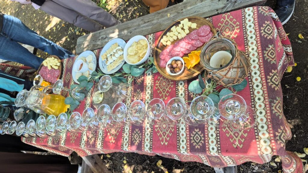
There was also a traditional Chilean dance performance by a local father-and-daughter duo.
A musical-chairs-style game was conducted, with the grand prize being a large bottle of wine.
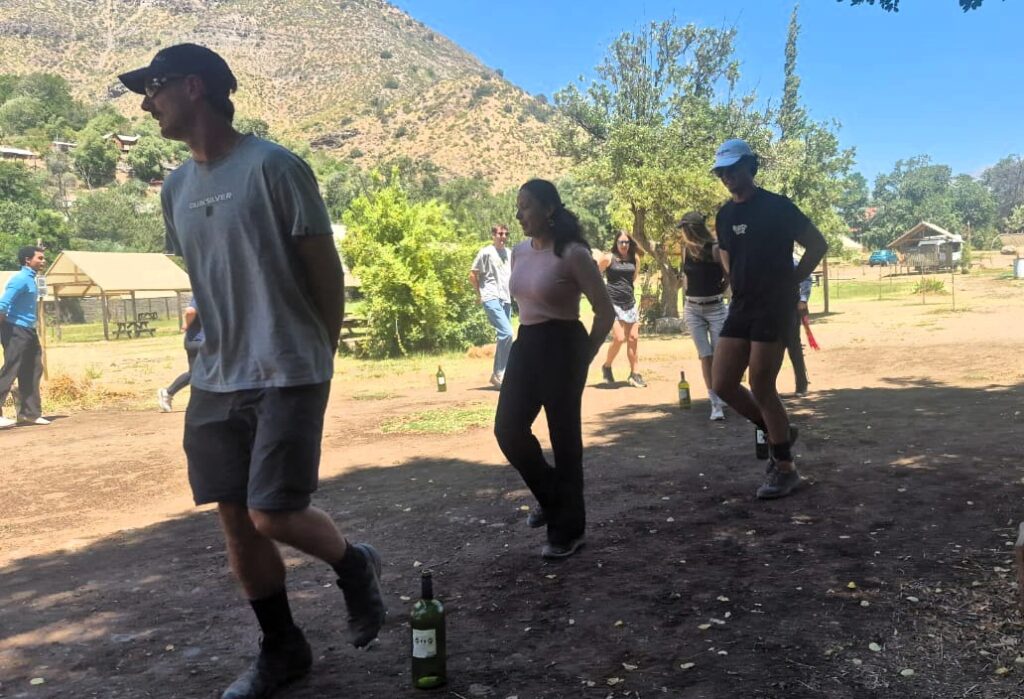
Anu was eliminated when about four people were still left in the game.
After the picnic and activities, we drove back to Santiago and reached around 5:00 pm.
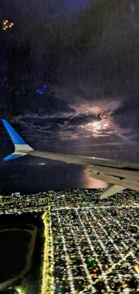
Later that night, we took the 9:50 pm flight from Santiago, Chile, to Buenos Aires, Argentina, arriving around midnight.
Wednesday, Jan 7, 2026 – Buenos Aires and Ushuaia
We did not do much in Buenos Aires, Argentina, apart from having lunch and then heading to Ezeiza Airport. From there, we flew to Ushuaia, the southernmost tip of Argentina.
We flew to Ushuaia in the evening of Sat, Jan 7. We took the Antarctica Voyage between Sat, Jan 8 to Sun, Jan 18 – Read the Antarctica blog here. We got back to Ushuaia in the morning on Sunday, Jan 18. We continued our South America trip further.
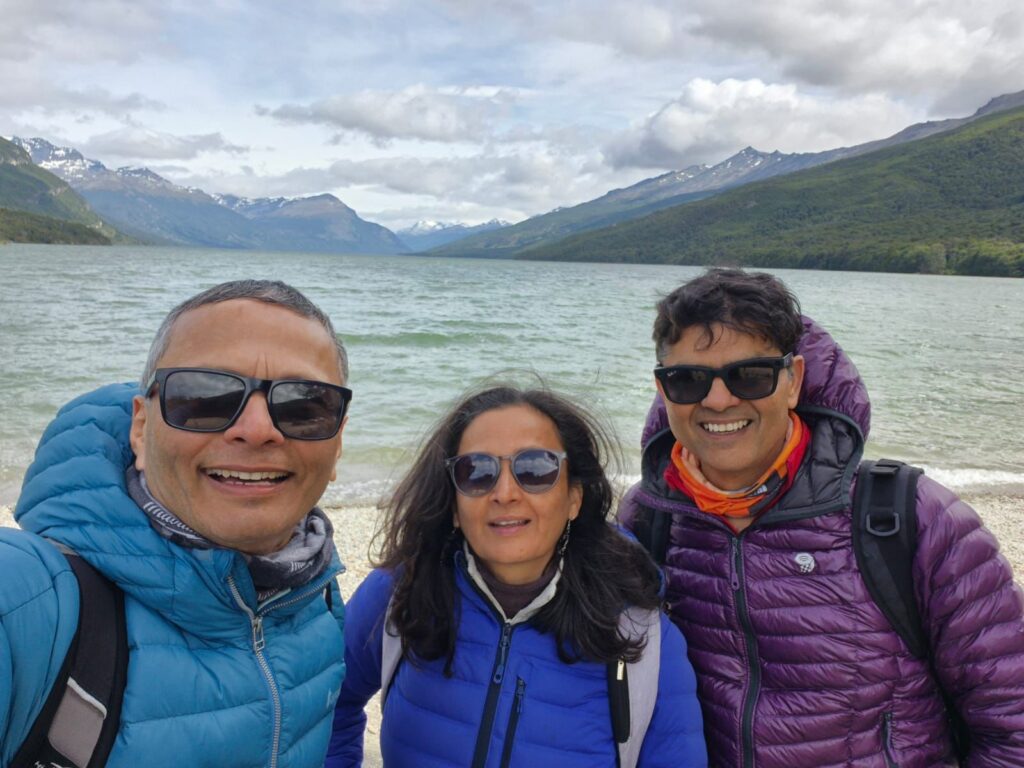
Sunday, Jan 18, 2026 – Ushuaia
We disembarked from our 11-day Antarctica trip at the port of Ushuaia. We had the entire day to spend before our night flight to Buenos Aires at 9:23 pm.
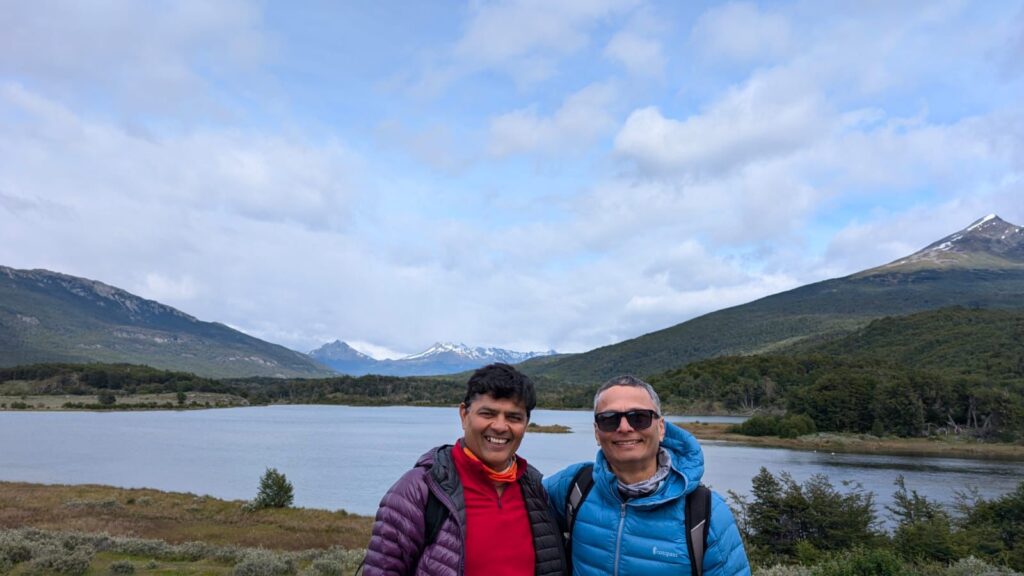
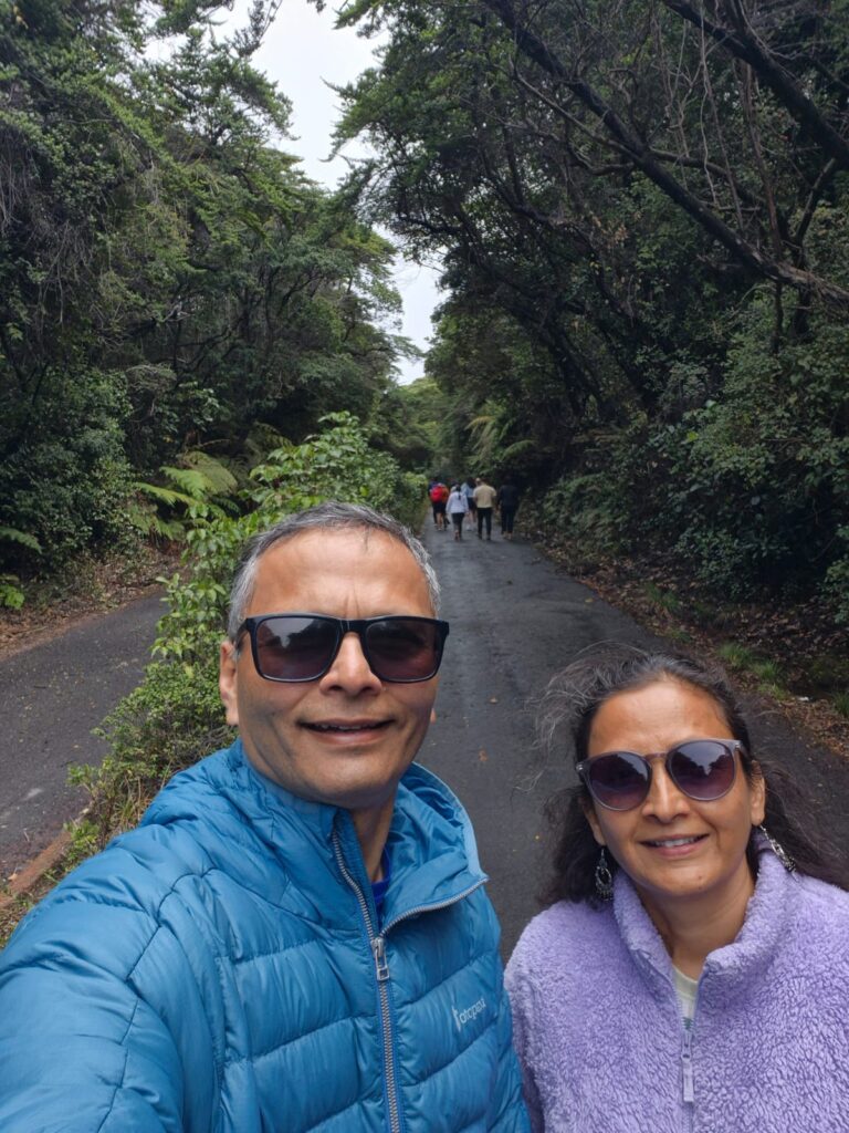
We decided to spend the day at Tierra del Fuego National Park, located about 15 km from Ushuaia. Tierra del Fuego translates to “Land of Fire.”
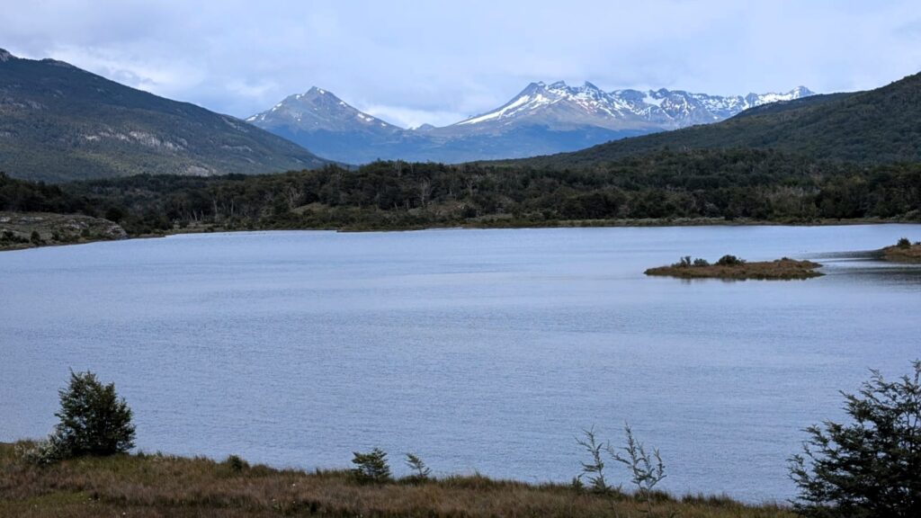
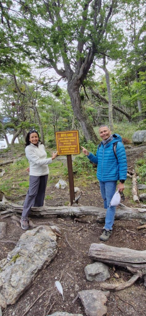
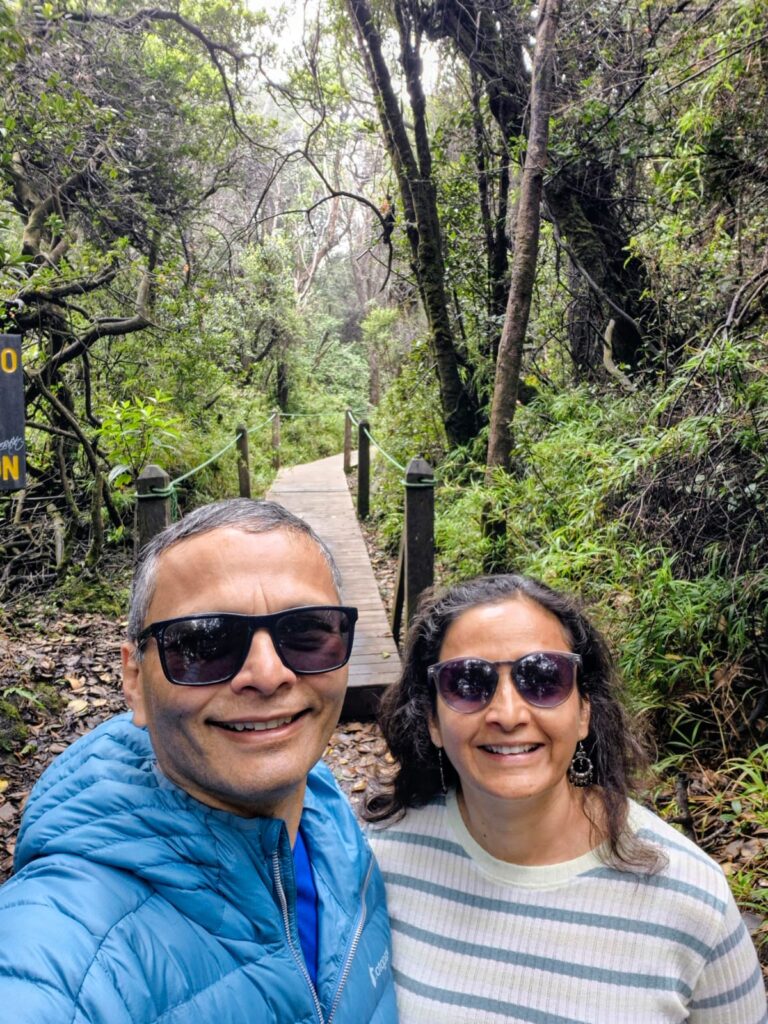
We went to the Alakush Visitor Center inside Tierra del Fuego National Park. After looking at the trail map, we decided to do the Hito XXIV (Hito 24) hike, which takes you to the Argentina–Chile border within the park.
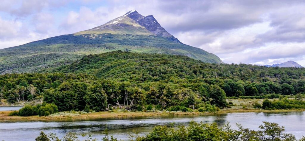
This easy-to-moderate hiking trail runs along the scenic shores of Lake Acigami (formerly Lake Roca), passing through lush forests and leading to the border marker.
It offers beautiful views and a unique experience at the edge of the world.
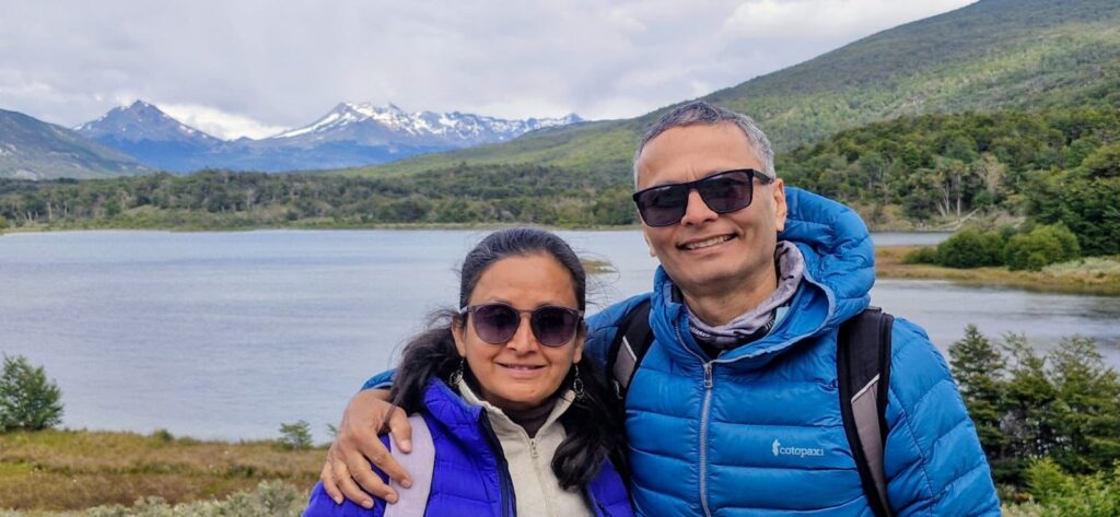
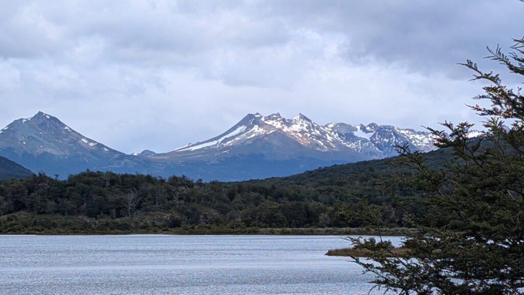
We started the hike around 11 am and were immediately treated to lovely views along the shores of Lago Roca (Lake Roca).
The trail ran almost entirely along the lake, and in some places, water from the lake spilled onto the trail itself.

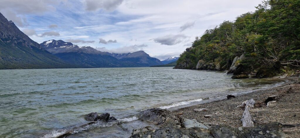
The path was densely wooded but still offered fantastic views of Lake Roca and nearby peaks such as Cerro Cóndor.


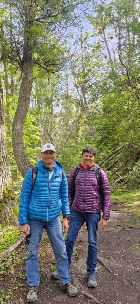
The hike was very gentle, with hardly any climbs, making it a relaxed walk.

Eventually, we reached the end of the trail, which marked the boundary between Argentina and Chile.
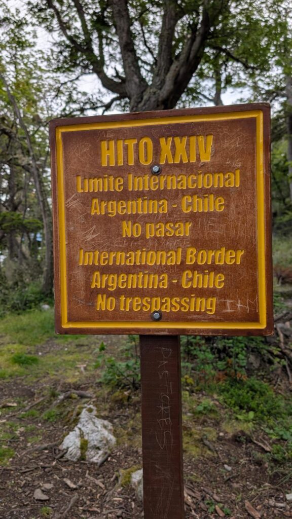
We could not go any further beyond this point.
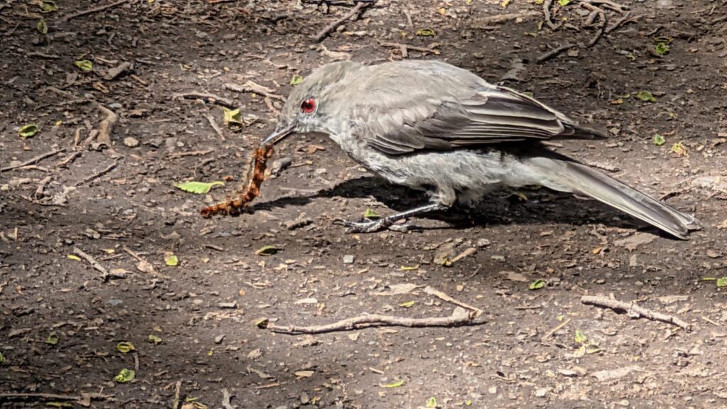
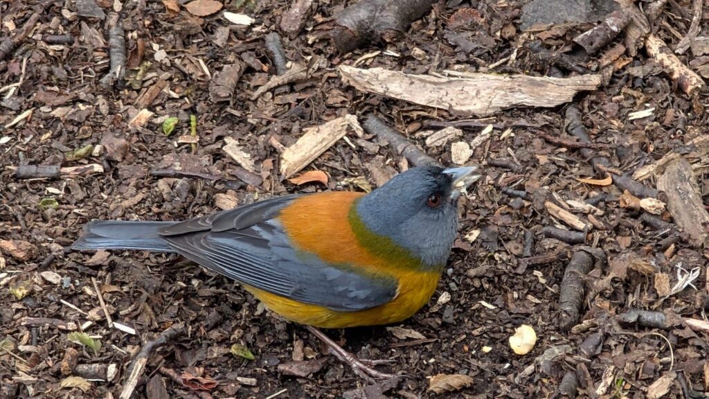
Along the way, we managed to capture an Andean fox and a couple of beautiful birds on camera.

We returned to the Alakush Visitor Center from the Hito XXIV hike around 1:45 pm.
In total, we covered about 10 km round-trip from the visitor center.
We took the 4 pm bus shuttle back to Ushuaia and then headed straight to the airport for our flight to Buenos Aires, followed by our onward journey to Colonia del Sacramento in Uruguay.
Monday, Jan 19, 2026 – Colonia del Sacramento, Uruguay
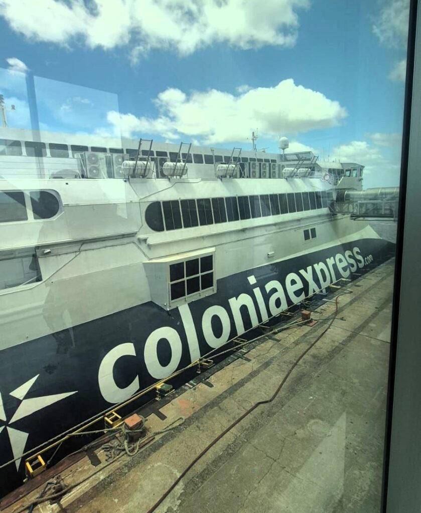
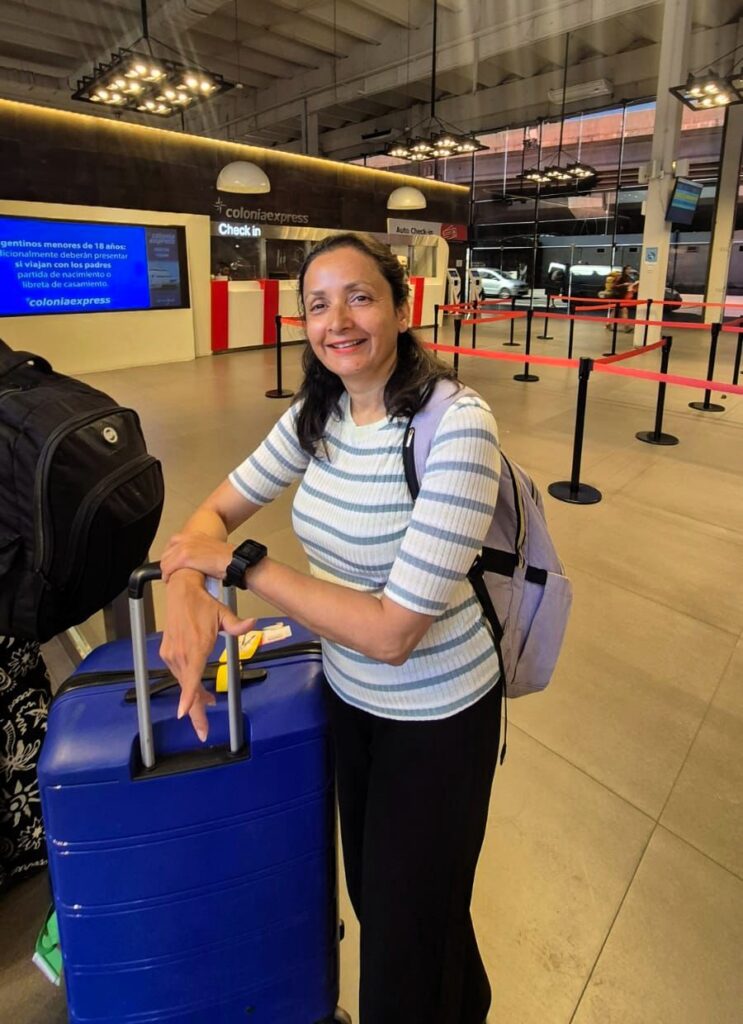
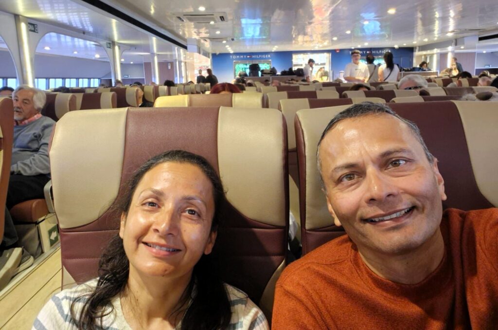
We took the 10:30 am Colonia Express ferry from Buenos Aires to Colonia del Sacramento in Uruguay.
We had to go through Argentine immigration first, followed by Uruguayan immigration.
Unfortunately, the process was not very well organized, and it turned into a bit of a mess.
The ferry eventually departed at 10:55 am, as it had to wait for everyone to complete immigration.
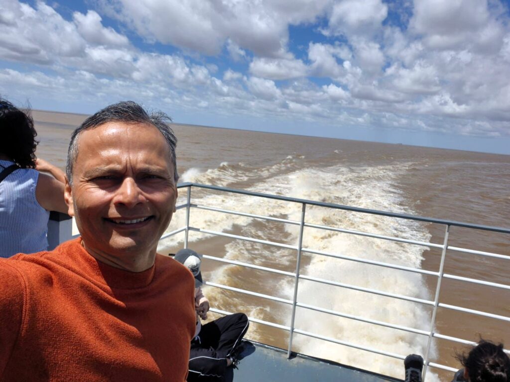
The ferry ride took about 1 hour and 15 minutes to reach Colonia, crossing the Río de la Plata, a massive river mouth formed by the Uruguay and Paraná rivers.
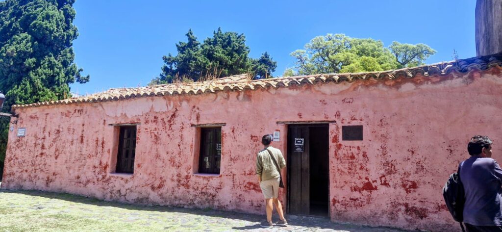
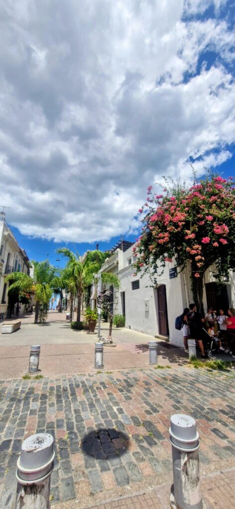
Colonia del Sacramento was founded as a Portuguese city by Brazil in 1680. At the time, Portugal and Spain were both fighting for control of the land that is now Uruguay. While Montevideo was Spanish, Colonia del Sacramento remained Portuguese. Even today, the northern parts of Uruguay speak a mix of Portuguese and Spanish. Colonia itself is a delightful city with a strong historical character.
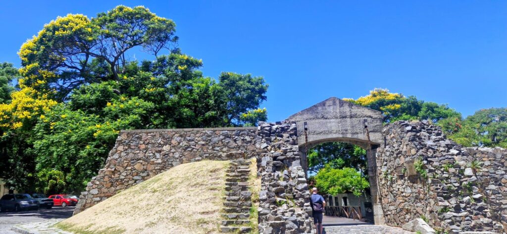
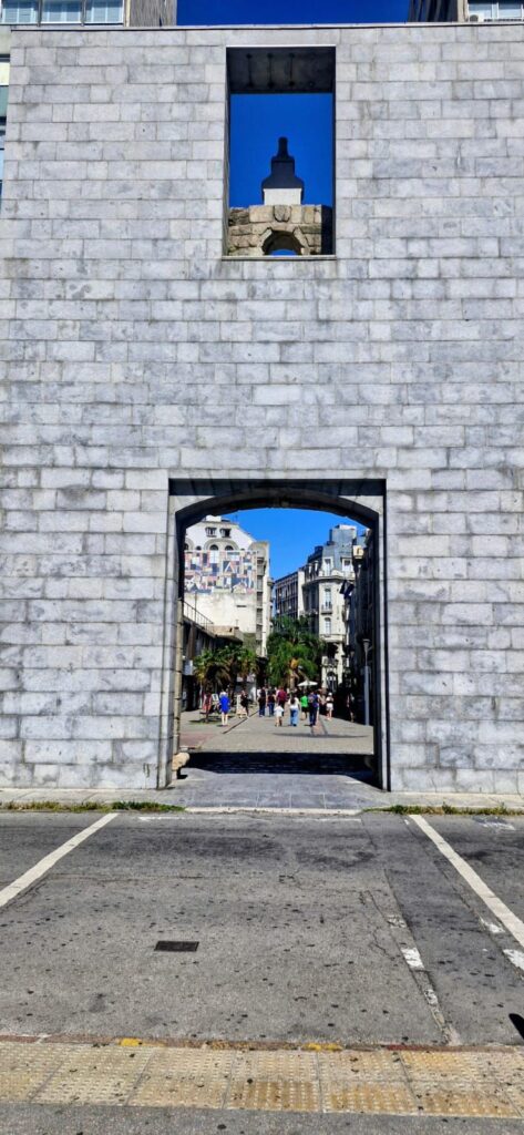
Entering the historic quarter of Colonia del Sacramento through its gates and drawbridge is a wonderful way to arrive in the old city.
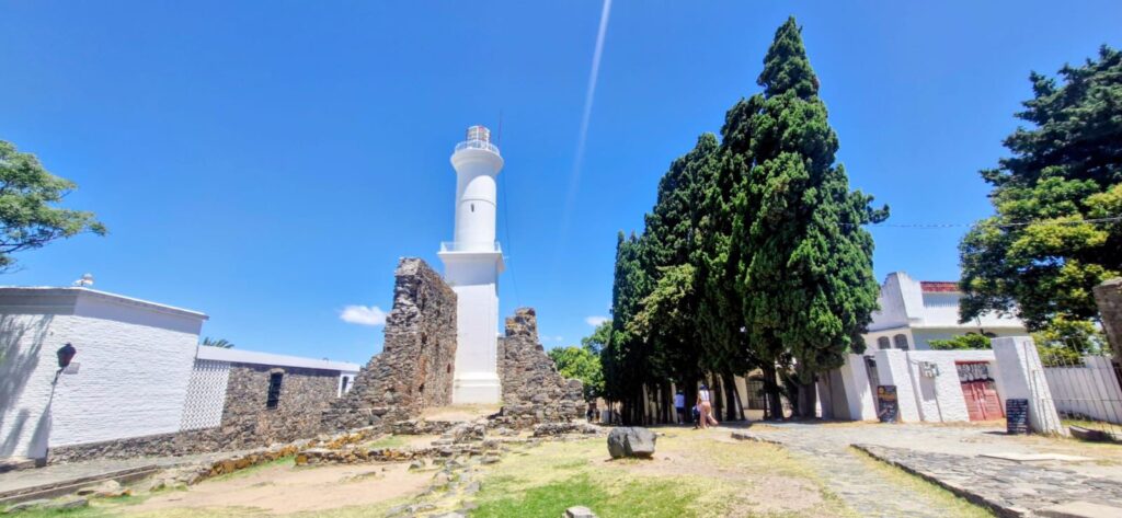
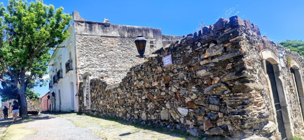
The lighthouse, erected in 1857, and the ruins of the convent next to it are notable points of interest.

Calle de los Suspiros, or the “Street of Sighs,” is one of the most historic streets in Colonia.
A drain runs through the middle of this cobblestoned street, and some of the homes still preserve their original colonial-era structures.

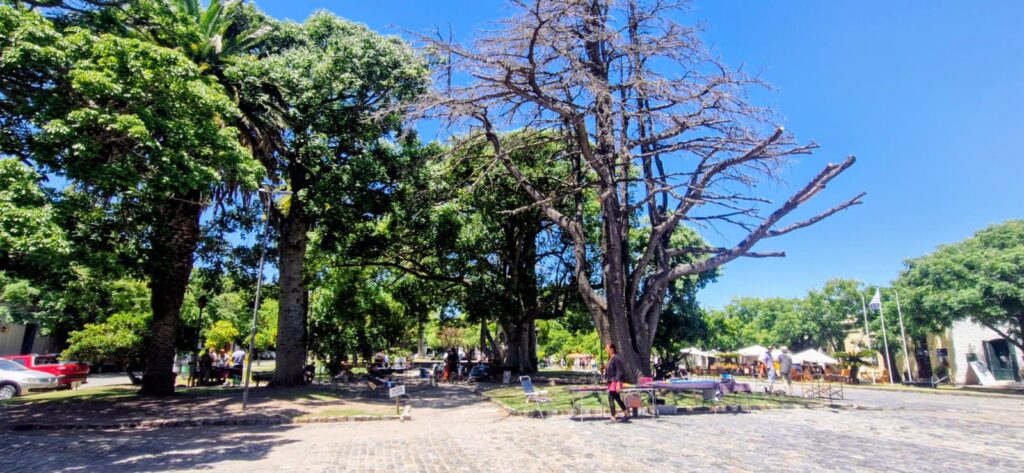
We walked around Plaza Mayor, which features a tree-lined square, an old Portuguese home, and the ruins of the Viceroy’s house.
For lunch, we ate at a burger place called Picaro Buda, located inside a hostel.
The veggie burger was quite decent.
Our final stop was the Basilica del Santísimo Sacramento, built in 1680. It is located in Plaza de Armas, the main square of the city.

Plaza de Armas is a lively square with many restaurants and shops, and it is a pleasant place to hang around and soak in the atmosphere.
Anu and I really enjoyed our visit to Colonia del Sacramento.
Even though we spent only about 2.5 hours there, Colonia is definitely worth visiting. It has a strong colonial charm and would likely be even more beautiful in the evening when the lights come on.
Colonia also serves as a reminder of the historical clash between Spain and Portugal for control of the land that is now Uruguay. It is a very interesting chapter of history.
We took the 4 pm bus from Colonia to Montevideo, reaching around 7 pm. We checked into the Hilton Garden Inn in the Pocitos area, a relatively upscale neighborhood in the eastern part of Montevideo.
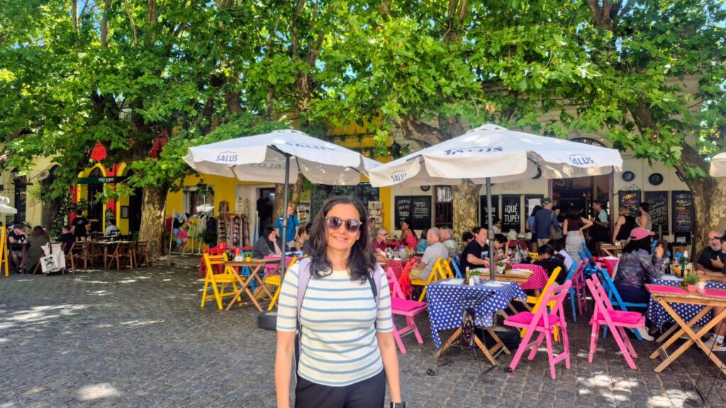
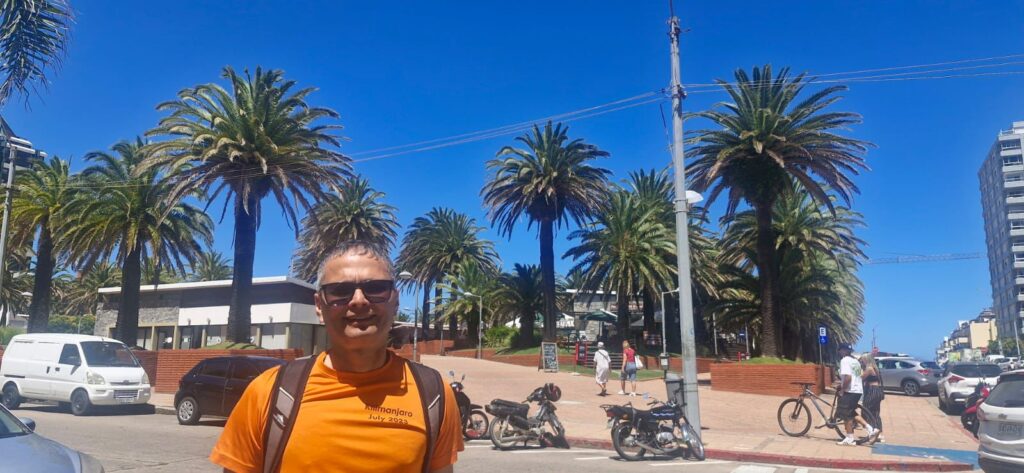
Tuesday, Jan 20 2026 – Punta del Este, Uruguay
We planned a day trip to Punta del Este, one of Uruguay’s most popular coastal destinations.
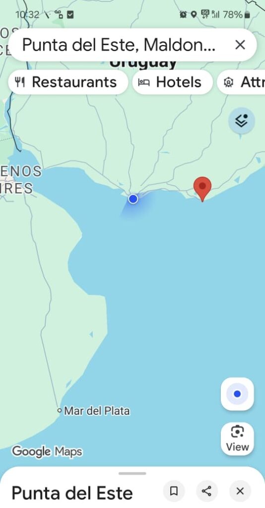
Punta del Este means “East Point,” the place where the Río de la Plata ends and the Atlantic Ocean begins.
Punta del Este lies to the east of Montevideo. We did a day tour of Punta del Este with Inver, a company we booked through Viator.com.
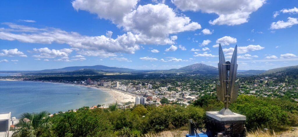
Our first stop was a viewpoint where we got panoramic views of Piriápolis – a city in the Maldonado Department (district) of Uruguay.
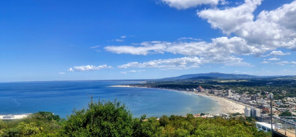
Piriápolis was founded on November 5, 1890, as El Balneario del Porvenir (the Resort of the Future). In 1890, businessman Francisco Piria, of Italian origin, purchased a large stretch of land here. In 1897, he completed the construction of his personal residence, Piria’s Castle. In 1905, he built Hotel Piriápolis, now known as Colonia Escolar de Vacaciones. In 1910, he constructed the coastal avenue Rambla de los Argentinos, which was completed in 1916.
Between 1920 and 1930, he built the Argentino Hotel, one of the largest hotels in South America at the time.
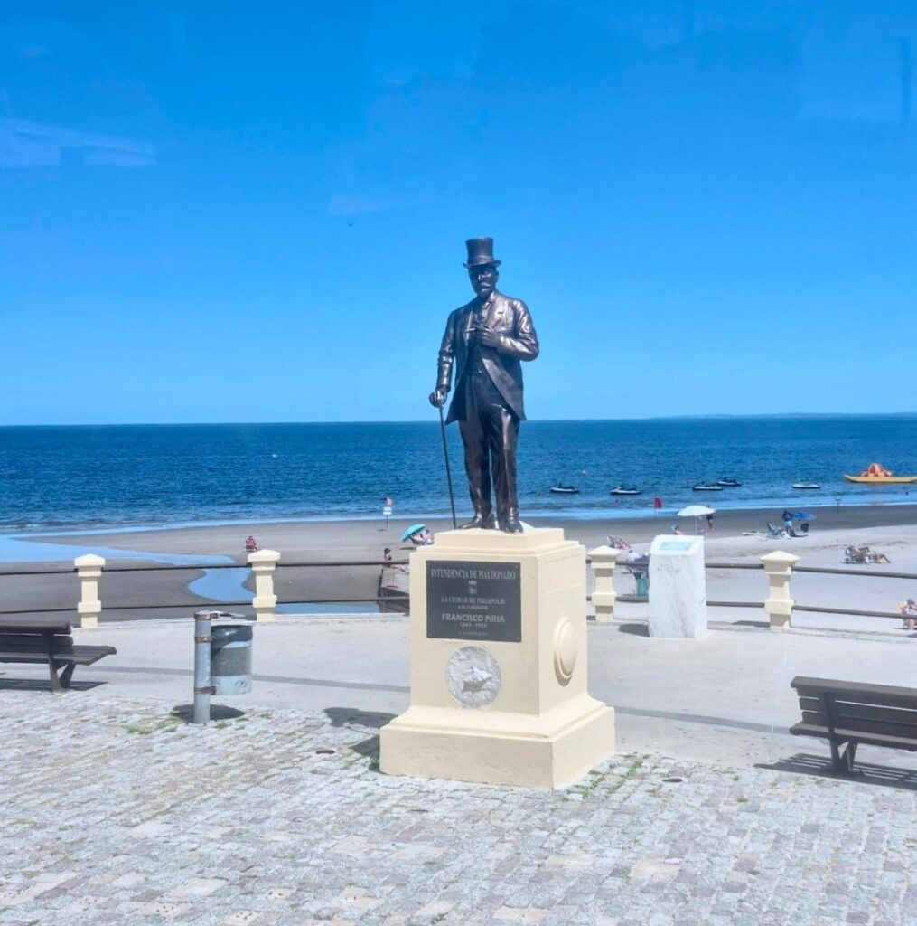
After Piria died in 1933, disputes broke out among his natural and legal children over the inheritance.
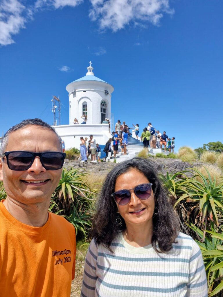
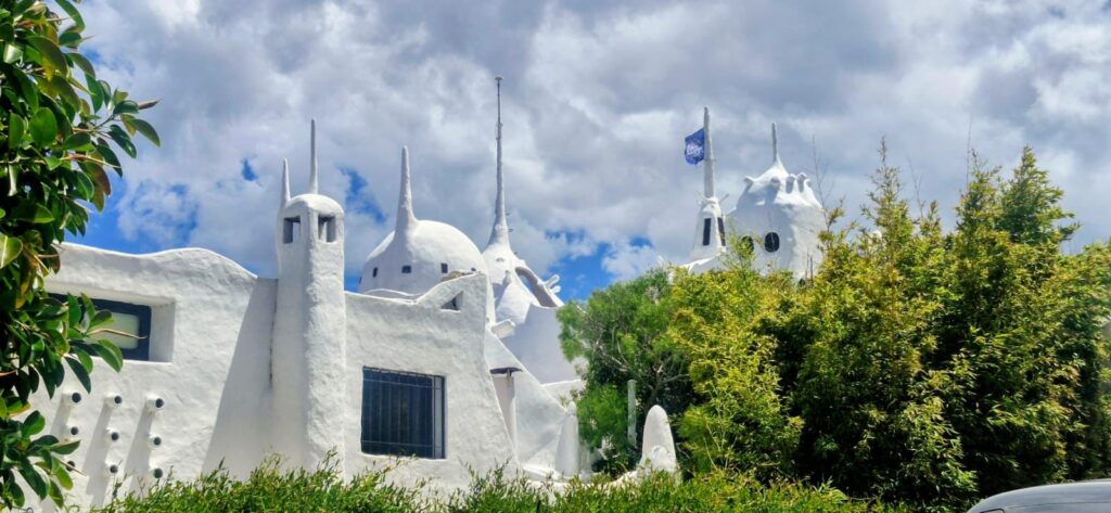
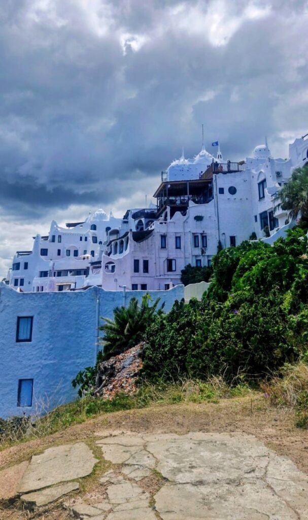
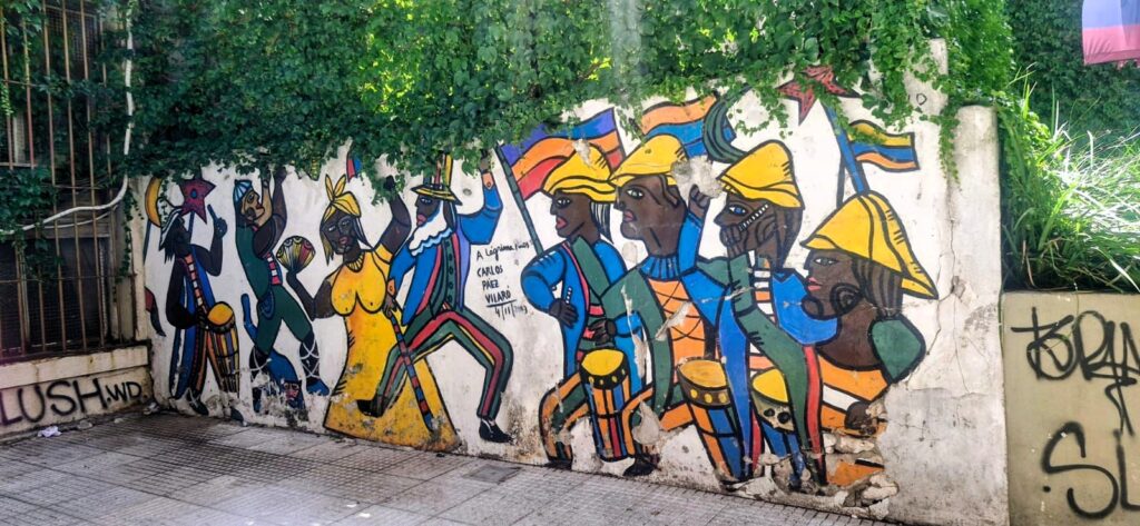
Our next stop was Casapueblo, a building constructed by the Uruguayan artist Carlos Páez Vilaró.
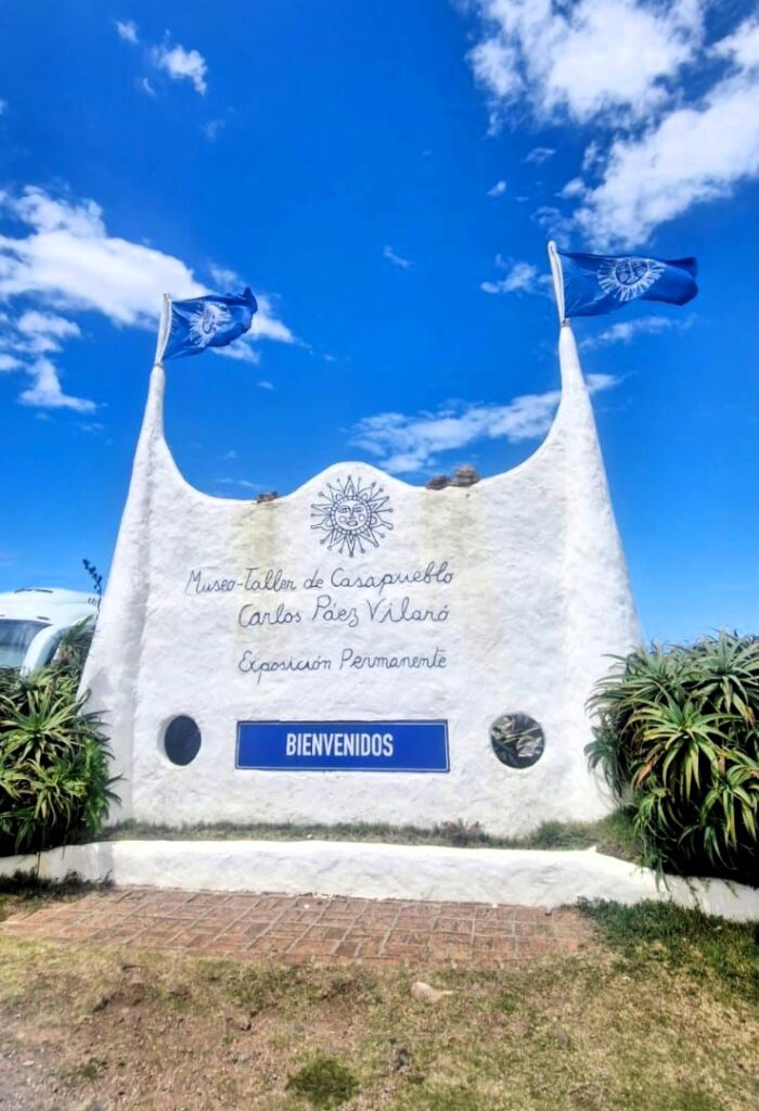
It is located in Punta Ballena, about 13 km from Punta del Este. Carlos Páez Vilaró was a well-known Uruguayan artist, and he began building this home in 1958, inspired by the whitewashed architecture of the Greek island of Santorini.
Earlier in his life, Carlos Páez Vilaró lived in Montevideo’s predominantly Black tenement called Mediomundo (“Half-World”), where he studied candombe and comparsa dances that are central to Uruguayan culture.

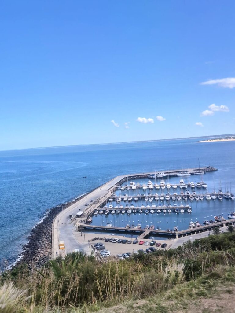
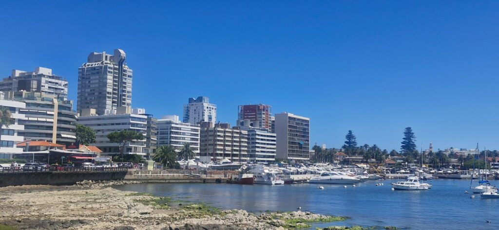
We then finally reached Punta del Este.
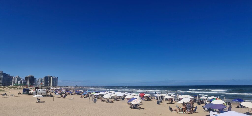
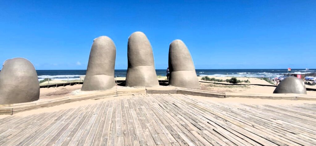
We visited the port area, the famous Five Fingers sculpture, also known as La Mano, and the Brava Beach area.
La Mano is a sculpture by Chilean artist Mario Irarrázabal. It depicts five human fingers partially emerging from the sand and is located at Brava Beach.
We could see a few sailboats out on the Atlantic Ocean. It was a great day to be outdoors.
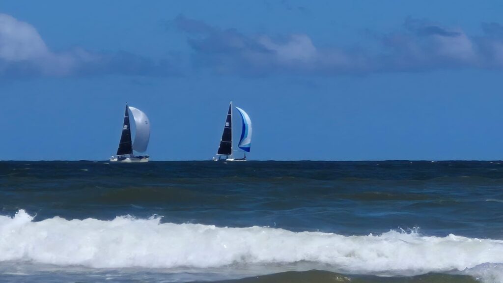
Brava Beach was fairly crowded, but it was very clean and well maintained.
We had lunch at Mercado Verde, a specialty store selling vegan food, Ayurvedic products, and organic goods. Their tofu burger was quite good.
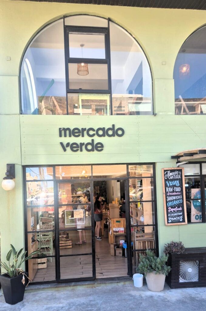
The cashier also spoke to us about the Ayurvedic products they sell, including churna.
We got back on the bus from Punta del Este at 4:15 pm and returned to our hotel around 6:30 pm, wrapping up a full and enjoyable day.
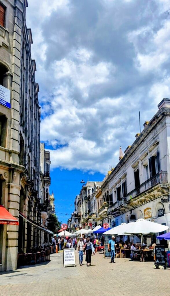
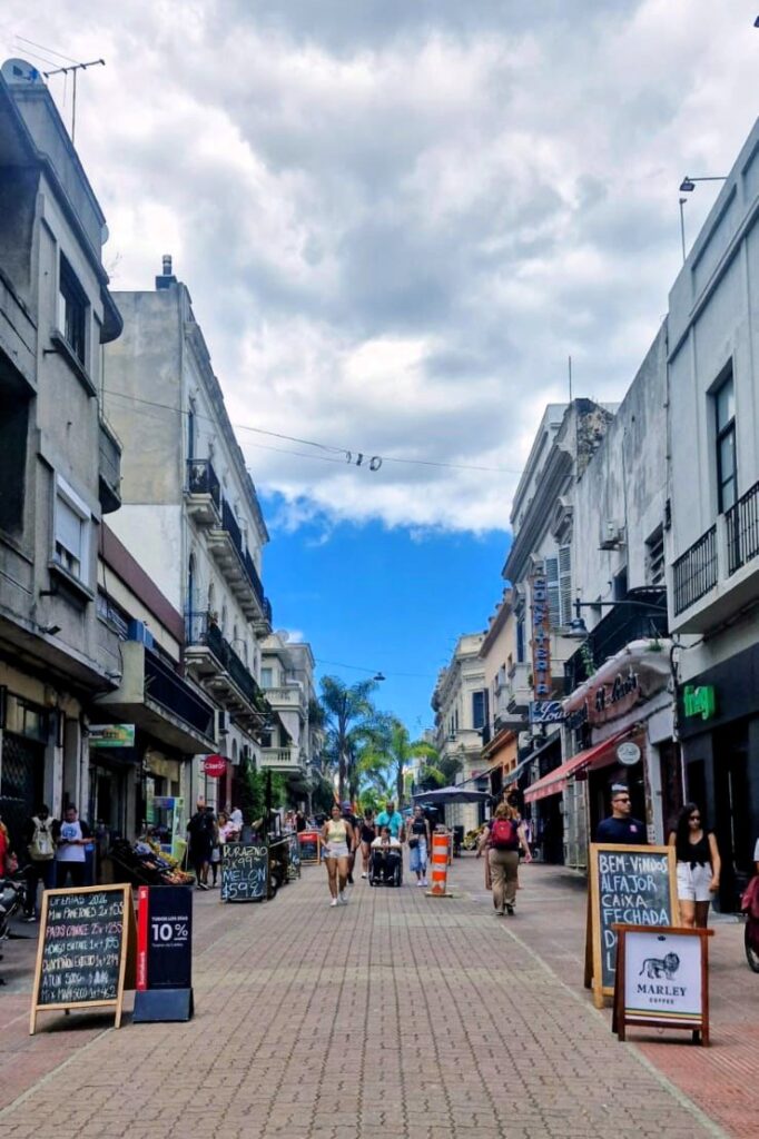
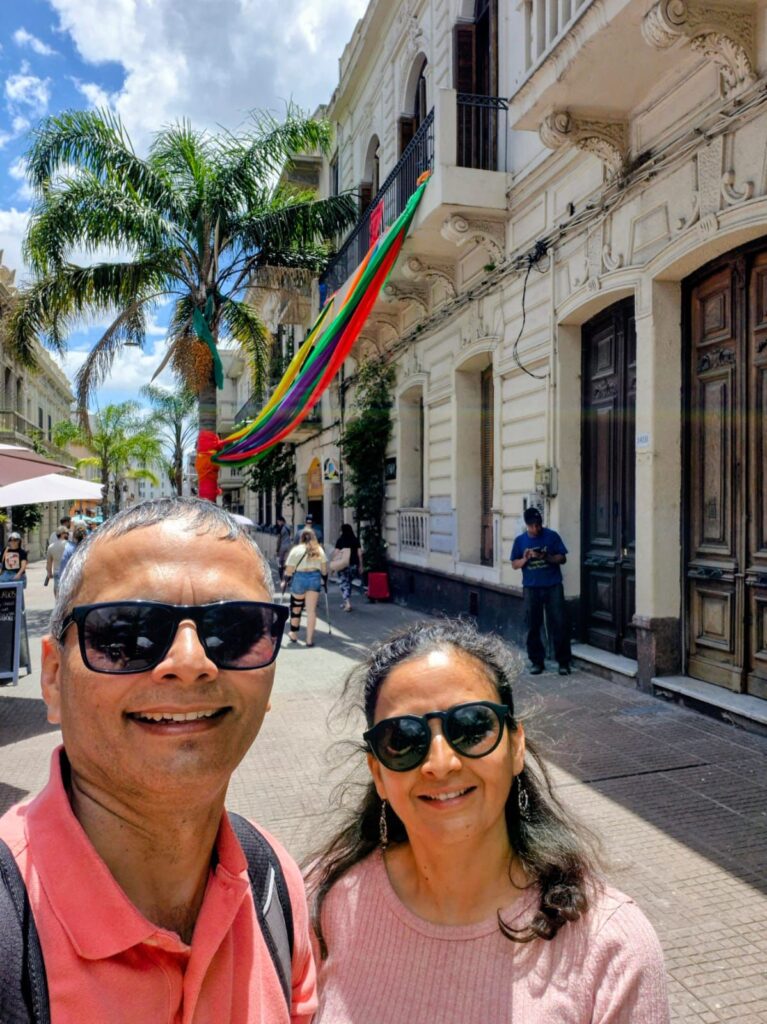
Wednesday, Jan 21, 2026 – Montevideo, Uruguay
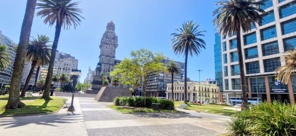
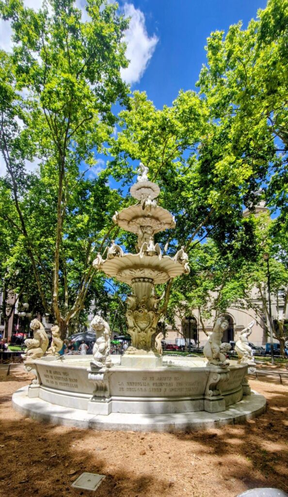
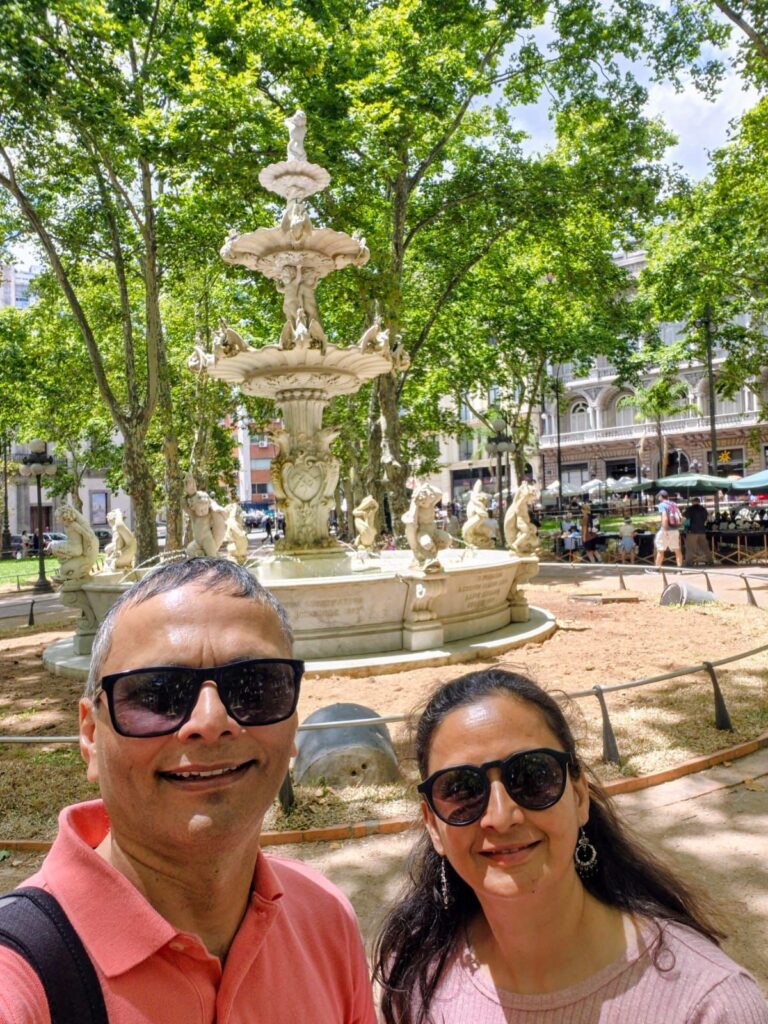
We started our day with a guided walking tour of Montevideo booked through Freetour.com. The tour began at 10:30 am at Plaza Independencia.
Our guide was Juan Pablo from Curioso Tour Company, and it turned out to be a very good and informative tour.
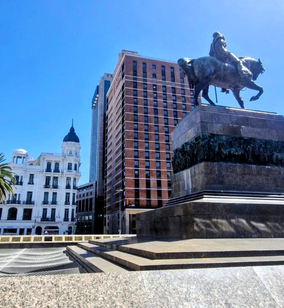
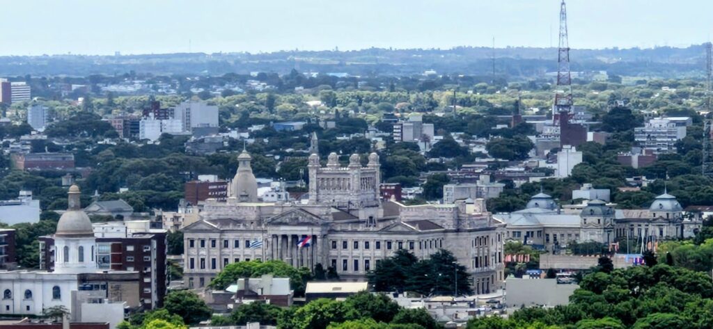
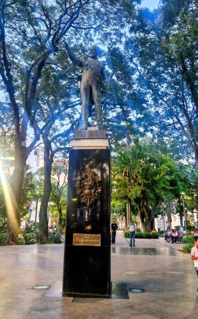
At Plaza Independencia stands the statue of José Gervasio Artigas, the national hero who led the fight for the freedom of Uruguayans against the Spanish Empire, beginning in 1811 and culminating in the formation of Uruguay’s constitution in 1830.

Below Plaza Independencia, underground, is a mausoleum dedicated to Artigas.
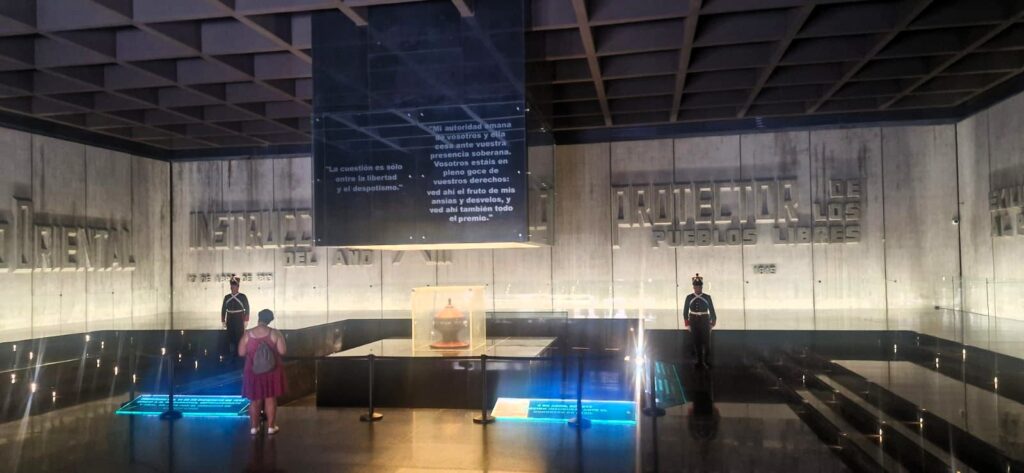
It also commemorates other important milestones in the history of Uruguay’s independence.
Nearby is the Solís Theatre, Uruguay’s most important and renowned theater.
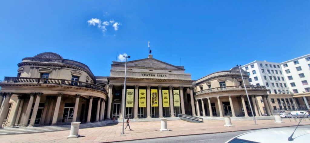
It opened in 1856 and was designed by the Italian architect Carlo Zucchi. The theatre is located in Montevideo’s Old Town, right next to Plaza Independencia, and is named after the explorer Juan Díaz de Solís, the first European to land in what is now Uruguay.
Artigas’ statue faces the Salvo Palace.
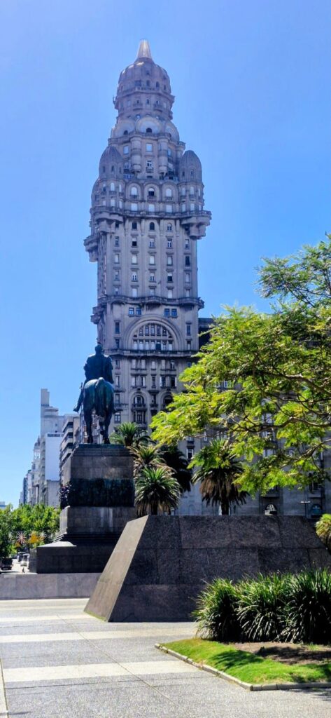
Palacio Salvo is an eclectic skyscraper next to Plaza Independencia that was completed in 1928. It was built by the business brothers Ángel, José, and Lorenzo Salvo. The 27-story building stands 105 meters (344 ft) tall and was, for a brief period, the tallest building in Latin America. At the time of its completion, it was also the tallest reinforced-concrete structure in the world.
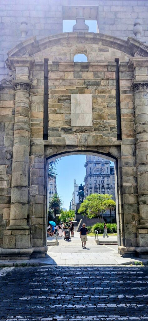
The Ciudadela Gate marks the remnants of the old citadel gate that once surrounded Montevideo’s Old Town. Plaza Independencia itself was outside the original citadel and represents the beginning of the newer part of the city.
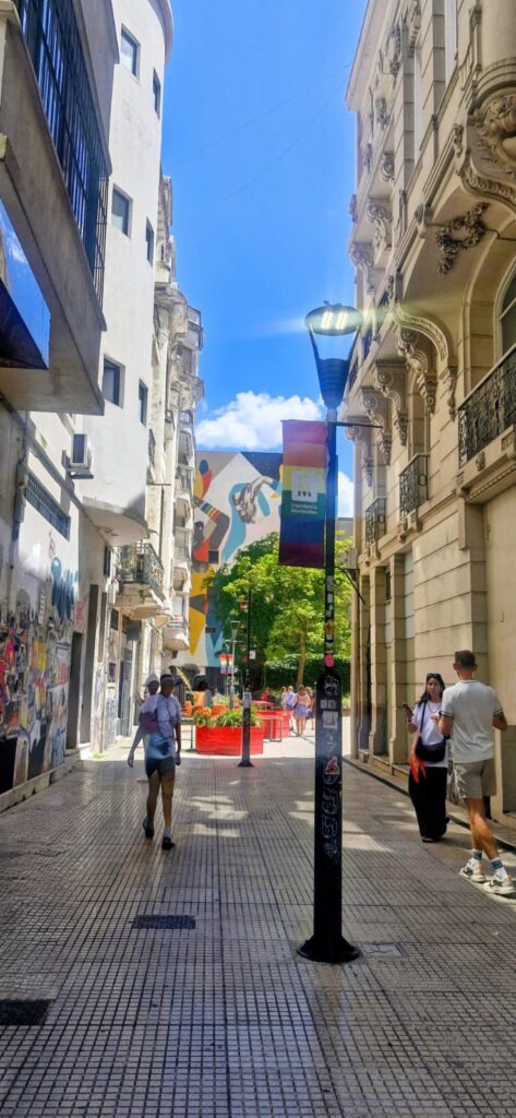
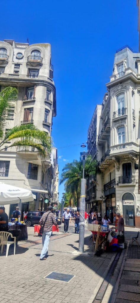
As we walked through the streets, Montevideo felt colorful and full of character.


We saw a wall mural by Carlos Páez Vilaró depicting candombe, a style of music and dance that originated in Uruguay among the descendants of freed African slaves.
We then visited Plaza Matriz, also known as Plaza de la Constitución.
It was the first plaza built in Montevideo in 1726 by the Spanish and followed the typical structure of early town settlements, with a fountain, a church, a square, and the town hall.
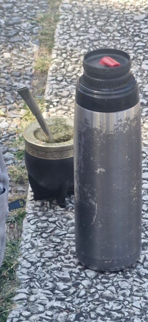
Mate (pronounced ma-tey) is the local drink of Uruguay. Uruguayans carry mate powder in a special cup with a straw and keep adding hot water to it.

They usually carry a thermos in their hand or in a special basket. Interestingly, there are no mate shops—it is a very personal drink meant to be shared among friends and family.
We continued exploring the streets of Montevideo as part of our guided tour.

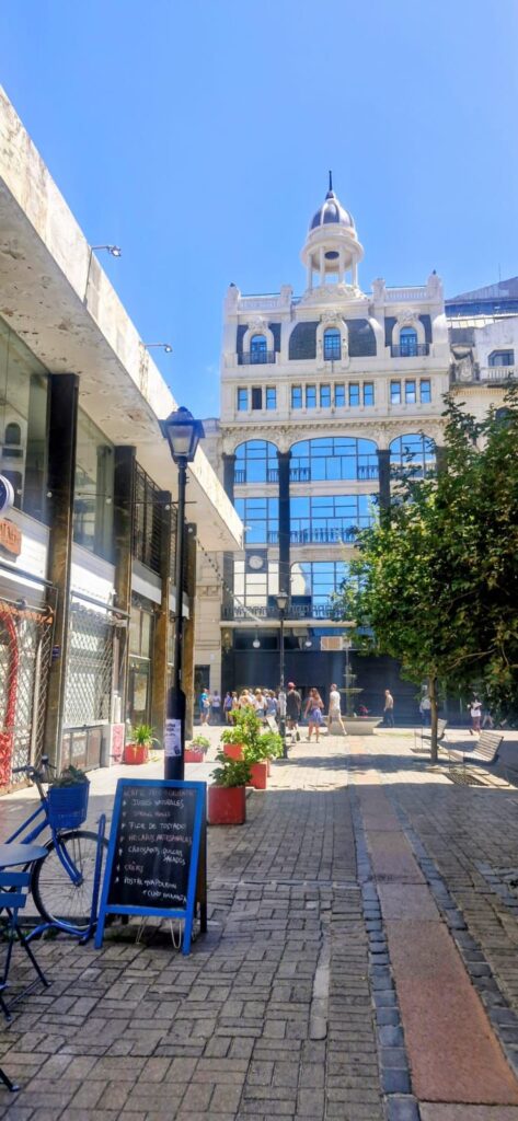
The tour ended around 1 pm at Puerto Mercado, the “Port Market,” an interesting area filled with many restaurants.
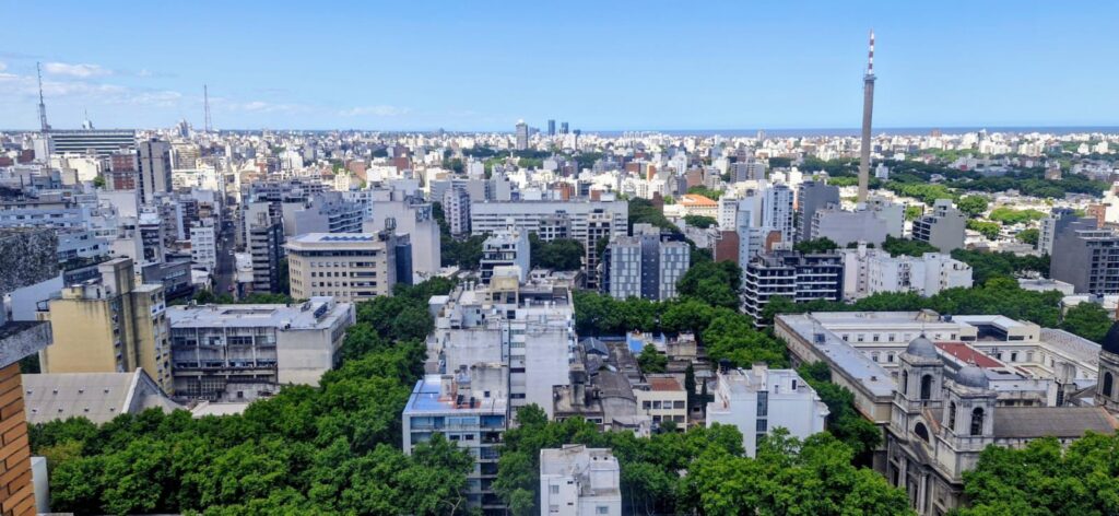
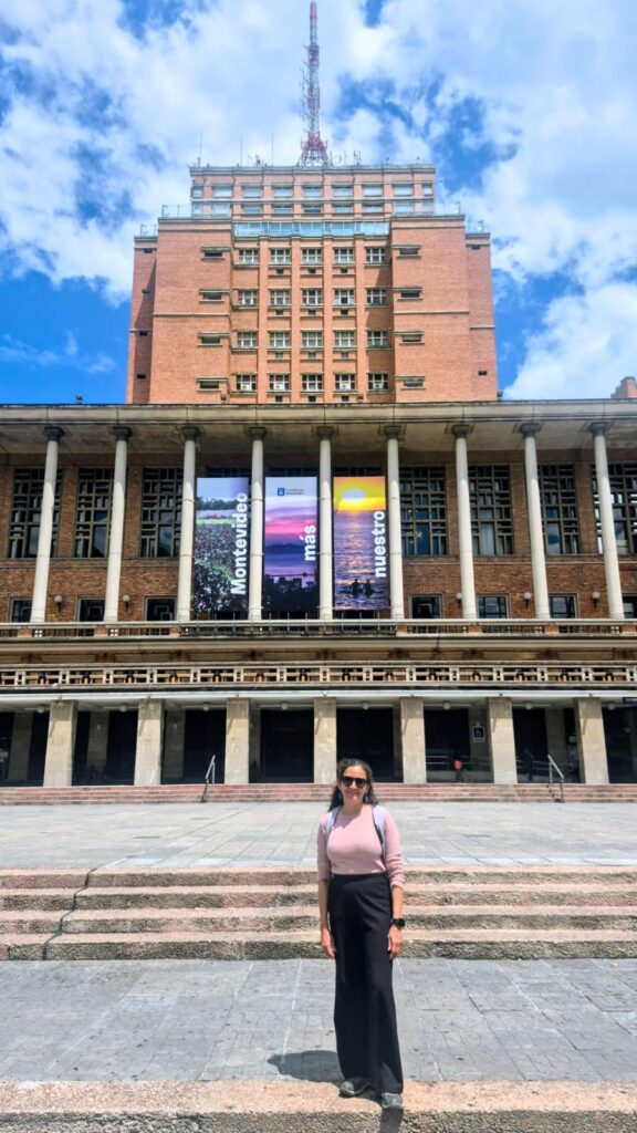
After the tour, we headed to Mirador Panorámico, an observation tower located on top of the 22-storey City Hall building.
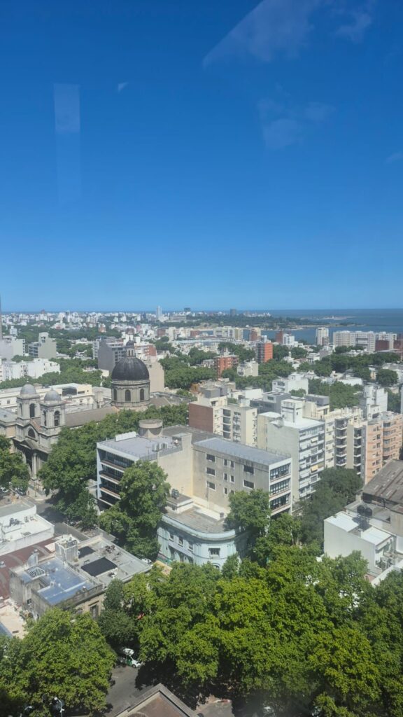
The visit is completely free—you simply tell the person at the entrance that you are going up to the panoramic viewpoint.
This turned out to be the highlight of our Montevideo visit. From the top, we could see the city in all directions, and all major landmarks were clearly marked as we walked around the observation area.
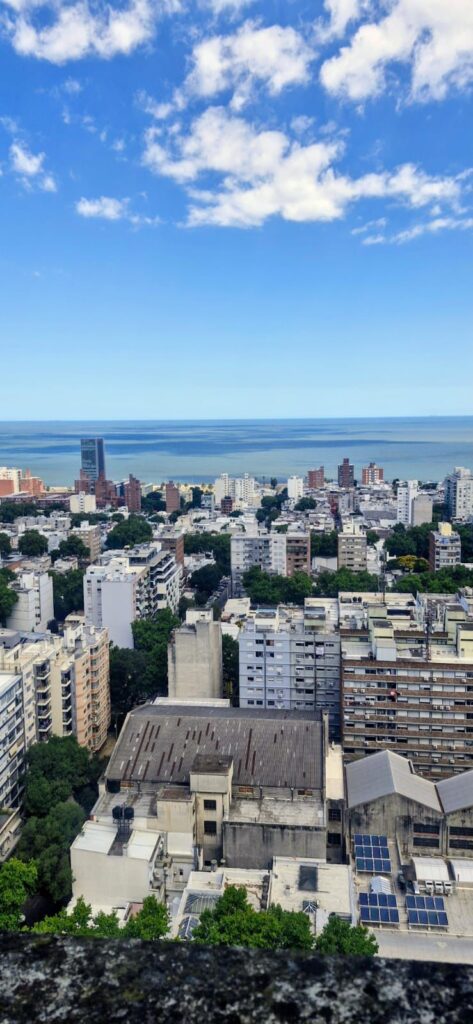
There is also a nice café at the top, so it was easy to spend about an hour there.
Next, we made a quick stop at Parque Rodó, a large park within Montevideo. It is an upscale area known for its eateries, pubs, and nightlife.

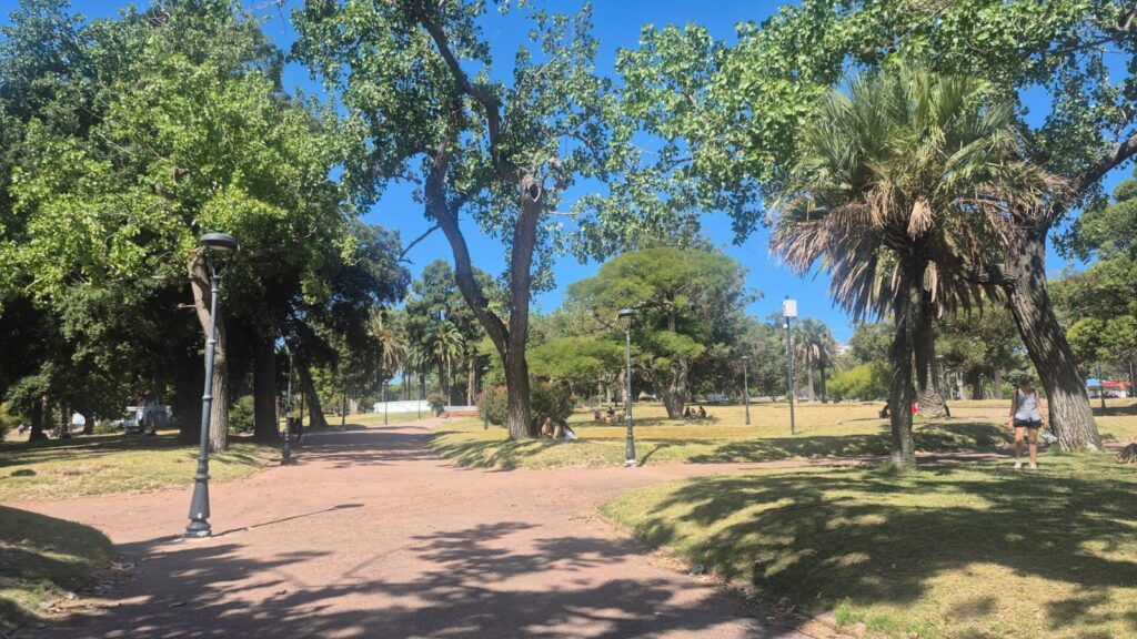
Since we visited in the afternoon, there wasn’t much activity at that time.
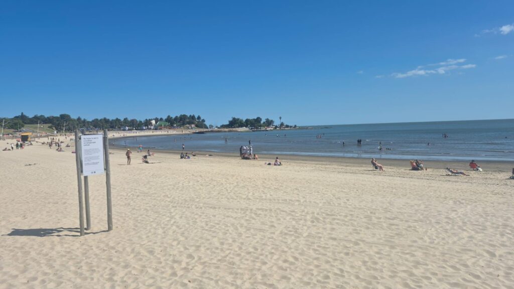
Our final stop was Playa Ramírez, located next to Parque Rodó. Even around 3:30 pm, there were plenty of people enjoying the beach.

We then returned to our hotel, the Hilton Garden Inn, picked up our bags, and left for the airport around 5:15 pm. We boarded our flight from Montevideo Airport to Asunción, Paraguay, at 7:25 pm.

Montevideo Airport was very modern and good-looking.
Our overall impression of Uruguay was very positive. It is a modern country with liberal values. Only about 40% of the population is Catholic, unlike many other South American countries, and about 50% of the population identifies as atheist. Voting in elections is mandatory.
The infrastructure and roads are very good, though things are quite expensive in Uruguay, even by US standards. The weather in January was excellent—it felt similar to California, with breezy and sunny conditions. We really loved our time in Uruguay.
Thursday, Jan 22 2026 – Asunción, Paraguay
We arrived in Asunción, the capital of Paraguay, at 3:30 am. After a late night, we slept in and started our self-guided walking tour of the city from our Hotel Palmaroga Hilton around 11 am.
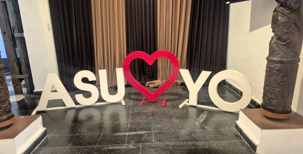
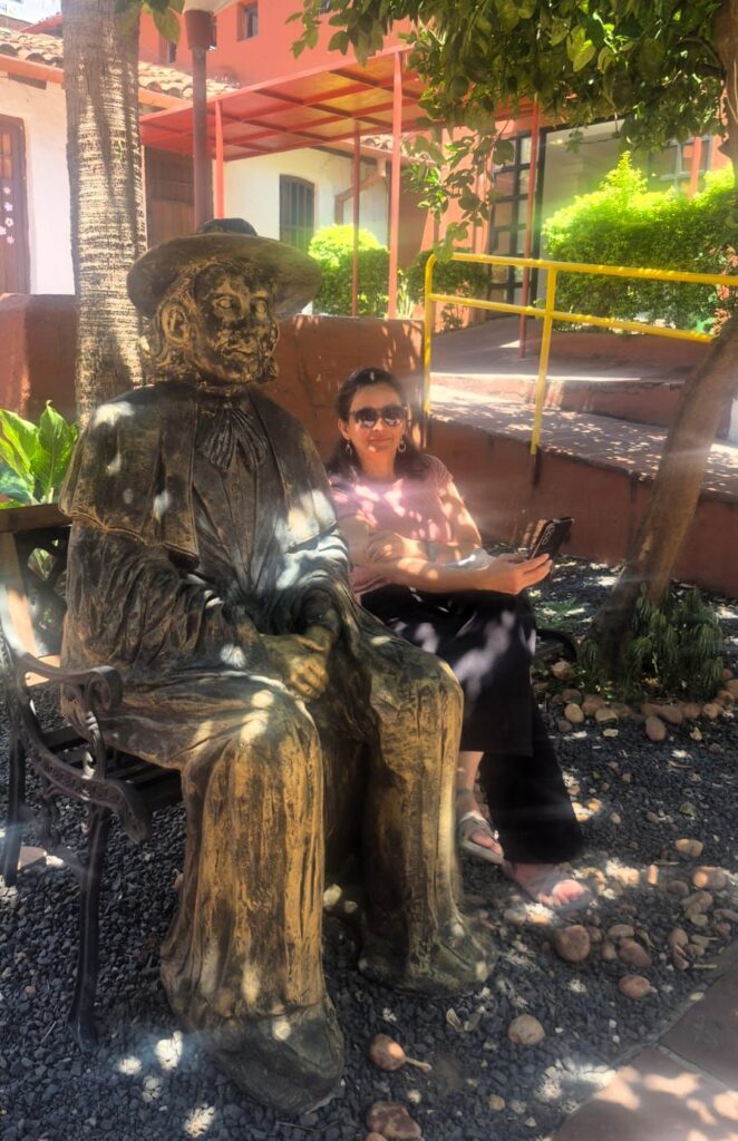
Our first stop was Manzana de la Rivera.
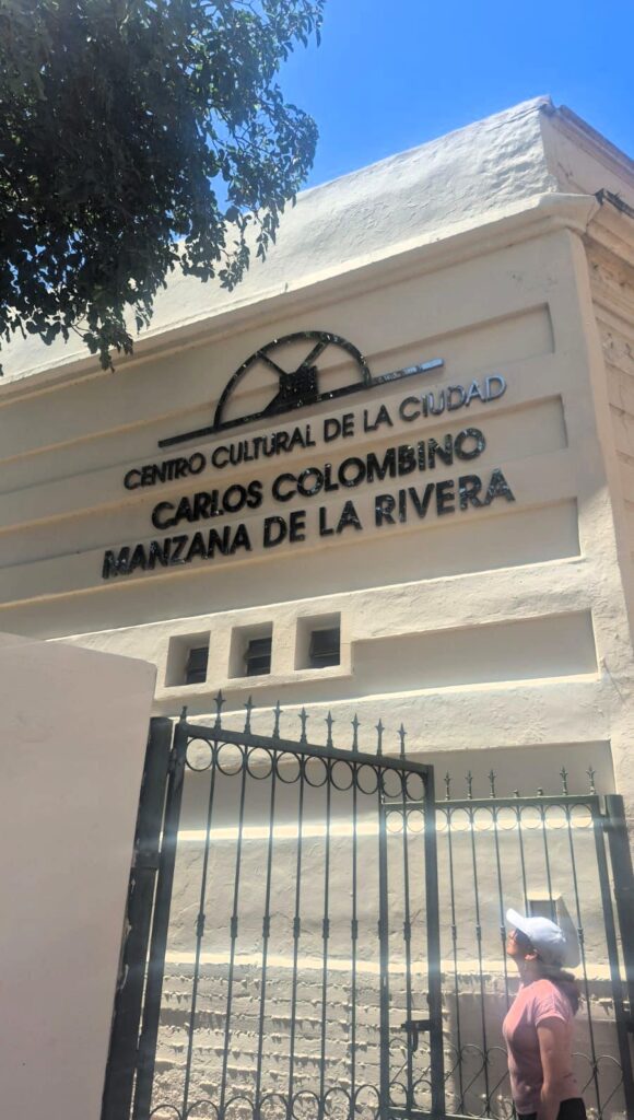
This was an antique city block that has been transformed into a museum-library-theater-café complex. One of the houses in the complex, Casa Viola, was originally built in 1950.
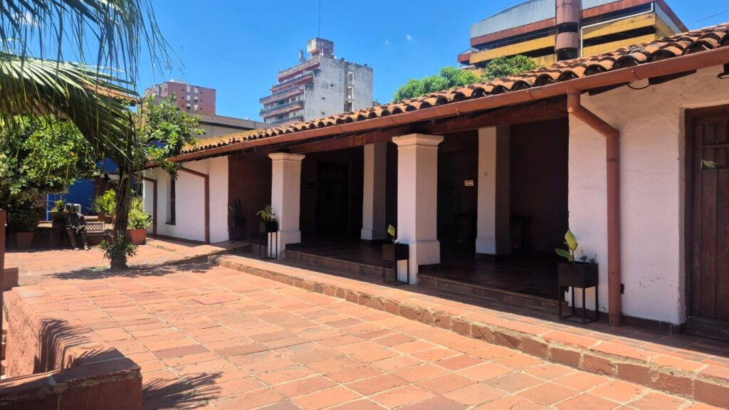
The restored block has become an important cultural symbol of Paraguay and includes several small museums highlighting the art, culture, and history of Asunción.
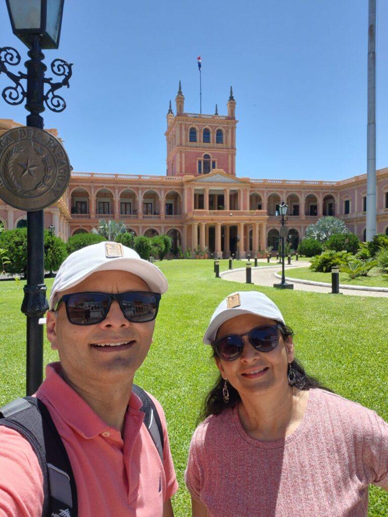
Right in front of Manzana de la Rivera is Palacio de López, which serves as the workplace of the President of Paraguay.
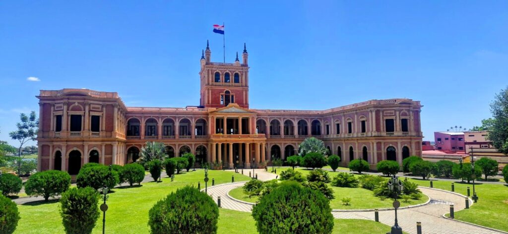
Located in the center of Asunción and overlooking Asunción Bay, Palacio de los López was built by order of Carlos Antonio López, the first Paraguayan head of state to hold the title of President under the 1844 constitution. He envisioned a López dynasty and intended the palace to house his son and successor, General Francisco Solano López, which is how the palace got its name. However, Solano López never lived there. Construction began in 1857 under the direction of the English architect Alonso Taylor and was largely completed by 1867.
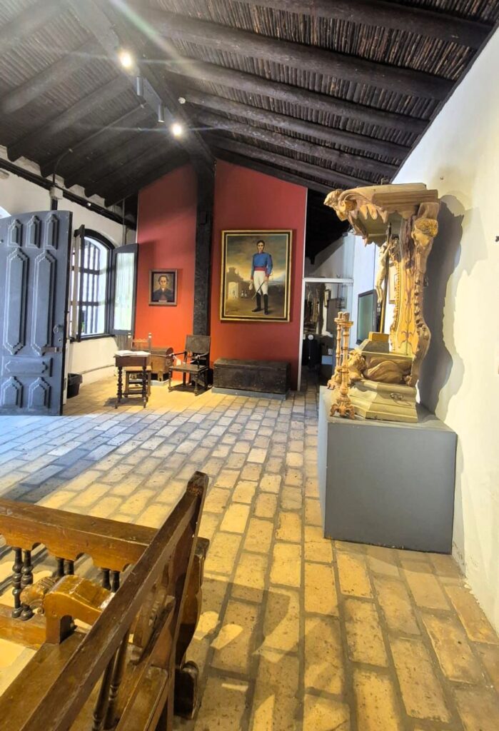
We then visited Casa de la Independencia (Independence House), a building of great historical importance.
On the evening of May 14, 1811, a group of Paraguayans emerged from this house to declare Paraguay’s independence.
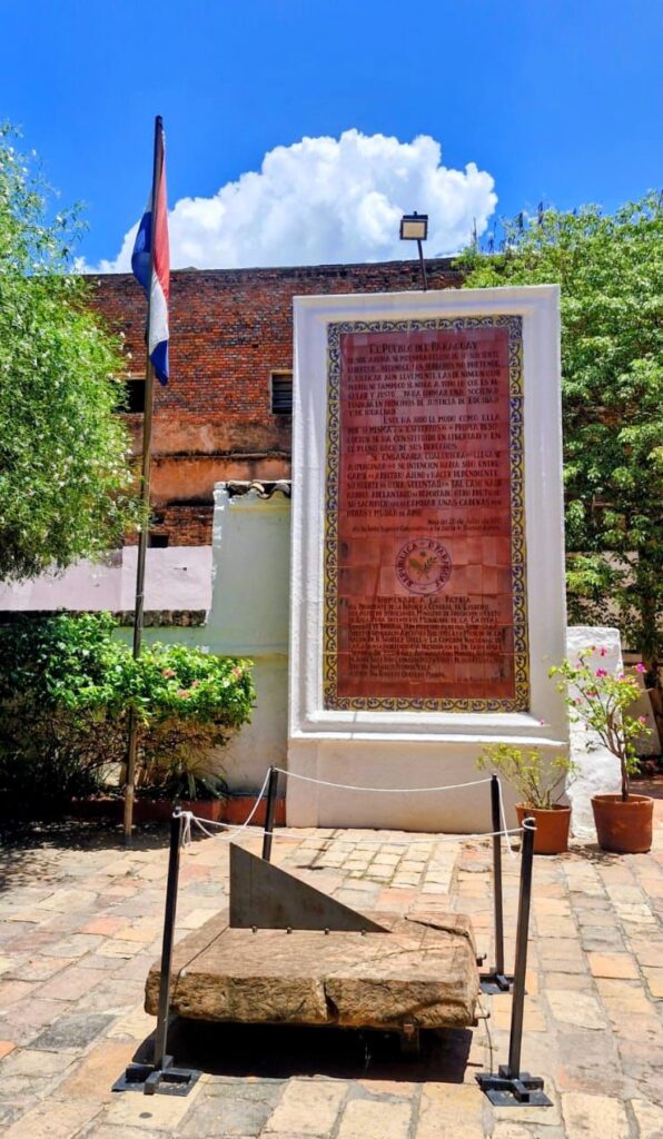
Today, it functions as a small museum with free admission.
Another important site was the National Pantheon of Heroes, the state mausoleum where the remains of several significant figures in Paraguayan history are interred. These include Carlos Antonio López, Francisco Solano López, José Félix Estigarribia (a hero of the Chaco War against Bolivia), and his wife.
We also passed by the Teatro Municipal, a theater where cultural, music, and art events are held. Originally, this building served as a meeting place for the National Congress.
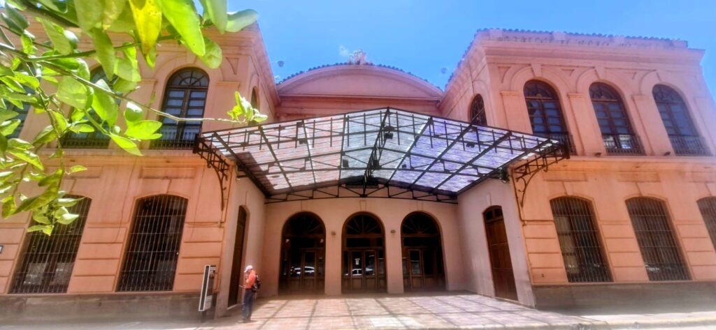
Historic Teatro Municipal façade
Plaza de Armas is a square built in 1913 and is another notable landmark in Asunción.
Nearby is the Centro Cultural Cabildo, considered the birthplace of Paraguay. On September 16, 1541, Governor Domingo Martínez de Irala founded the military enclave called Fort Nuestra Señora de la Asunción at this site.

The building later housed the National Congress and was originally constructed in 1844 to accommodate both the Executive and Legislative branches of government.
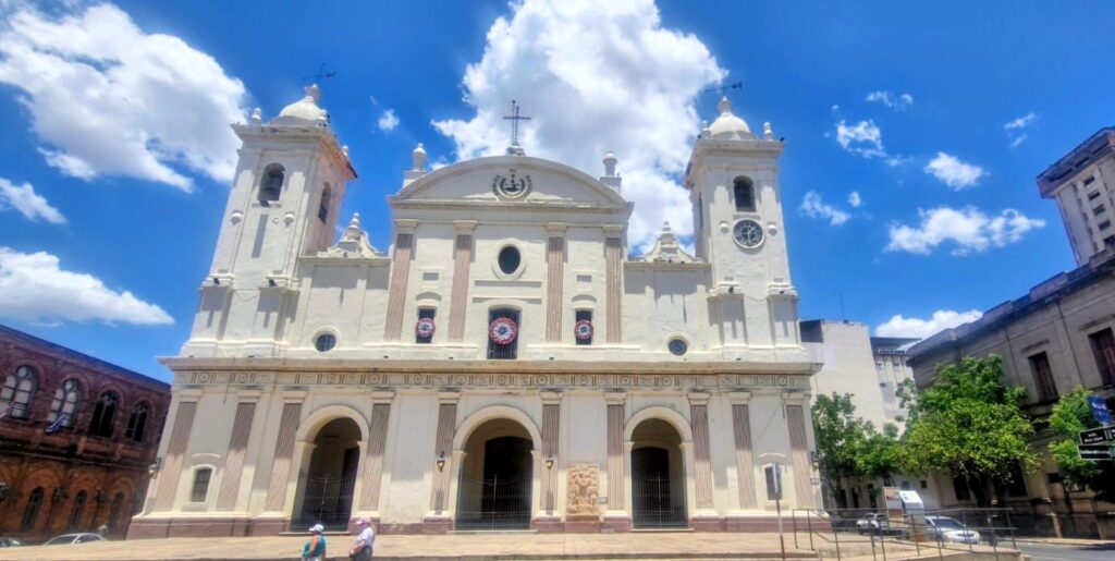
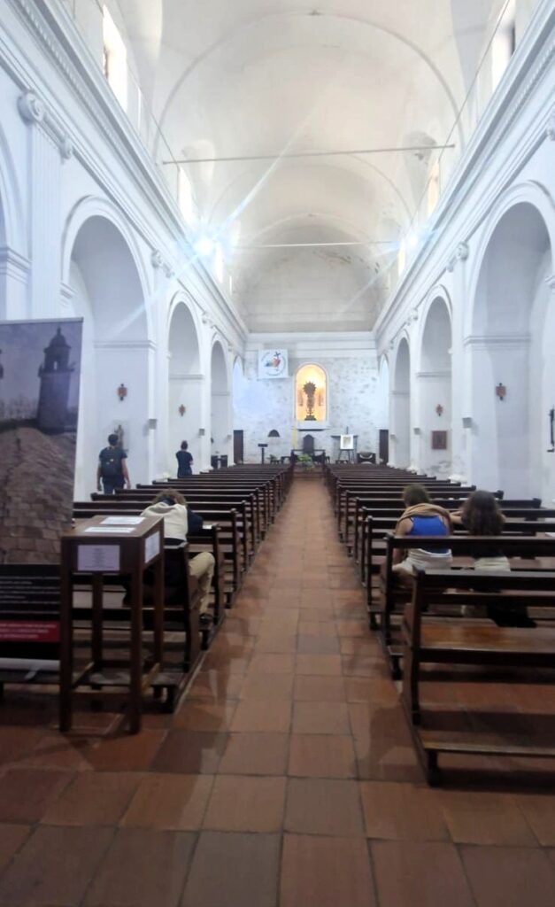
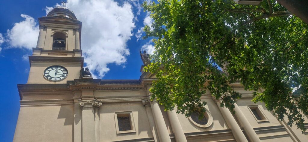
We also visited the Metropolitan Cathedral of Our Lady of the Assumption, the main Catholic church in Asunción, which was inaugurated in 1845.
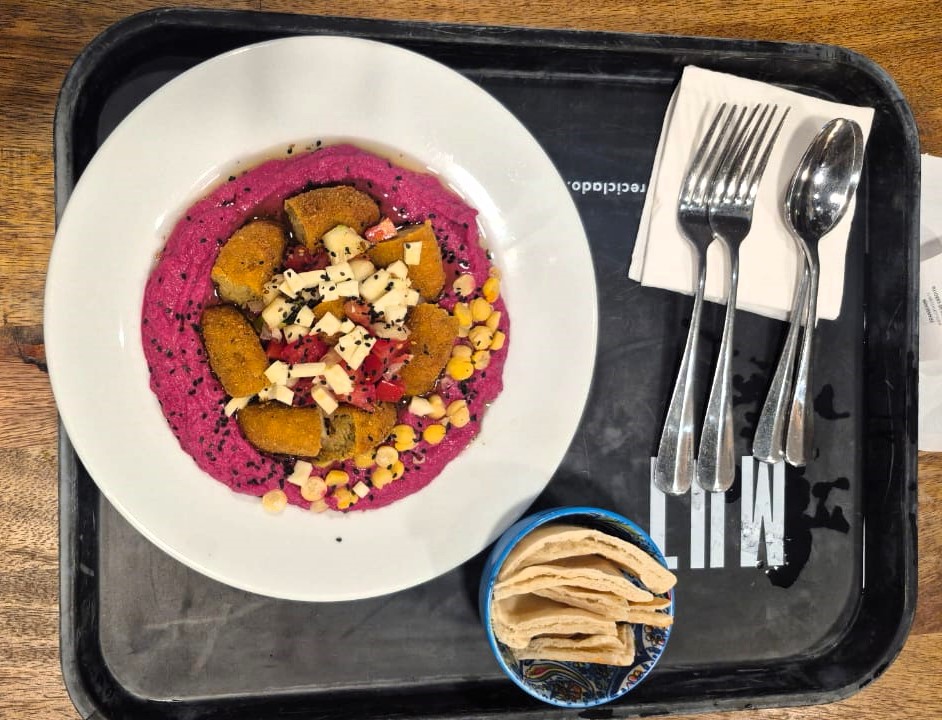
Around 2 pm, we stopped for lunch at a restaurant called Bolsi. We had a hummus wrap and stir-fried vegetables with fresh juice.
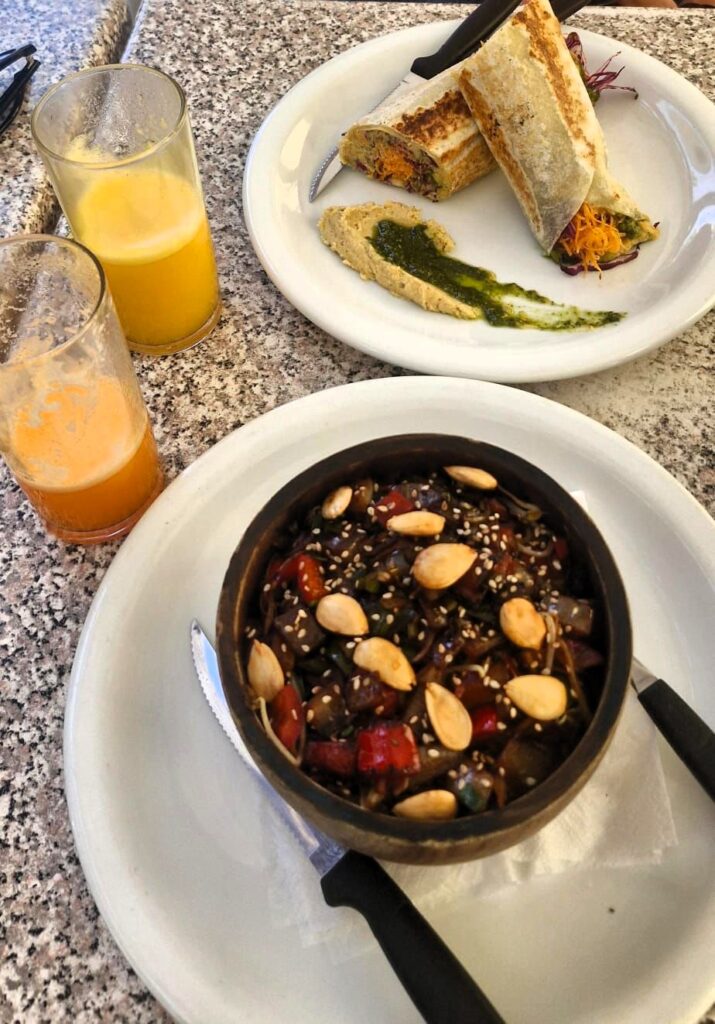
It turned out to be an excellent vegetarian meal.
In the evening, around 5:30 pm, after the sun had gone down a bit, we set out to see the remaining sights in Asunción.
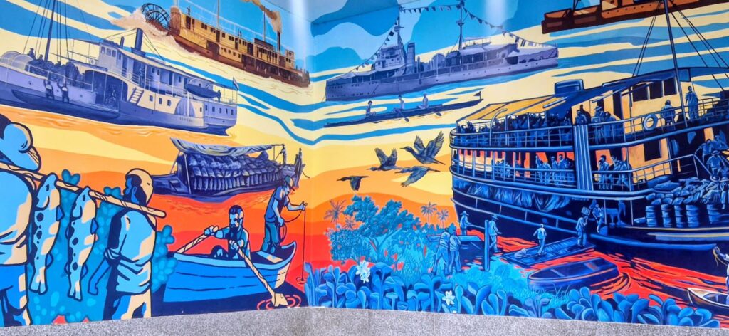

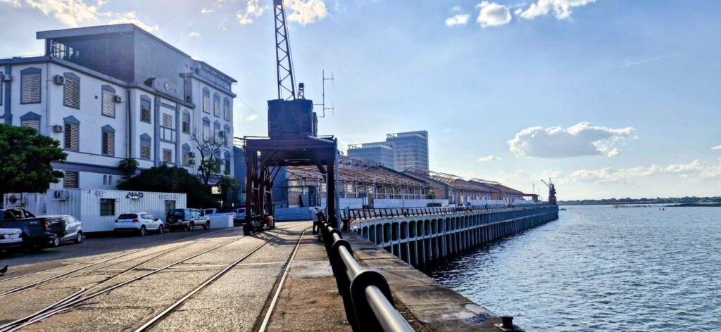
We first strolled through the area around Puerto Asunción, the city’s port.
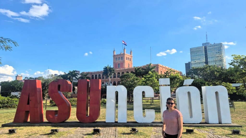
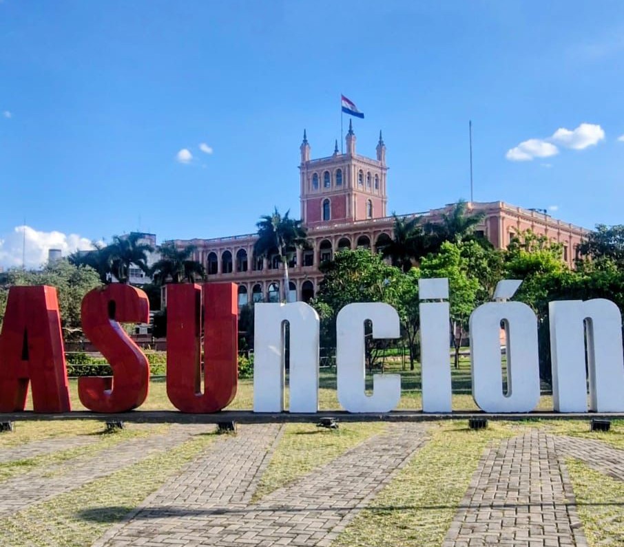
Next, we walked along the Costanera Asunción, the waterfront promenade, where we once again got a good view of Palacio de López, this time with the Asunción sign in the foreground.
The waterfront runs along Asunción Bay, a small inlet from the Paraguay River.
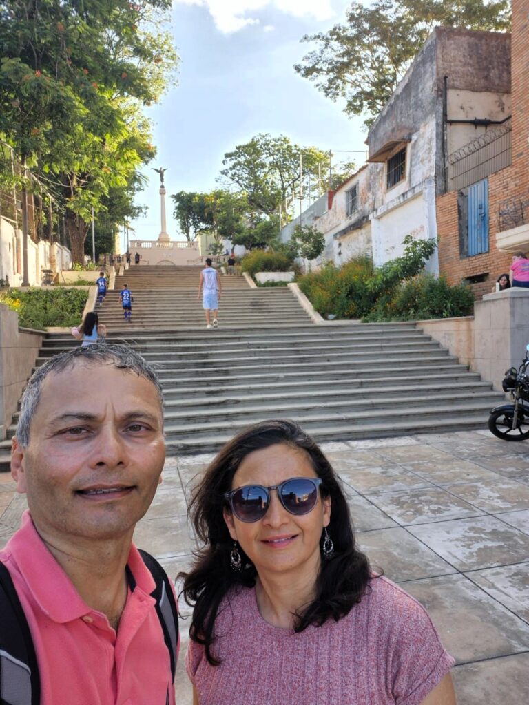
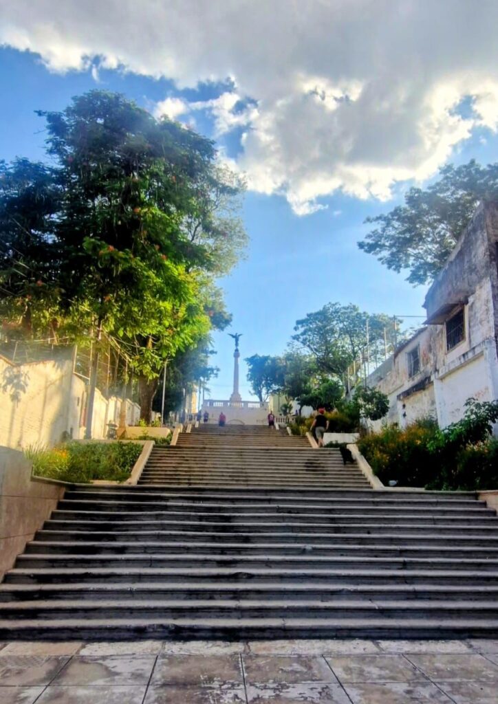
Our last stop of the day was Escalinata Antequera, a series of stairs built in 1928 on top of Asunción’s hill, Cerro Sansón Cue.
Friday, Jan 23 2026 – Golden Circuit of Towns around Asunción, Paraguay
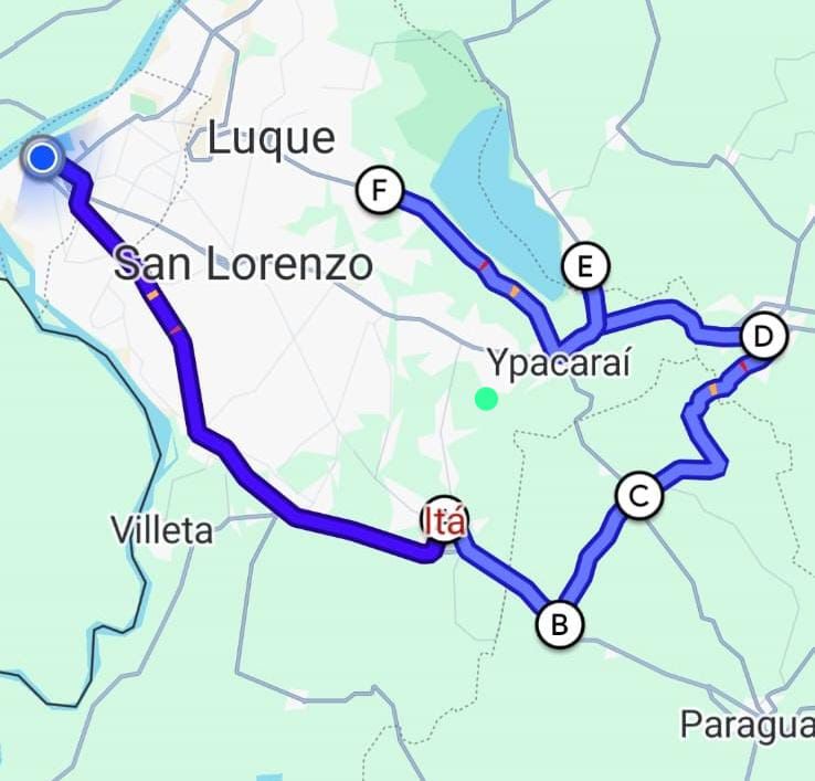
We took a guided tour of several towns within a radius of about 65 km from Asunción to get a feel for the culture, history, arts, and people of Paraguay. Most of Paraguay’s population lives within this 65 km radius to the east of Asunción (to the west lies the border with Argentina).
We started around 9 am and visited the towns of Itá, Yaguarón, Pirayú, Caacupé, San Bernardino, and Areguá before returning to Asunción around 5 pm.
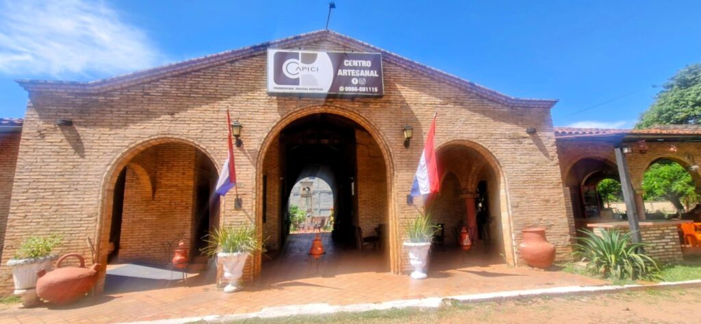
Our first stop was the cultural center in the town of Itá, where various locally produced artworks by local artisans were displayed.
As we drove out of Asunción, we could feel the summer heat. The roads, shops, people, streets, trees, vegetation, and overall landscape felt very much like being in India.
We also came across a rather amusing local tradition — keeping chickens as pets.
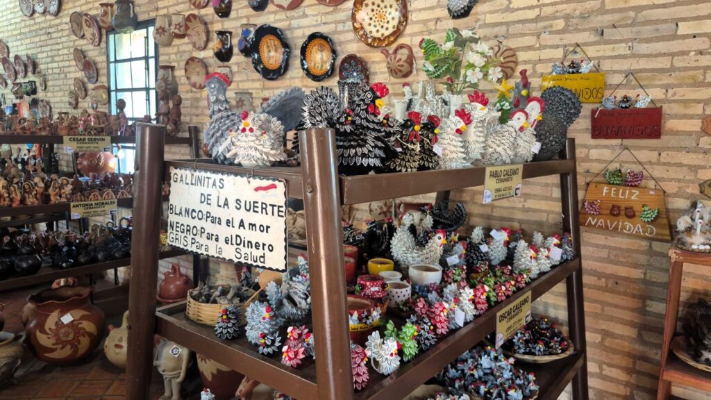
Because of this, clay chicken figurines are sold as good-luck charms: white chickens for love, black chickens for money, and gray chickens for health.
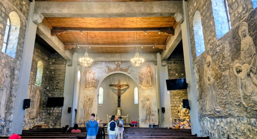
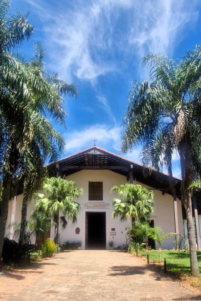
Our next stop was the Temple of Buenaventura, a church in the town of Yaguarón (pronounced Jaguaron).
This church was built around 1750 by Jesuit priests and was used to convert the local Guaraní people in the region.

Guaraní indigenous people form a large part of Paraguay’s population. They speak the Guaraní language, which is different from Spanish.
Since 1992, Guaraní has been taught in schools along with Spanish, the main language of Paraguay. Spanish remains the most widely spoken language in the country.

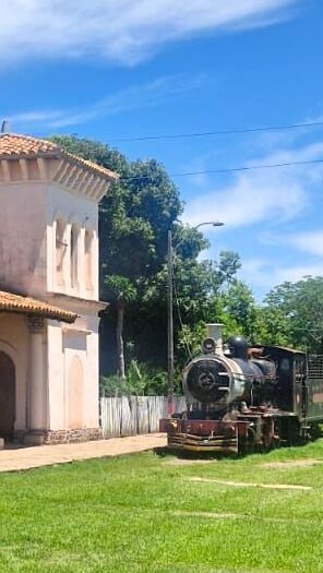
We then stopped at the railway station in Pirayú.
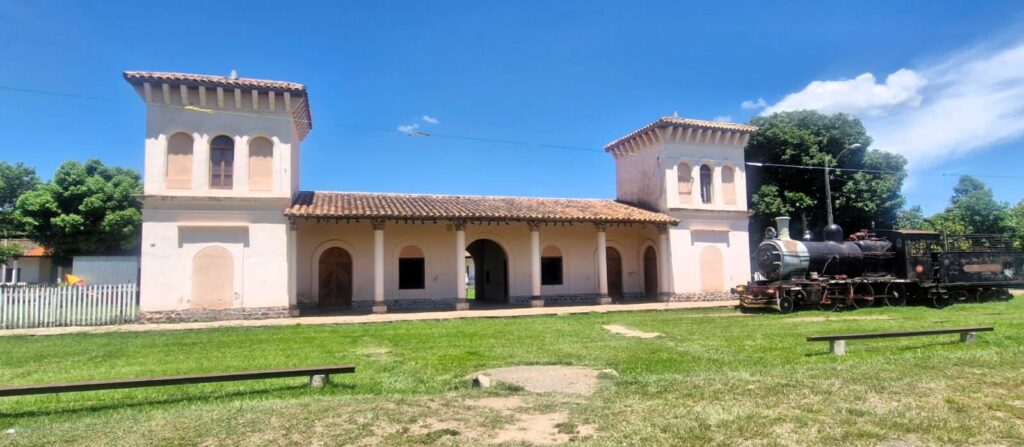
Railways came to Paraguay in 1861. Although often privatized, they were nationalized in 1961. In 1988, The New York Times described a train journey from Buenos Aires, Argentina to Asunción, Paraguay.
There was once a 376 km railway line from Asunción to Encarnación in southern Paraguay, but rail transport has now ceased completely.
Today, the Pirayú station serves mainly as a photo stop, with a steam locomotive displayed to complete the picture.
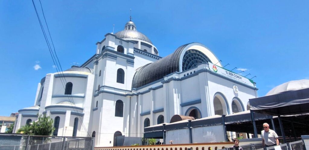
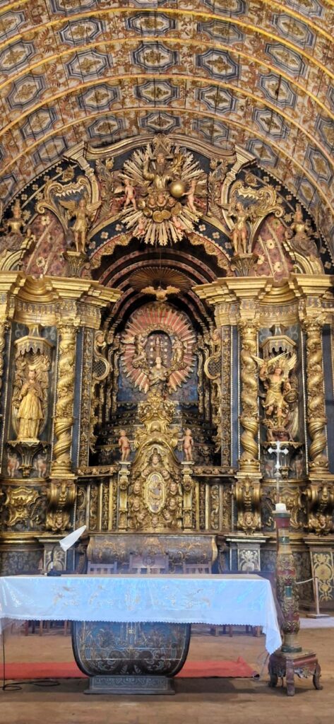
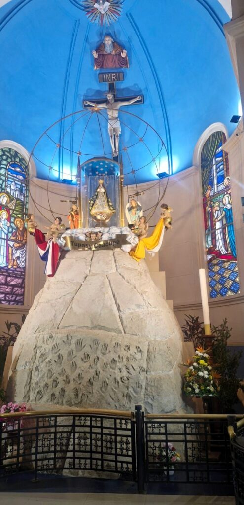
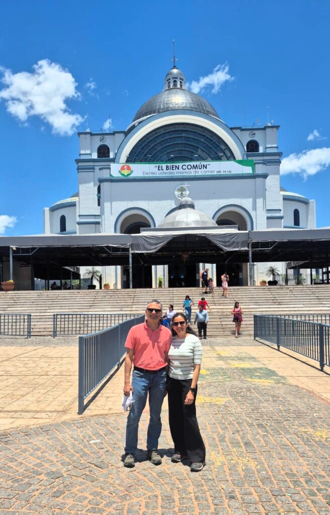
The Basilica of the Virgin Mary in the town of Caacupé was originally built in 1765. It is considered more important than the church in Asunción by many Catholics in the country.
Baptisms and marriages are often performed here.
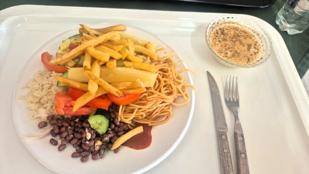
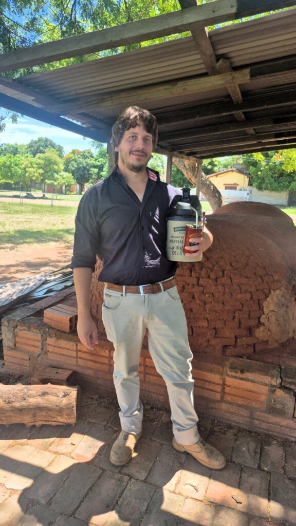
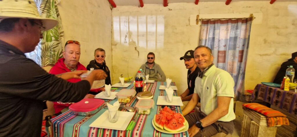
We had a buffet lunch at a roadside café on the highway with our guide Helmut (on the left) and our driver Nicolás (on the right).

Helmut, on the left in the photo, is of Austrian origin. His father, an Austrian, moved to Paraguay in 1977 and married a woman of Paraguayan descent. Helmut speaks Spanish and Guaraní, but not German.
Vegetarian food is uncommon in Paraguay, as it is a beef-eating country (there are more cows than people), but some vegetarian options are usually available.
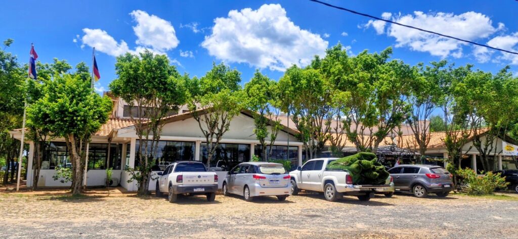
This is what the café along the highway looked like from the outside.
After lunch, we proceeded to Lake Ypacaraí, located near the town of San Bernardino.

This is a wealthy town where many residents of Asunción have second homes along the shores of the lake. Some of these homes are quite large.
Lake Ypacaraí is about 90 square kilometers in area and approximately 24 km long. It eventually flows into the Paraguay River.
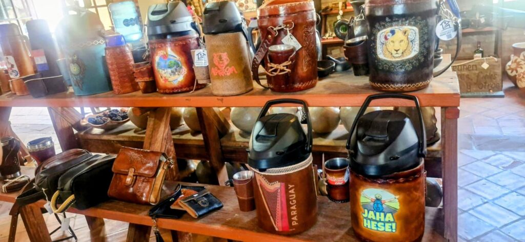
We then drove to the town of Areguá on the other side of Lake Ypacaraí. This town is mainly known for its ceramics, and there are many shops selling ceramic goods.


Areguá is also known for Ñandutí, a traditional and intricate Paraguayan needle lace. The word translates to “spider web” in the Guaraní language.
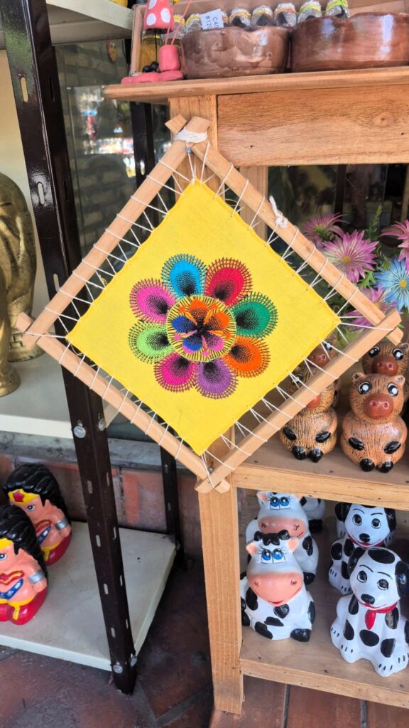
It is handcrafted on fabric stretched over a frame and is known for its delicate radial designs, often in white or vibrant colors. Ñandutí is considered the “queen” of Paraguayan handicrafts.
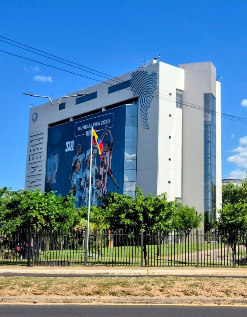
Our final stop of the trip was the South American headquarters of FIFA in Asunción, Paraguay.


We returned to our hotel around 5 pm, having gained a nice overview of the rural towns and landscapes around Asunción.
As we spoke with our guide, we learned several interesting things about Paraguay:
- It is a landlocked country with no direct access to the sea except through the Paraguay River.
- $800 per month is considered an average income to live decently, while $2,000 per month is considered upper class.
- It is common for both husband and wife to work to earn a combined income.
- Paraguay is a very traditional society; LGBT lifestyles are tolerated but uncommon.
- Guaraní is widely spoken in rural areas.
- The War of the Triple Alliance (Brazil, Argentina, and Uruguay versus Paraguay) in the 1860s is considered one of the worst disasters in Paraguayan history.
- The Chaco War against Bolivia in the 1940s was fought over oil resources in the north.
- Most of the population lives around Asunción. Ciudad del Este (near Iguazú Falls) in the east and Encarnación in the south are the other two major cities.
- To the west of the Paraguay River lies Argentina, and to the east lies Paraguay.
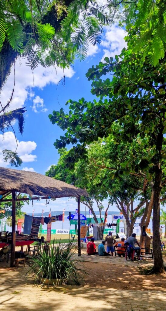
In the evening, we visited Shopping del Sol, a mall in the newer part of town near the suburb of Carmelitas.
While the historic part of Asunción felt less vibrant, this newer area was lively and modern, much like any other South American city — well lit, well paved, and full of activity.
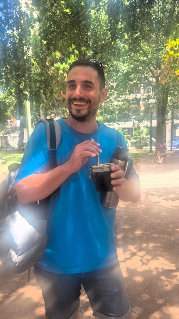
One interesting observation stood out from both Paraguay (Helmut in the first photo) and Uruguay (Juan Pablo in the second photo).
In Uruguay, people drink a tea called mate (pronounced maatey). They use a special cup and bent metal straw, carrying a thermos of hot water and refilling it throughout the day.
In Paraguay, they follow a similar tradition but drink it with ice-cold water instead. They carry a larger thermos filled with ice cubes and water. This version is called tereré.
Both countries proudly claim it as their tradition!
Saturday, Jan 24, 2026 – Asunción & Santa Cruz de la Sierra, Bolivia
In the morning, I visited the Museum of the Paraguayan Economy in Asuncion.
It was a small exhibit consisting of a few rooms that traced the progress of Paraguay’s economy through the centuries, beginning with the founding of Asunción in 1537.
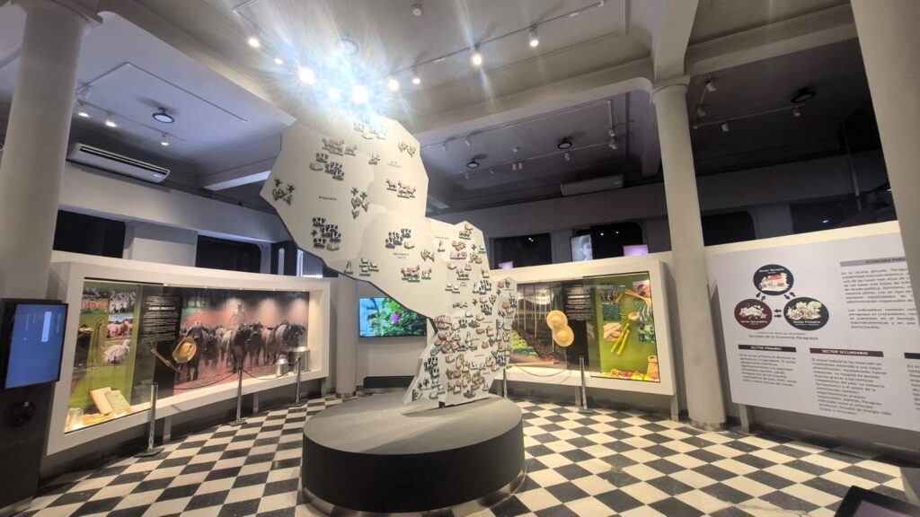

It is a decent museum, though not very large.
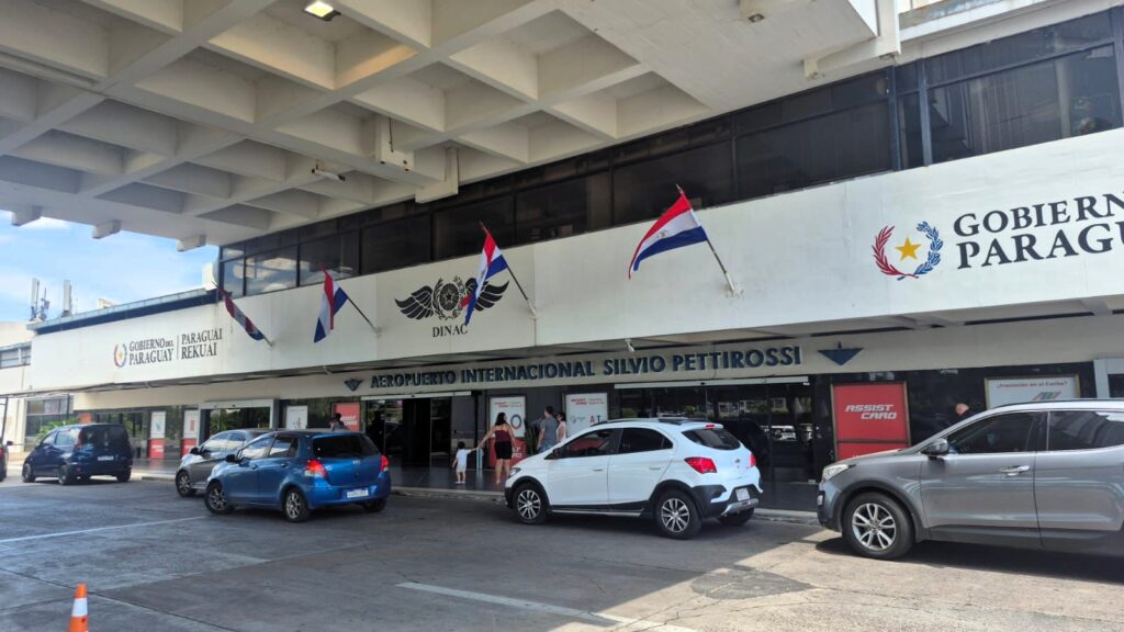
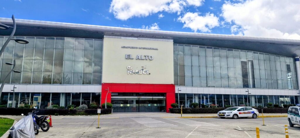
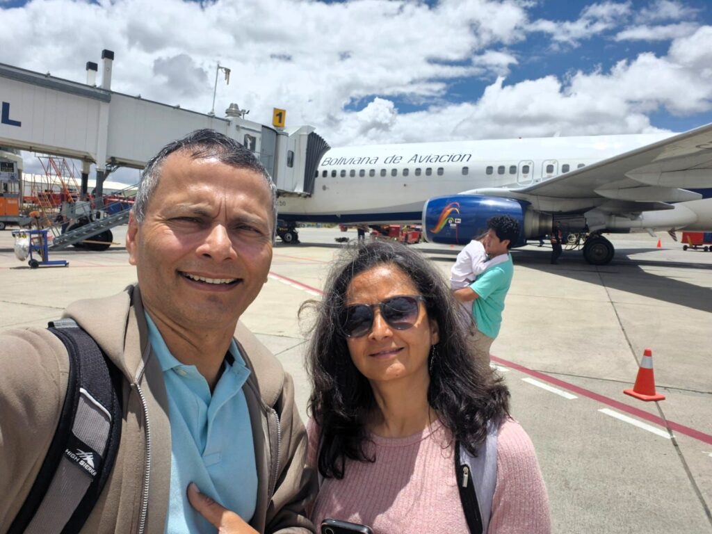
We flew out from Asunción around 3 pm and reached Santa Cruz de la Sierra in Bolivia at about 3:40 pm local time (Bolivia is one hour behind Paraguay).
Immigration was very smooth, and we were through immigration, baggage claim, and customs within 30 minutes.
We took an Uber to our hotel. In Bolivia, there is about a 30% difference between the official USD exchange rate and the unofficial rate. Therefore, it is better to exchange USD into Bolivian currency at a favorable rate and pay for everything in cash, including hotel bills.
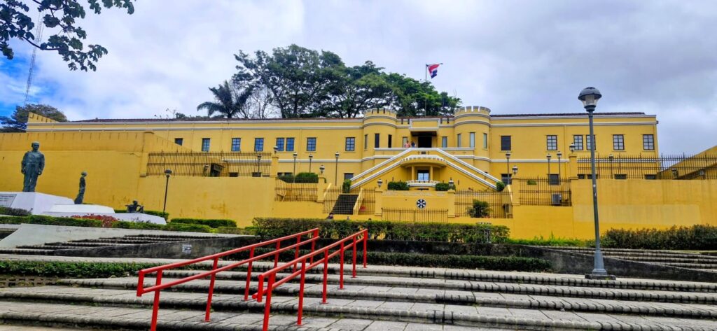
In the evening, we visited the September 24 Square in the main area of Santa Cruz.
The plaza was formerly known as Plaza de Armas. It now bears the name of the date of Santa Cruz’s independence uprising in 1810.
The statue of Ignacio Warnes, a freedom fighter, stands in the plaza.
The Metropolitan Cathedral of Santa Cruz was originally built in the 1550s and later restored in 1770.
It is a beautiful building, especially when lit up by the evening sunlight.
Around September 24 Square, a huge carnival event was in progress.

There were thousands of people, with singing, dancing, and performances taking place.
We really enjoyed the atmosphere. There was a lot of fun and energy in the air.
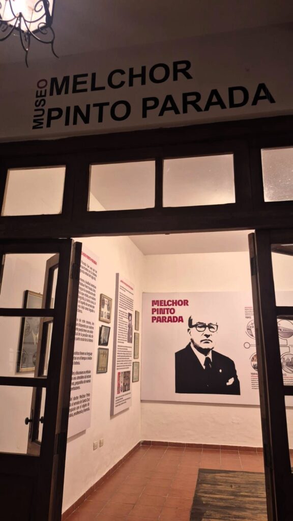
We also spent a few minutes at the Museum of Melchor Pinto Parada, a well-known political figure from Santa Cruz.
After grabbing a quick sandwich for dinner, we headed back to our hotel in an Uber. Our brief evening in Santa Cruz, Bolivia, was well spent.
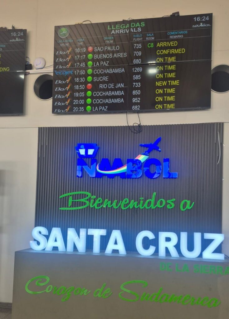
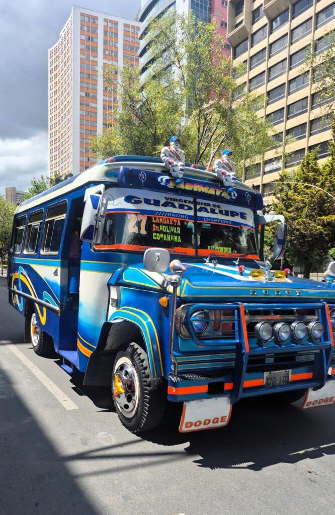
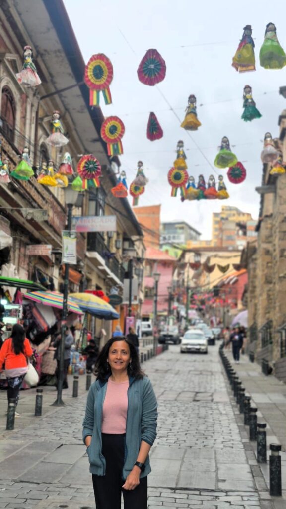
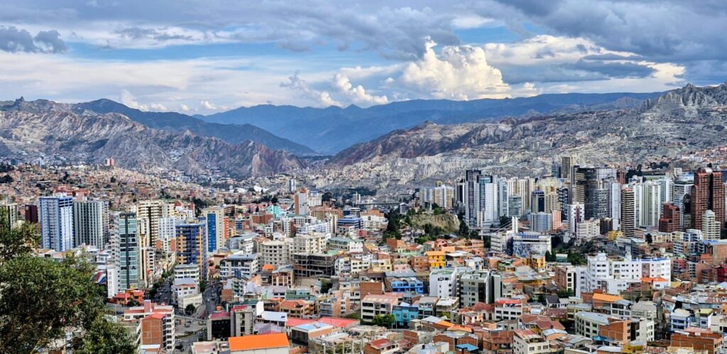
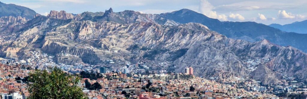
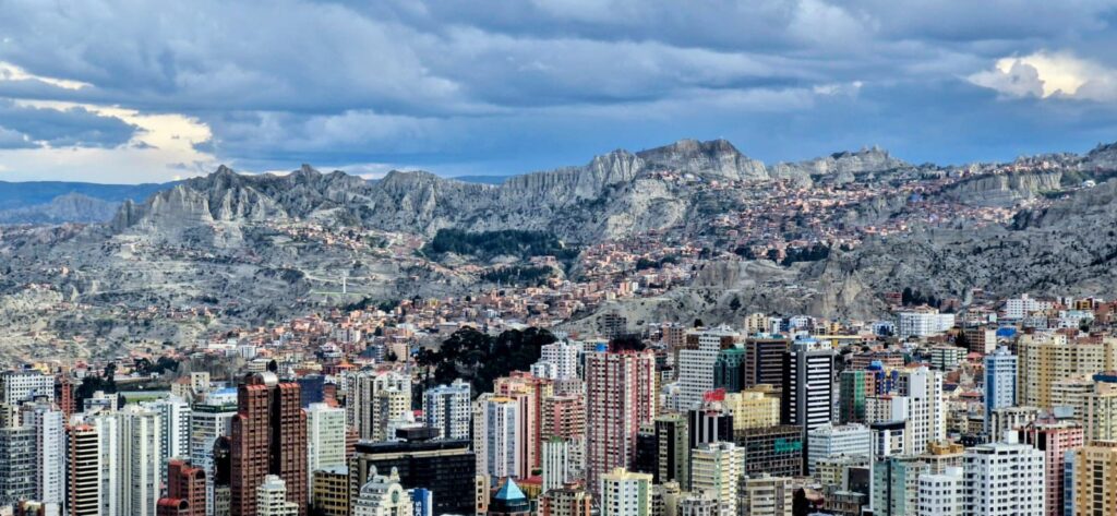
Sunday, Jan 25, 2026 – La Paz, Capital of Bolivia
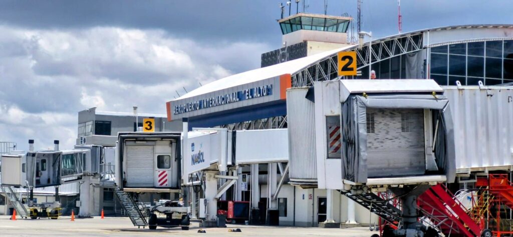
We landed at La Paz airport at 12:10 pm.
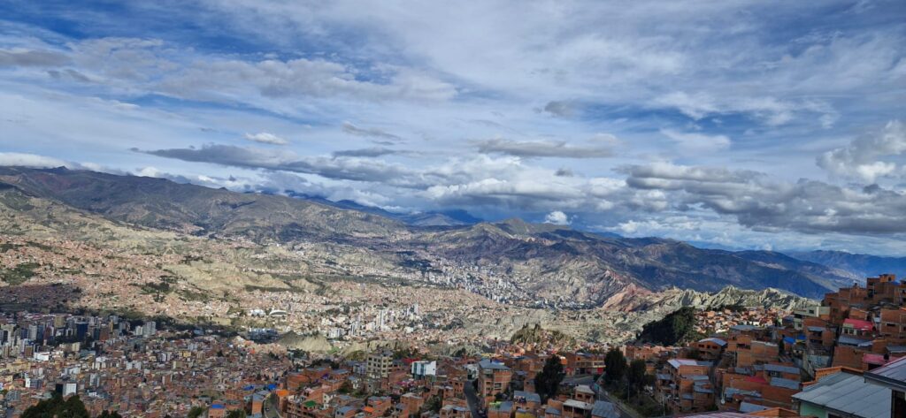
La Paz is the tallest capital city in the world — the airport sits at around 13,500 ft above sea level, and the city itself is about 12,000 ft in altitude, nestled in a bowl surrounded by the Andes Mountains.

We decided to do a self-guided walking tour of the city.
One of the first things that caught our eye was a brightly colored private transport bus — a common sight in many South American cities.
We also saw a brightly painted restaurant nearby.

In several public areas, we spotted statues of Simón Bolívar, the Venezuelan military leader who fought for independence from Spain and after whom Bolivia is named.
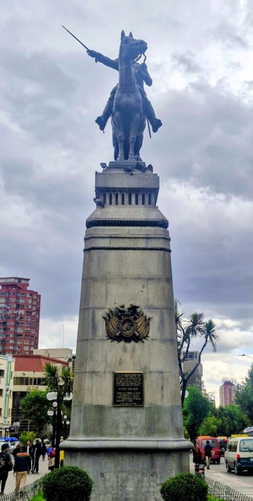
Bolívar had envisioned unifying countries such as Venezuela, Colombia, Peru, and Bolivia, but that larger union never fully materialized.
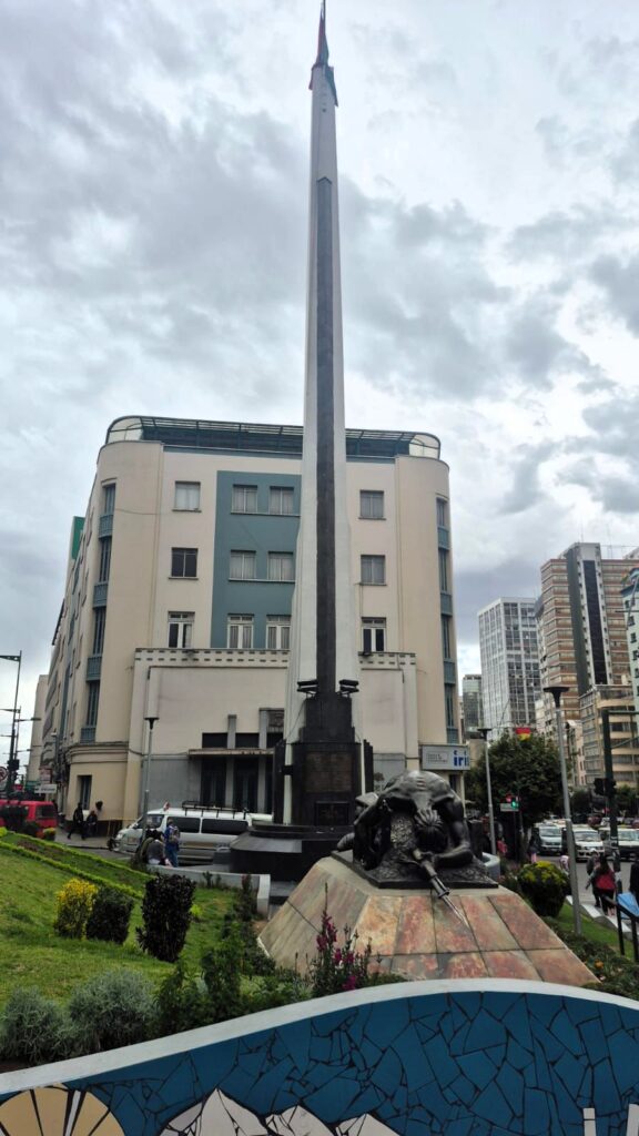
One of the first monuments we saw was the Monument to the Unknown Soldier, which commemorates the fallen soldiers from the Chaco War of the 1930s between Bolivia and Paraguay.
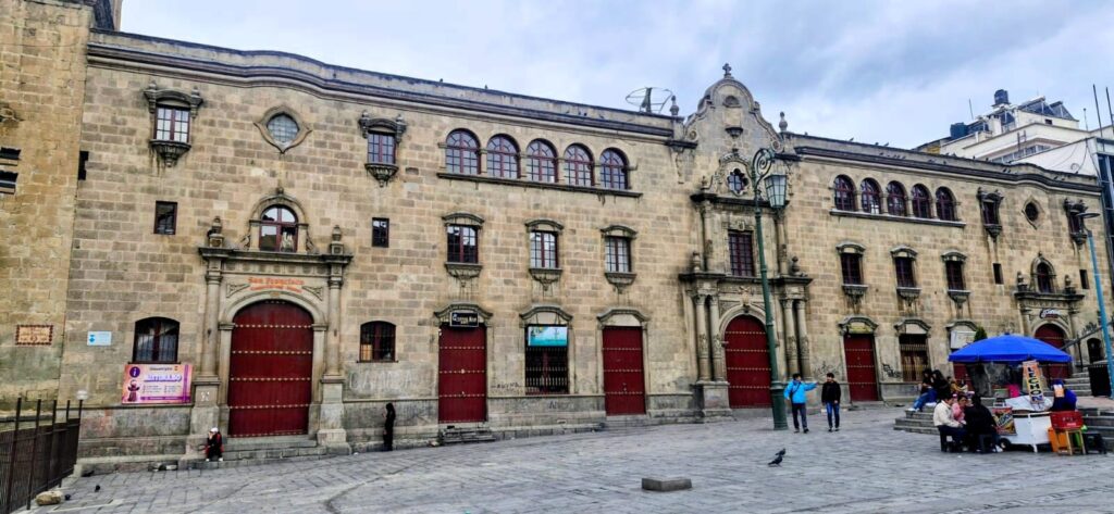
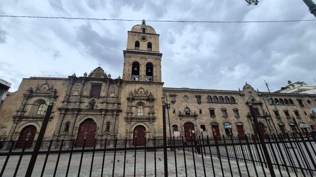
We then visited Plaza San Francisco, one of the main public squares in La Paz.

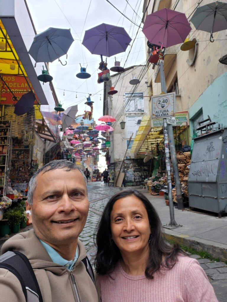
Nearby, we explored the Witches’ Market — a unique and traditional open-air market where vendors sell a wide variety of items connected with indigenous Aymara rituals and spiritual beliefs.
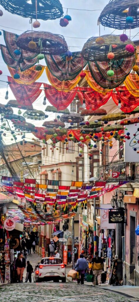
Among the many unusual products are dried llama fetuses, believed to bring prosperity and good luck, dried frogs used for rituals, herbs, and folk remedies.
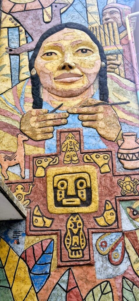
Witch doctors, known locally as yatiris, often wander through the market offering fortune-telling services. Walking through the market was fascinating and a vivid way to connect with local culture.
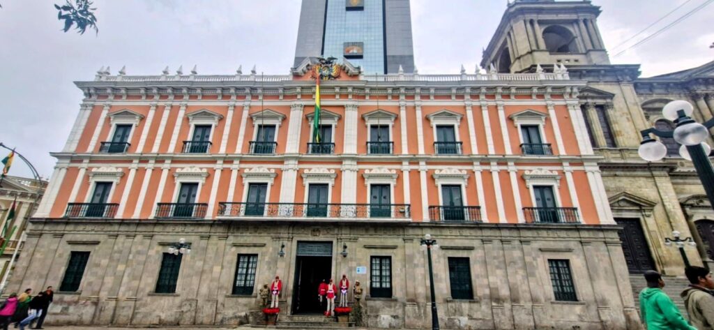
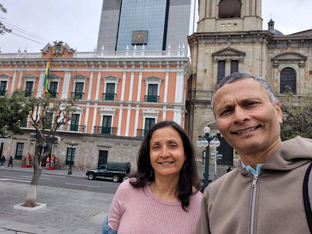
Another notable stop was the Metropolitan Cathedral of La Paz, the main Catholic church in the city, originally built in 1935.
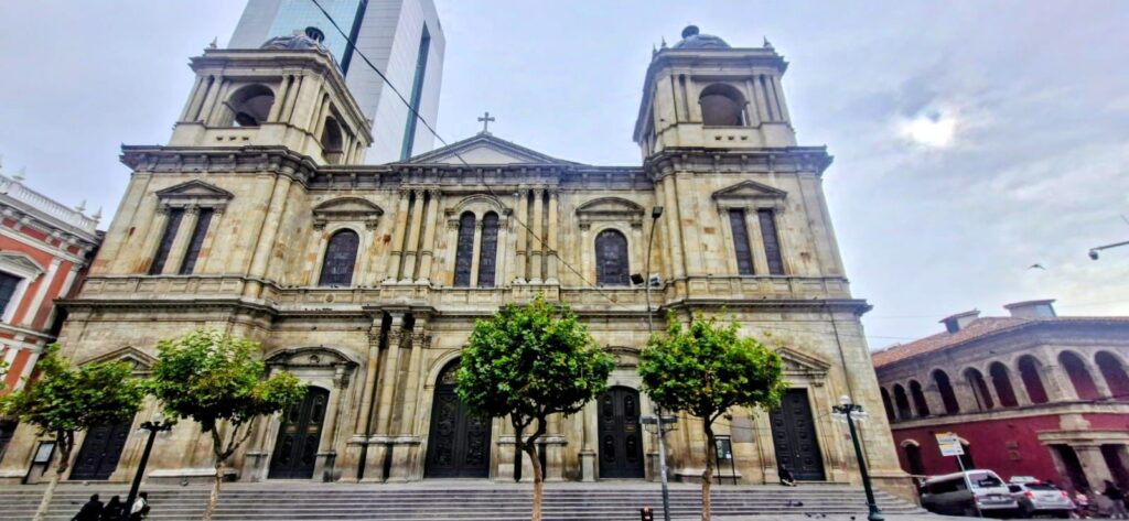
Right next to the cathedral is the President’s Palace, another important landmark in the historical center.
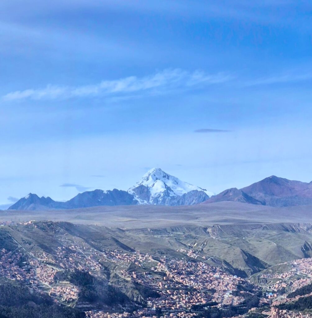
In the afternoon, we headed up to Mirador Killi Killi, a scenic viewpoint that offers spectacular panoramic views of La Paz, a captivating city nestled in the mountains.
From here, we could see Mt. Illimani towering above the city.
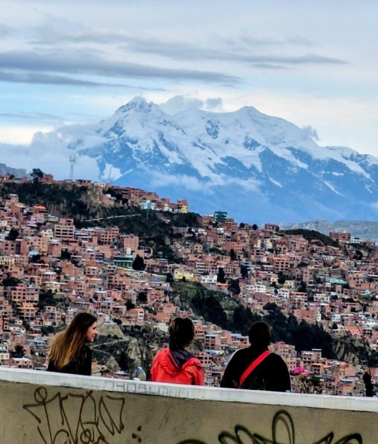
Illimani, with its snow-capped peak rising more than 21,000 ft, is an iconic natural landmark visible from much of La Paz.
To finish the day, we had dinner at Curry House, an Indian restaurant in La Paz.
The owner is from Karnal, Haryana, and we talked to him at length about why he chose Bolivia as the place to open the restaurant. We had a really good meal to round off our day.
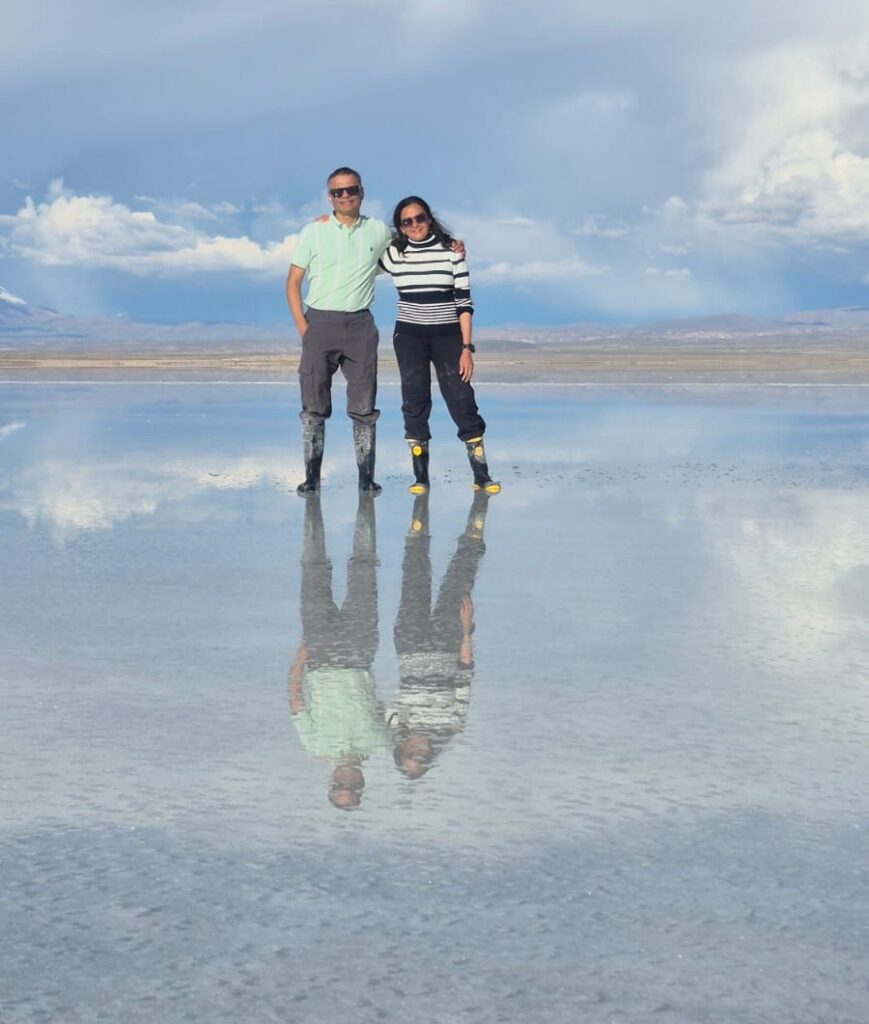
Monday, Jan 26, 2026 – Uyuni Salt Flats, Bolivia
We took a morning flight from La Paz to Uyuni in southwestern Bolivia.
We were picked up from the airport around 11:30 am and driven to the town of Colchani, where we were served lunch.
There were vegetarian options available.
The tour to the Uyuni Salt Flats began around 2 pm.
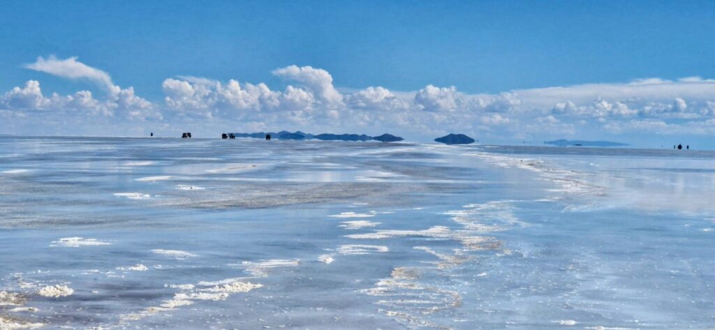
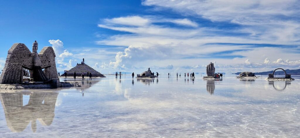
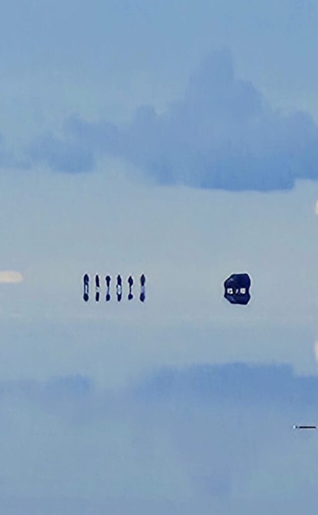
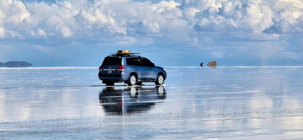
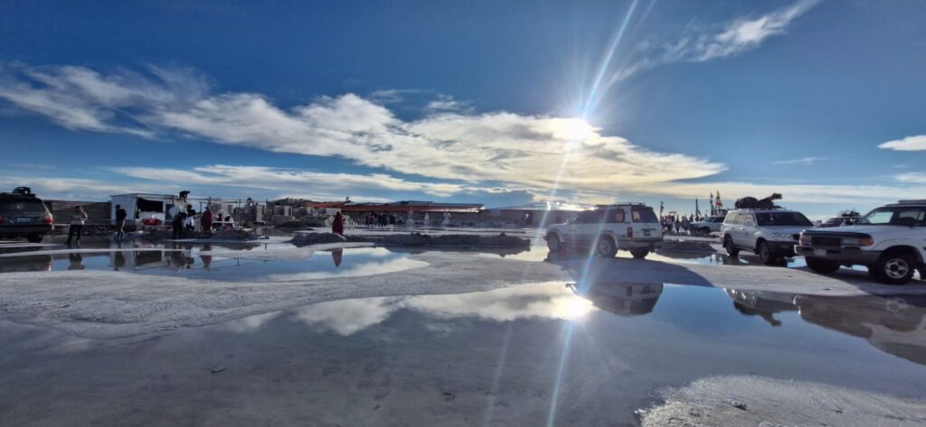
Uyuni is located at about 12,000 ft above sea level. The Uyuni Salt Flats cover an area of approximately 10,000 square kilometers near the town of Uyuni

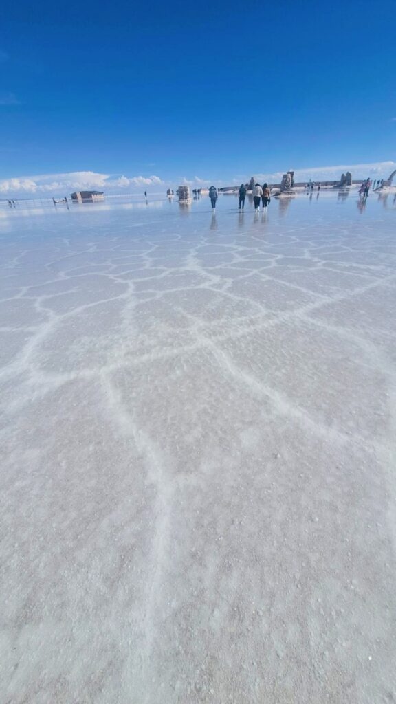
Instead of soil, the ground is covered entirely with salt. During the wet season, a thin layer of water — about 2 cm deep — sits above the salt crust.
Because the water layer is so shallow, it is possible to drive or walk across it. Since the water is thin, there are no waves, and the white salt beneath acts like a mirror, creating stunning reflections.
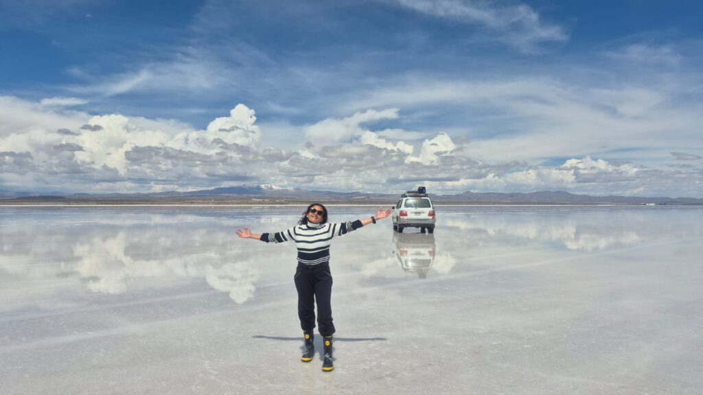
Imagine walking on a 10,000 sq km reflecting mirror. Imagine walking on the surface of a vast lake. That is exactly what the Uyuni Salt Flats experience felt like!
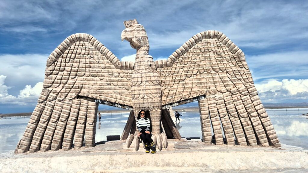
In the middle of the salt flats was a Salt Sculpture Park, where all sculptures were made entirely of salt blocks.
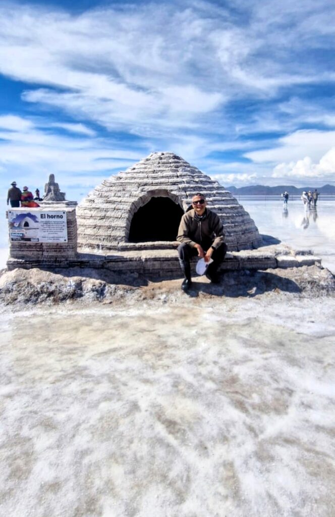
It was a very interesting place to explore.

The salt crust forms natural hexagonal patterns as the salt dries during the dry season from April to September.
It is recommended to visit the salt flats during the wet season, as the reflections appear only when there is water covering the surface.
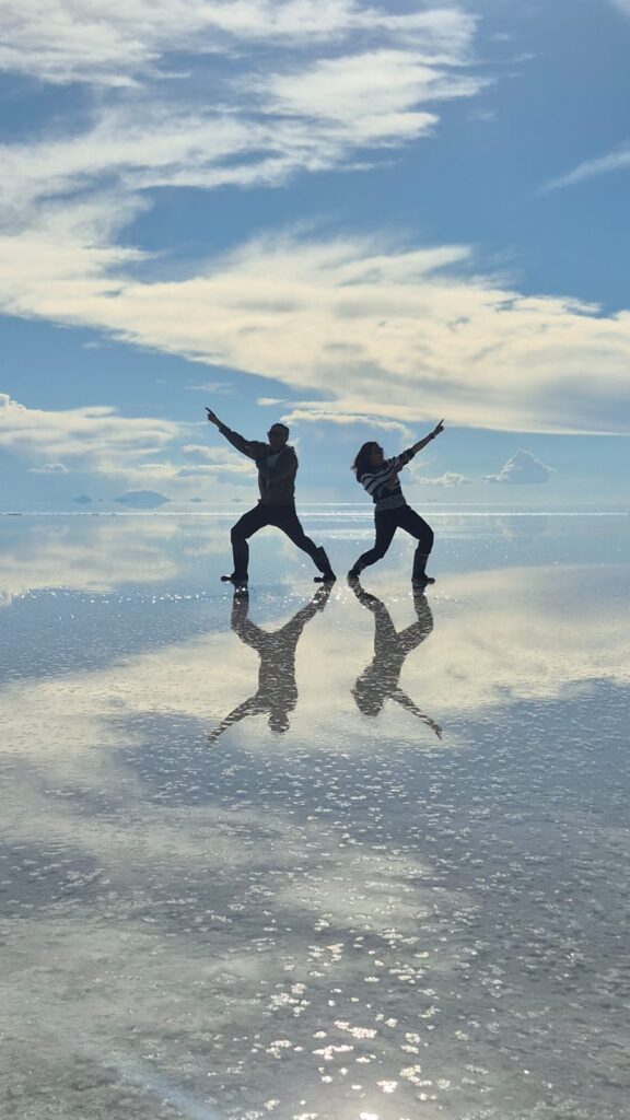
We took some very interesting photographs.
We also visited a hotel in the middle of the salt flats that is built entirely from salt blocks.
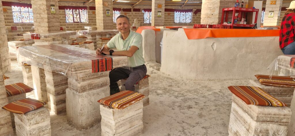
Although the hotel no longer hosts overnight guests in the rooms, the restaurant and shop remain open.
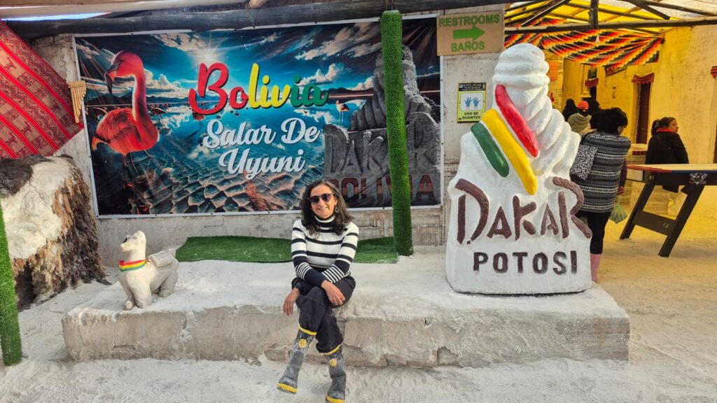
The Dakar Car Rally has been held four times in Bolivia, and its route runs directly through the salt flats.
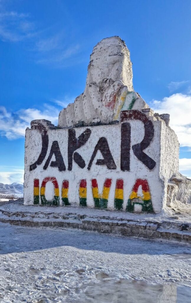
There is even a memorial made entirely of salt blocks dedicated to the Dakar Rally. It is quite something to imagine cars racing across this vast white expanse.
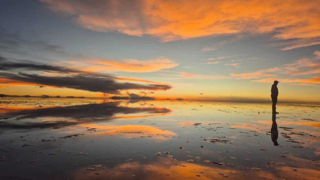
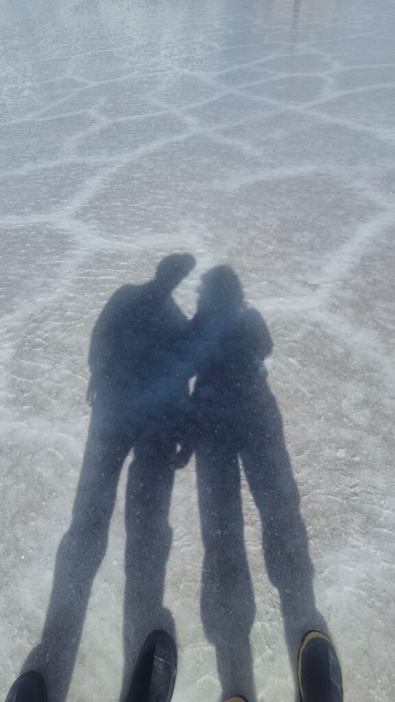
The sunset views were among the best we have ever seen.

There were no winds, and the weather was perfect.
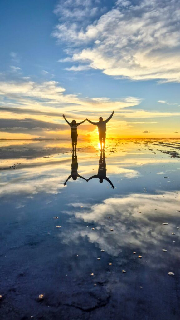
Our guide helped us take some creative and interesting photos on the salt flats.
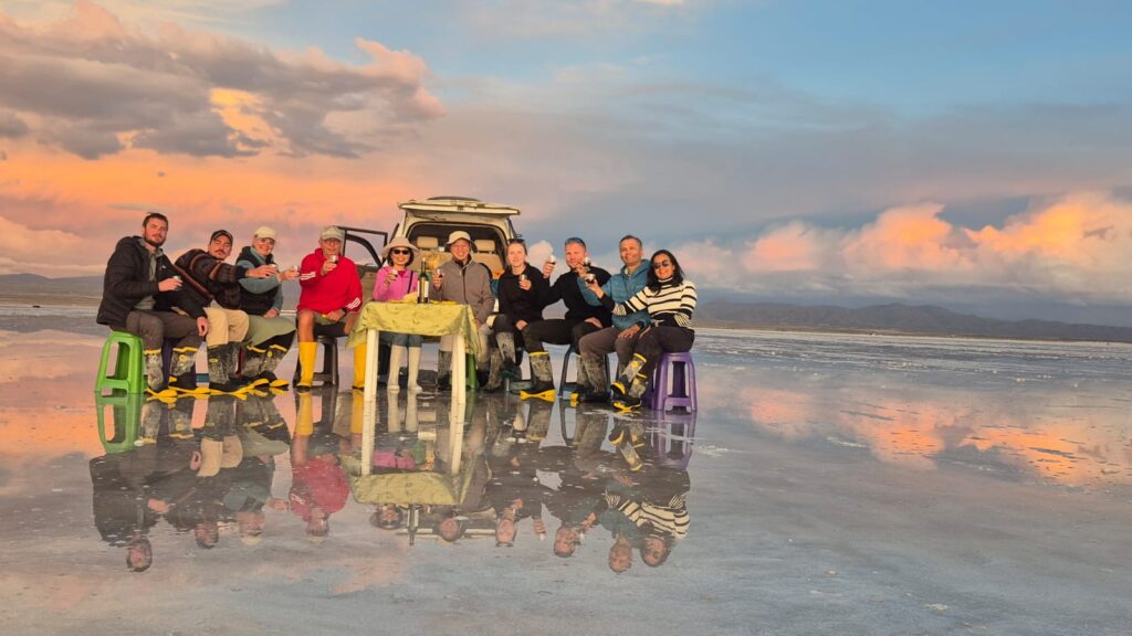
We were also served wine, cookies, and chips in the middle of the flats, which made the experience even more special.

The tour ended around 7:30 pm, and we were dropped off to catch our 8:30 pm bus from Uyuni back to La Paz. We had booked with Todo Turismo bus service. The buses were luxurious and clean, and they even served good vegetarian food.
Highly recommended!
Tuesday, Jan 27, 2026 – Chacaltaya Peak and Valle de la Luna
We took a guided tour to visit Chacaltaya Peak and Valle de la Luna.
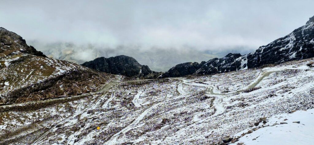
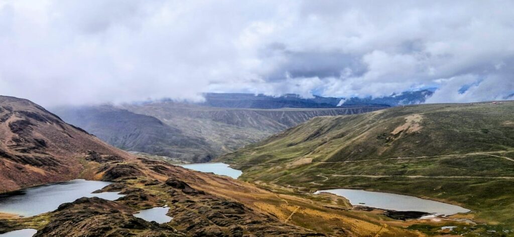
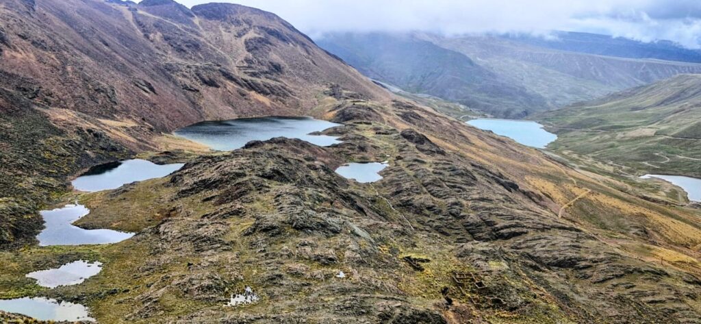
Chacaltaya Peak is about a two-hour drive from La Paz. Our vehicle took us along a winding, unpaved mountain road toward the peak.
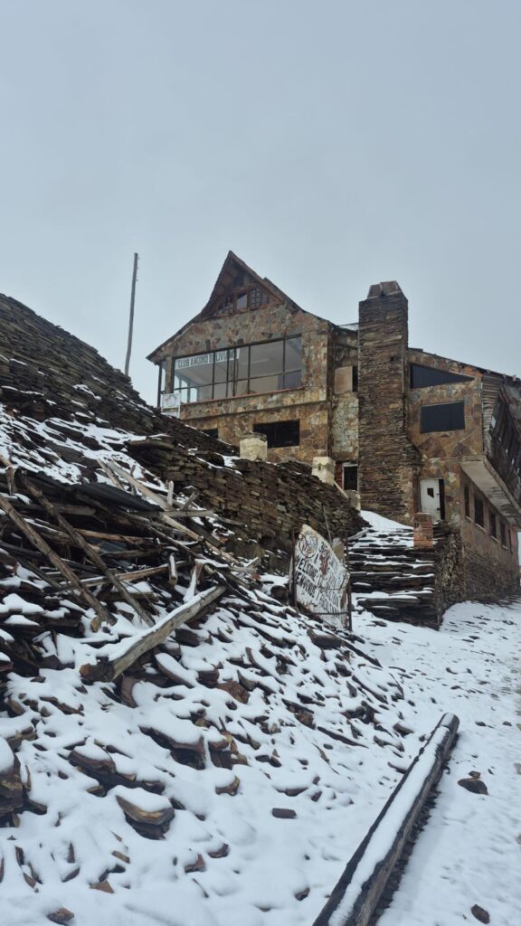
Near the top, there was quite a bit of snow. The vehicle parked at approximately 17,200 ft above sea level, near a lodge that sits in a beautiful location.
From the lodge, we began our climb to the peak.
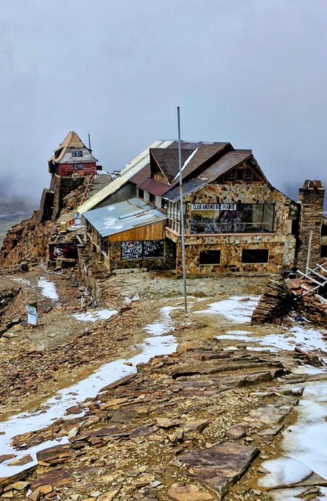
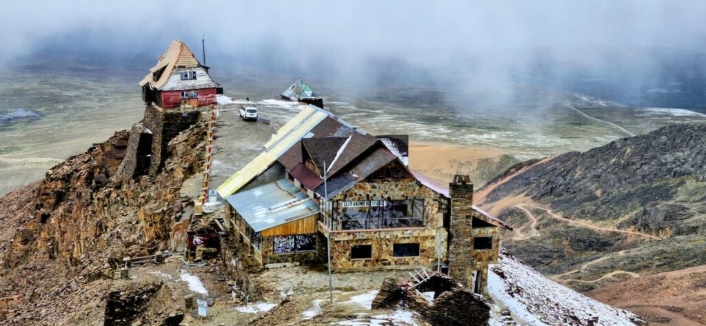
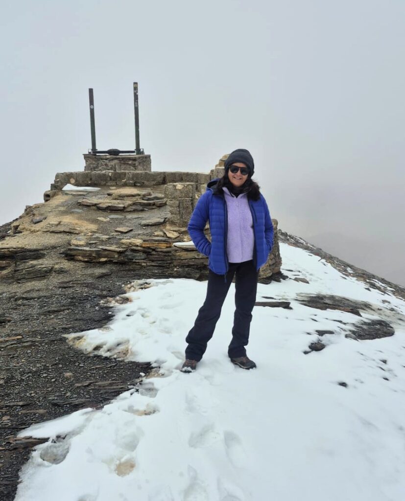
We reached the summit in about 30 minutes, climbing roughly 600 ft to an altitude of 17,800 ft.
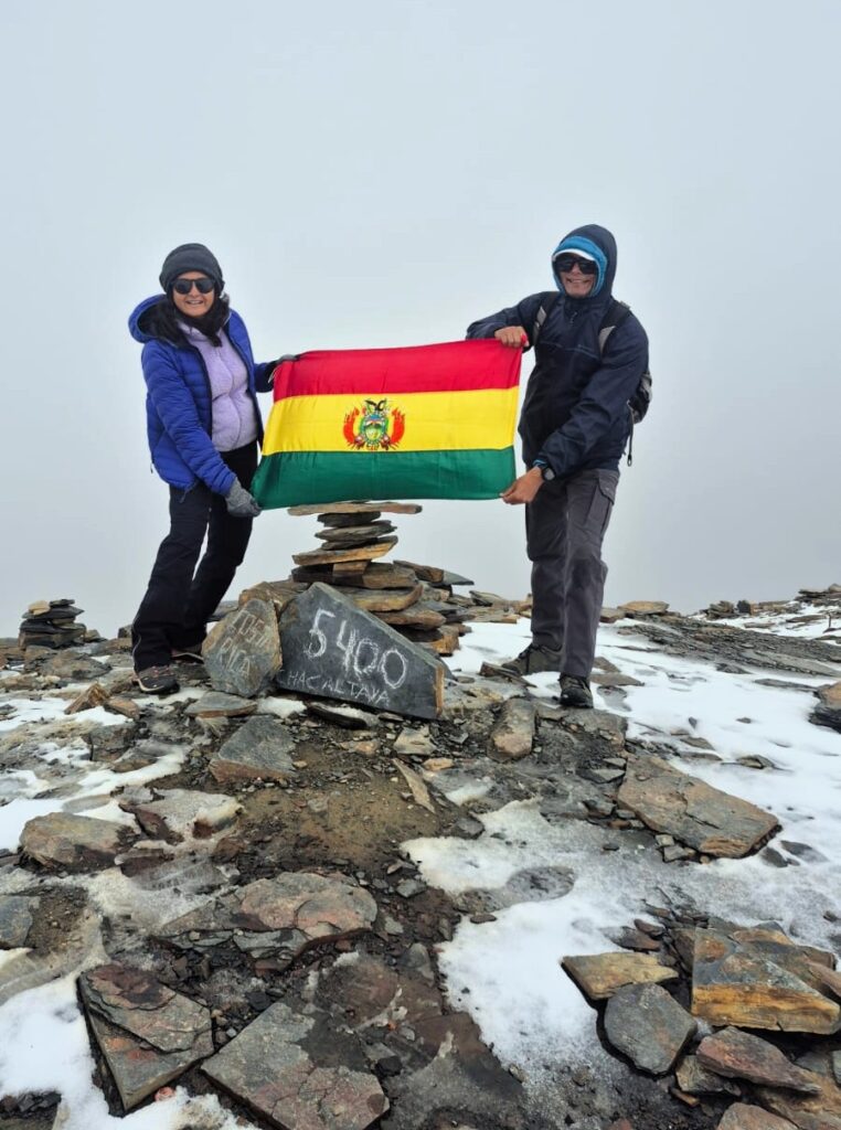
The guide asked if we would be willing to take a picture with the Bolivian flag, and we happily obliged.
It was really beautiful up there. Reaching 17,800 ft so quickly, in great weather with very little wind, felt special.
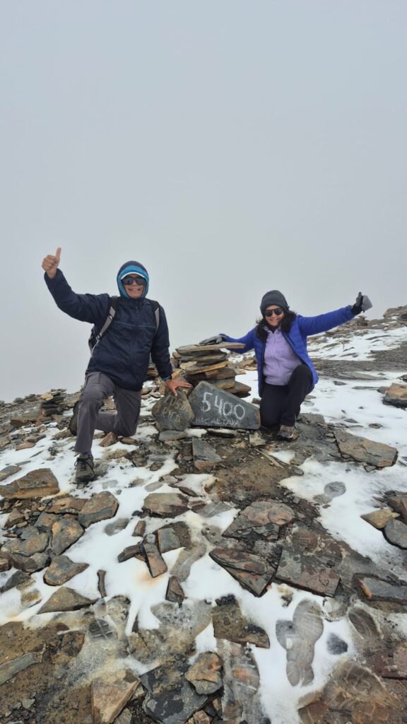
We stayed at the peak for about 30 minutes before climbing back down.
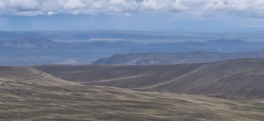
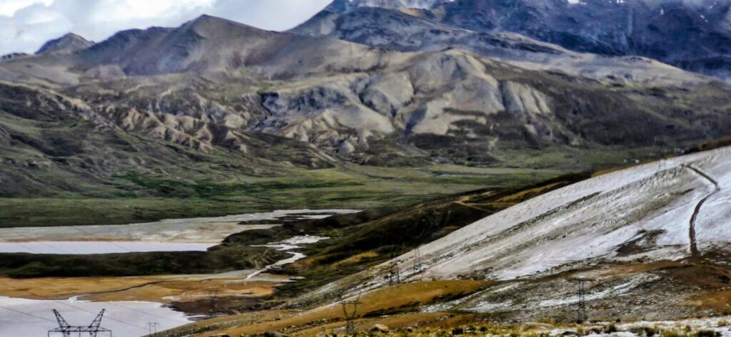
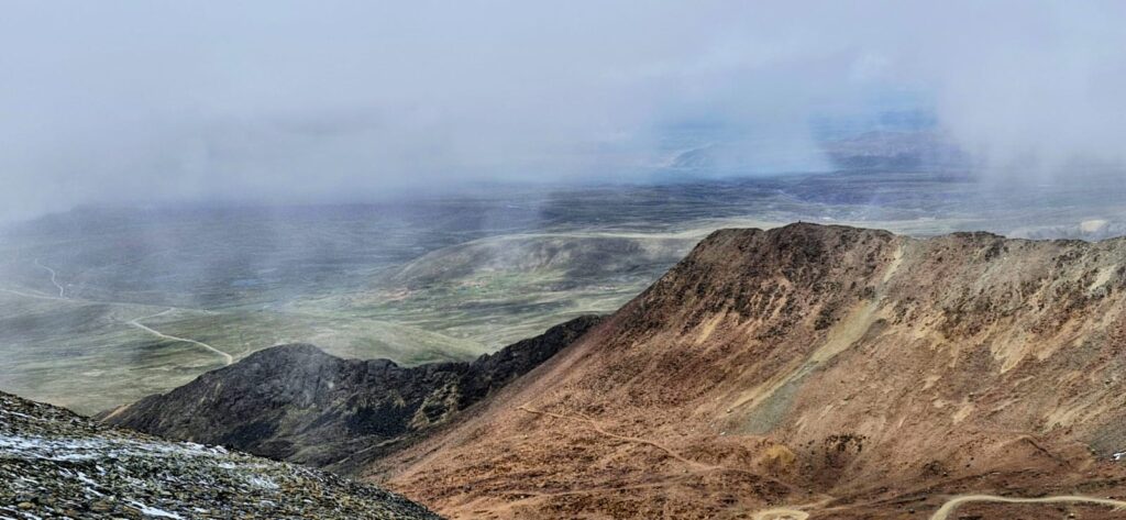
As our van drove down the mountain, the weather cleared even further, and we were treated to some spectacular views.
In the distance, we could even see the famous Lake Titicaca.
Our second stop was Valle de la Luna, also known as Killa Qhichwa (Moon Valley), located about 10 km from downtown La Paz.
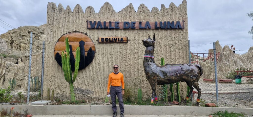

The valley consists of an area where erosion has worn away most of a mountain composed mainly of clay rather than rock, leaving behind tall, thin spires.
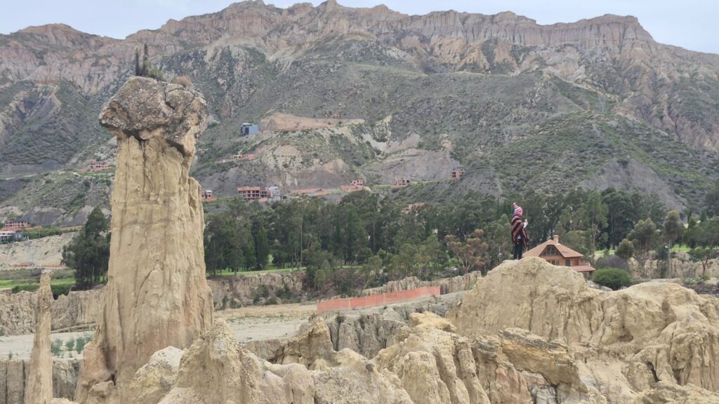
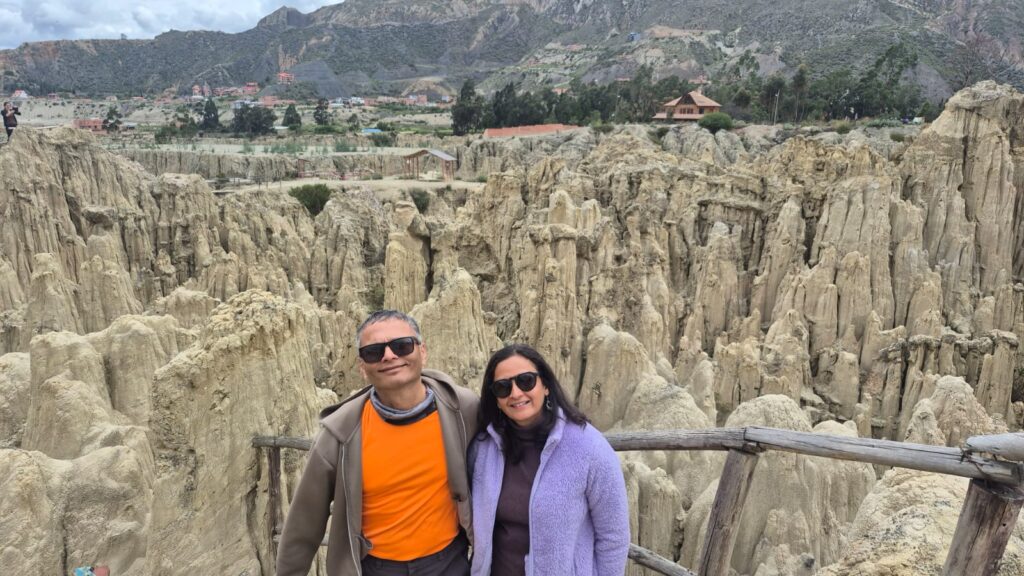
The area was originally called Valley of Spirits, but when Neil Armstrong visited Bolivia in 1969, he remarked that it resembled the surface of the moon. Since then, it has been known as the Valley of the Moon.
We had a late lunch at a restaurant called Curry House, run by a Haryanvi man named Harvinder Singh.
He migrated to Bolivia about three years ago and hopes to open more restaurants in the country. It was an interesting choice for an Indian to open a restaurant in Bolivia, and we had a nice chat about life there.
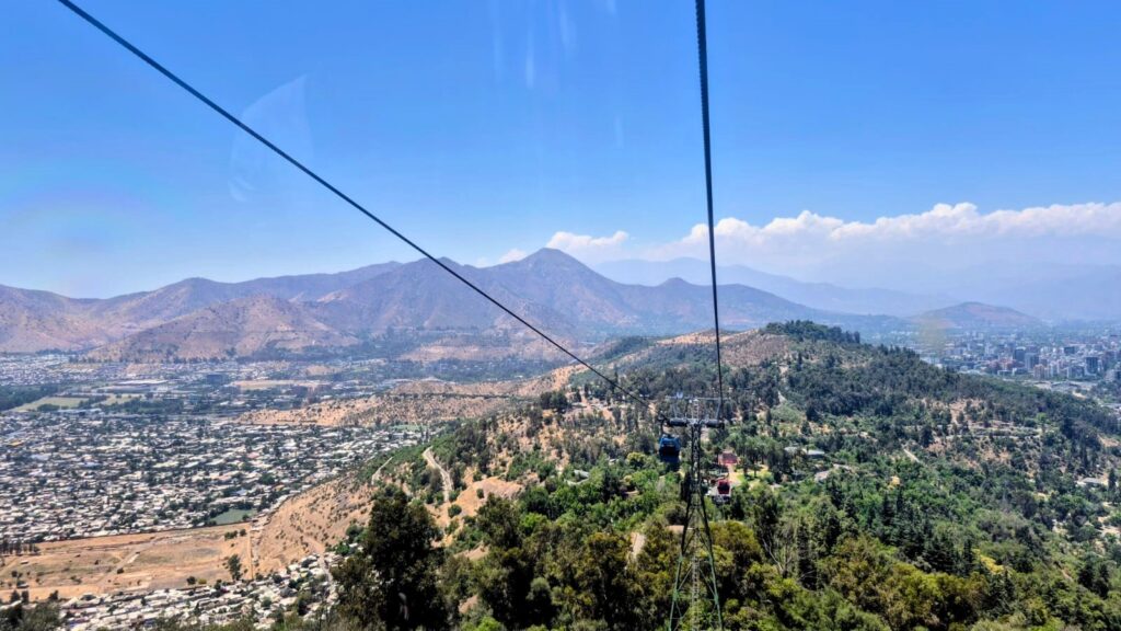
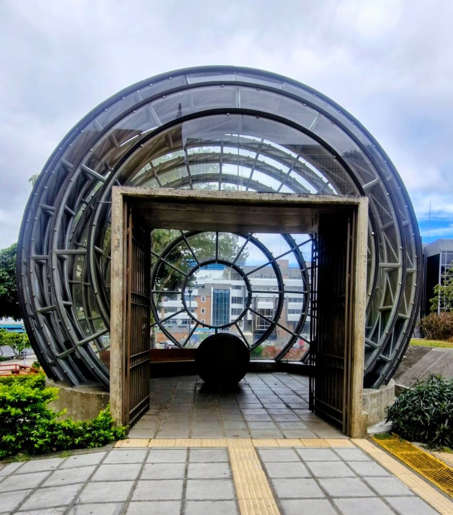
Our final activity for the day was riding the Teleférico (cable car) system in La Paz.
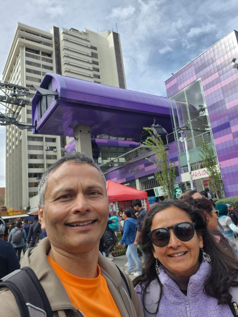
Instead of a metro system, the city has an extensive cable car network with 11 lines.
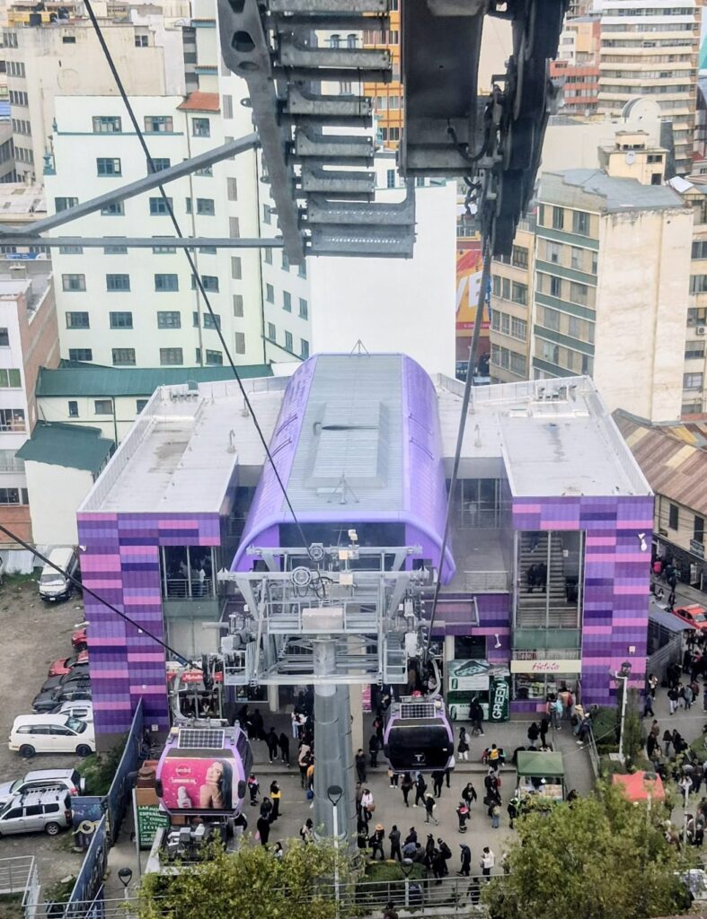
For a mountainous city like La Paz, this is a very practical solution and helps people avoid traffic. A single ride costs 3 bolivianos (about 30 rupees). We went to Estación Mirador, which offers amazing views of La Paz.

It was a great experience and a perfect way to end the day.
Wednesday & Thursday, Jan 28–29 – Flight from La Paz, Bolivia to San José, Costa Rica
Our journey from La Paz to San José turned out to be quite eventful.
Our flight was first delayed and then eventually cancelled, and we were moved to a flight the next day. Even that flight was delayed. We were originally supposed to reach San José by 9 am on January 28, but instead we finally arrived at 7 pm on Thursday, January 29.
We ended up losing almost two full days in Costa Rica.
We were stuck in Bogotá, Colombia for about 1.5 days due to the disruptions. Since we had visited Bogotá before, we did not go out to see any attractions this time. We simply walked around near our hotel and waited for our onward flight.
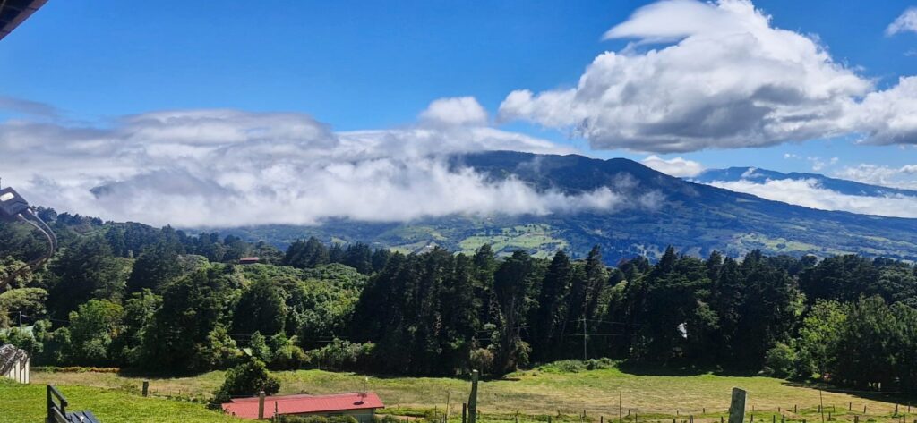
Friday, Jan 30, 2026 – Poás Volcano & Cinchona Waterfall Trails near San José, Costa Rica
We wanted to visit places that were typical of Costa Rica. After some research, we decided on the Poás Volcano crater and the tropical waterfalls in the surrounding region.
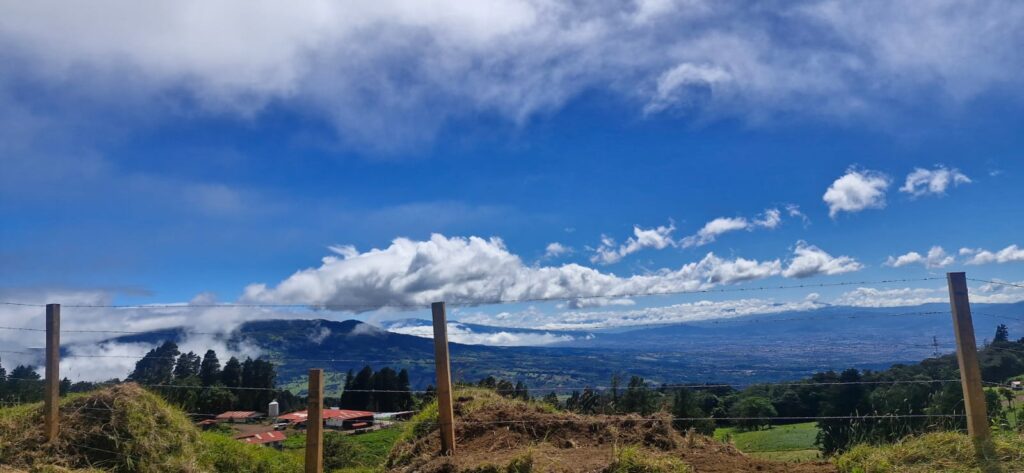
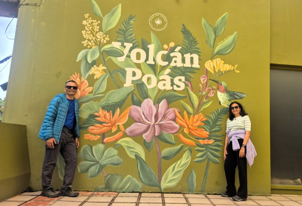
Poás Volcano Visitor Center is about 50 km north of the city of San José. We picked up our rental car and drove there. It took about 1.5 hours, and we reached around 11 am.
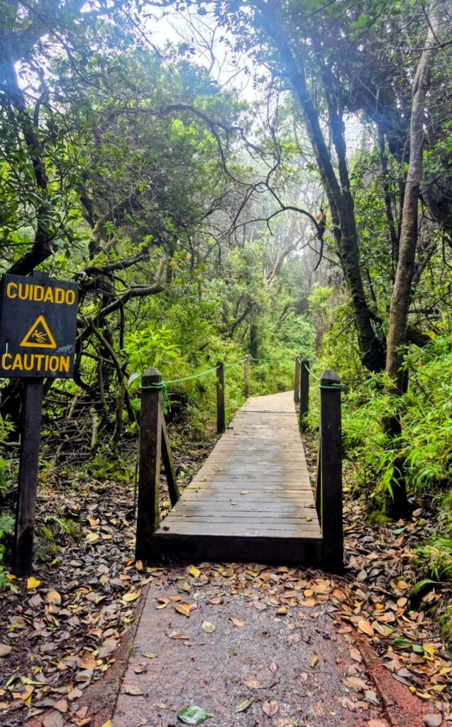
The Poás Volcano area has a well-maintained paved trail system. We walked about 3 km along the circular trail, first visiting the Poás Volcano crater.
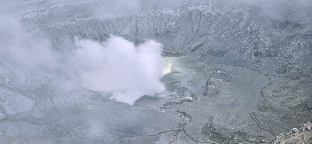
Poás Volcano is located at an altitude of about 9,000 ft. The main crater is approximately 290 meters (950 ft) wide and remains quite active, with frequent small geyser and lava eruptions. However, the last major eruptions occurred between 1952 and 1954.
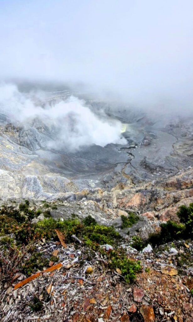
We really enjoyed the close-up view of the Poás Volcano crater.
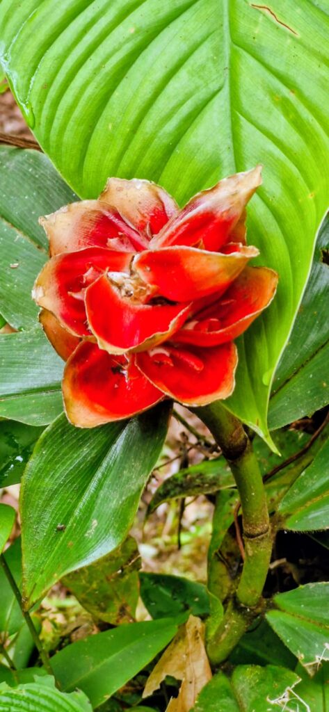
One plant that stood out along the trail was the “Poor Man’s Umbrella,” which is commonly seen throughout the Poás Volcano park. Its large leaves act like a natural canopy, protecting against the rain.
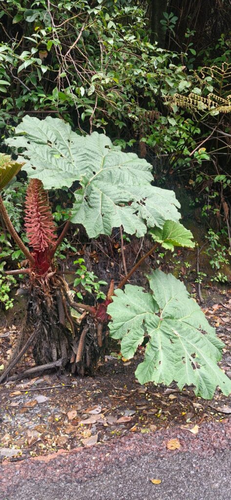
This plant was visible all along the path.
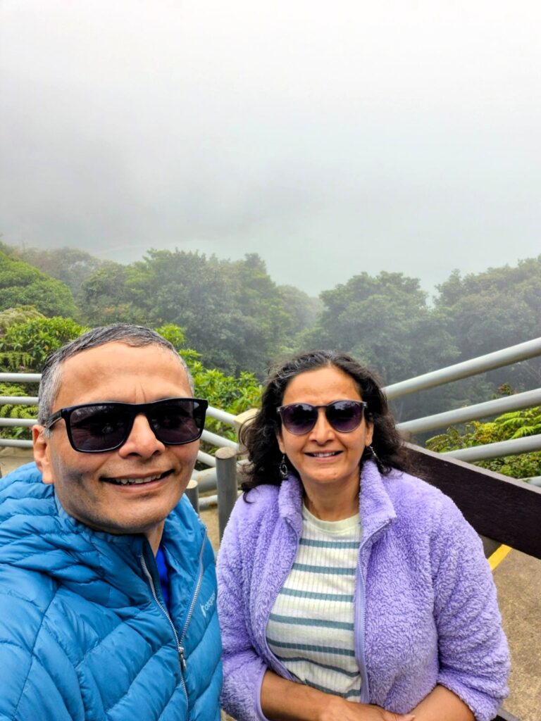
Two additional craters form part of the park — the extinct Von Frantzius crater and the Botos crater. We visited the Botos Crater Lake, but unfortunately it was shrouded in clouds, and we did not get any clear pictures.
Lake Botos is a beautiful, cold, green-water crater lake with a diameter of about 370 meters (1,200 ft). The Botos crater has not erupted for around 7,500 years.
There was a circular paved path from the visitor center that went to the Poás Volcano crater, continues to the Botos Crater Lake, and looped back to the visitor center.
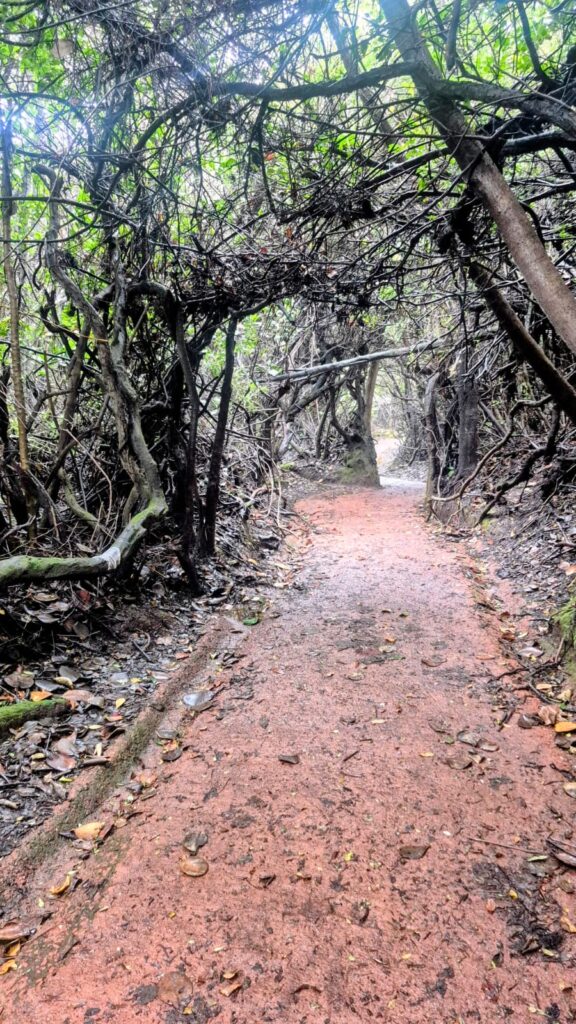
The walk passed through dense tropical forest and was very scenic.
We returned to the visitor center around 12:30 pm.
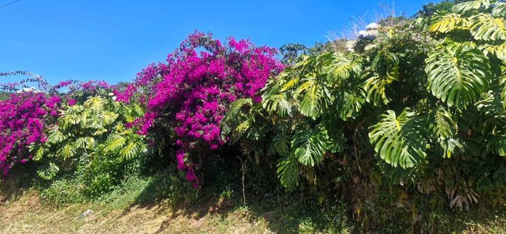
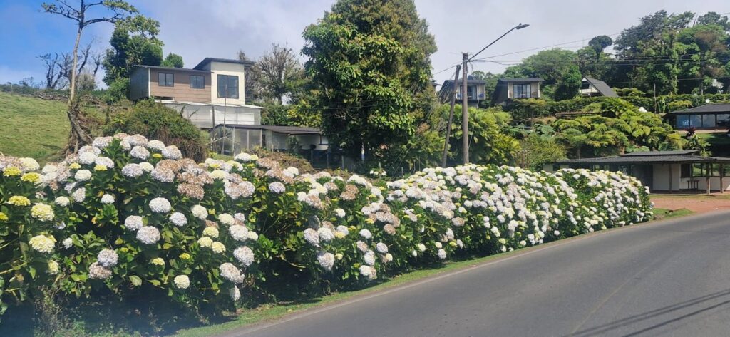
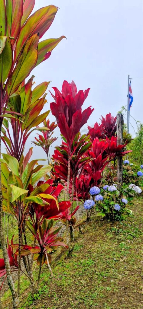
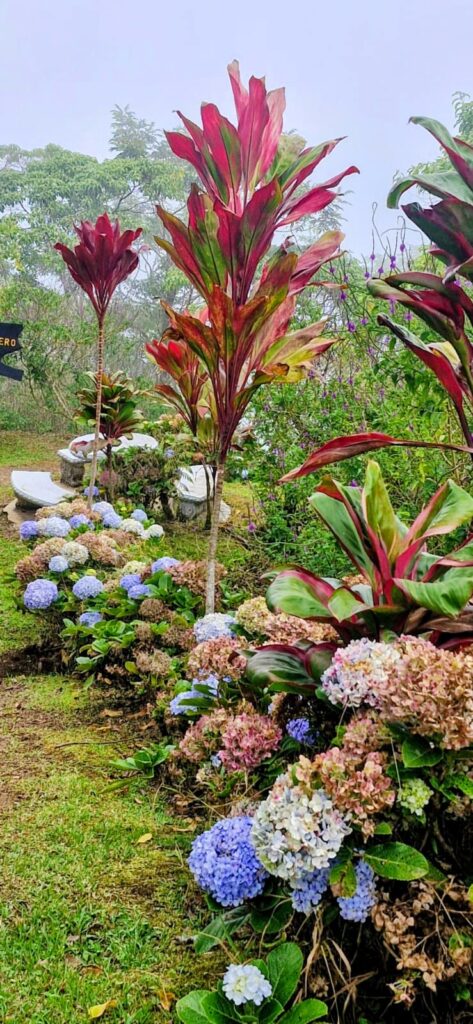
From there, we drove toward our next attraction — the waterfalls. We had heard a lot about La Paz Waterfall Gardens. Along the road, we enjoyed beautiful scenery and flowers.
However, when we reached La Paz Waterfall Gardens, we realized that it felt quite touristy, almost like an amusement park. So we decided to skip it and continue further down the road.
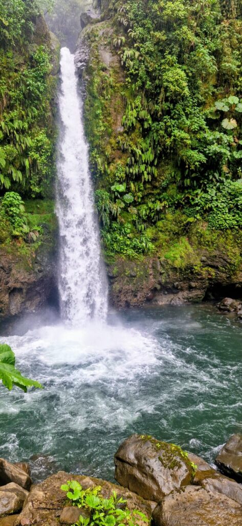
We came across a place called Cinchona Waterfall Trails (pronounced Sinchona). The trail includes four waterfalls — San Fernando, Botos, Paulus, and Cinchona.
On the way to Cinchona, we passed the smaller La Paz waterfall, which was quite nice.
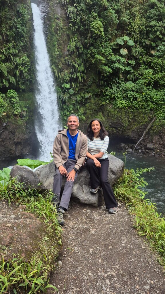
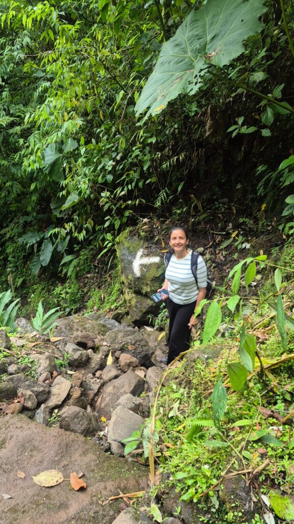
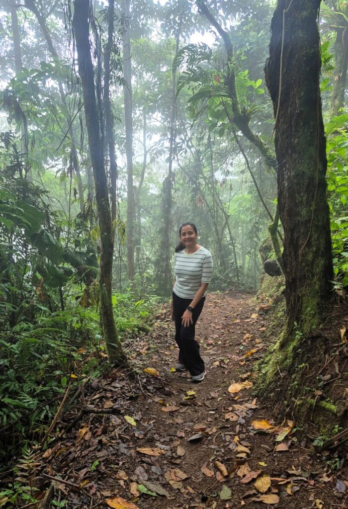
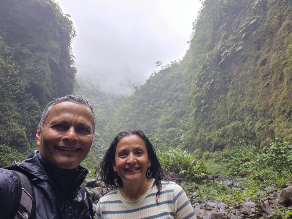
The Cinchona waterfall trail was steep and passed through dense tropical forest.
Since these trails are not very popular, Anu and I were the only two people hiking there, which felt slightly intimidating.

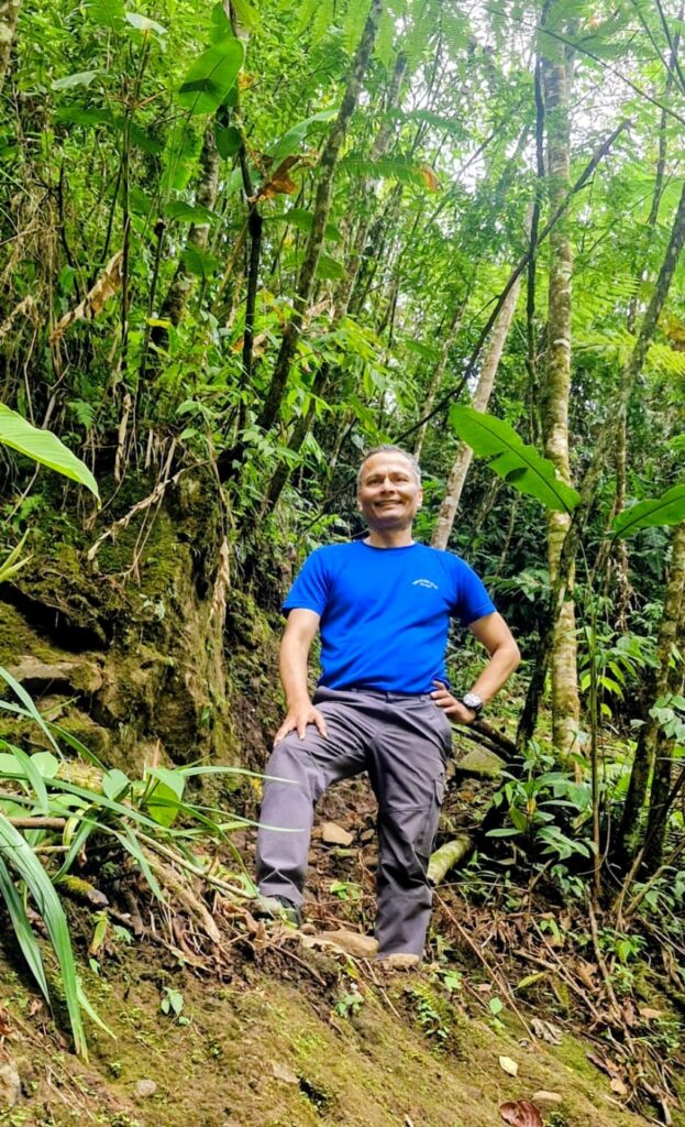
The trail was extremely beautiful — a true hiker’s paradise.
When we reached San Fernando Waterfall, the experience was highly rewarding. It is a 105-meter-tall waterfall cascading majestically into a tropical canyon.
This was exactly the kind of authentic Costa Rica experience we had been hoping for.
We descended nearly 1,500 ft into the canyon and then climbed back up. The surroundings felt like a dense tropical jungle straight out of movies like Jurassic Park — lush, dramatic, and largely untouched.
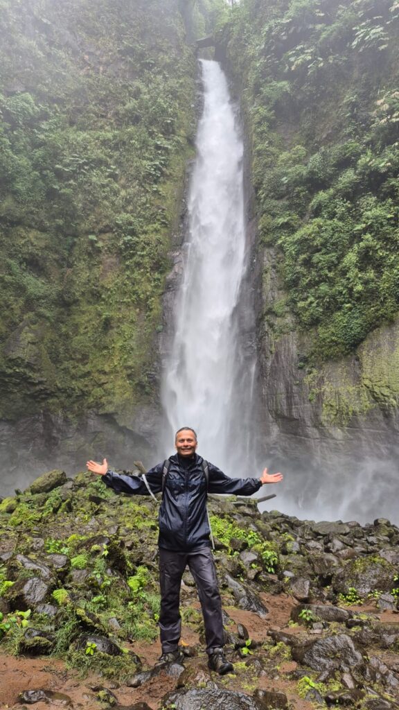
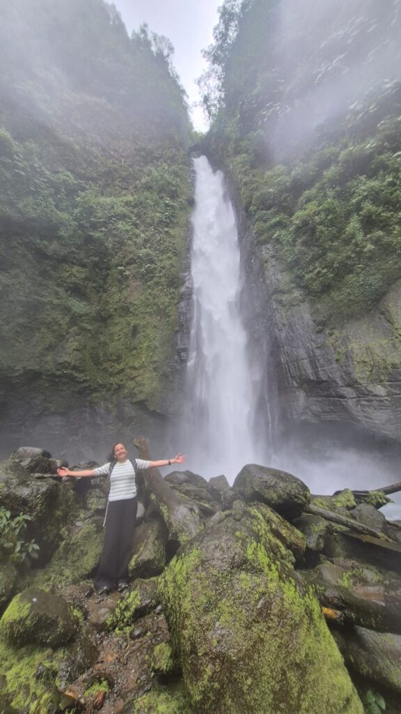
In total, we saw four waterfalls: San Fernando (105 m, the tallest), followed by Botos, Paulus, and Cinchona. The entire hike took about 1 hour and 45 minutes to complete. It was an absolute treat.
In the evening, we drove back to our hotel in Santa Ana, a suburb of San José, Costa Rica.
Saturday, Jan 31 2026 – Downtown San José, Costa Rica
We had until 1:30 pm before heading to the airport for our flight to Washington DC. We spent the morning exploring downtown San José, the capital of Costa Rica.
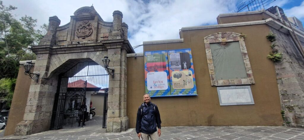
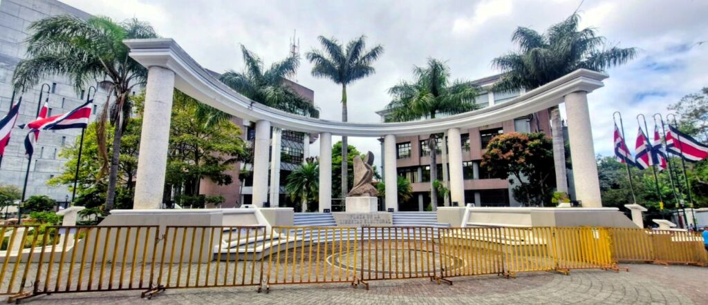
We began at Plaza de la Democracia.
The plaza was inaugurated in 1989 to commemorate the centennial of former president Bernardo Soto Alfaro’s decision to withdraw from power rather than violently contest his loss to José Joaquín Rodríguez Zeledón in the 1889 election.
The National Museum of Costa Rica, an impressive building, stands in this square.
Costa Rica is a long-standing democracy in South America, maintaining stable, civilian, democratic governance since 1949, when it abolished its military. It functions as a representative democratic republic with a strong separation of powers, featuring a president, a 57-member unicameral Legislative Assembly, and an independent judiciary.
Nearby is the Castillo Azul (Blue Castle), a historic and iconic building in downtown San José, recognized for its distinctive neoclassical-Mediterranean architecture.
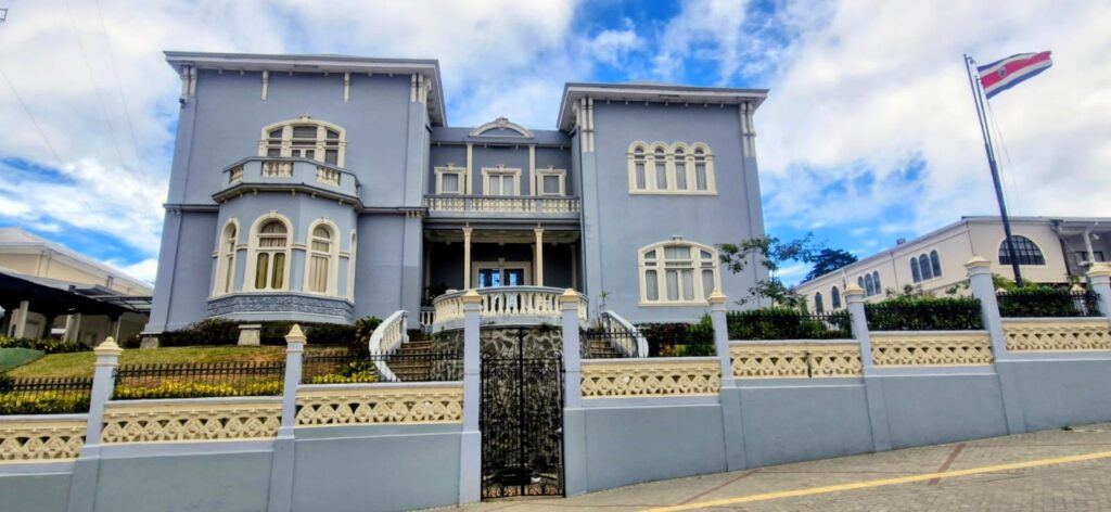
Constructed in the early 1900s, it has served as a presidential residence, a U.S. embassy, and now functions as part of the Legislative Assembly, symbolizing Costa Rican political history.
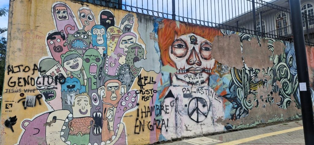
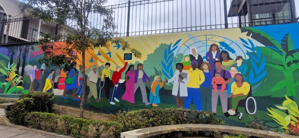
As we walked, we noticed several interesting murals along the way.
We saw the National Monument in Parque Nacional and passed Plaza of Electoral Liberty and the Fine Arts Museum.
We then walked through the classy Otoya neighborhood.
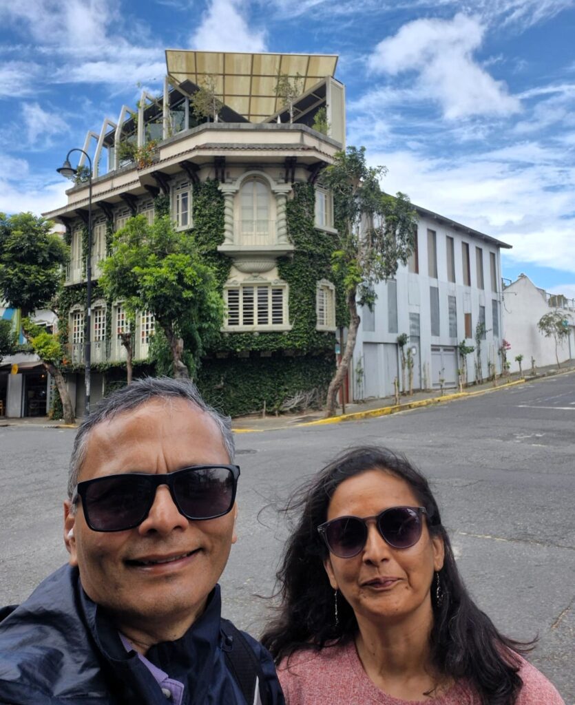
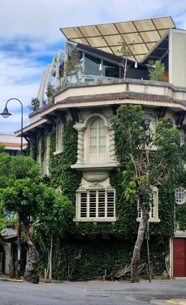

Lined with stately buildings and former homes of Costa Rica’s coffee elite, it is one of the most attractive neighborhoods in San José.
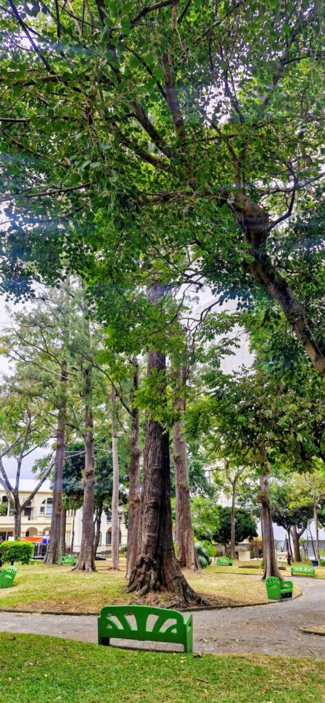
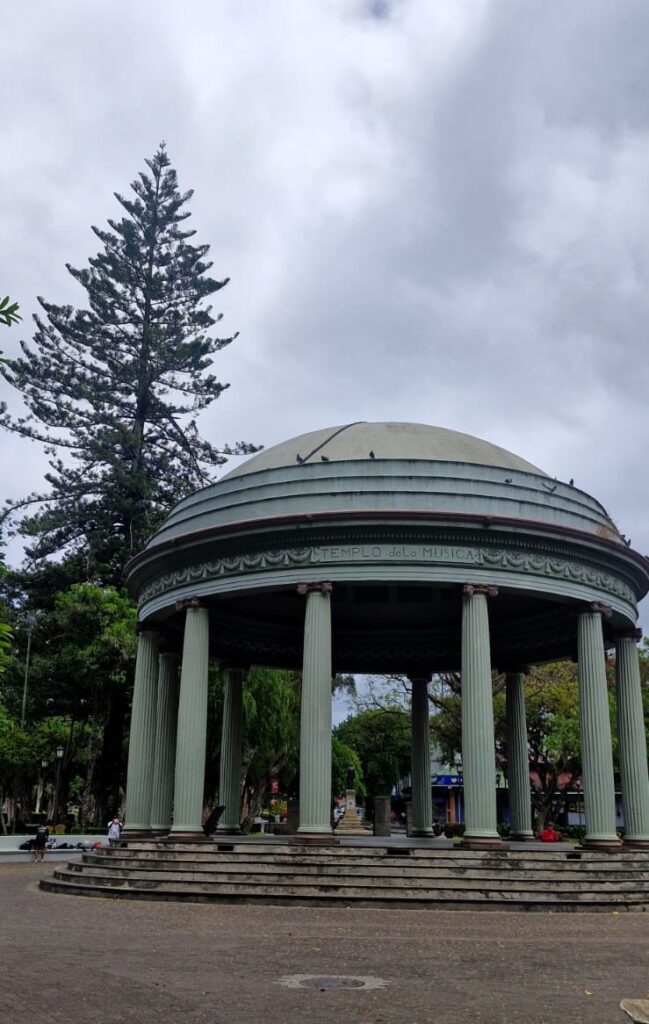
Parque Morazán is the largest park within San José. The iconic Temple of Music, the park’s focal point, was inspired by Francisco Morazán of Honduras in the 1800s, in hopes of unifying the countries of Central America.
We also visited the National Theater of Costa Rica (Teatro Nacional de Costa Rica).
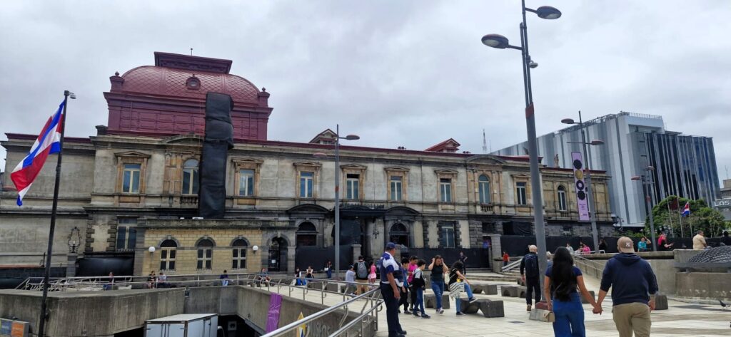
Completed in 1897 and financed by a coffee export tax, it is a stunning neoclassical building and one of Central America’s most beautiful landmarks. It is known for its opulent interior with gold leaf, chandeliers, murals, sculptures of musical legends, and a famous mural depicting the coffee and banana industries.
We passed by the Central Bank of Costa Rica.

For lunch, we chanced upon a Vietnamese restaurant offering vegetarian noodles with tofu. They even served Sriracha sauce. It was a delicious meal.
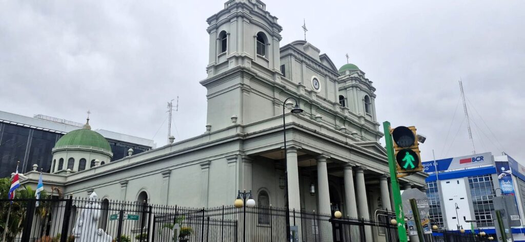
We continued on to the Metropolitan Cathedral of San José.

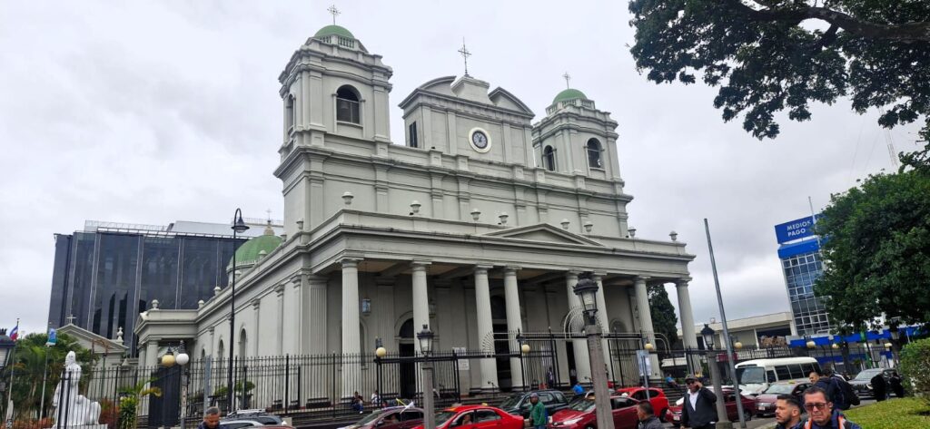
The original cathedral was built in 1802 but was destroyed by an earthquake.
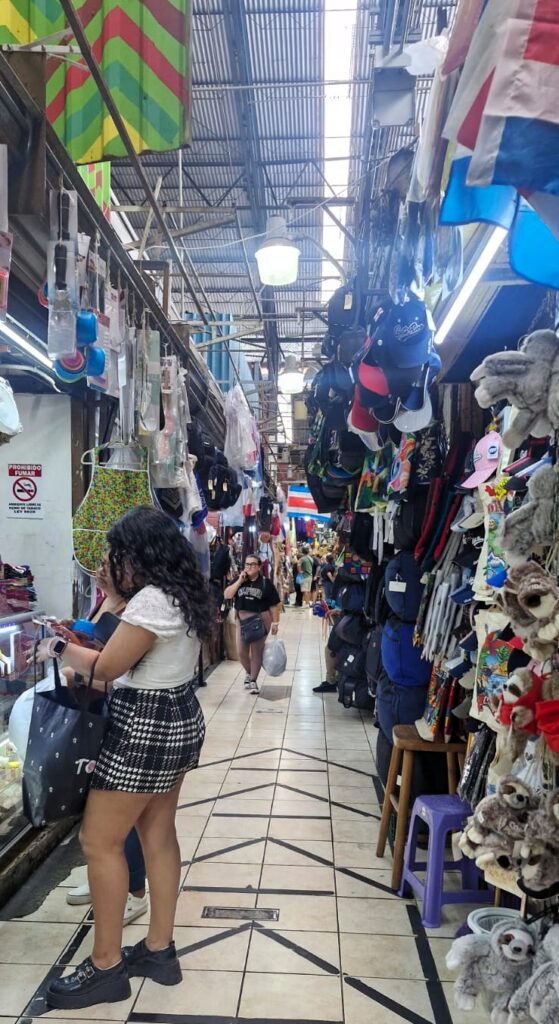
Our final stop was the San José Central Market, originally built in 1880.
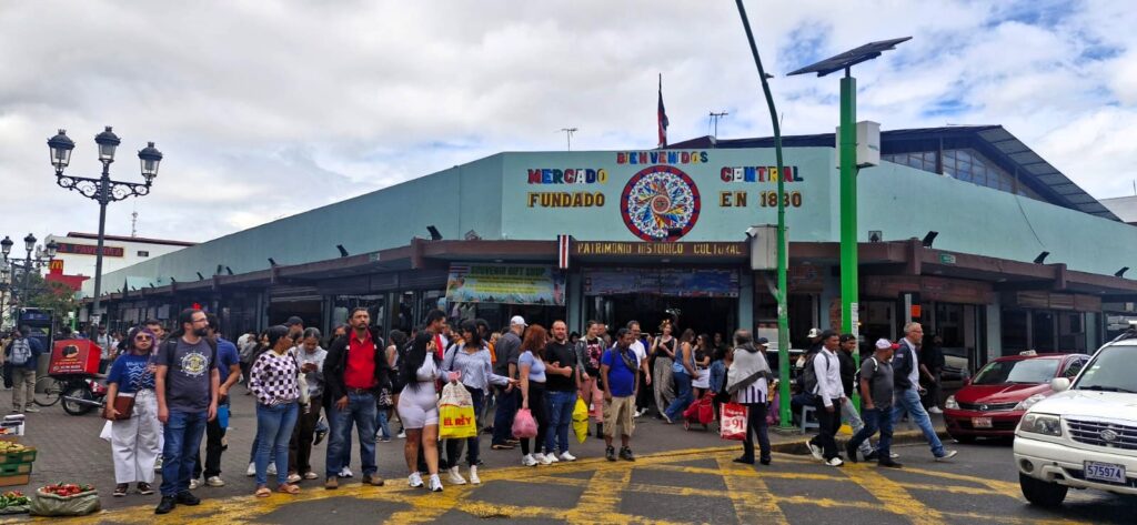
It was a bustling market selling everything a household might need.

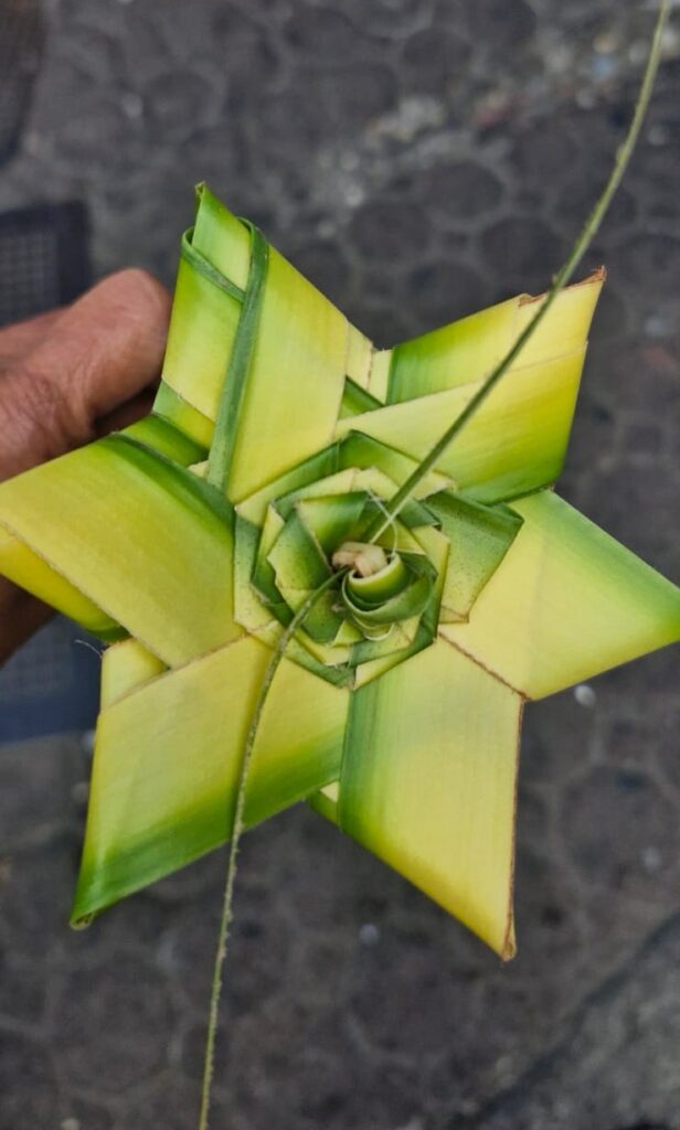
As we walked toward our Uber pickup point, we spotted a person making artwork out of palm tree leaves — very creative!
At around 1:30 pm, we got into the Uber and headed back to our hotel and then onward to the airport. We took the 5:10 pm flight from San José, Costa Rica to Washington DC.
Our impression of Costa Rica was that it is a modern Central American country with good infrastructure and US-like prices. It has beautiful volcanoes, lakes, tropical jungles and beaches. It is a great place to spend a few days.
Costa Rica marked the end of a wonderful South America trip where we covered Chile, Argentina, Uruguay, Paraguay, Bolivia, and Costa Rica after completing the W-trek and the Antarctic voyage.


