
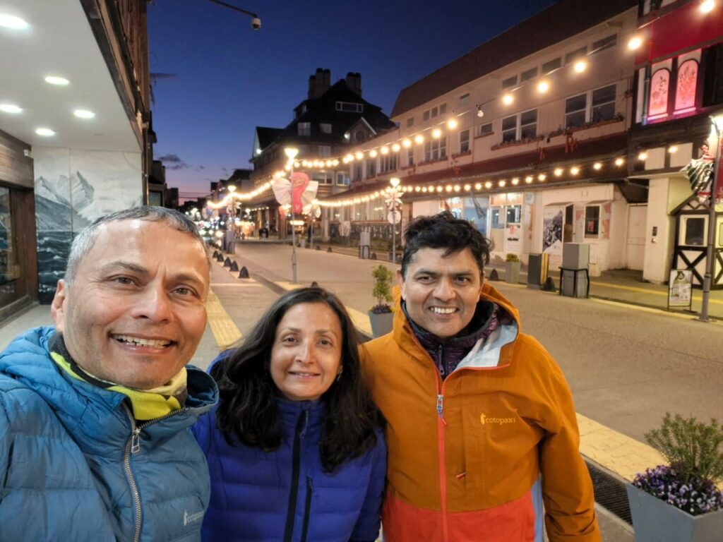
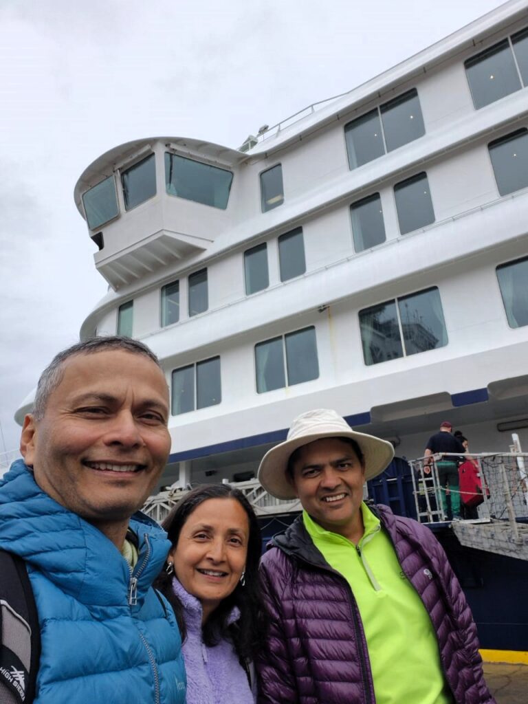
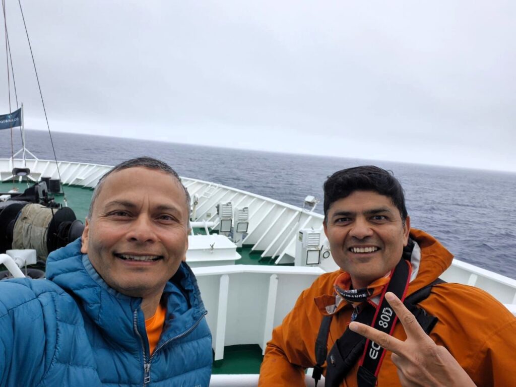
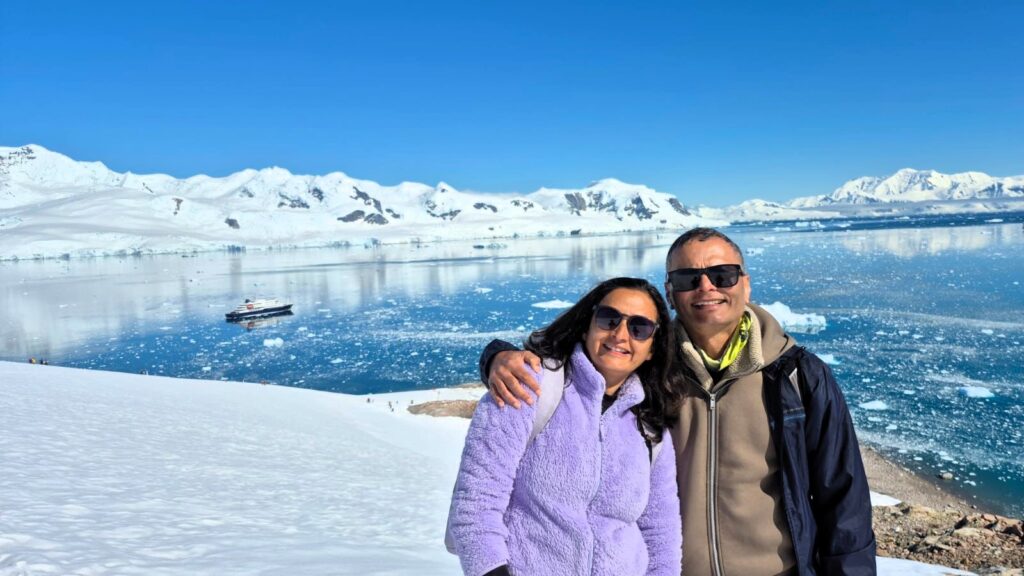
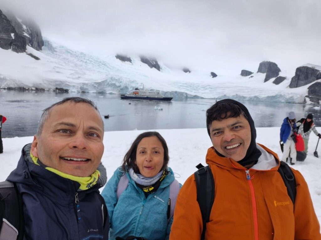
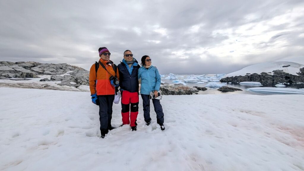
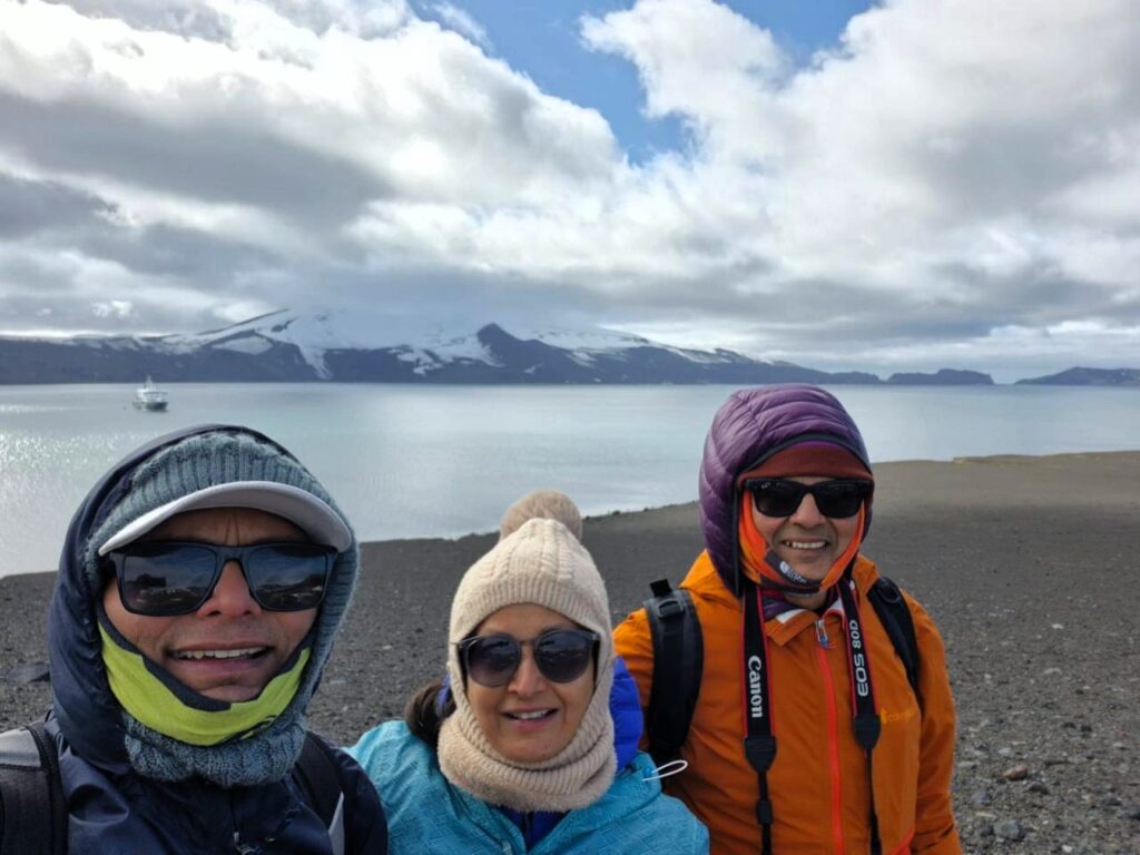
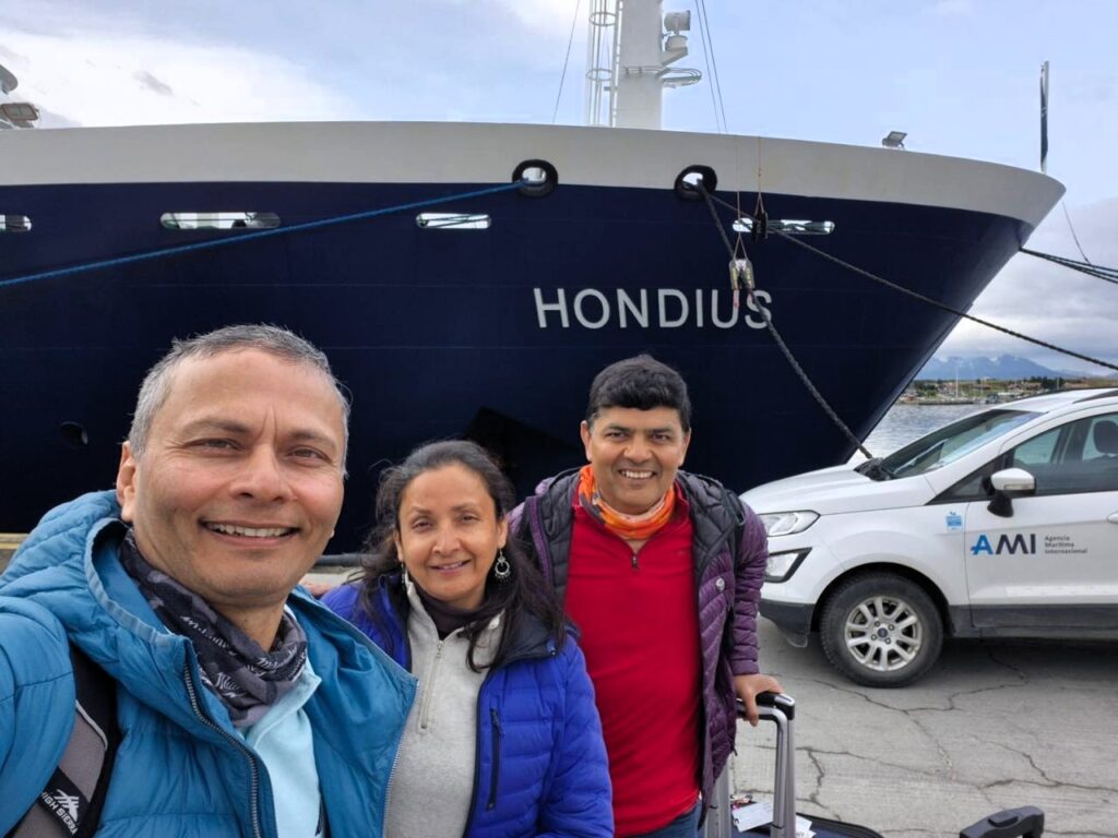
Anu and I had wanted to do a voyage to Antarctica, ever since we had heard about it from our friends Sudhir and Leena Alekar many years ago. In Jan 2026, since we were doing the W-trek in Patagonia region of Chile, we were already close by, so we decided to take the opportunity to do the Antarctic Voyage as well from Jan 8-18, 2026. Jai Rawat, my close friend, and his wife Jyoti Rawat were initially planning to join us, but Jyoti gets very seasick. So she decided that she is unlikely to undertake this voyage. Therefore, Jai, Anu and I decided to continue with our plans to do the Antarctic voyage.
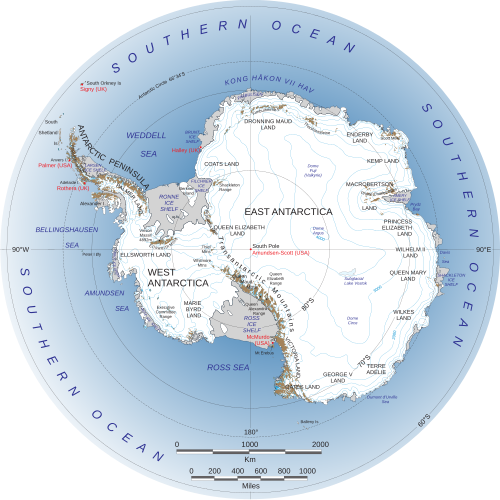
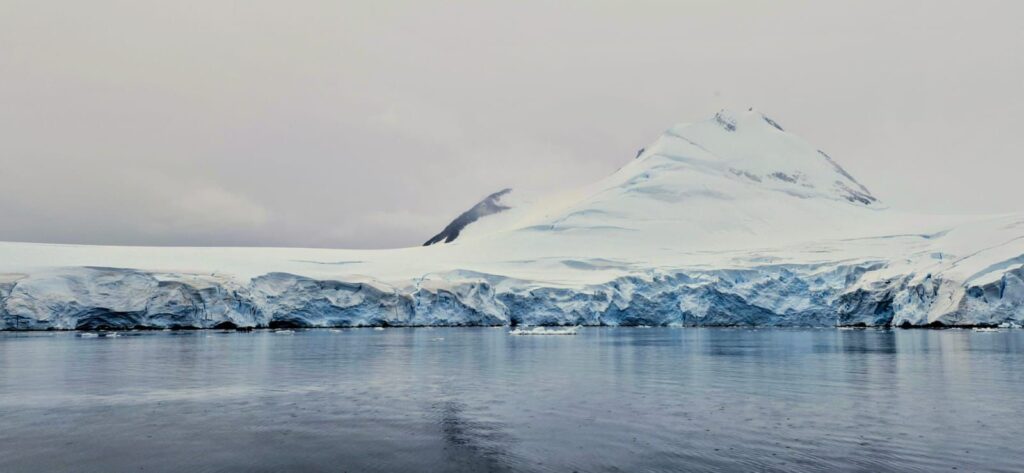
Positioned asymmetrically around the South Pole and largely south of the Antarctic Circle, Antarctica is surrounded by the Southern ocean. Antarctic ice sheet covers the continent and on an average, is about 1.9 km in thickness. Antarctica is, on average, the coldest, driest, and windiest of the continents, and has the highest average elevation of about 8,000 ft, this was surprising for me as I always thought it was a flat continent.
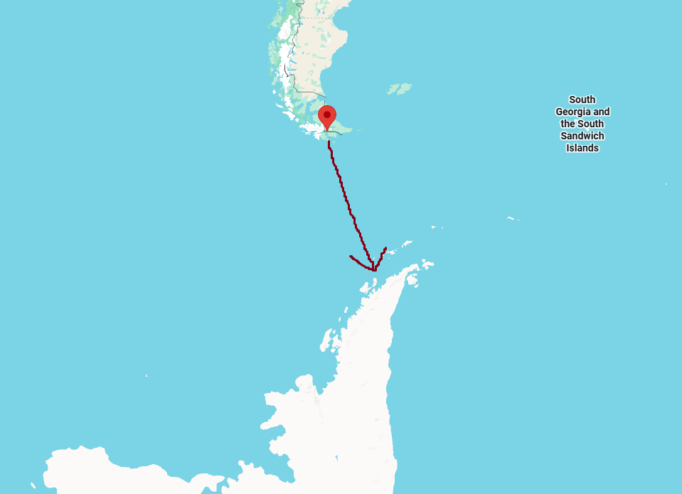
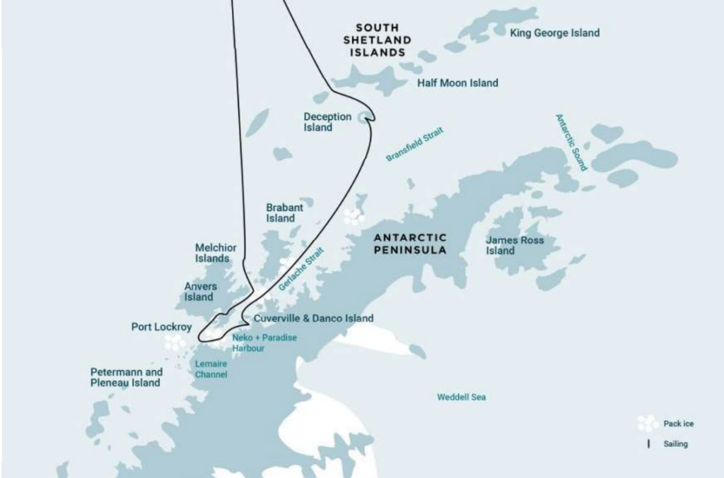
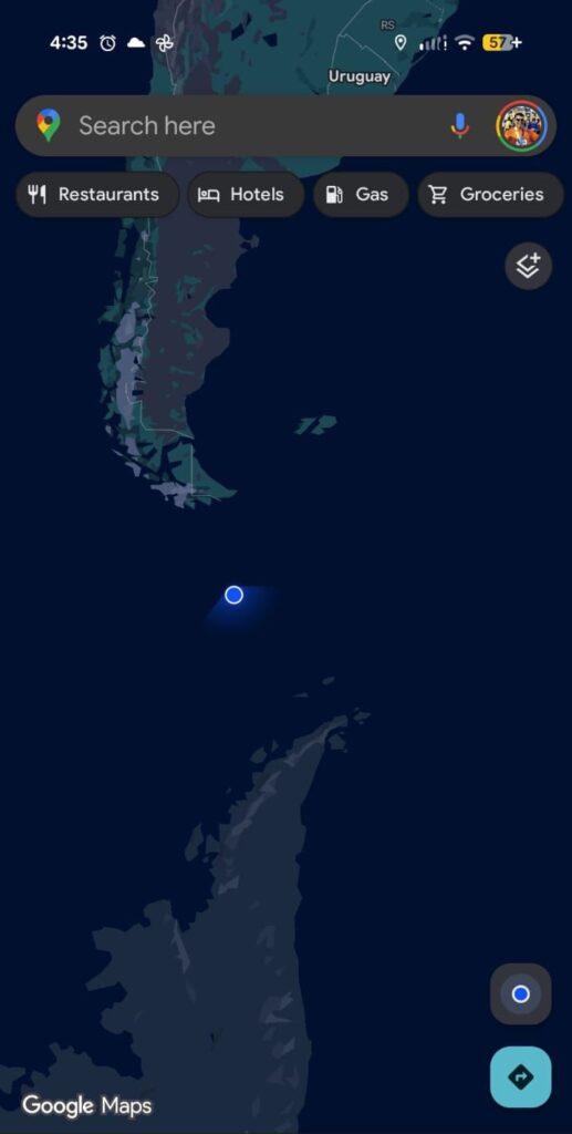
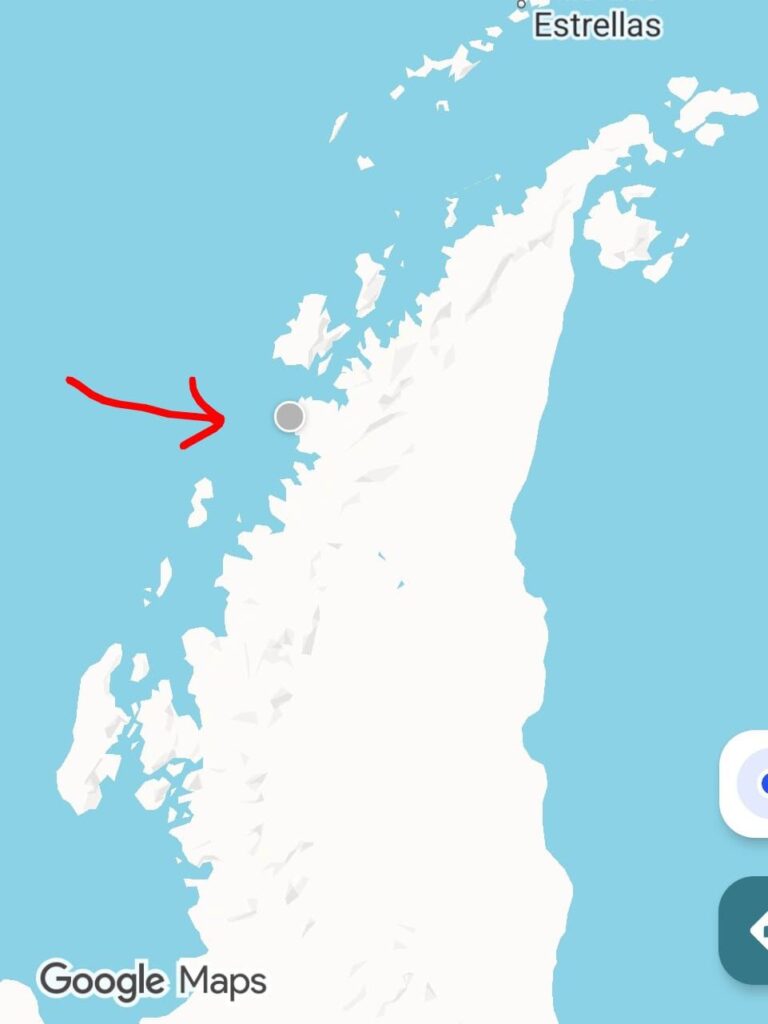
We traveled from Ushuaia, Argentina (often, referred to as the “End of the World”) to the Antarctica Peninsula.
Here is a day by day description of our wonderful voyage. You might also be interested in a detailed trip log or a video slideshow generated by Oceanwide Expeditions, our voyage operator.
Wed, Jan 7: Day 0: Arrival in Ushuaia
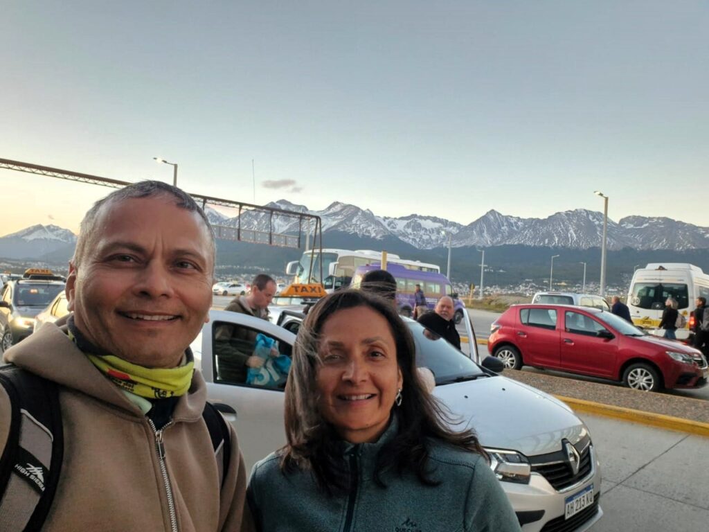
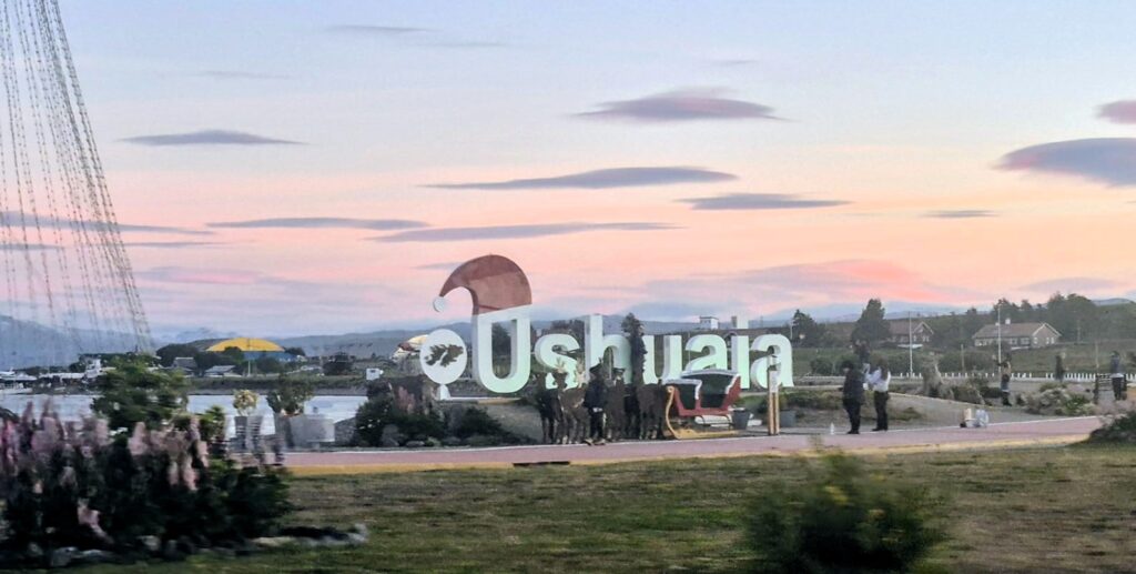
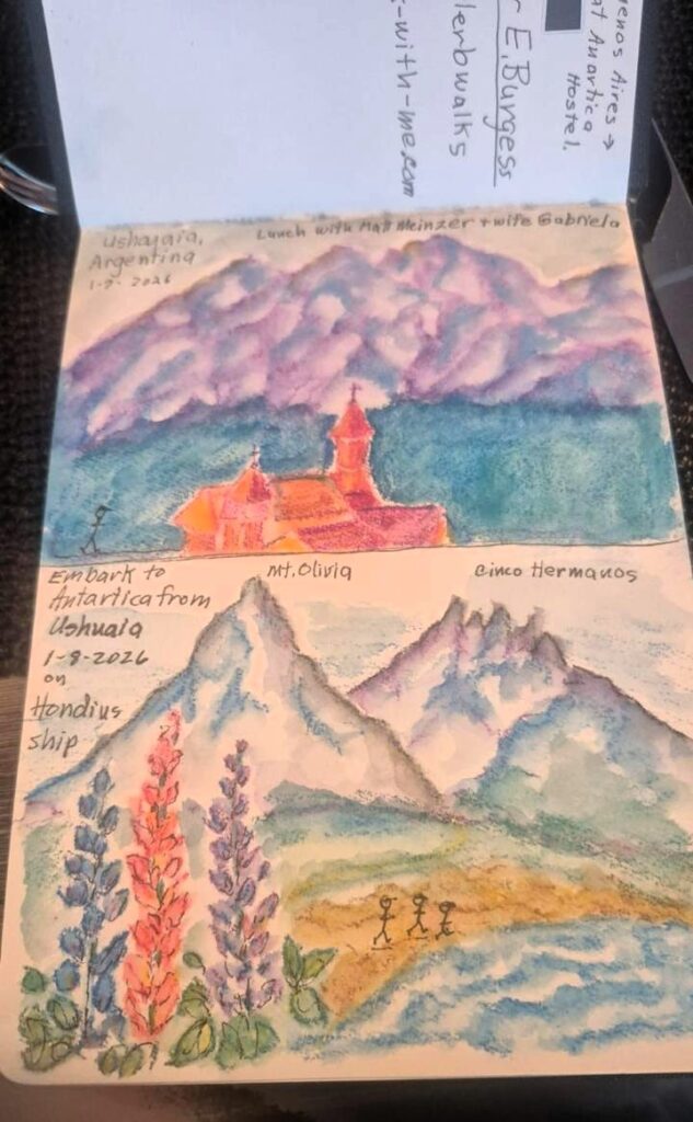
We landed in Ushuaia from Buenos Aires at 10 pm. Jai had already landed an hour earlier. Ushuaia is located in Patagonia, the southernmost part of Argentina. The region is called Tierra del Fuego or the “Land of Fire.” It is the largest southernmost city in South America.

Ushuaia airport is a nice wooden structure in a beautiful setting. It reminded me of Fairbanks in Alaska.

Ushuaia is a beautiful city surrounded by snow-clad mountains. It lies on the 54th parallel below the equator.

We went out for a walk around 10:45 pm, but there was still some light. It gets completely dark only around 11:15 pm.
Thu, Jan 8: Day 1: Starting the Antarctic Voyage
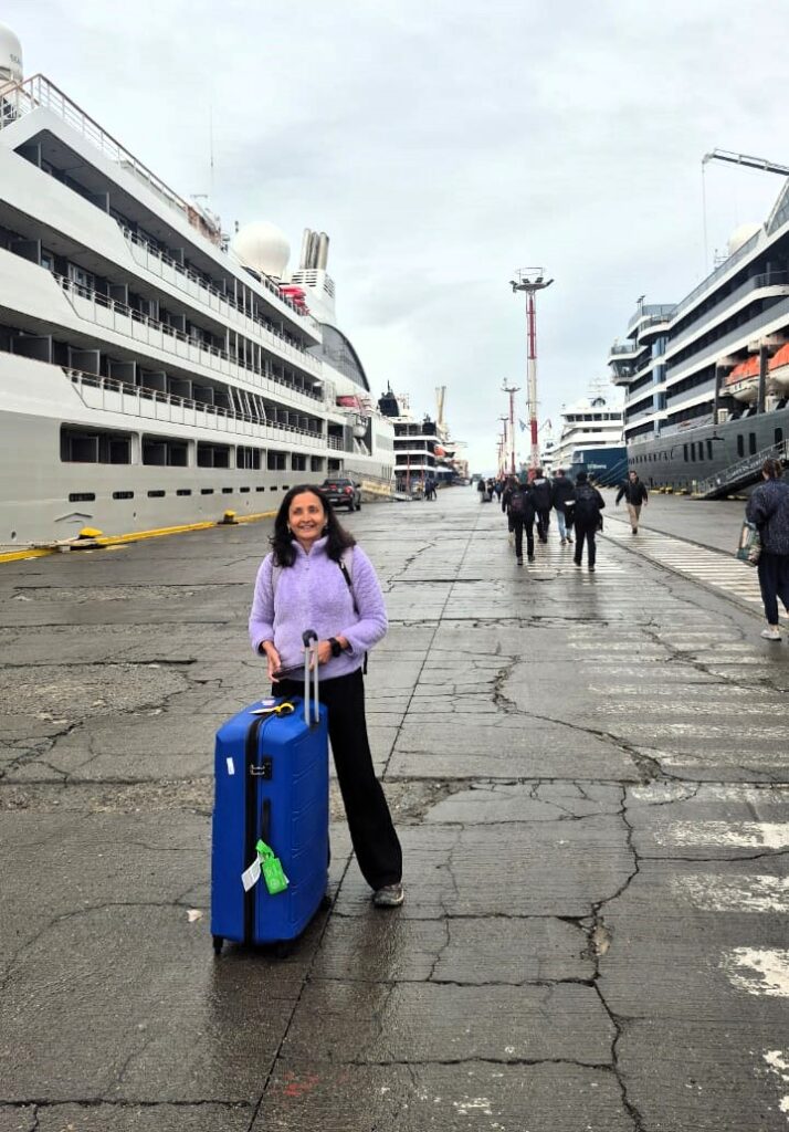
Our voyage boarding was at 4 pm. We decided to explore Ushuaia, which is considered the end of the world in South America.
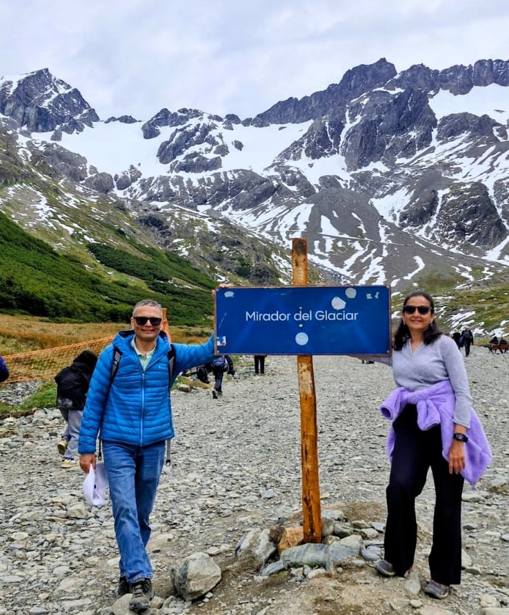
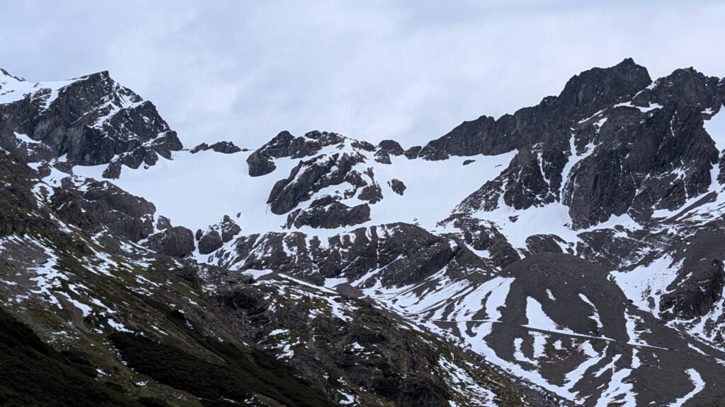
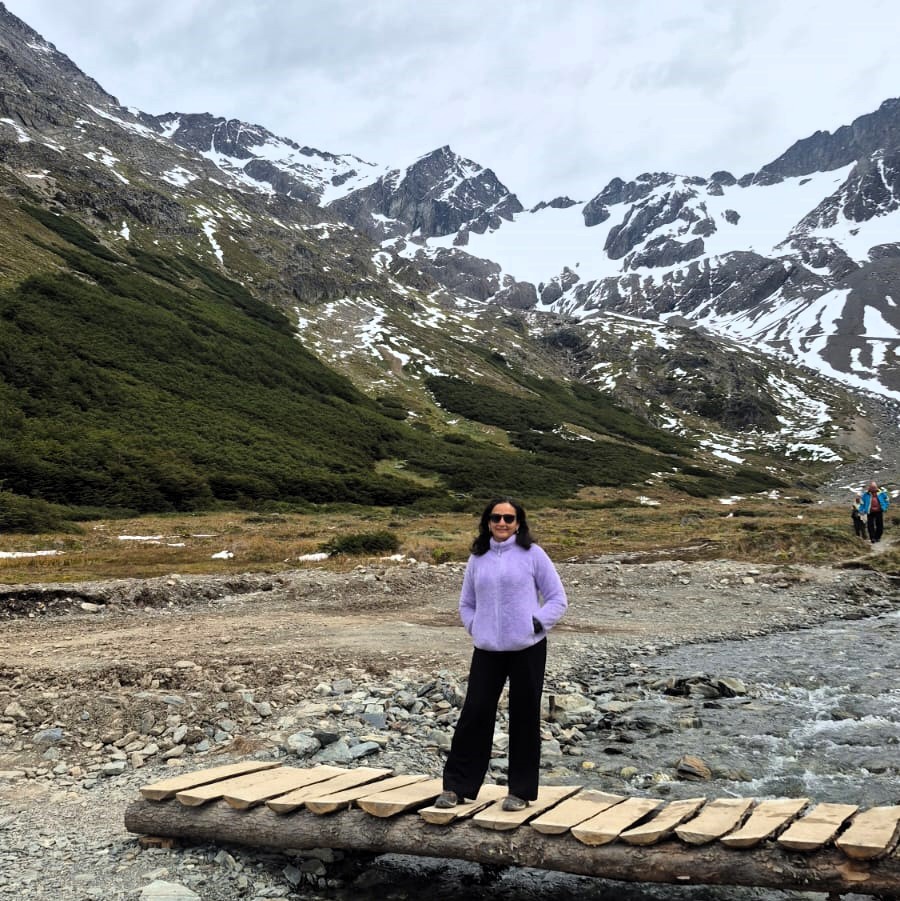
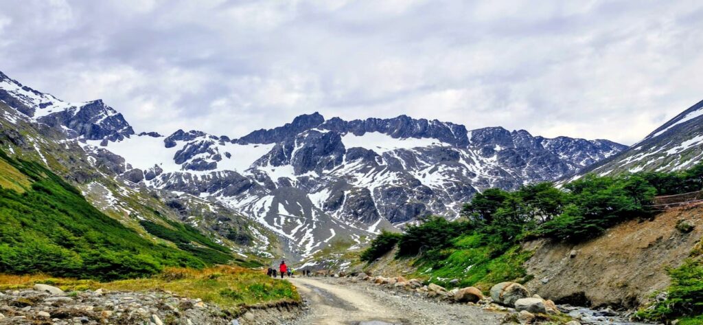
We visited Glacier Martial about 8 km from the city center. It is a ski resort in winter.
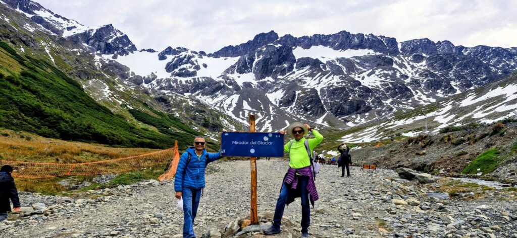
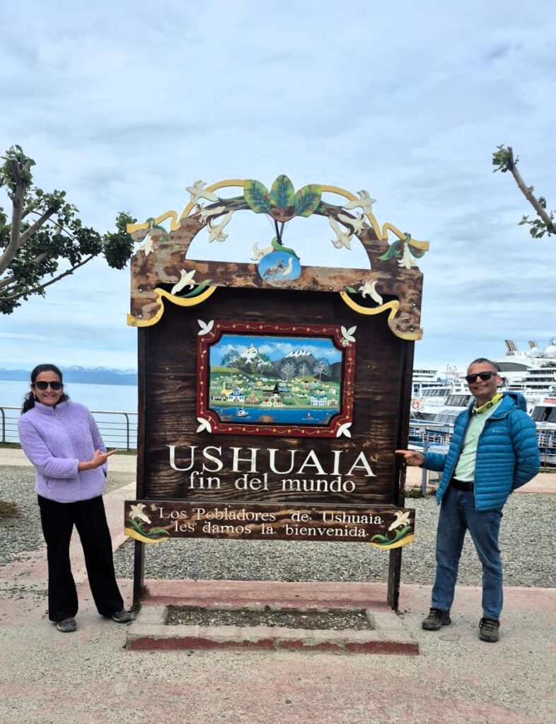
The glacier is named after a French explorer. Ushuaia is known as the “End of the World” (Fin del Mundo) because it is the southernmost city in the world, a remote gateway to Antarctica, and the literal end point of the Pan-American Highway.
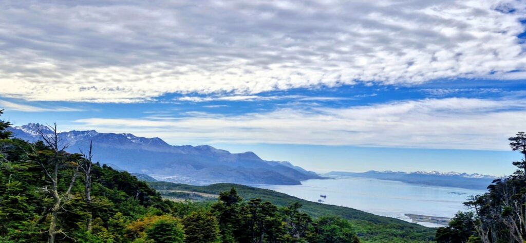
Ushuaia is a very pretty and bustling city.
There is a signpost that says “Fin del Mundo” or the end of the world.
This was our last stop before we boarded the ship for the voyage at 4 pm.
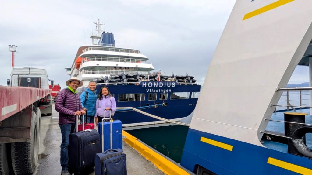
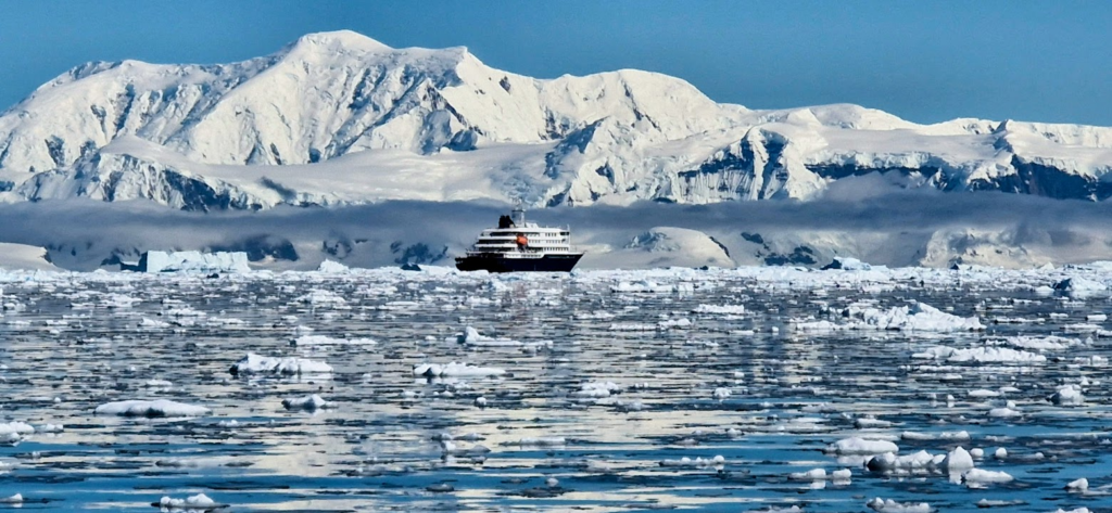
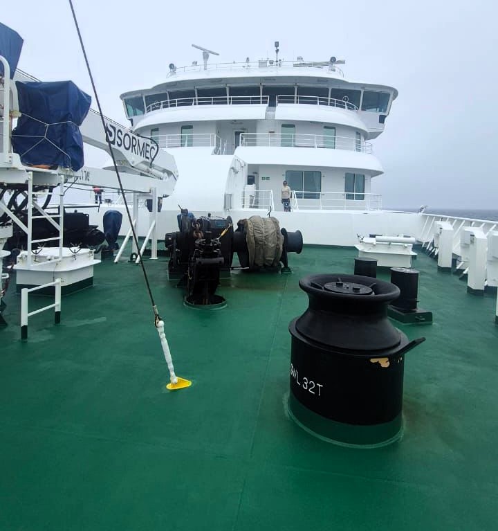
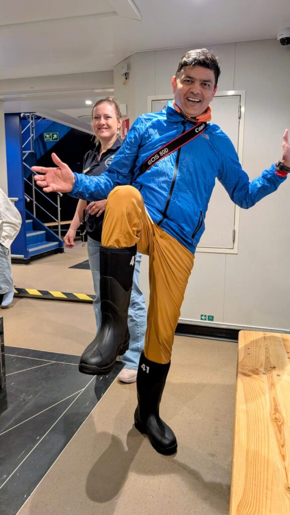
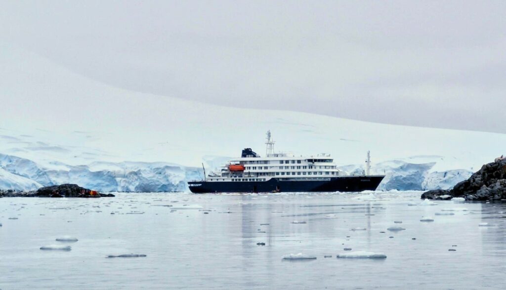
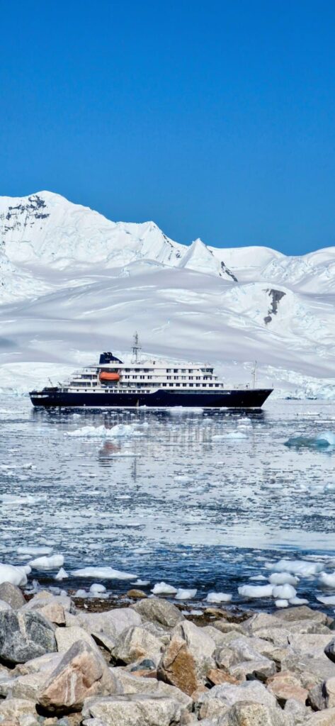
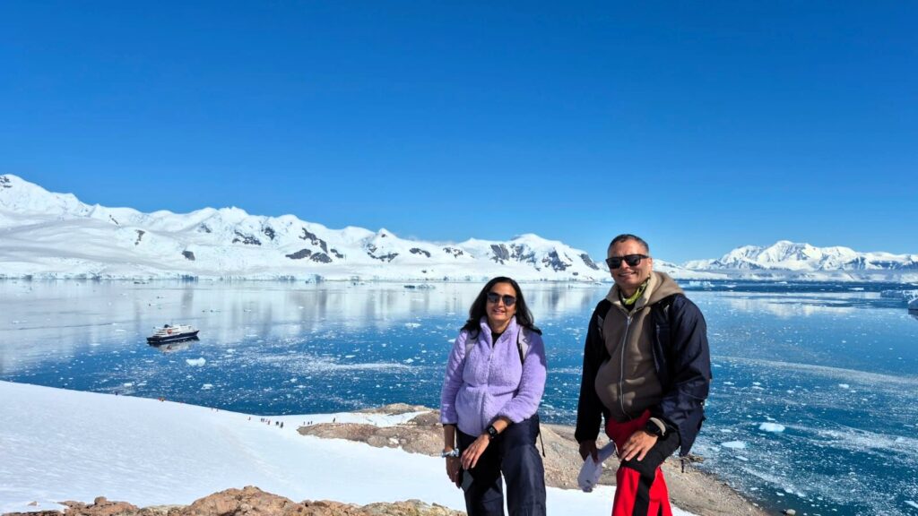
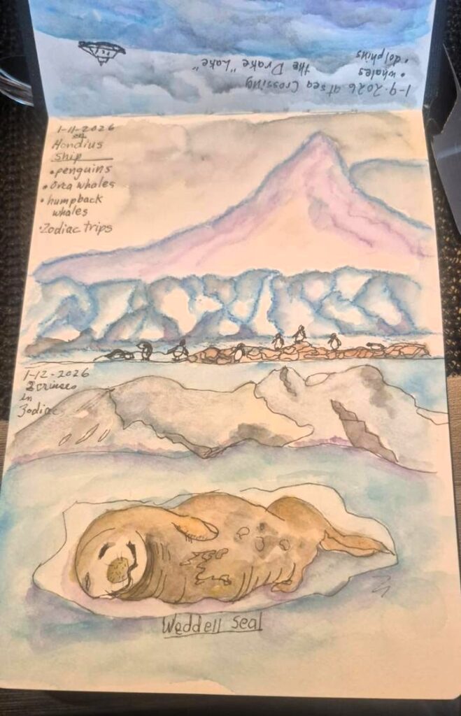
The name of our voyage operator was Oceanwide Expeditions. We were on the Hondius ship with a max capacity of only 170 people. It was built in 2019. It had 7 decks.

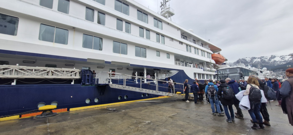
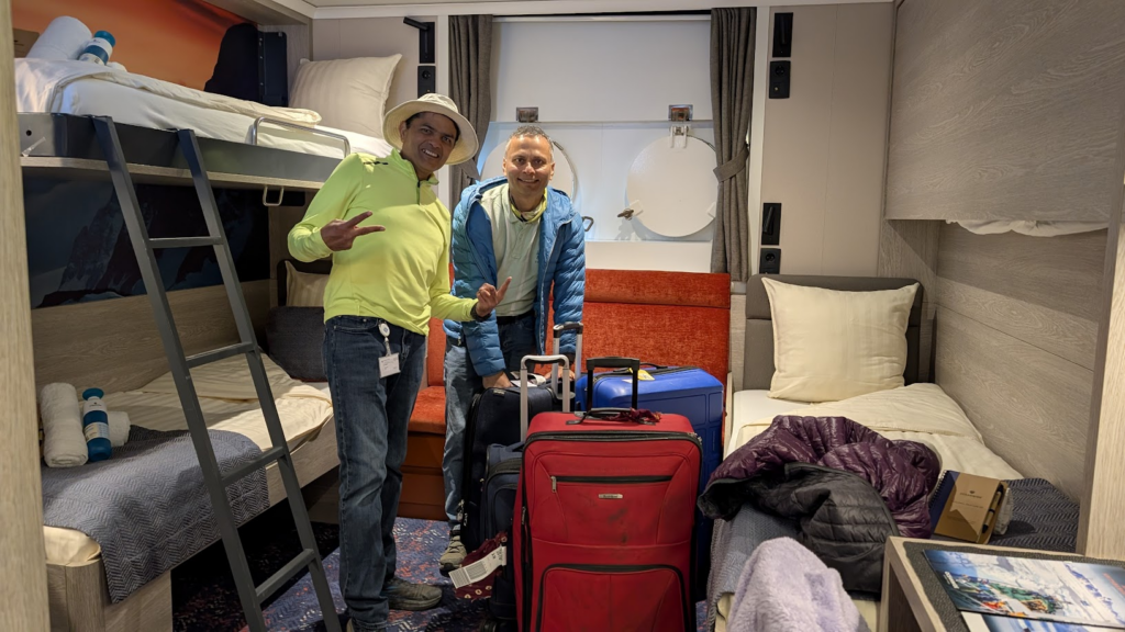
We were escorted to our room 310 on Deck 3 of the ship. It was a very comfortable room with bunk beds. The rooms were cleaned by the service staff everyday, just like a hotel room.
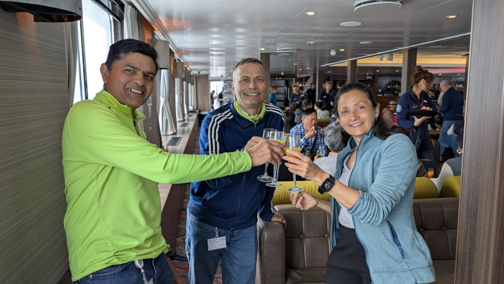
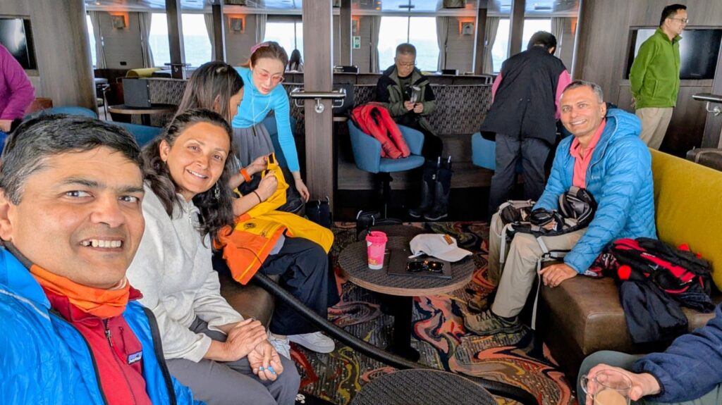
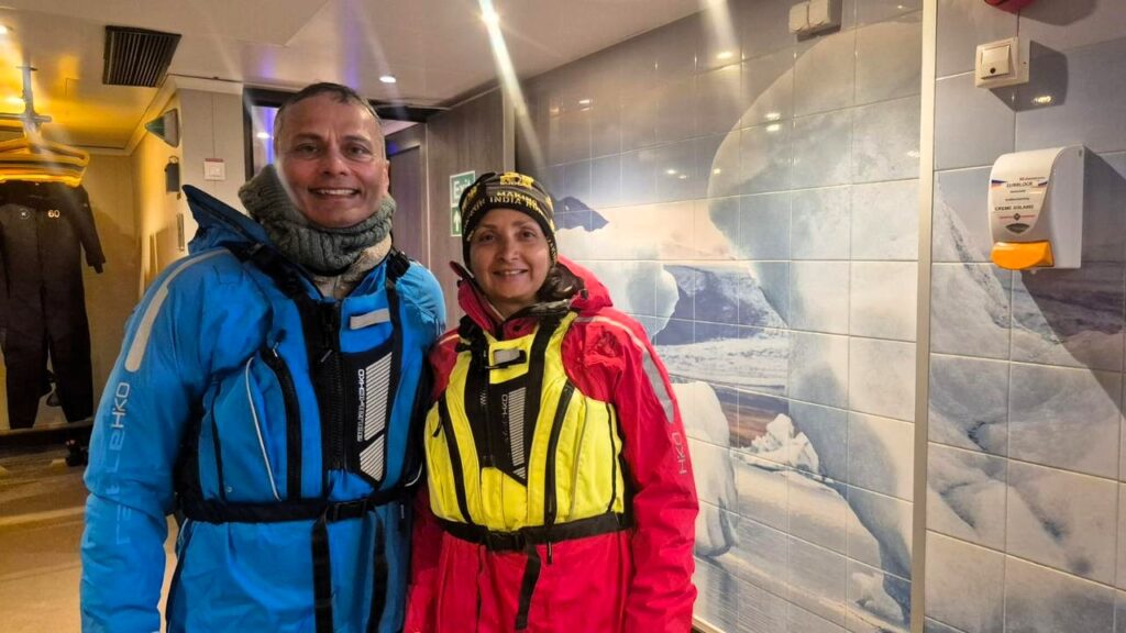
We had our safety briefing, which was really well-scripted. It was very informative and also funny.
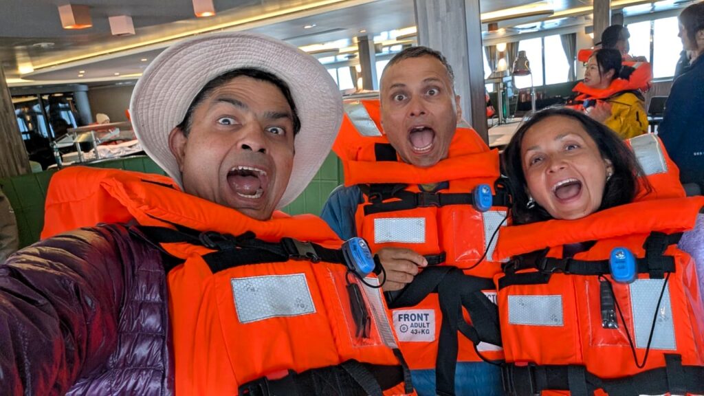
We then went through a mock safety drill. A tiny-looking lifeboat is supposed to be able to house up to 120 people.
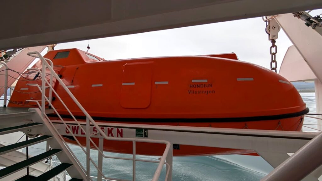
It had emergency supplies, food, seasickness medicine and even fishing gear.
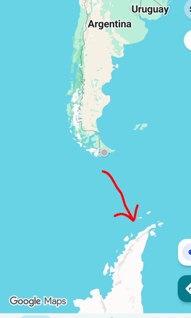
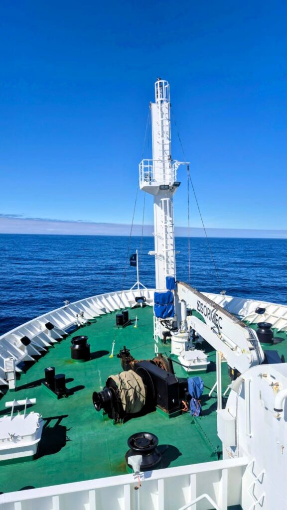
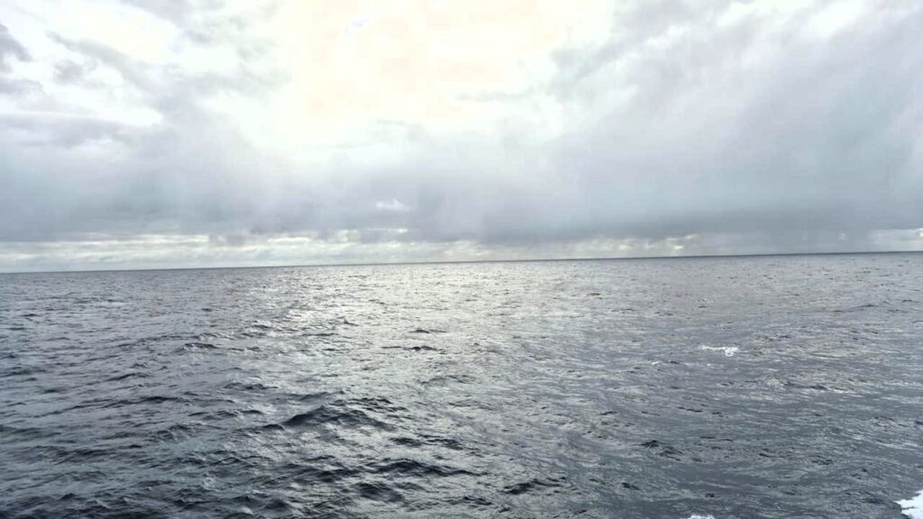
We were supposed to cross the Drake passage, the open seas between Cape Horn and the Antarctic peninsula, and are supposed to be some of the roughest seas in the world, with waves as high as 50 ft because there is no land or mountains to stop the wind.. But this is the shortest sea voyage to Antarctica. Weather patterns were predicting that we might get lucky and the seas might be gentle. It felt exciting to have come so far down south.
The ship was getting regular weather updates from windy.com.
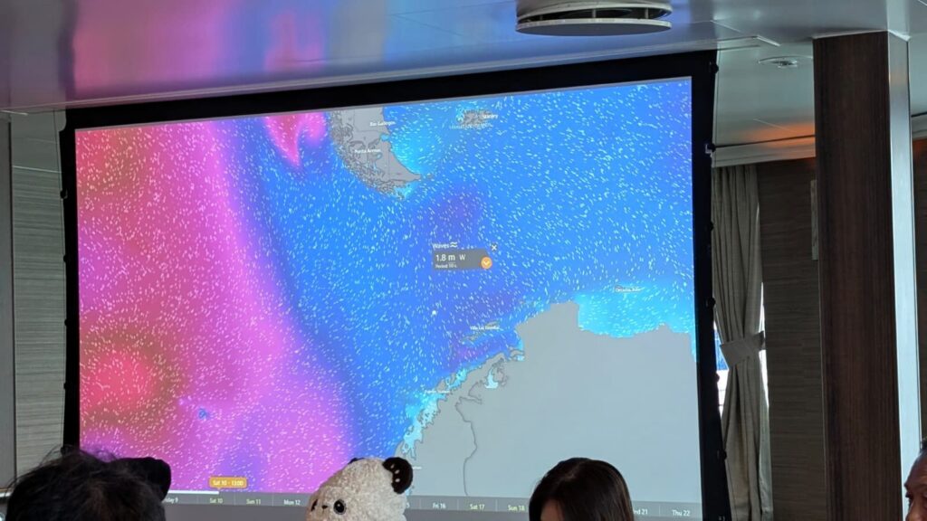
Blue meant good, orange/red meant not good, and this is one situation where you definitely don’t want to be in the purple patch! We were seeing a blue patch as we were going into the dreaded Drake Passage. This meant that the weather was good.
This journey was called an expedition because the plans change frequently depending on the weather. They have plans A, B, C, D, etc. for every day! So we didn’t really know for sure which part of Antarctica we would land on.
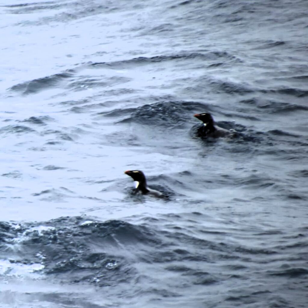
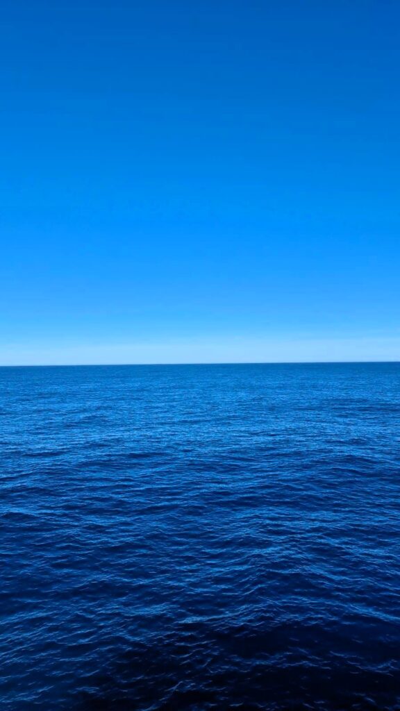
There were some bird sightings in the Drake Passage. Wide open sea expanse! No land in sight.
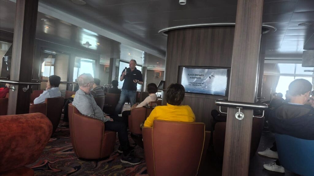
Wandering albatross are really big with a wingspan of 3.5m (11.5 ft)!! Albatross are typically found in the Antarctic and sub-antarctic oceans.
Luckily, the waves were very calm currently in the dreaded Drake Passage.
Friday, January 9: Day 2: Crossing the Drake Passage
We spent the entire day on the ship, crossing the dreaded Drake Passage.
The water was relatively calm, with only 6 ft waves, not the 50 ft waves that we had expected. The calmer seas made the long crossing far more comfortable than we had imagined.
We wandered around the ship and spent some time on the deck as well, watching the vast emptiness of the ocean stretch endlessly in all directions.
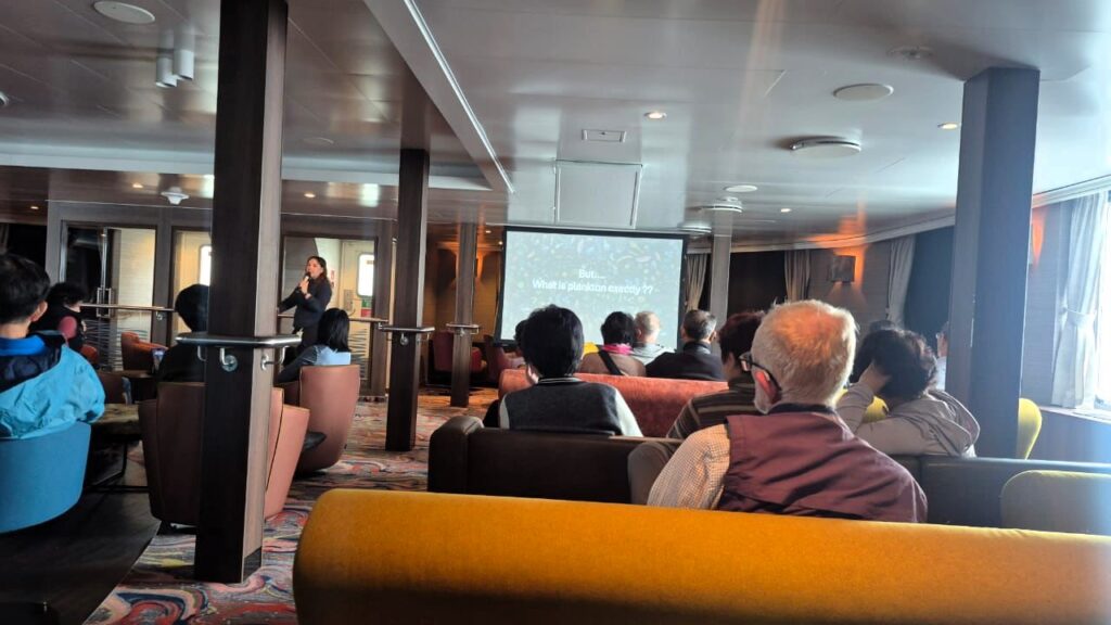
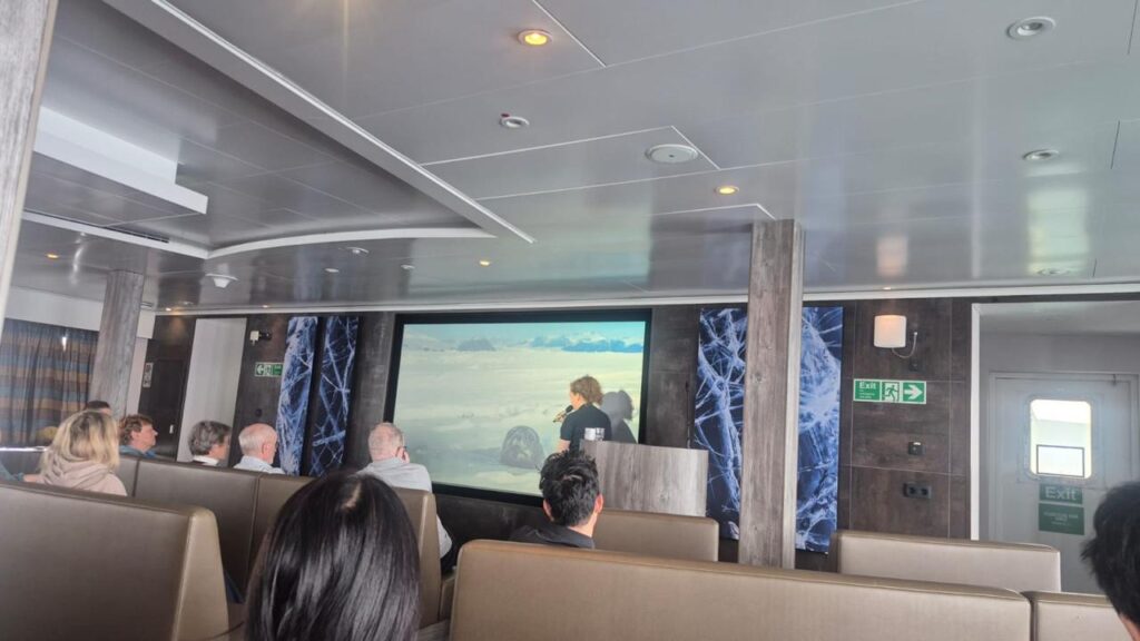
There were three educational sessions during the day:
- Birds and albatrosses
- Whale recognition
- Life under the Antarctic sea
Each session was about 1 hour and 15 minutes long.
This trip was a combination of educational sessions, sea excursions, and on-land excursions—very different from leisure cruises. Every day was packed with activities. Plans were flexible and depended entirely on the weather, so landings were decided on the fly. No guarantees. Therefore, this voyage was defined as an expedition, not a cruise.
Though we did not notice it much at first, the ship was rolling continuously. In the video below, you can see the chairs rotating due to the roll of the ship.
Here is a video of the front of the ship and the endless expanse of the oceans at the Drake Passage:
We were in the Drake Passage, the passage between the continents.
Only open seas. No land in sight.
Day 3, Friday: Jan 10: Drake Passage
Our ship, the “Hondius,” was still navigating the dreaded Drake Passage.
The passage is 800 km long. It takes about 2.5 days just to cross it, as the ship travels at 12 knots, about 21 kmph.
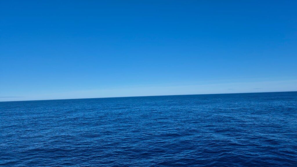
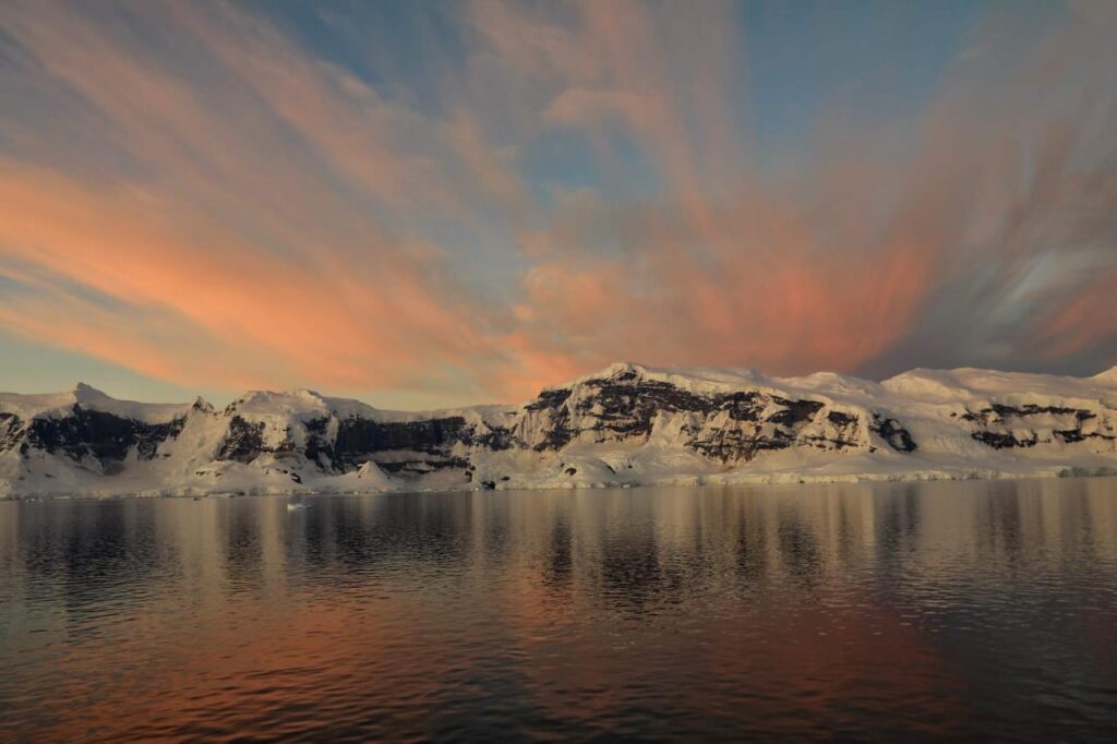
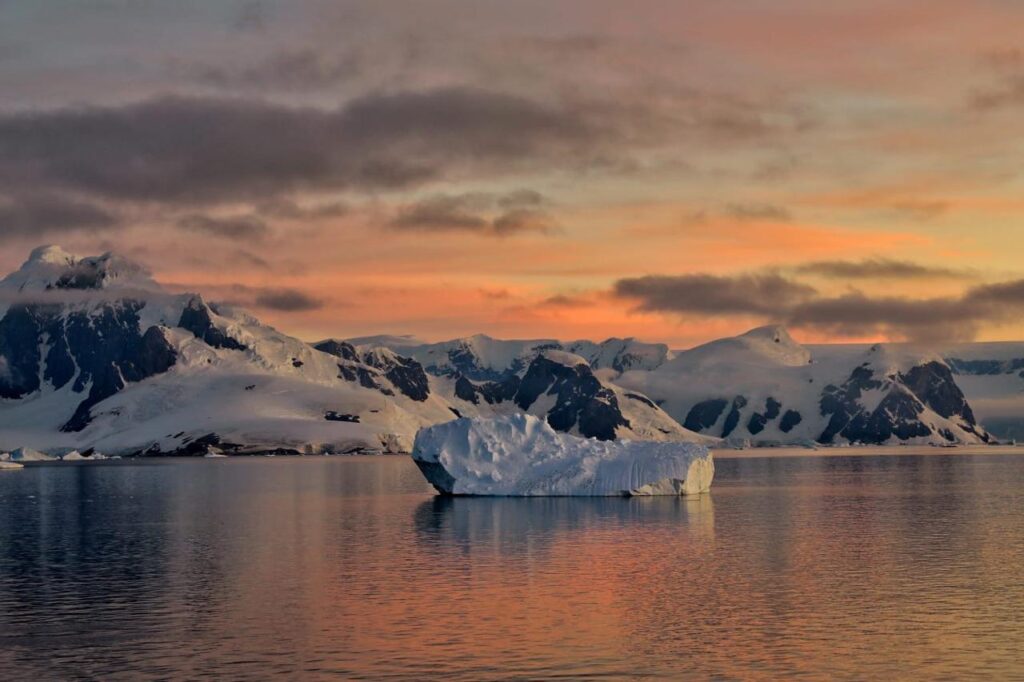
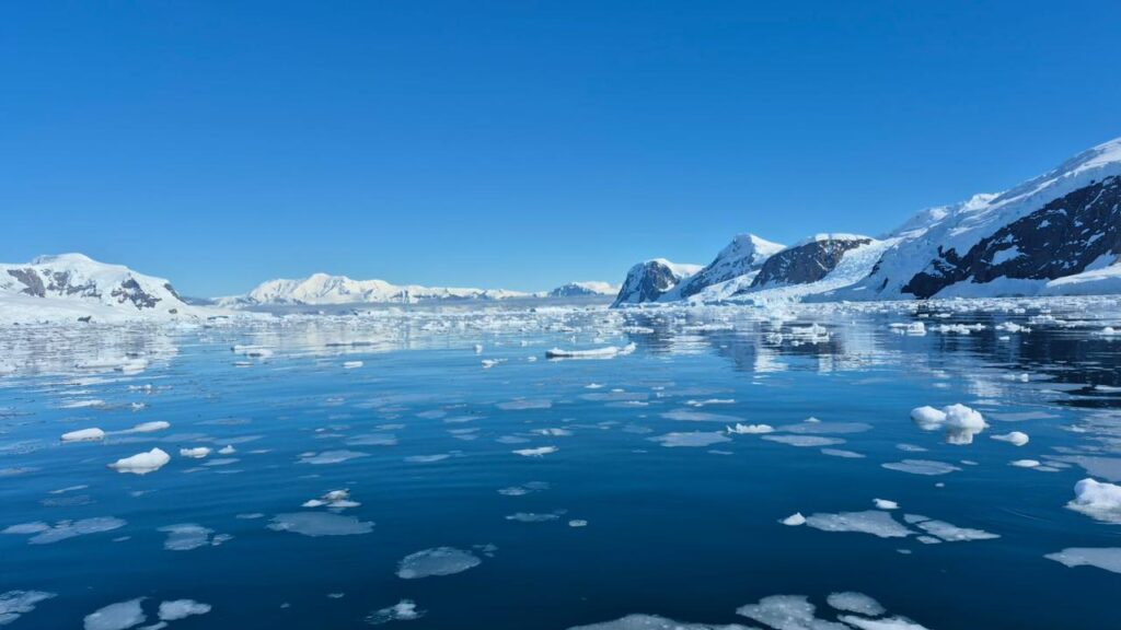
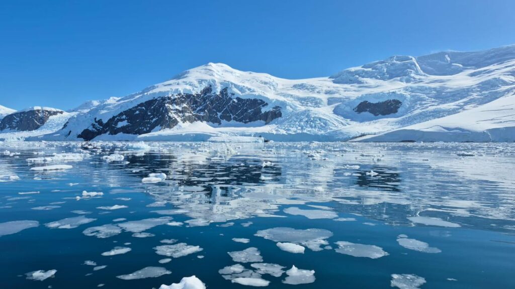
The above photos show the vast expanse of the Drake Passage, where three oceans meet – the Pacific, Atlantic and the Southern Ocean. No land in sight anywhere. Bright, sunny day. The scale of the open ocean was humbling.
We were likely to be on the Antarctic continent by the end of Day 3 or early Day 4, that is, within the next 24 hours.
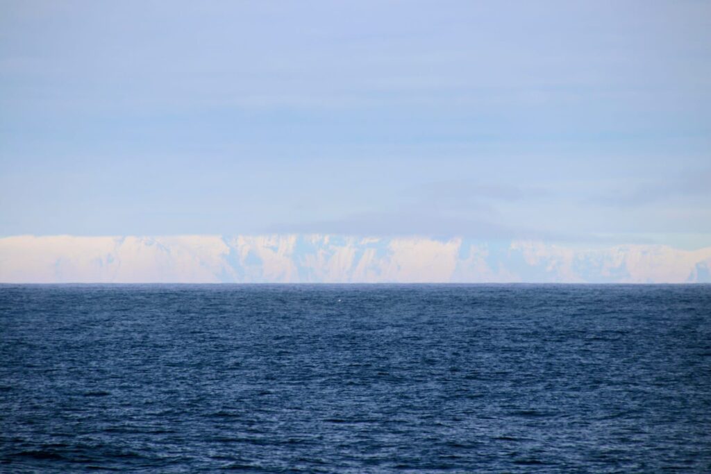
The South Shetland Islands were now in sight – a volcanic archipelago in the Drake Passage, just north of the Antarctic Peninsula. They are considered part of the Antarctic region.
Since we were going on land the next day, one of the expedition leaders checked all of our gear that could potentially touch the surface of Antarctica.
They wanted to make sure that we didn’t carry any dirt, grass, seeds, etc., which might impact the continent. They vacuum-cleaned our bags and gear if necessary. We were not even allowed to pee on the island! During the landings, if we had to pee, we would have to come back to the ship!!
We had nearly completed the dreaded Drake Passage crossing with excellent weather and very little turbulence.

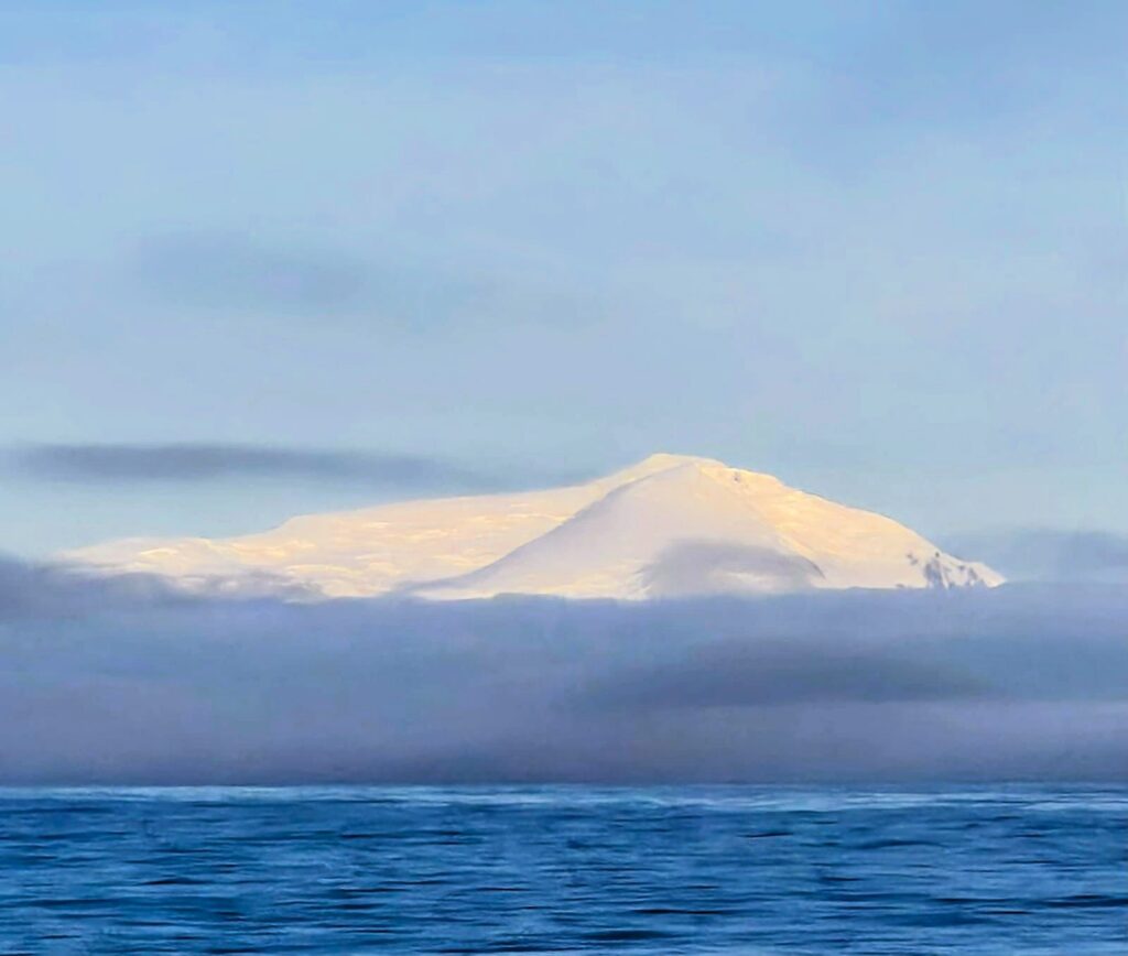
As of 9 pm on Jan 10, we were almost there. The continent of Antarctica was within sight, with its snow-clad peaks.
Tomorrow, Jan 11, we would land on the Antarctic continent. We were quite excited!
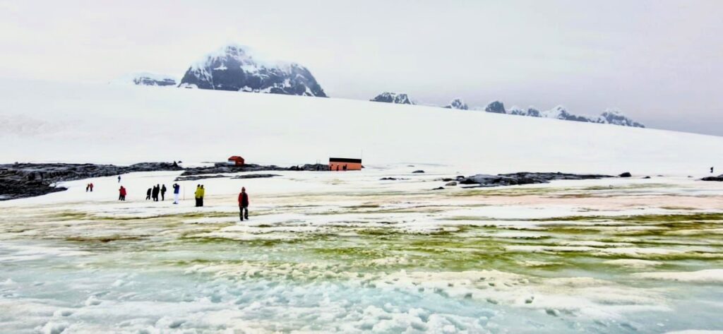
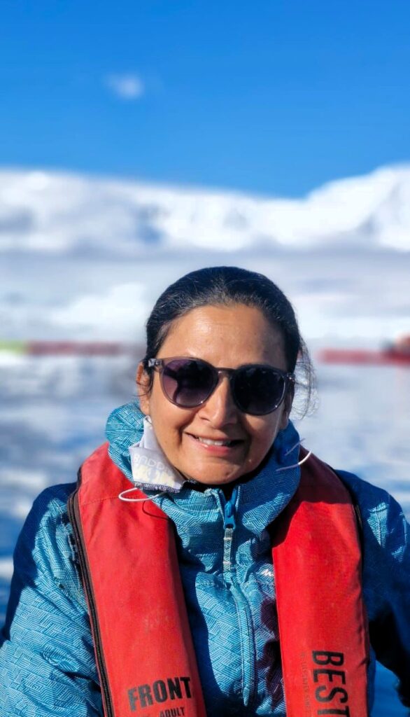
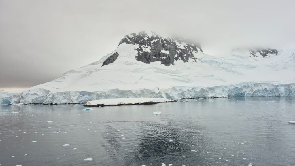
Day 4, Sunday: Jan 11: Port Lockroy, Antarctica
We started the day at 8:30 am by landing at Damoy Point in the Port Lockroy area, originally a British base.
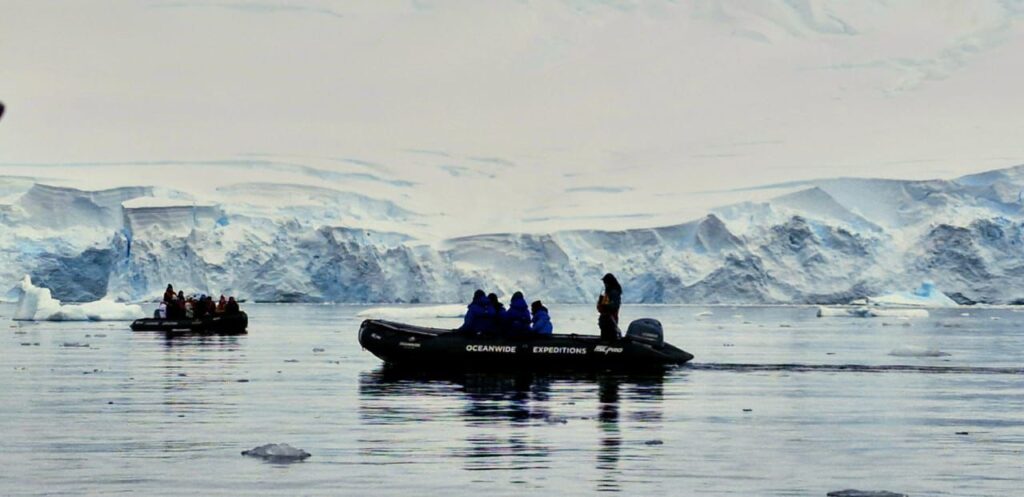
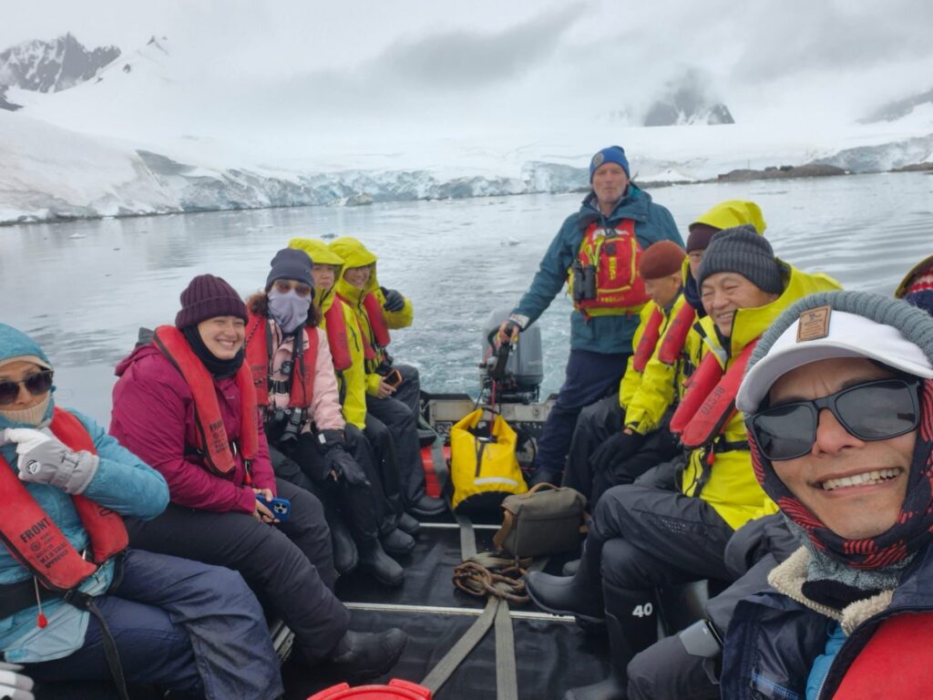
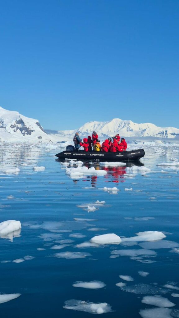
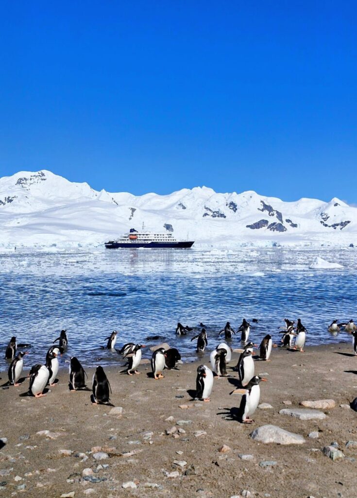
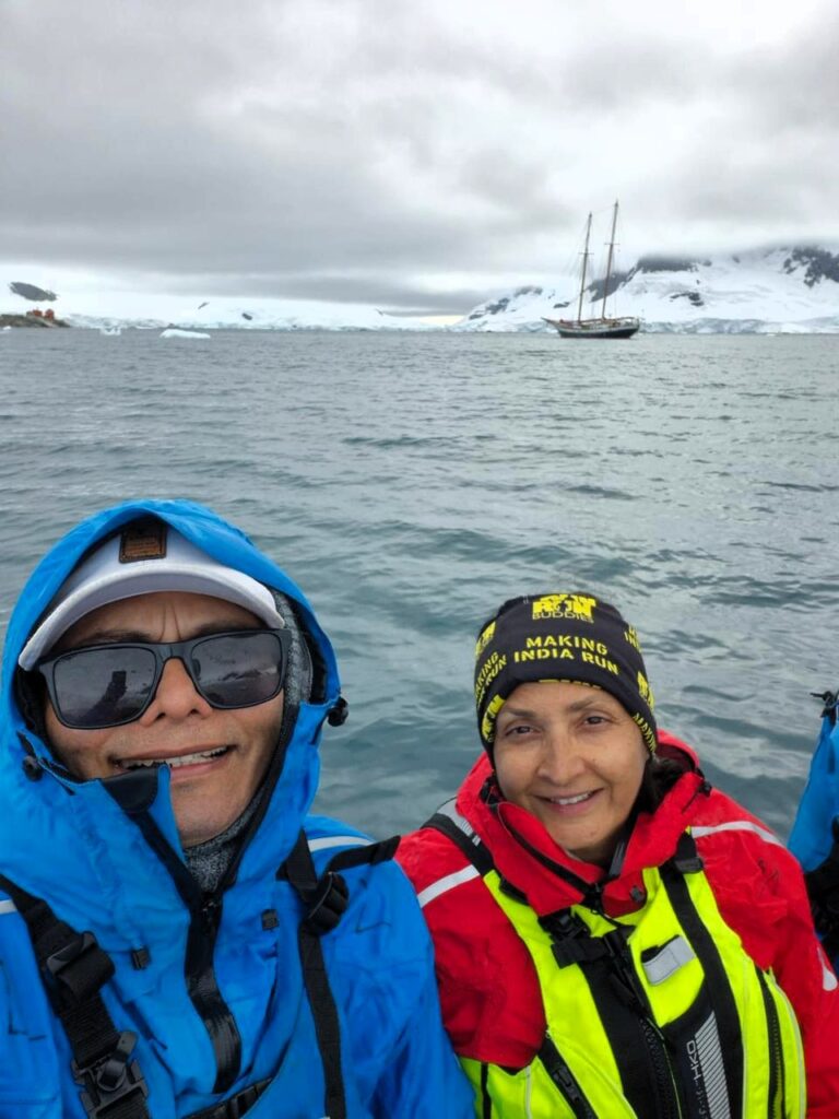
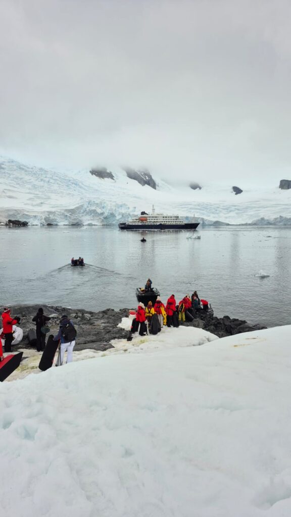
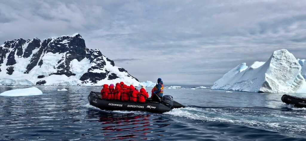
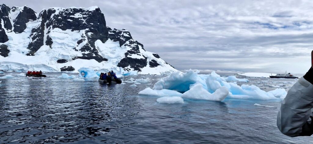
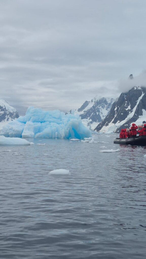
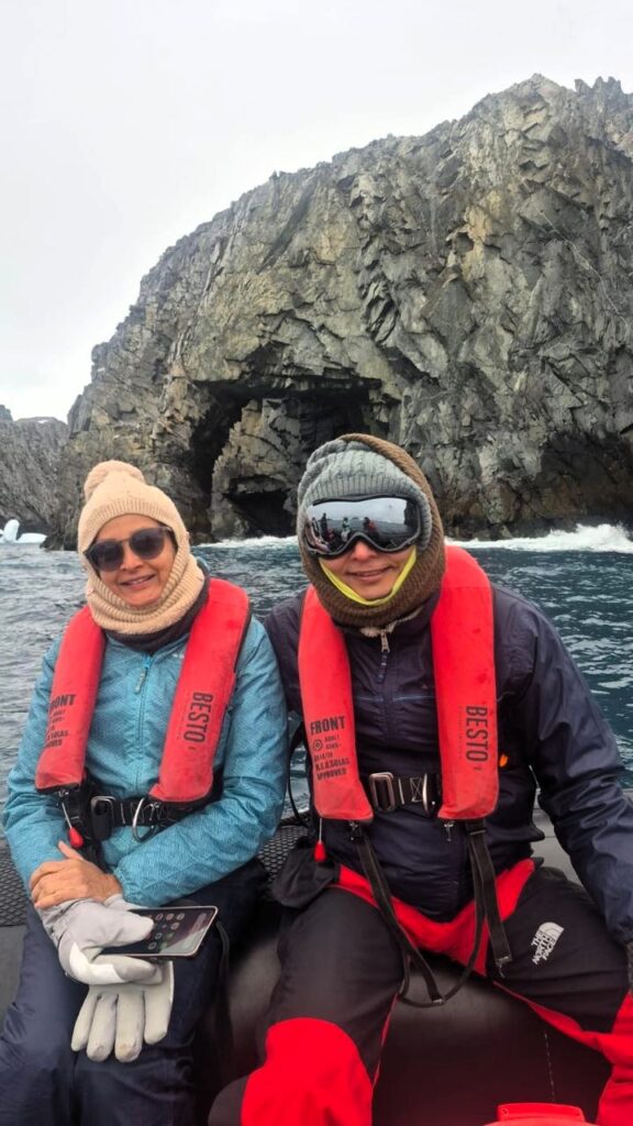
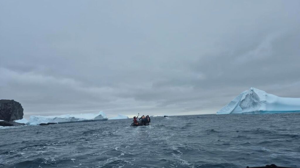
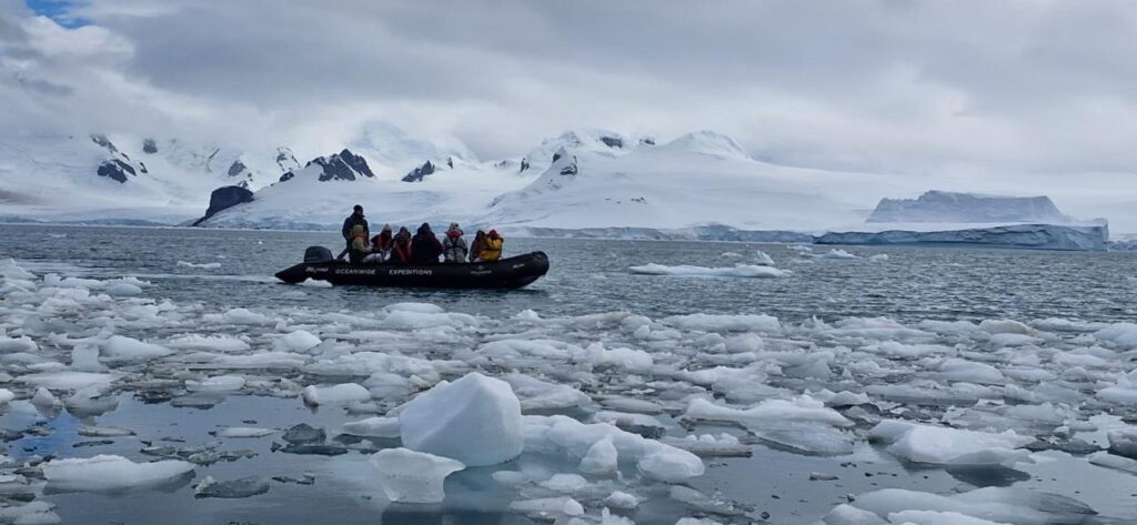
We traveled in zodiacs (small inflatable boats) from the ship to the shore. This was a standard procedure. Only 100 people are allowed on shore at a time. Therefore, the 170 people on the ship were split up into two groups, the red group and the blue group. When the red group went on shore, the blue group went on a zodiac expedition in the water looking for wildlife, and vice versa. We were in the red group.
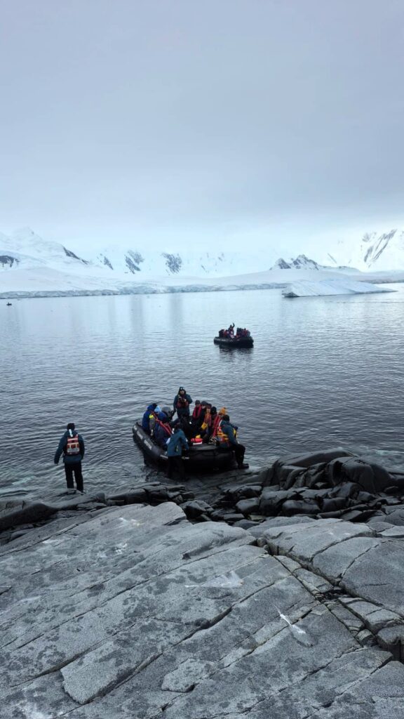
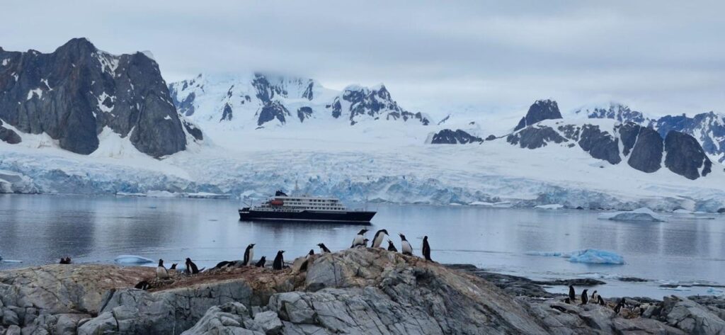
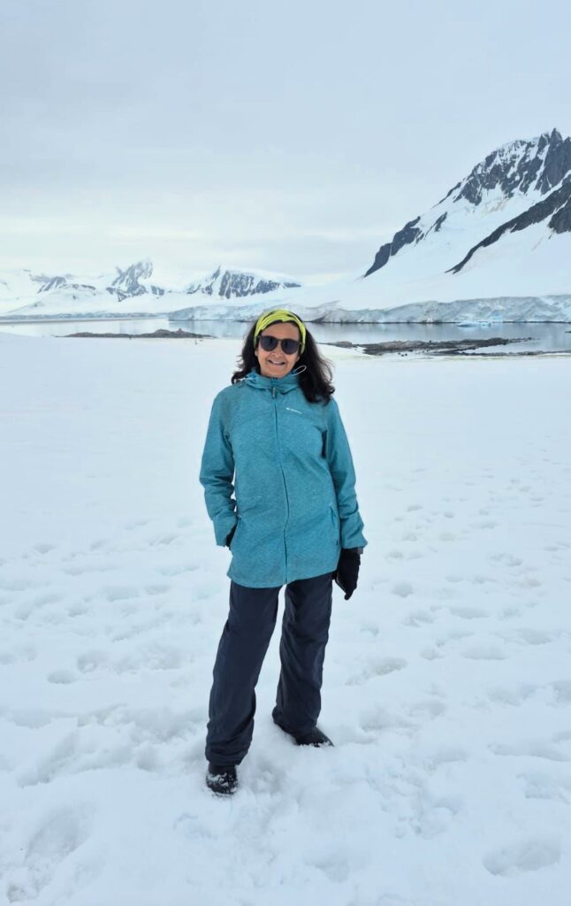
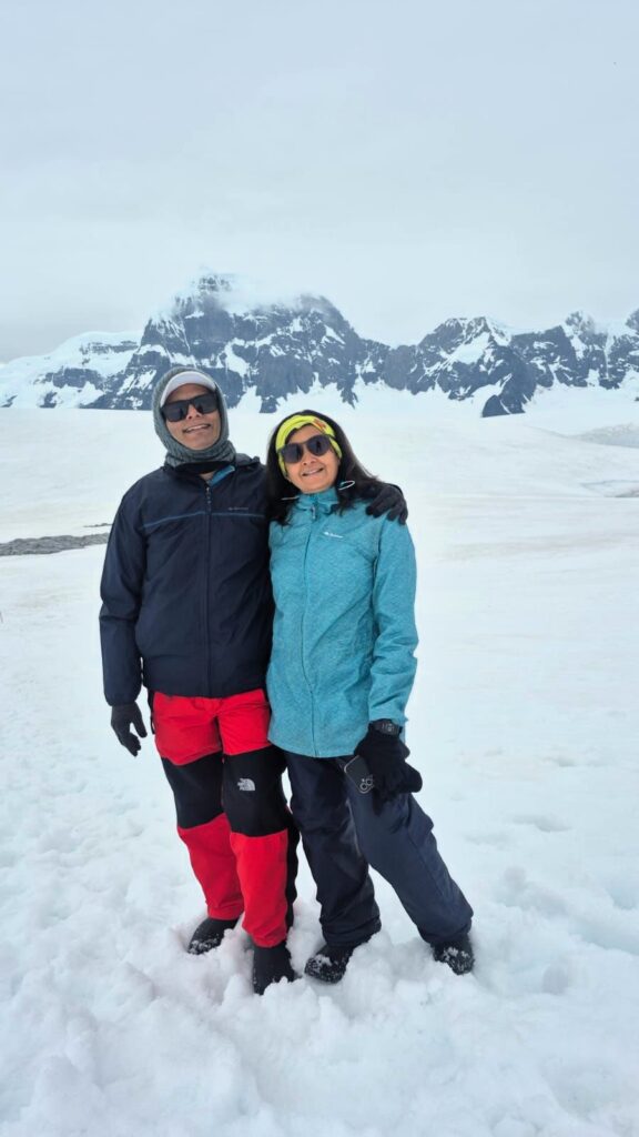
We were happy to have now stepped onto the Antarctic continent, the seventh continent that we have been to. We were now at the 64th parallel below the equator.
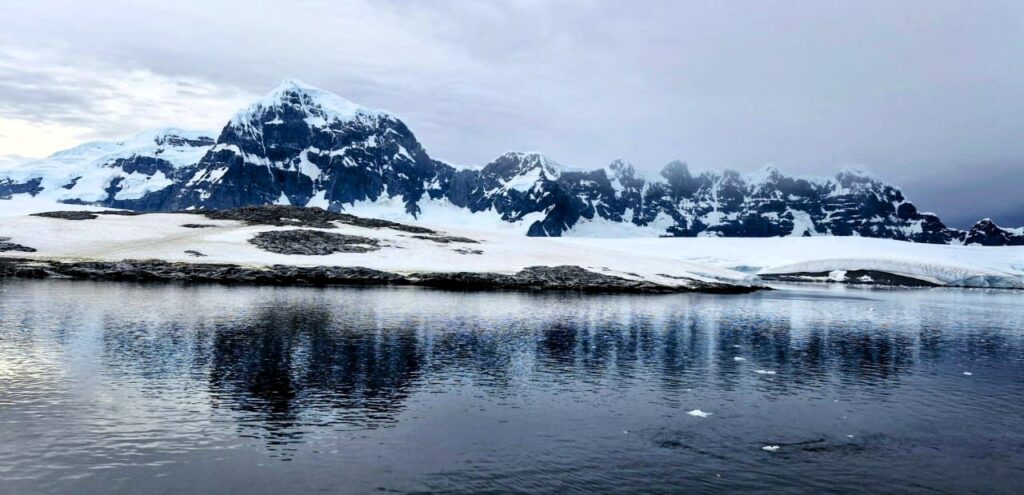
It was also quite mountainous, unlike my expectations of flat land (not sure why I thought that way).
We visited the Damoy Hut at Damoy Point.
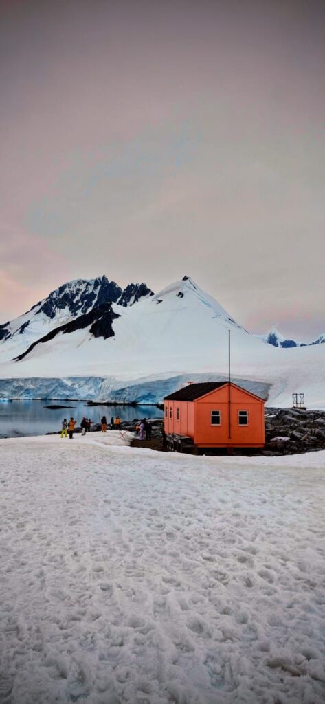
This hut is maintained by the British Antarctic Survey (BAS) as a part of the Port Lockroy establishment that was built during World War Two.
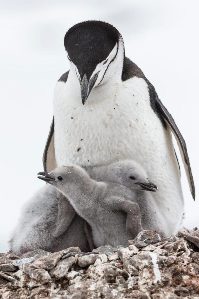
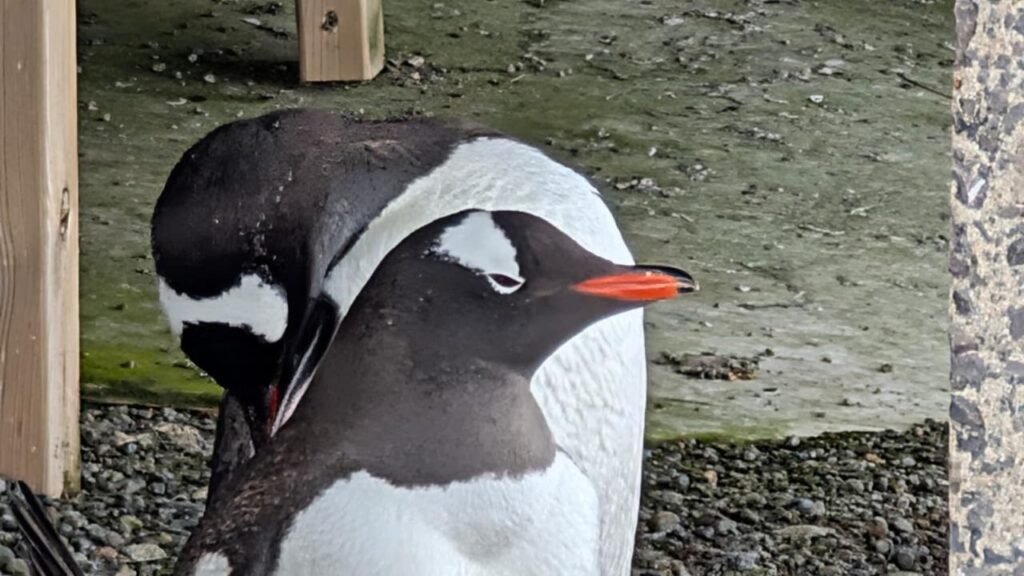
We noticed an interesting interaction. A penguin was tending to her chick. Her mate had just returned from the sea. See the video below.
Penguins walk along preset paths called penguin highways. Watch the video below.
As a tourist, you are not supposed to stand on their highways.
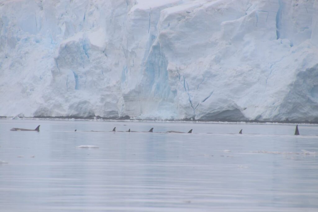
Immediately after the landing, we took a small cruise in the zodiacs to spot some wildlife. We were richly rewarded.
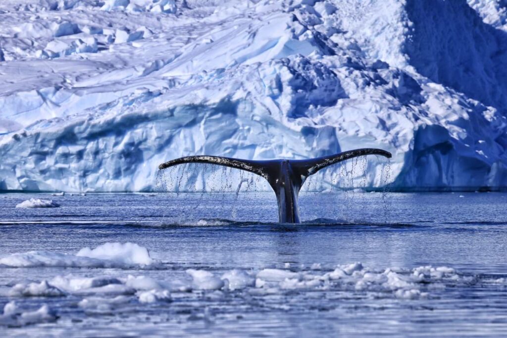
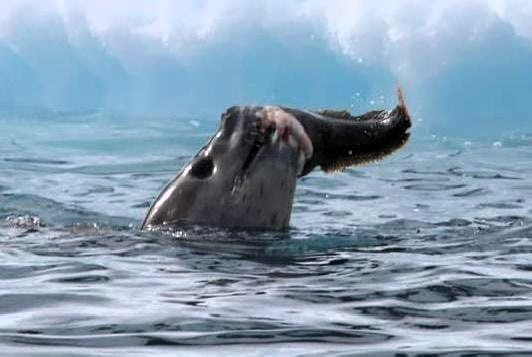
We saw two humpback whales, a minke whale and nearly six orcas.

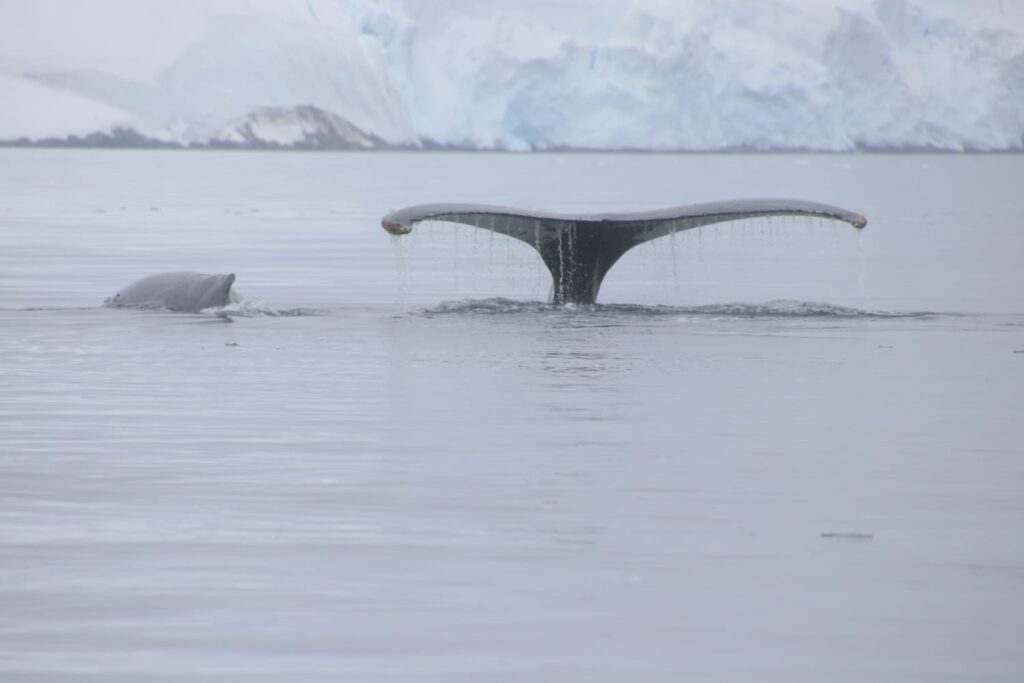
This video shows the “fluking” of the whale, i.e. when the whale dives deep and shows its tail fin:
The guide said he had never seen this much wildlife in one morning ever! I guess they say that to everyone.
We finished our morning activity around 12:30 pm. Our afternoon activity was a zodiac cruise to Goudier Island and Jougla Point around the Port Lockroy area. That activity started at 3 pm.
We saw some great views of Port Lockroy.
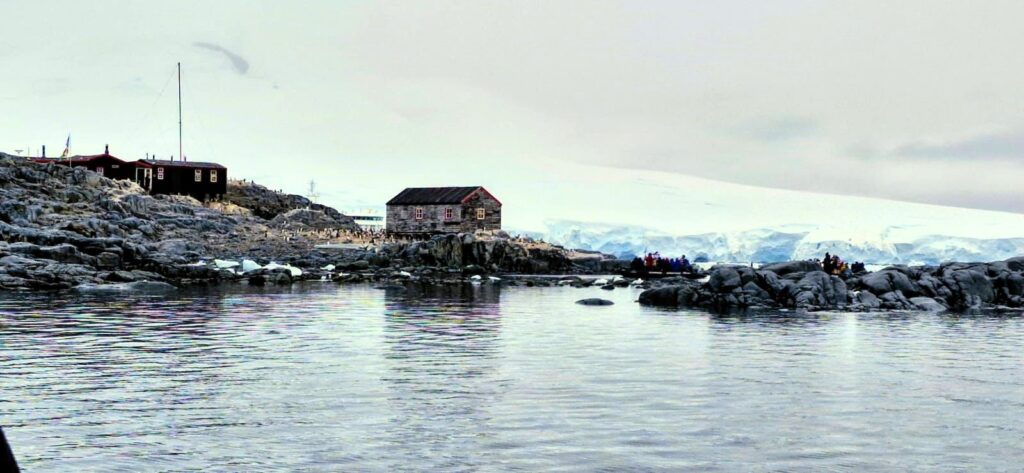
Port Lockroy was established by the British in 1944 during World War Two. It also runs the southernmost post office called the “Penguin Post Office.”
It is faster for the penguins to travel this way because they face less resistance in the air.
We got back to the ship around 5 pm.
A camping trip was a part of the expedition, but we were not able to camp that night because it was slightly raining. In Antarctica, plans are always made on the fly. That is why it is called an expedition, not a cruise. It had been a packed day with never-ending surprises in Antarctica. Great weather. Delightful first day!

Monday, Jan 12: Day 5: Neko Harbor and Skontorp Cove
It was a beautiful day with lots of sunshine – Here is a video showing the landscape:
In the morning at 8:30 am, we boarded the zodiacs and headed into Neko Harbor.
The plan was to cruise around the harbor for about two hours, taking in the scenery and spotting wildlife. The scenery in Neko Harbor was stunning.
The weather was picture perfect— not a single cloud in the sky, bright sunshine and no winds.
The beauty of the place was overwhelming, and we simply could not click enough pictures. See the following video for a sighting of the humpback whale.
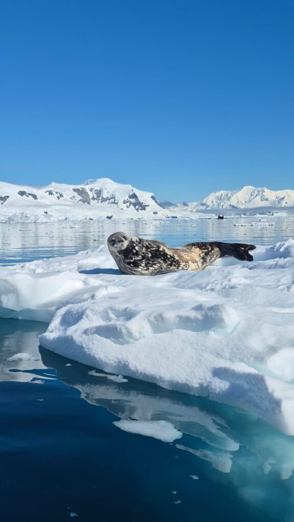
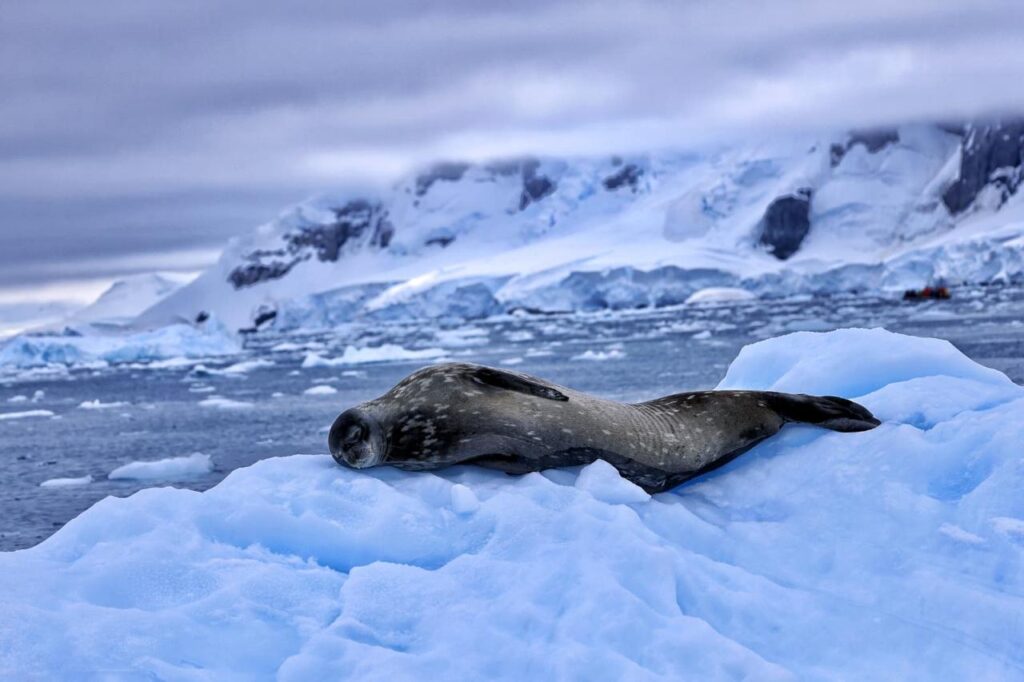
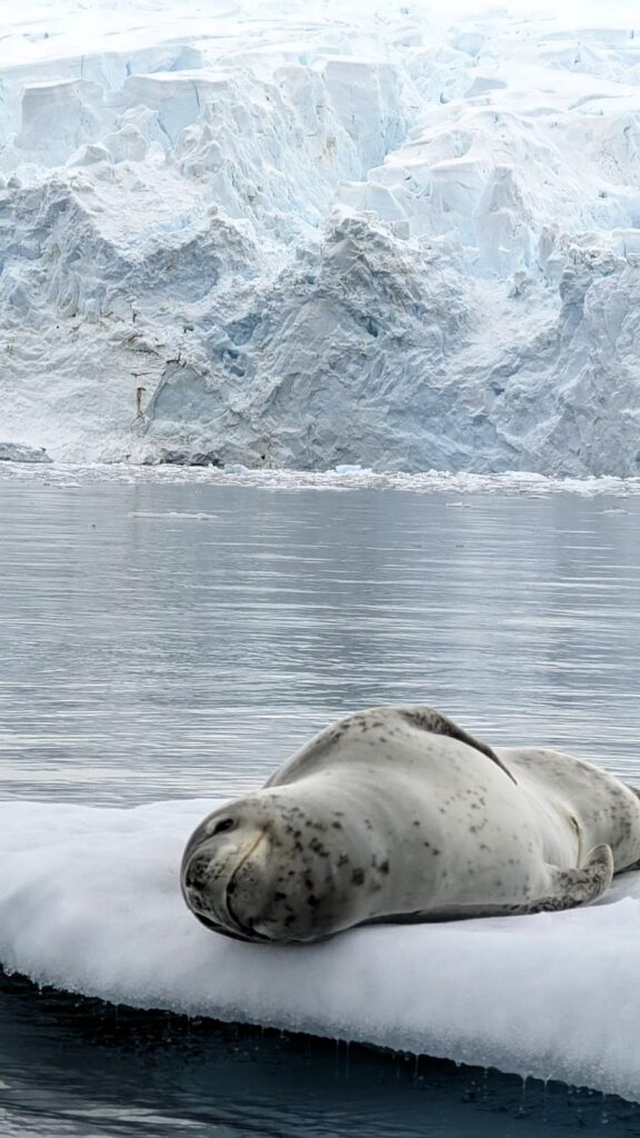
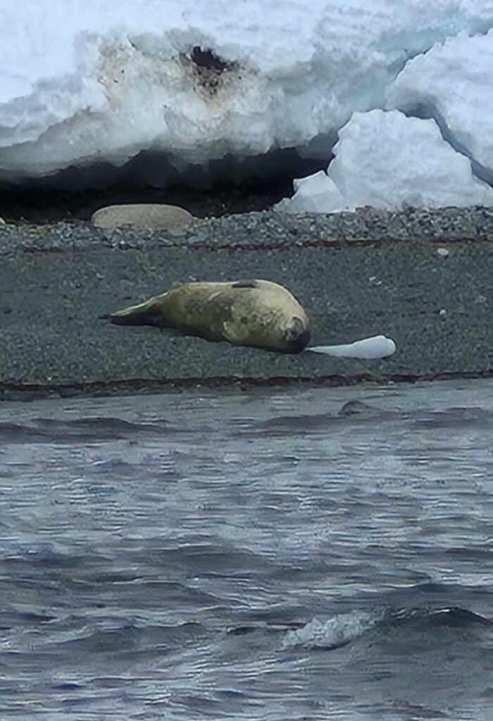
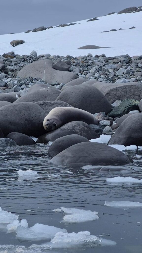
We also saw a Weddell seal up close, lazing around on an iceberg.
Zoom into the photo to see the details.
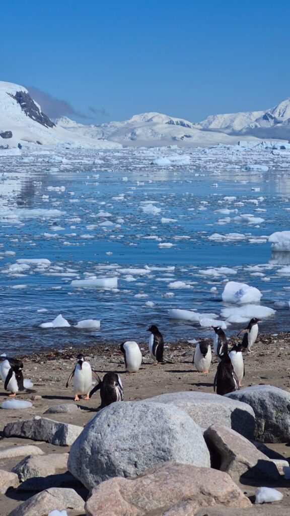
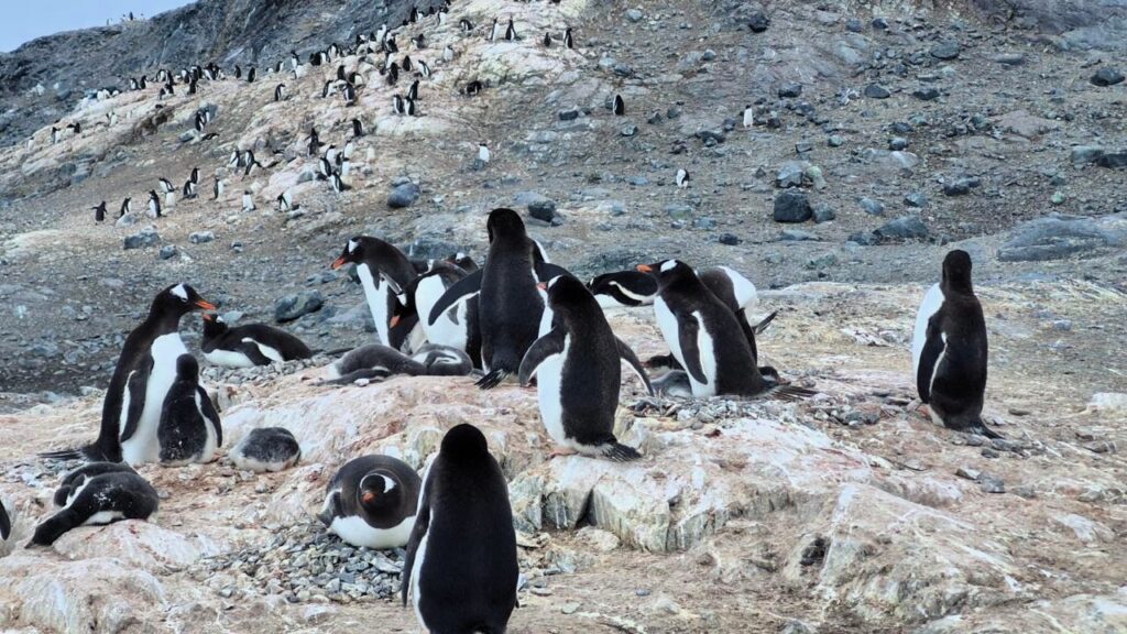
At around 10:30 am, we landed at Neko Harbor and were greeted by thousands of penguins.
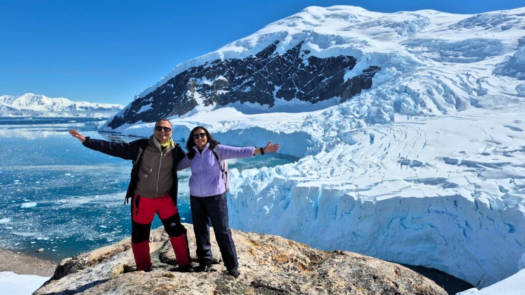
We climbed up to a high point to get a panoramic view of Neko Harbor—an unforgettable sight.
Around 12 noon, we got back on to the ship.
It was a wonderful morning session at Neko Harbor, and it already felt like a full day.
In the afternoon, around 3:45 pm, we proceeded for a kayaking activity in Skontorpe Cove in the area of Paradise Bay.
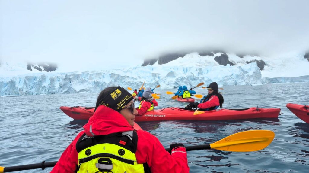
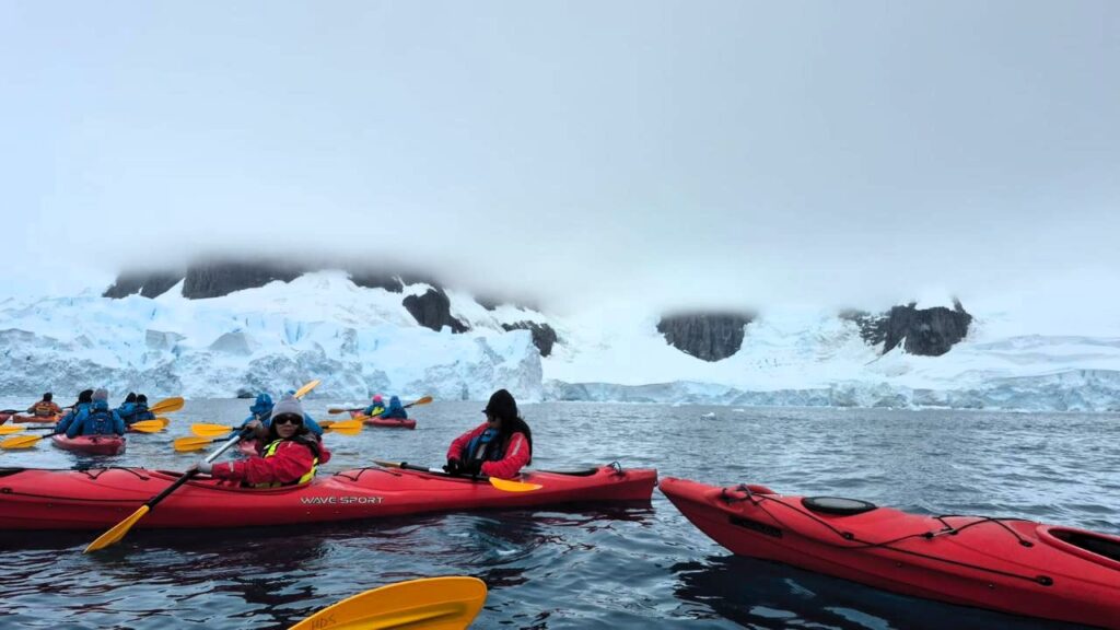
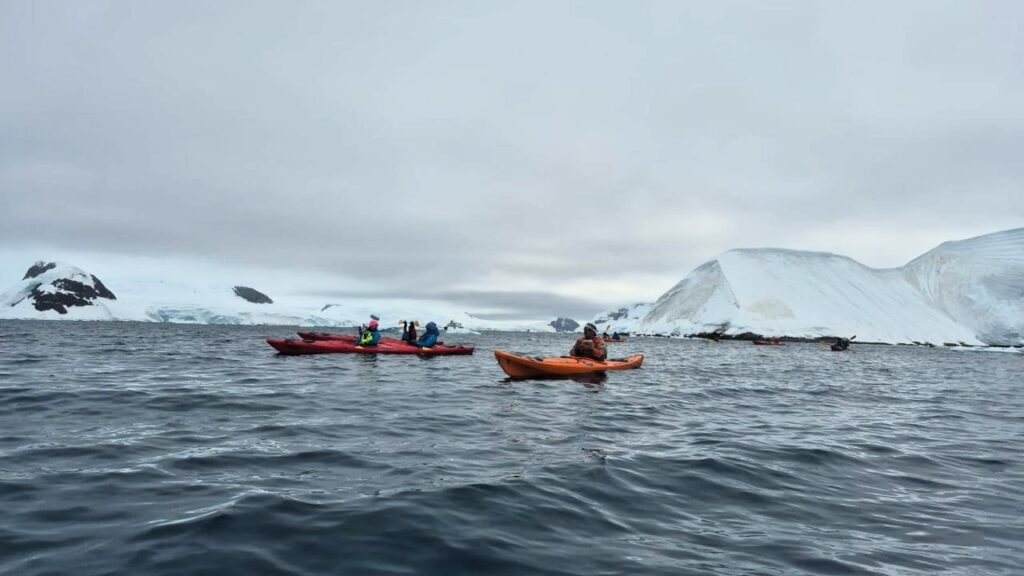
We got up close to the glacier and witnessed the calving of a glacier. Typically, such calving produces a mini tsunami, so we were ready to run away from the glacier. 😁 The raw power of nature was on full display.
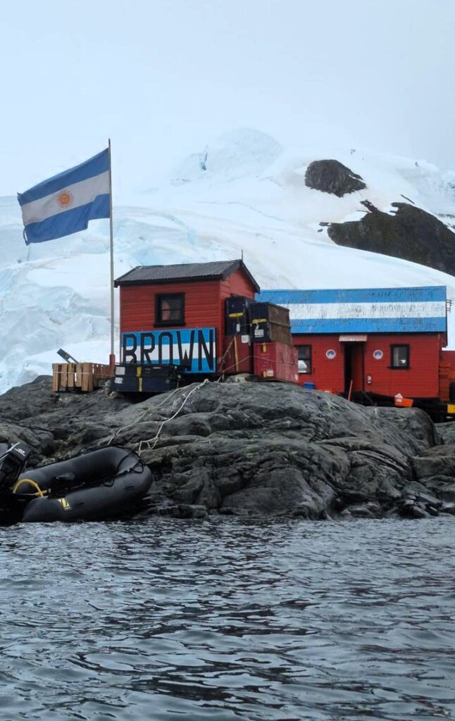
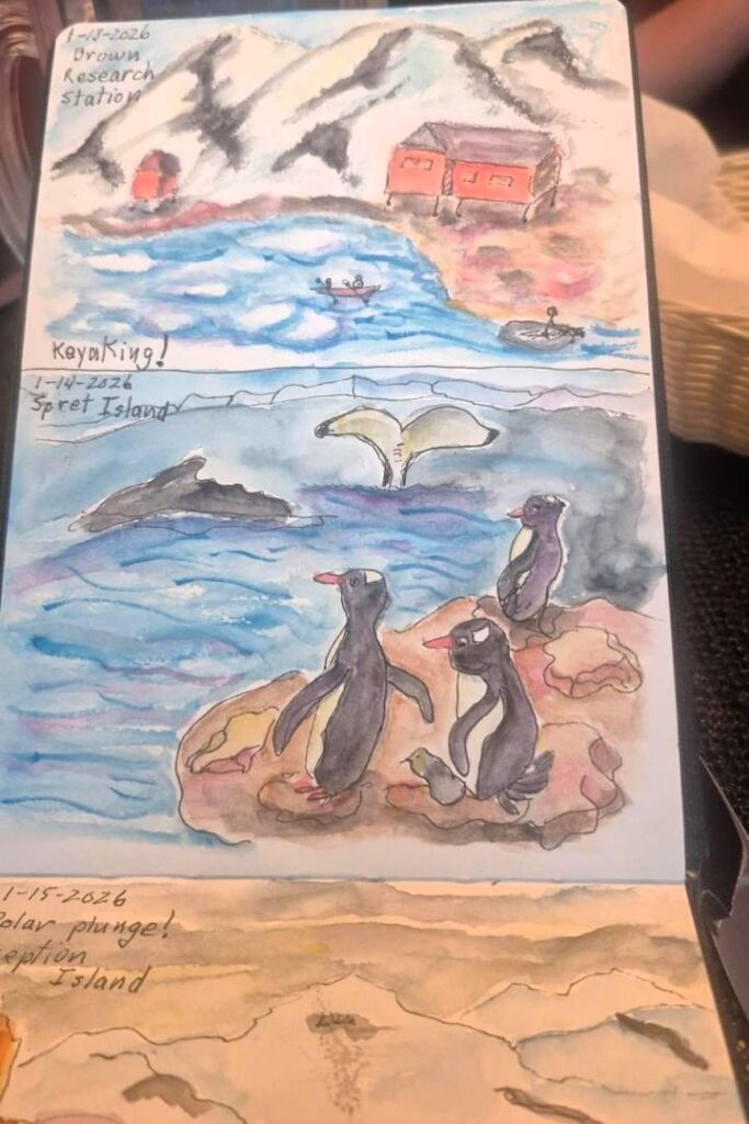
We kayaked to Brown Station, an Argentine research station named after Argentine admiral William Brown.
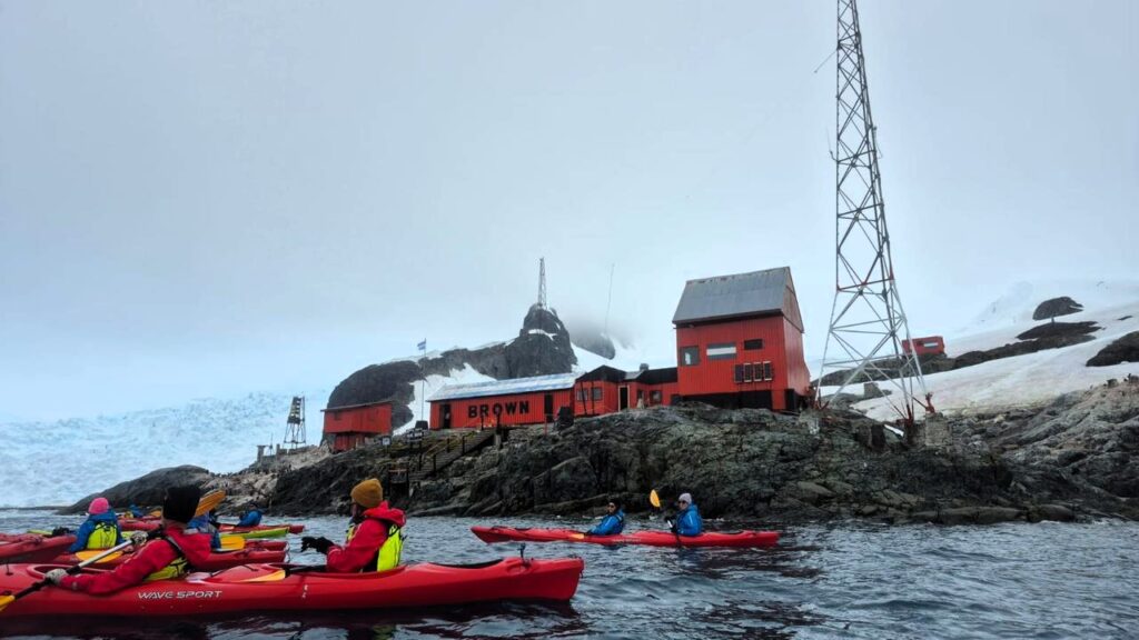
The station has been in existence since 1951.
We got back from the kayaking activity around 6 pm.
After a short break, we started getting ready for the night camping activity around 9:30 pm, where we would sleep on the snow on the Antarctic continent at Paradise Harbor.
On Monday night, Jan 12, at around 9:15 pm, we headed out again in the zodiacs for the night camping activity.
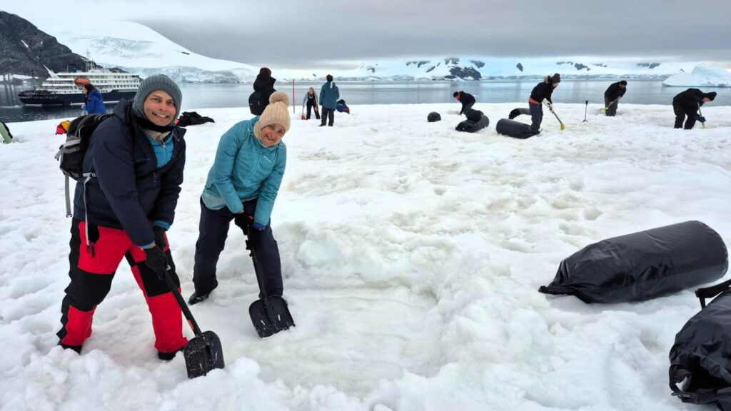
We dug a hole in the snow and lay down in it in the open, inside a sleeping bag covered by a bivy bag.
We also had to dig a wall to stop the wind coming from the direction of the bay. It felt like building a small home in the snow!
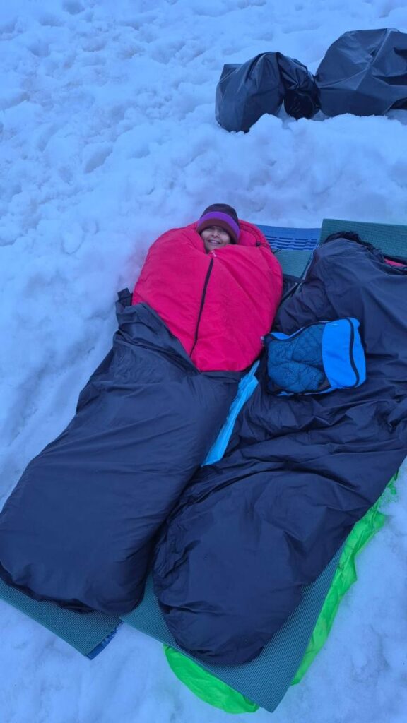
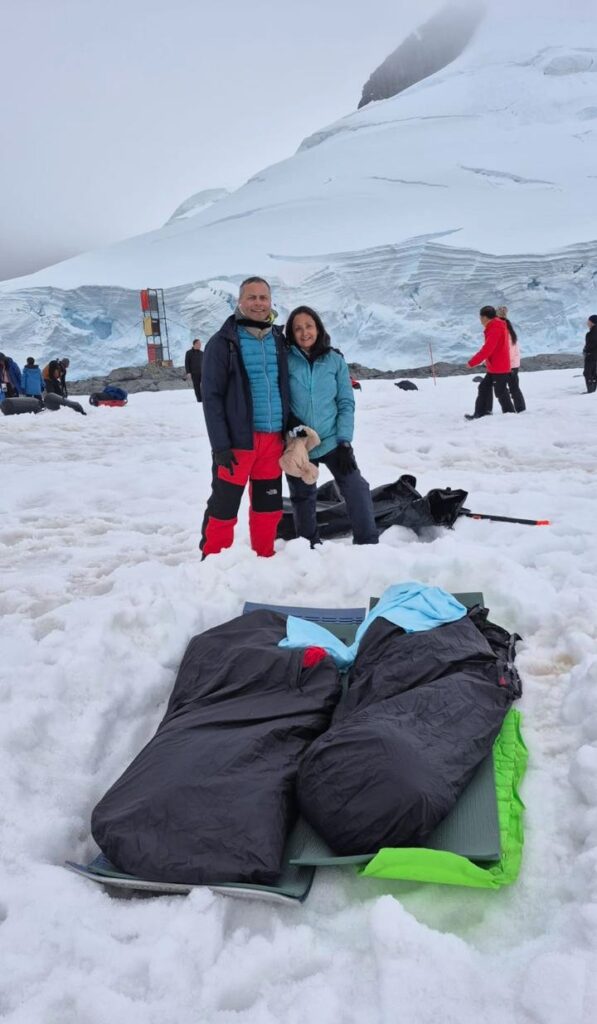
We were to camp on an island close to the glacier.
The temperature was around 0°C. Sleeping on the snow in the open, on the Antarctic continent, was a truly unique experience.
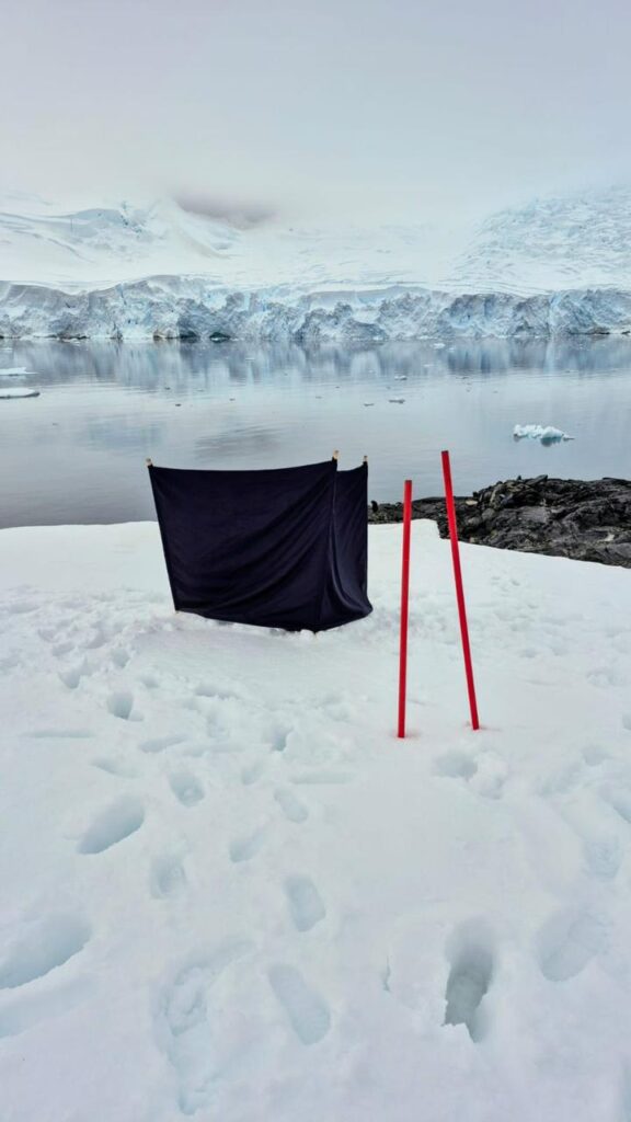
This was the toilet tent.
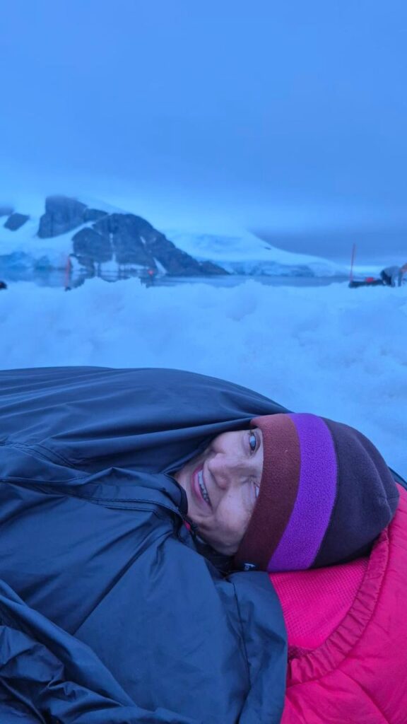
All of us—Jai, Anu and I—slept reasonably well. We were woken up at 4 am and greeted by the serene calmness of the Antarctic scenery, quiet and surreal.
A zodiac picked us up around 4:30 am and brought us back to the ship. Monday, Jan 12, turned out to be an action-packed day around Neko Harbor and Paradise Harbor.
- Zodiac cruise plus landing in the morning.
- Kayaking in the afternoon.
- Open-air camping in the snow on an Antarctic night.
What a day!
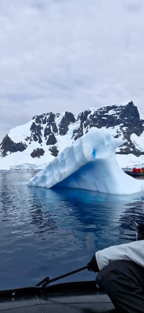
Tuesday, Jan 13: Day 6: Lemaire Channel and Petermann Island
Our first outing of the day started with a zodiac cruise at 8:30 am.
We sailed along the Lemaire Channel, named after a Belgian explorer of the Congo.
It is a narrow strait between the Antarctic mainland and Booth Island.
The channel is 11 km long and was first traversed in 1898.
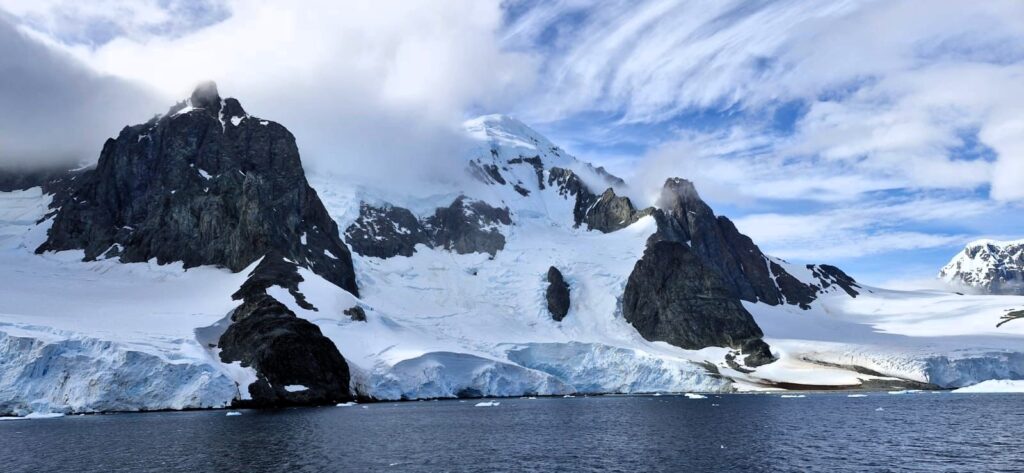
The Lemaire Channel, nicknamed the “Kodak Gap” by some, is one of the top tourist destinations in Antarctica.
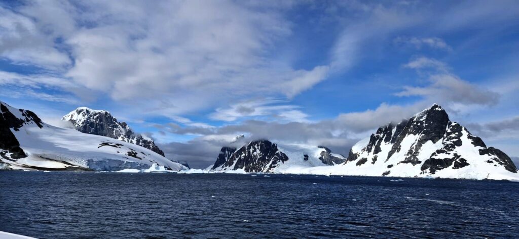
Steep cliffs hem in the iceberg-filled passage, which is 11 km long and just 600 metres wide at its narrowest point. It is easy to see why photographers love this place.
This channel is so full of icebergs that it is possible to cross it in a zodiac only once in 2–3 years. We were lucky enough to get conditions that allowed us to cross it in a zodiac. The sense of being somewhere truly rare was unmistakable.
The scenery was too good.
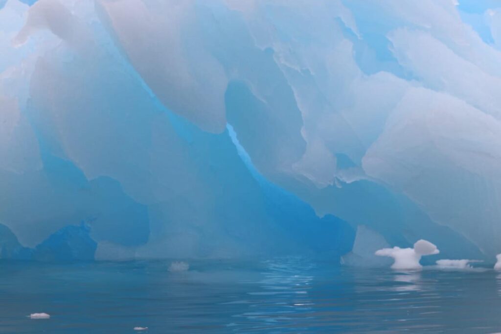
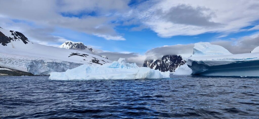
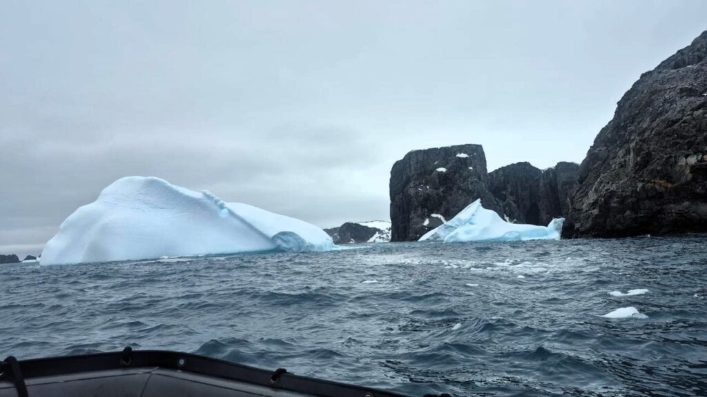
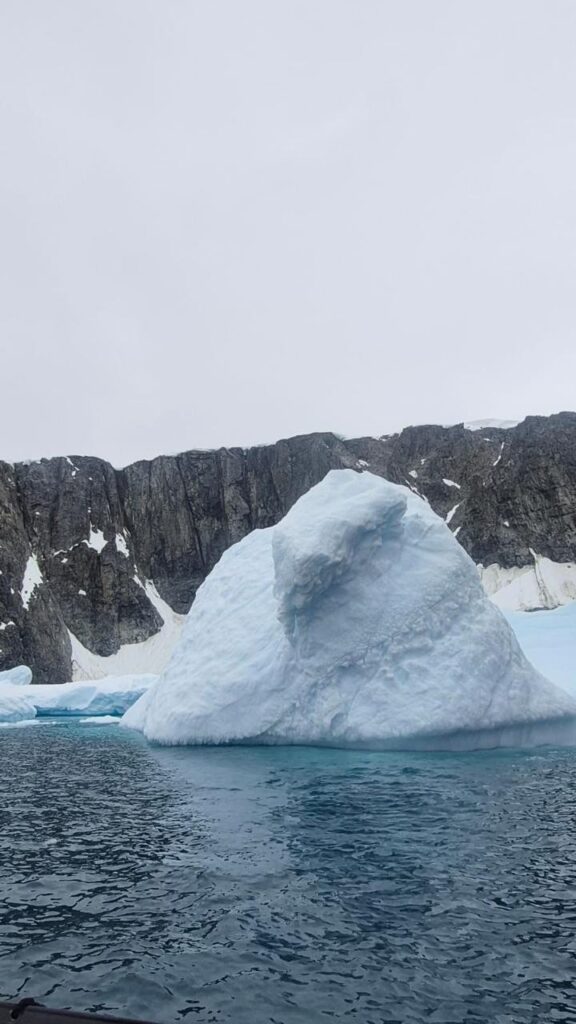
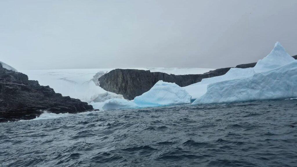
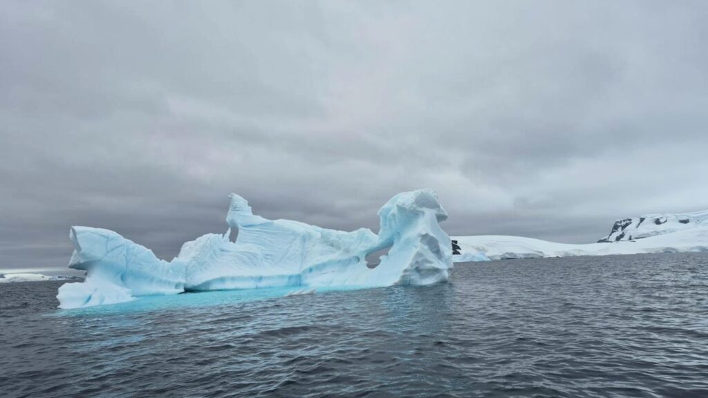
We saw several interesting iceberg formations.
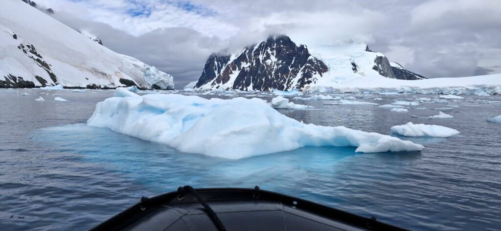
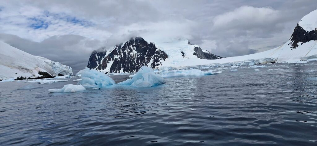
It was fascinating to see how nature carves out such striking sculptures from ice.
We reached our destination, Petermann Island, at around 12 noon. This marked the end of our morning excursion.
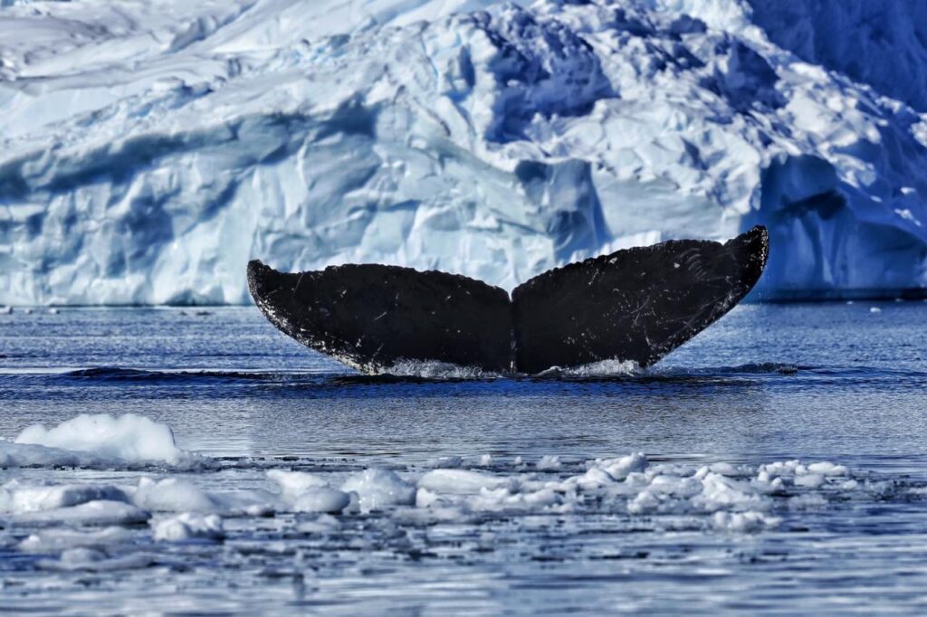
In the afternoon, around 2:30 pm, we first went on another zodiac cruise near Petermann Island. Once again, we saw whale fluking — an iconic Antarctic experience.
Whales do this when they want to dive deep. They lift their bodies slightly and then dive, with their tail rising into the air as they complete the dive.
The last activity of the day was a landing on Petermann Island, where Adelie penguins were present in large numbers.
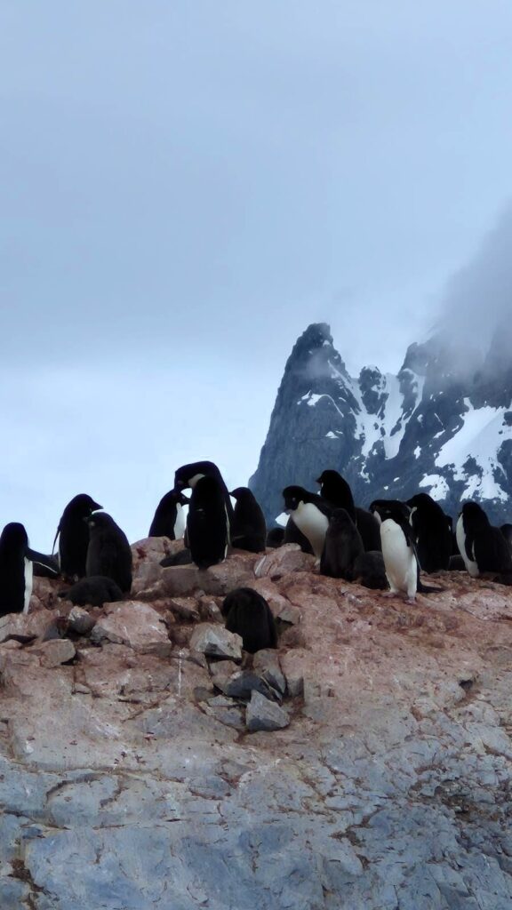
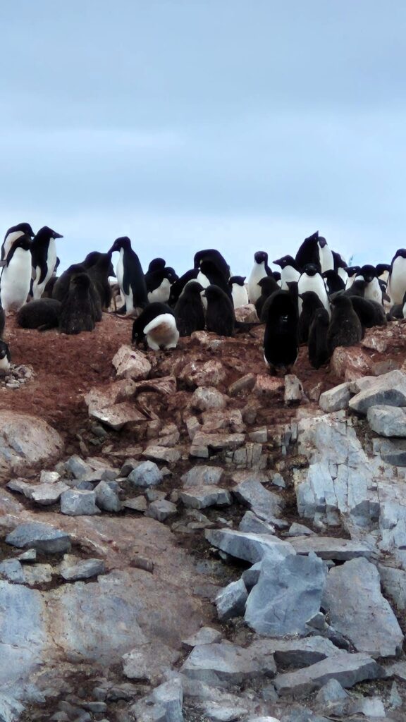
Unlike Gentoo penguins, Adelie penguin beaks are black.
There were large penguin colonies, but penguin poop smells incredibly bad, so we had to get out of there asap.
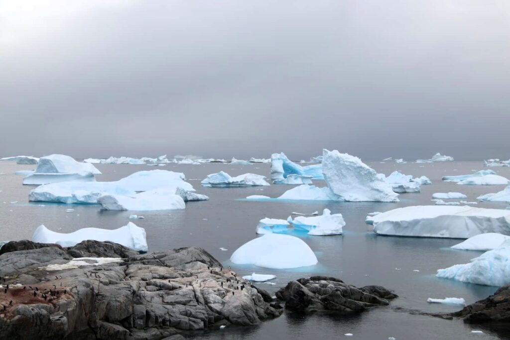
Wind and water flow bring a lot of icebergs here and tuck them away in one corner. The icebergs lie in the graveyard for a long time, slowly changing shape.
The ship has a photography expert, Valeria. She took some amazing pictures of us in front of the iceberg graveyard.
We returned from Petermann Island around 5 pm. We ate our dinner and retired early.
Wednesday, Jan 14: Day 7: Spert Island, Mikkelsen Harbor, Mikkelsen Island
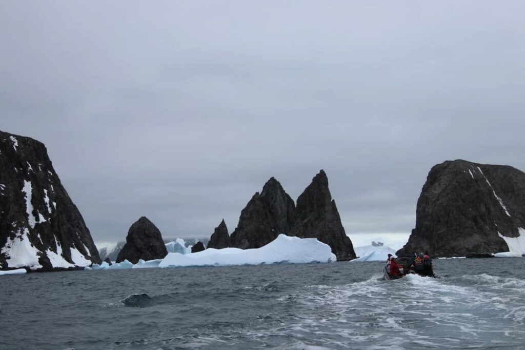
Around 9 am, we went on a zodiac cruise around Spert Island.
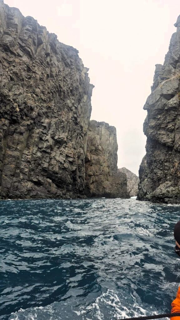
This island is distinct because of its jagged, rocky formations, arches, and water running through the arches. From the very start, the landscape felt dramatic and different from what we had seen earlier.
Unlike the other cruises, where we were mostly looking for animals, we spent a lot of time simply admiring these amazing rocky formations. Nature was clearly the star here.
Our zodiac went through some of these arches. Pretty cool experience.

We felt really tiny in our zodiac boats in the open seas. The scale of the surroundings made that feeling unavoidable.
The seas were really choppy. We could sometimes feel scared when we saw tall waves coming at us, especially in such small boats.
In the afternoon, around 3 pm, our ship was parked in Mikkelsen Harbor, named after a whaler who died in an accident here in 1910. The harbor is located at the southern end of Trinity Island.

Notice that Petermann Island was the southernmost point we had reached, and we were now retracing our path back north toward the Drake Passage.

We did a zodiac cruise of Mikkelsen Harbor starting at 3 pm.
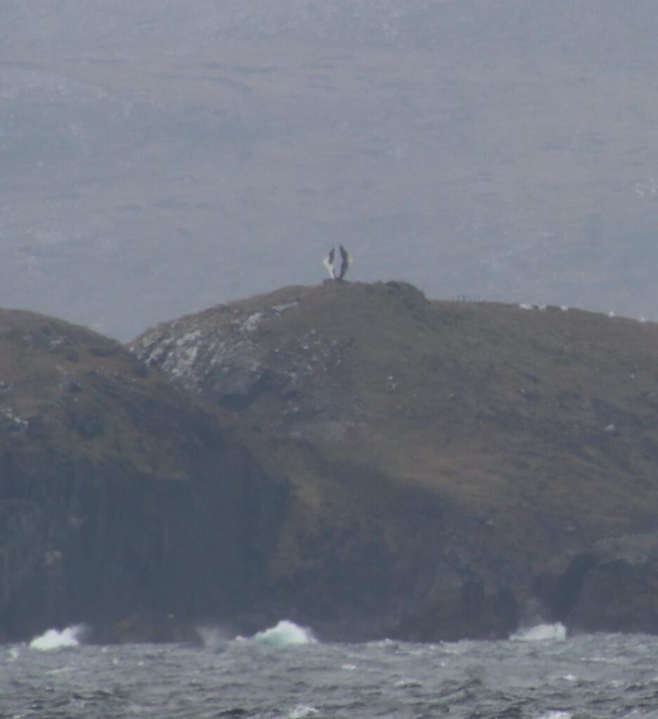
We saw Weddell seals, an elephant seal, and a leopard seal (which usually lies on icebergs).
We also spotted a giant petrel bird (white color) and several beautiful iceberg formations.
Wildlife sightings continued to pleasantly surprise us.
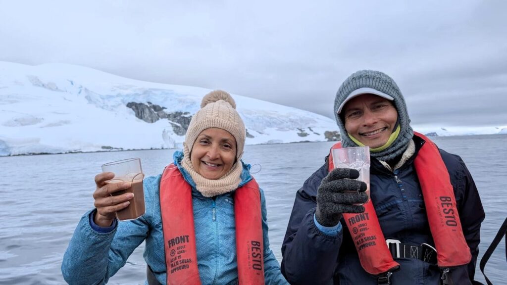
During our afternoon cruise, we had an unexpected surprise waiting for us. In the middle of the harbor, there was a zodiac waiting to serve all the guests hot chocolate. That was really cool!
After the cruise, around 4:15 pm, we landed on D’Hainaut Island, a tiny island within Mikkelsen Harbor.
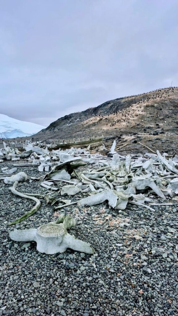
The island was used as a whaling station when hunting whales was prevalent until the 1950s.
Lots of whale bones from dead whales.
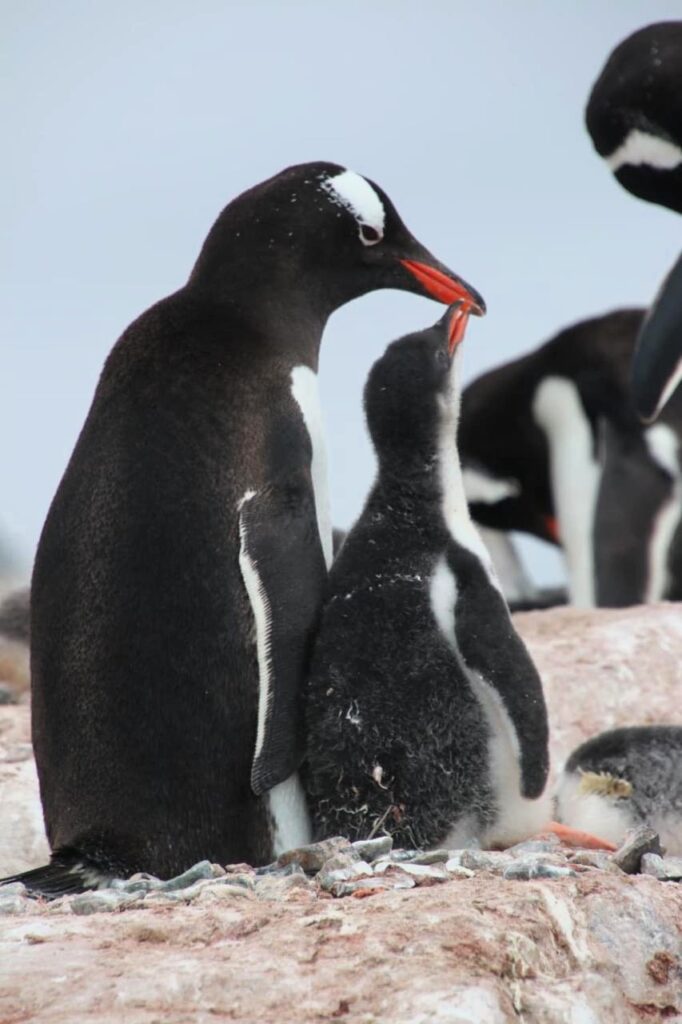
On the island, we also saw penguin chicks being fed by their parents. It was really cute!
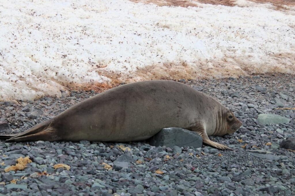
Elephant seals are more active in the water. They can dive as deep as 1,500 ft. The male seals are twice as big as the females!
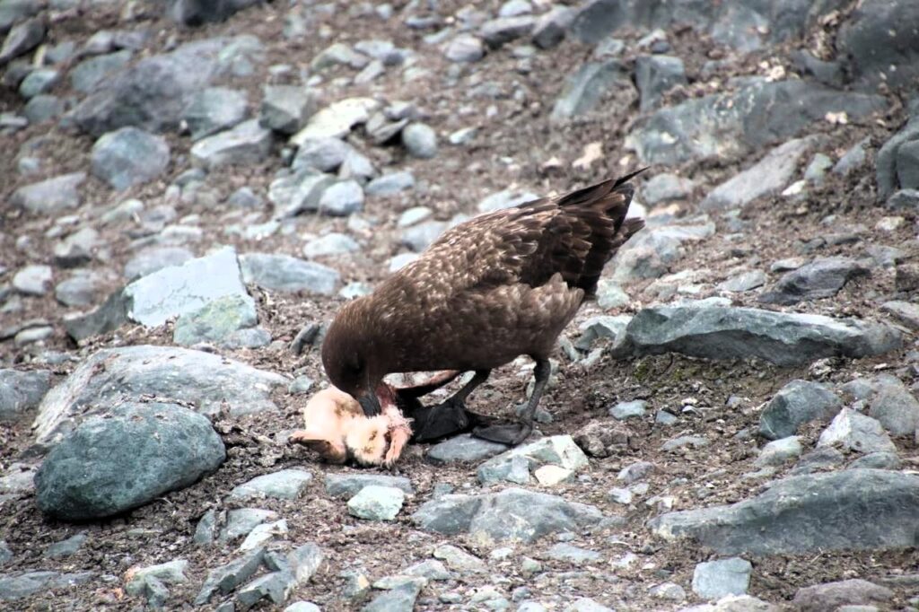
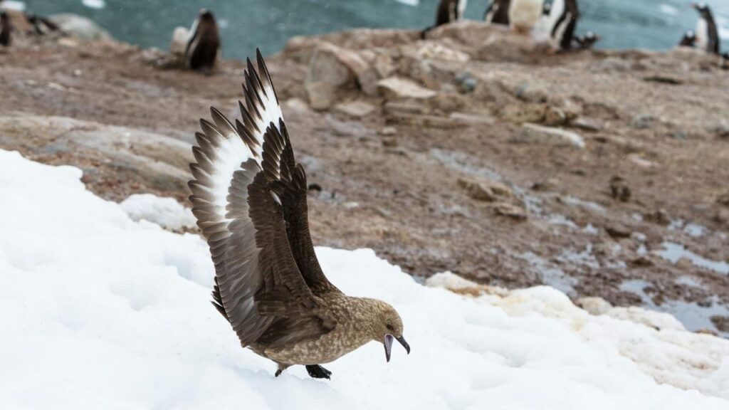
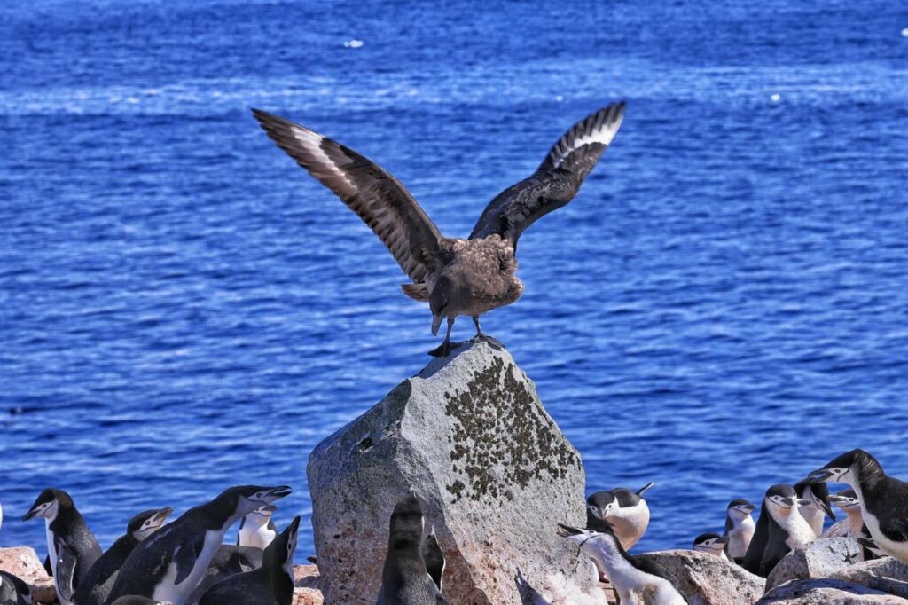
If a mother penguin leaves her baby unprotected, a skua is likely to prey on it. It is brutal, but this is how nature works…
We saw multiple penguin colonies on the island.
But penguin colonies smell bad because of penguin poop.
In this case, the entire island was covered with penguin poop. We had to thoroughly wash our shoes and pants when we got back to the ship.
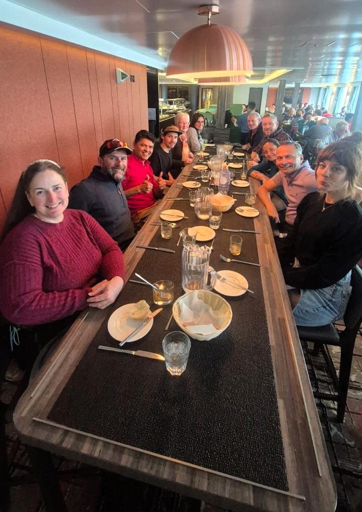
We got back onto the ship around 5:15 pm. In the evening, there was a barbeque party on the deck.
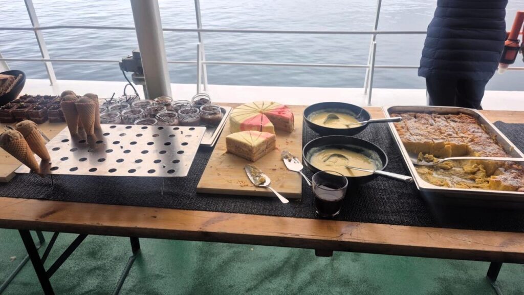
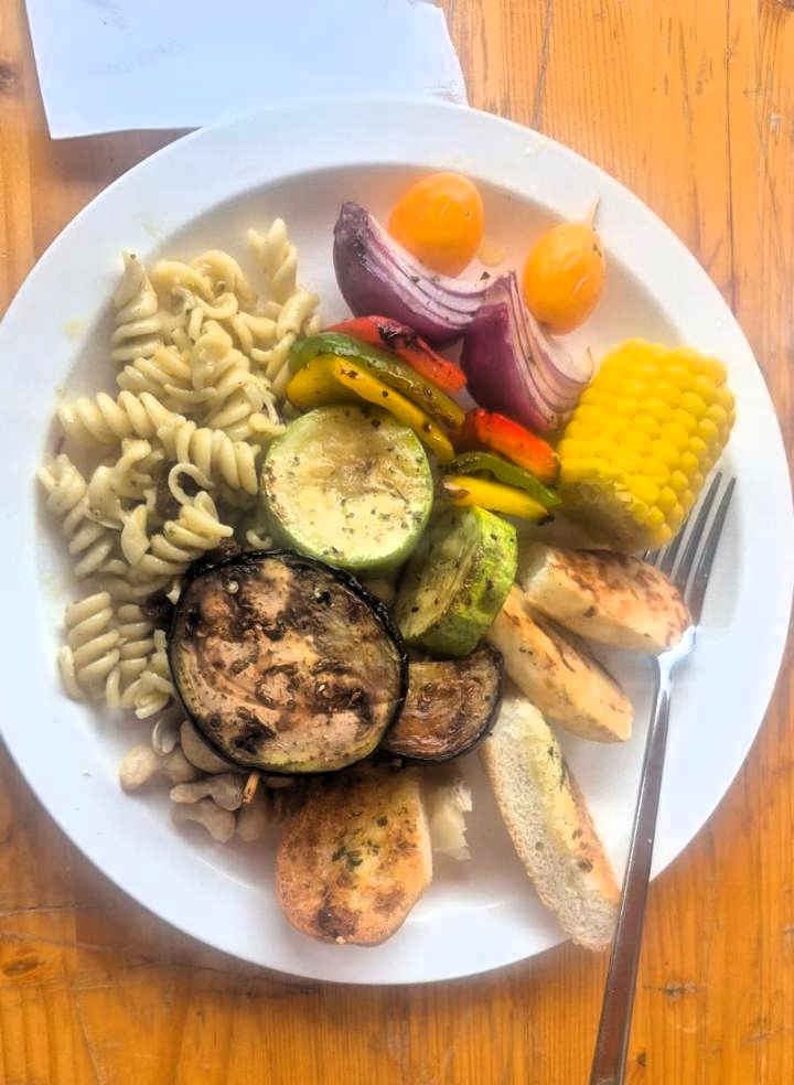
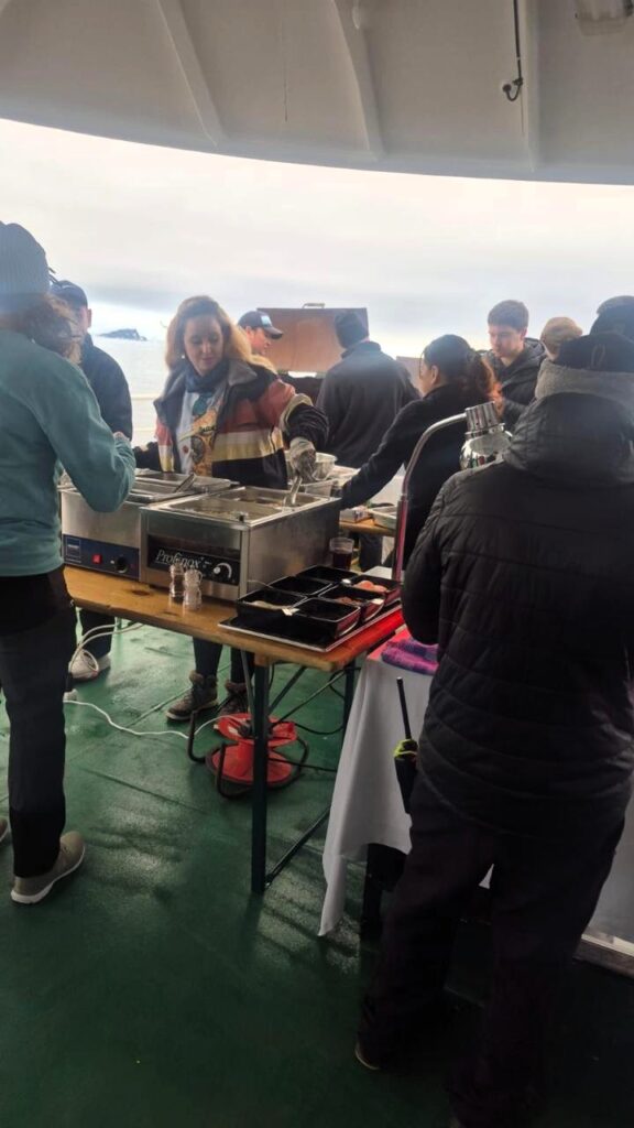
Lots of food, wine, beer, and dessert.
This was followed by dancing. One of the stewards named Prince led the dance moves. Everyone joined in and got on the dance floor.
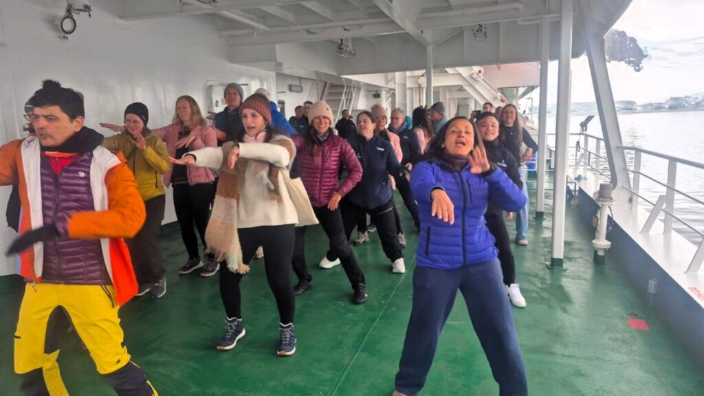
A great way to finish the day!
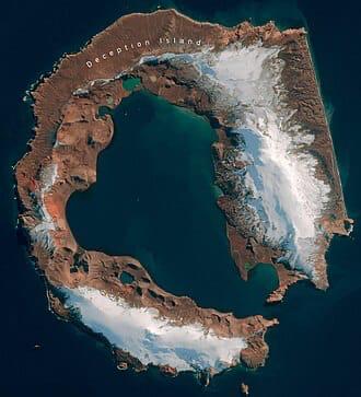
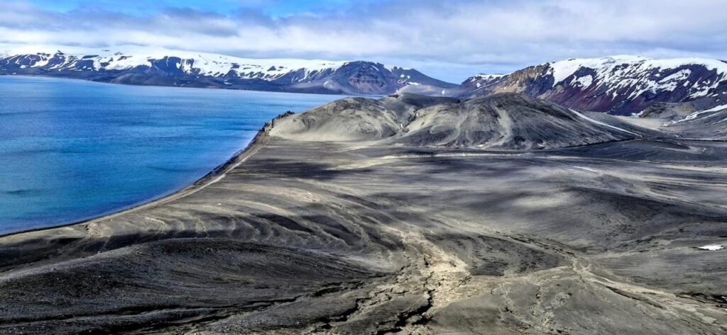
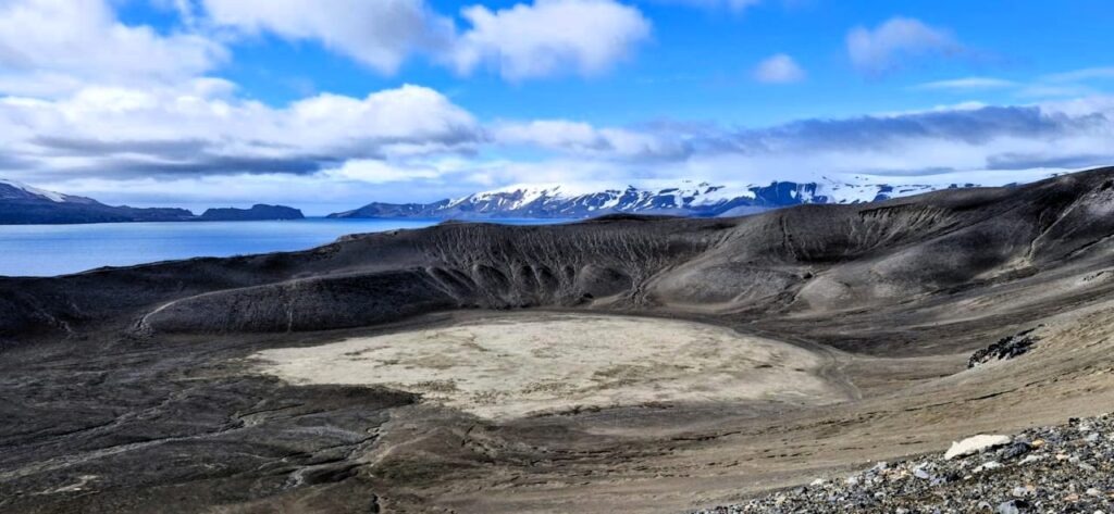
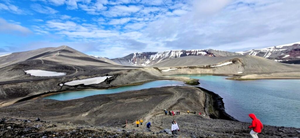
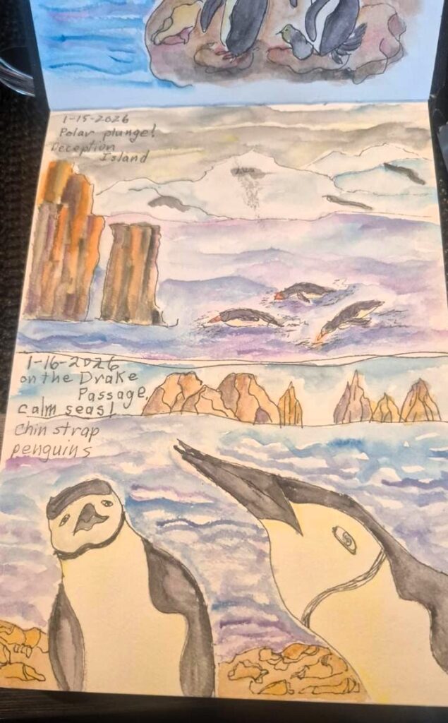
Thursday, Jan 15: Day 8: Deception Island, Telefon Bay, Edinburgh Hill
We visited Deception Island around 9:15 am. It is a unique island shaped like a horseshoe, with the center forming a massive volcanic caldera that is now filled with seawater. It is called Deception island, because from the outside it looks like a big landmass, but when you come into the harbor, you realize it is a big volcanic caldera surrounded by land.
Just approaching the island already felt different from everything we had seen so far.
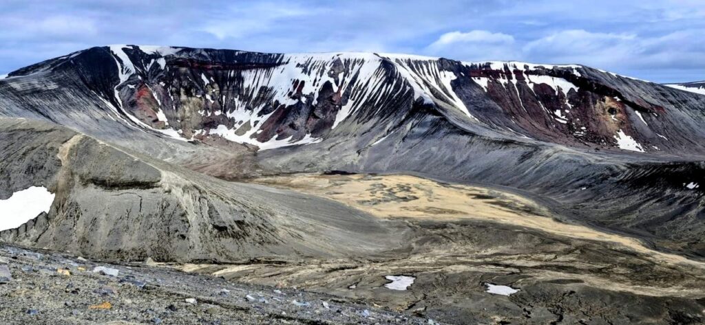
The island also has two glaciers.
Therefore, it is called the island of fire and ice.

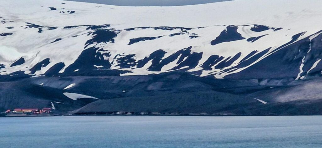
We landed at Telefon Bay inside the Deception Island caldera. From there, we had a hike of about 3 km with a 700 ft climb to the top of the hill. The hike offered views of the entire caldera, along with the Spanish and Argentinian research stations spread across the landscape.
The views were fantastic. The scale of the caldera really hit home once we reached the top.
After the hike around Telefon Bay, we had an opportunity to do a polar plunge in the ice-cold waters off Antarctica. It felt like a once-in-a-lifetime chance.
So we decided to take the plunge. The water was really cold, but once we got out, it felt reasonably warm. They had towels waiting for us to dry up, which was much appreciated.
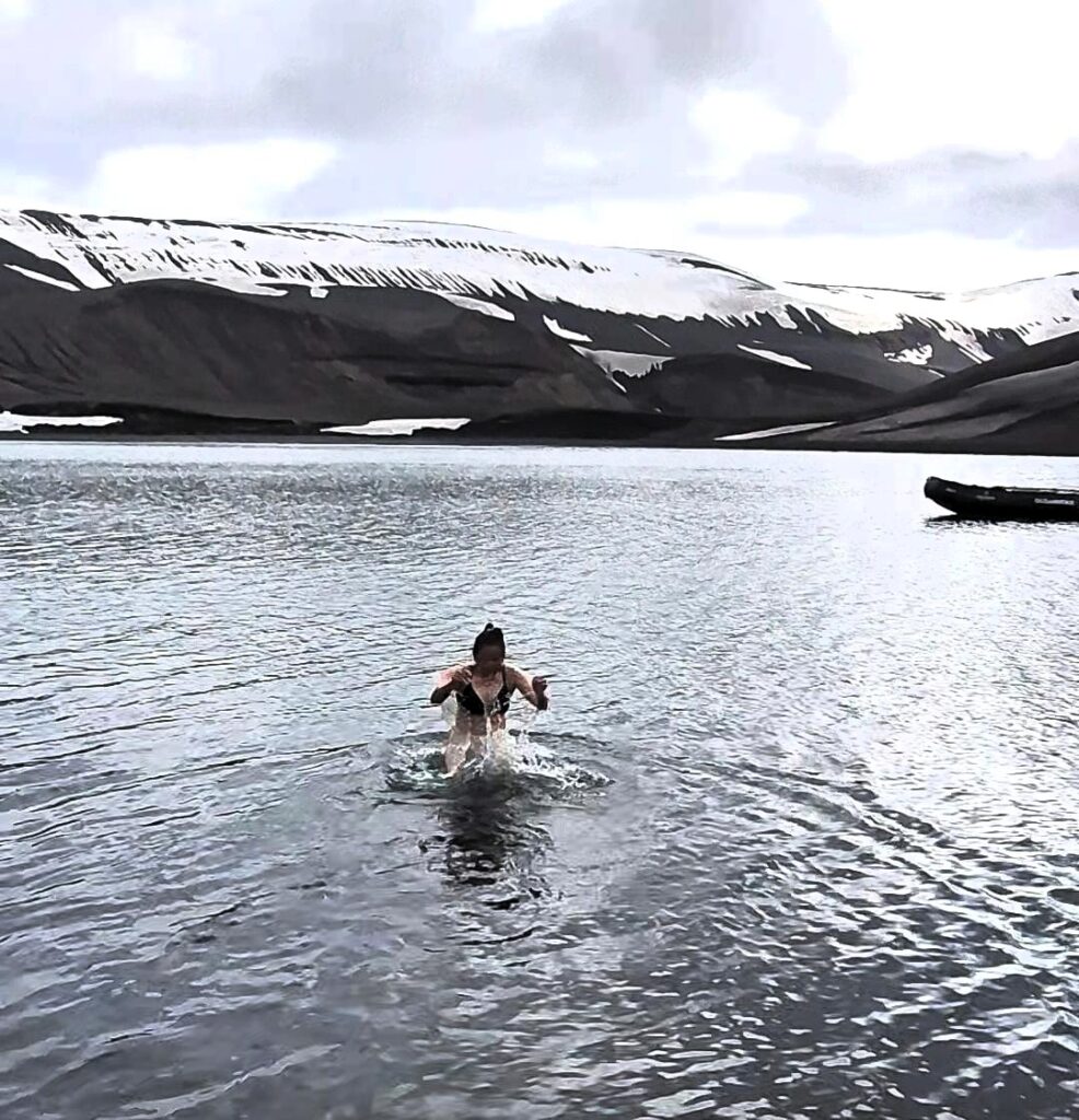
We felt quite refreshed after the plunge. In the afternoon, around 5 pm, we went on a zodiac cruise around Edinburgh Island.
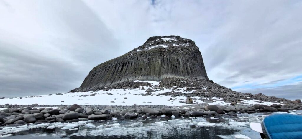
This rock formation is made up of hexagonal basalt columns, giving it a very striking appearance.
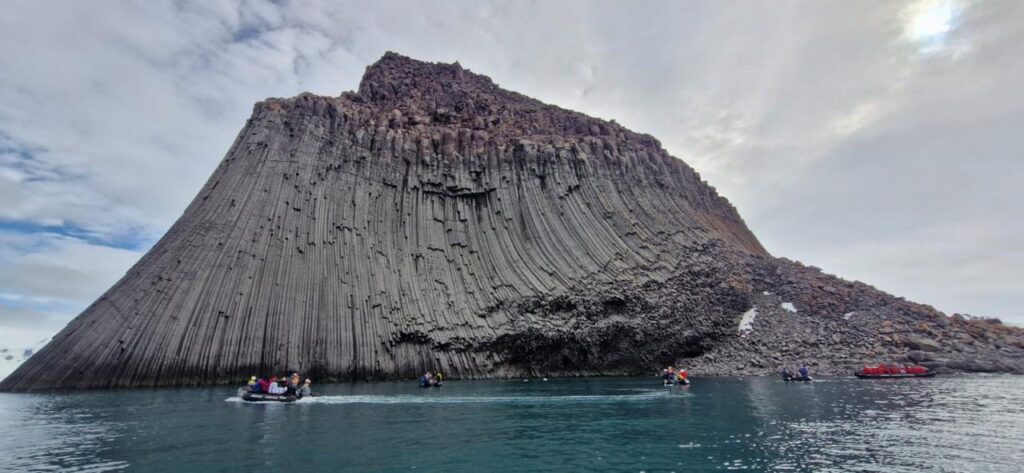
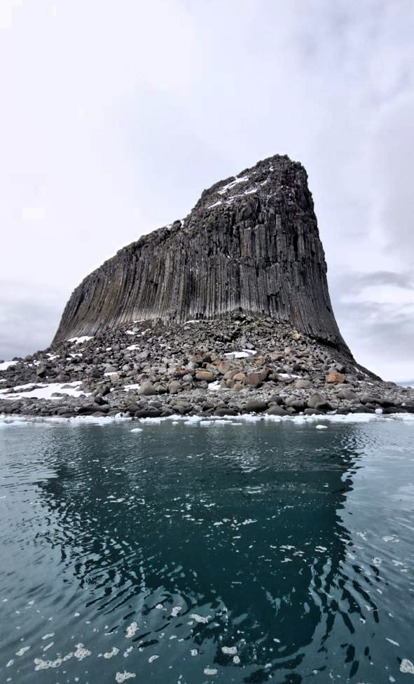

I have seen similar hexagonal columns in California, Iceland, and Armenia. They are pretty cool!
Our final rendezvous in Antarctica was with a leopard seal, happily lying on an iceberg and yawning lazily. It felt like a perfect closing moment.
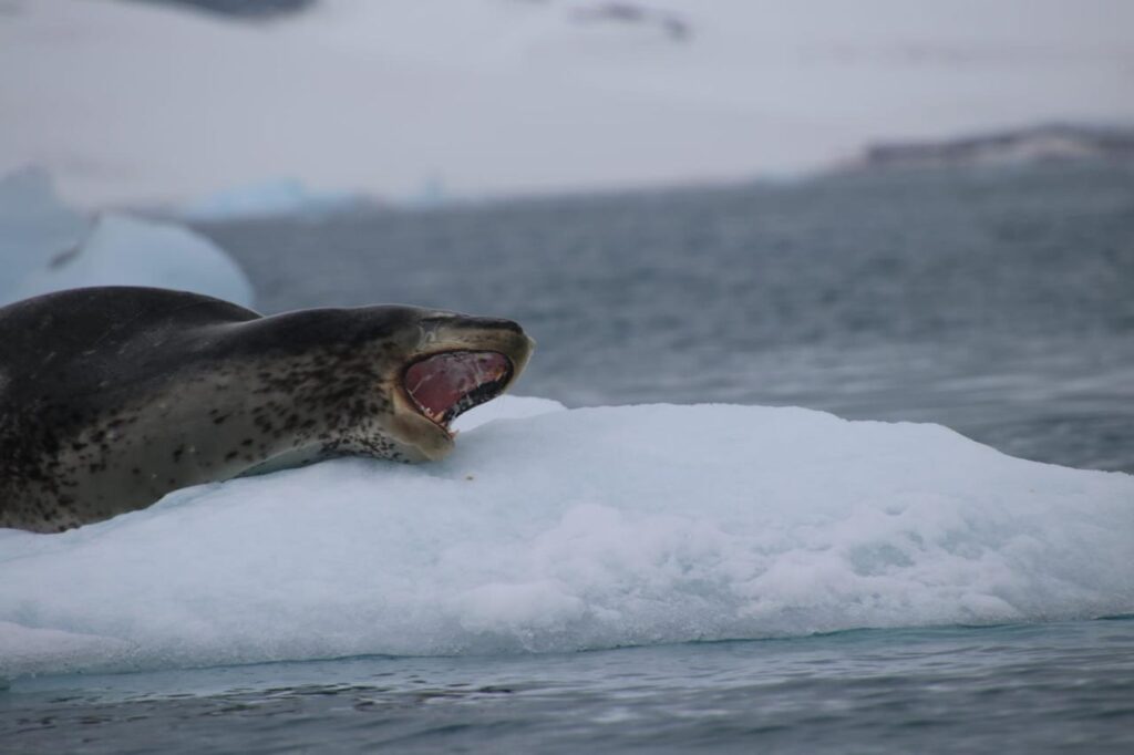
We got pretty close to it before finally heading back to the ship around 6:30 pm.
This marked our last outdoor activity in Antarctica before we headed back into the Drake Passage on our way to Ushuaia, Argentina.
We would now spend the next two days crossing the 800 km Drake Passage.
Friday, Jan 16: Day 9: Drake Passage (Return)
Today was a leisurely day, with no wake-up call. Breakfast was at 8 am, followed by a lecture at 10 am about life at the New Zealand Antarctic station. After several intense days of activity, the slower pace felt welcome.
We were cruising through the Drake Passage on our way back to Ushuaia.
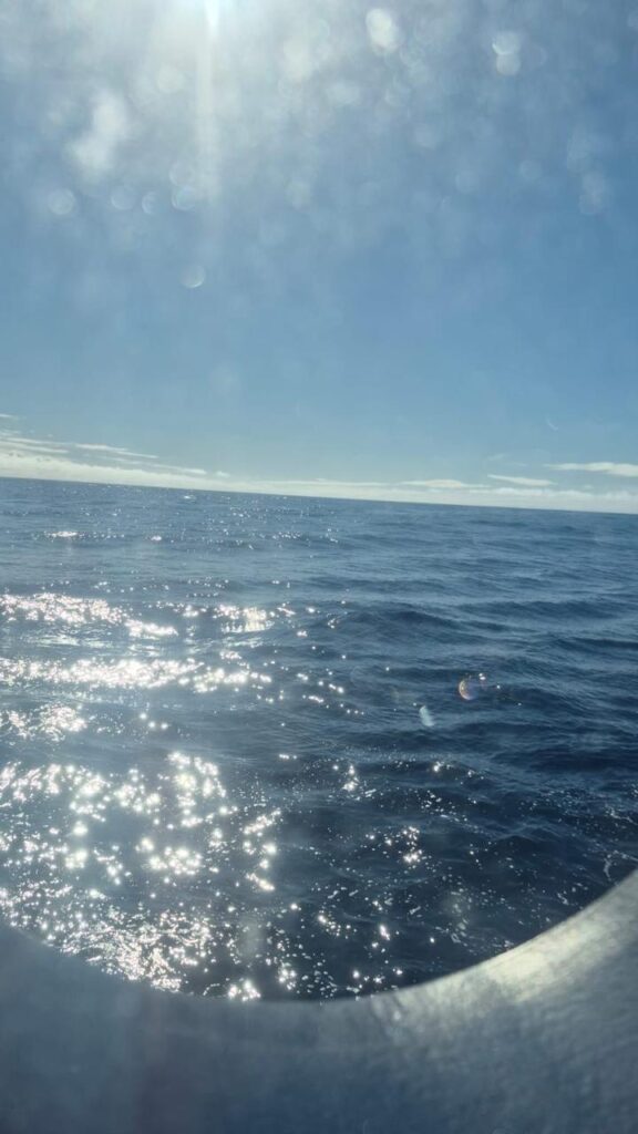
The weather was bright and sunny, and the open seas in the Drake Passage were relatively quiet. It was a calm crossing so far, a pleasant contrast to the reputation of these waters.
The expedition was now coming to a close in a couple of days. We would be in the open seas of the 800 km Drake Passage for the next two days, away from most of the action. There was time to slow down and reflect on everything we had experienced.
This trip has been a total treat, a world apart from our daily lives. It was fascinating to observe the natural ecosystem and the food cycle in Antarctica, so raw and undisturbed.
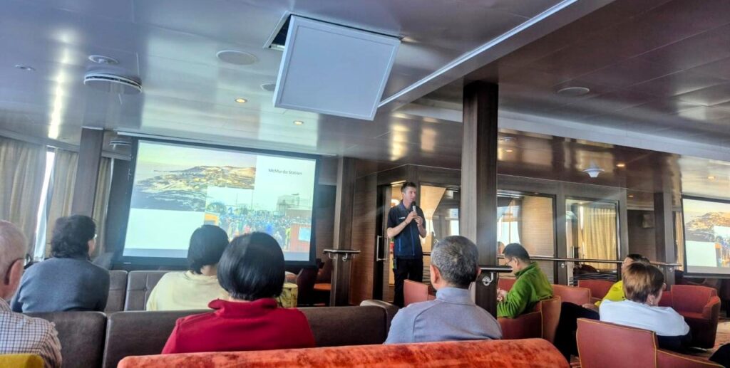
At 10 am, we attended a presentation by Chris Long, the expedition leader, about the six months he spent at the Scott Antarctic New Zealand research station. It offered a glimpse into what life is like in such an extreme environment.
I learned that Antarctica gets very little rain and experiences heavy winds, sometimes exceeding 100 kmph. Antarctic is called a polar desert.
At 11:20 am, Jade Heister delivered a presentation on how Antarctic animals adapt to the cold environment—covering food, breathing, swimming, and reproduction. The science behind survival in these conditions was truly fascinating.
One interesting fact was that Weddell seals can decide when their embryo develops based on environmental conditions. Their bodies determine the timing of embryo development.
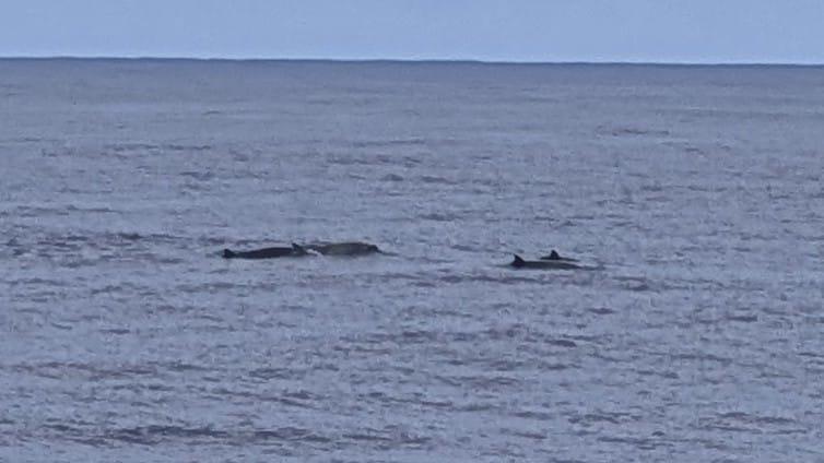
We also briefly interrupted the presentation to see some spade-toothed whales. It is a rare species of whales!
Lunch brought a very pleasant surprise. Gaurav Bawa, the head chef, is an Indian from Delhi.
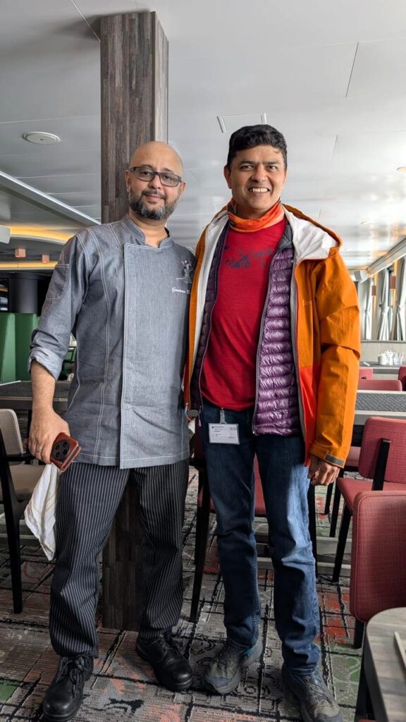
We were talking about how Indian food is soul food, and for lunch, he cooked black Delhi chhola bhatura with pyaaz.
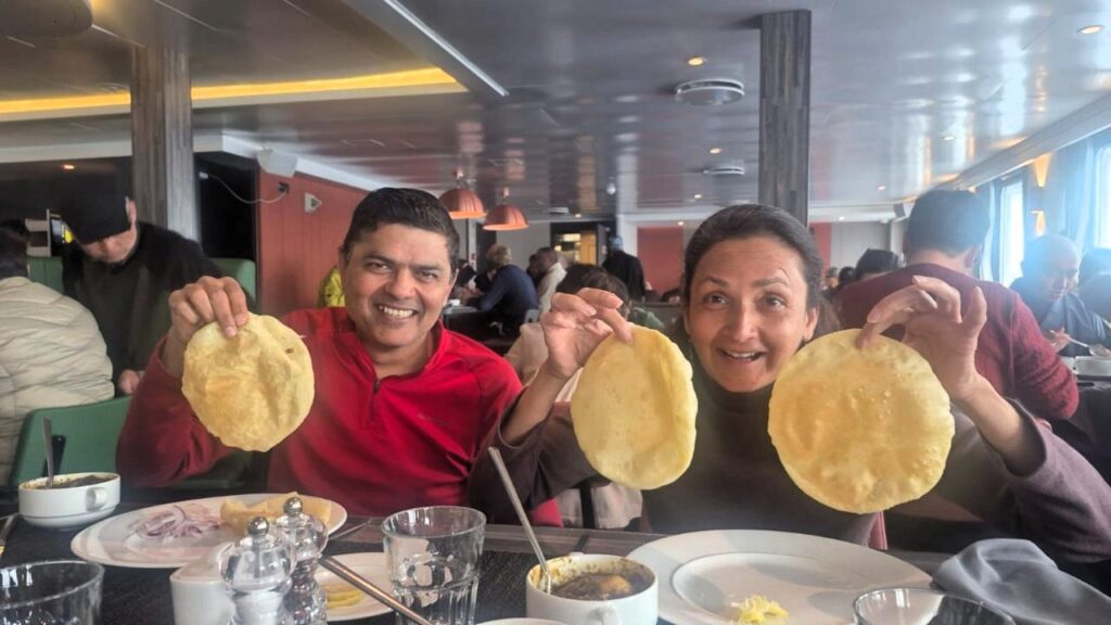
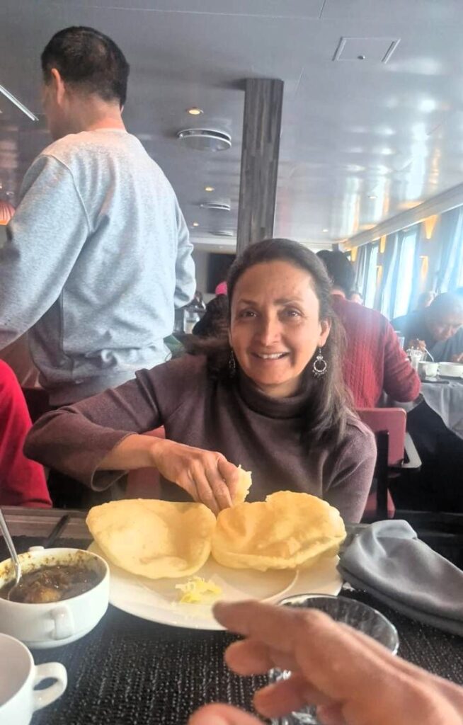
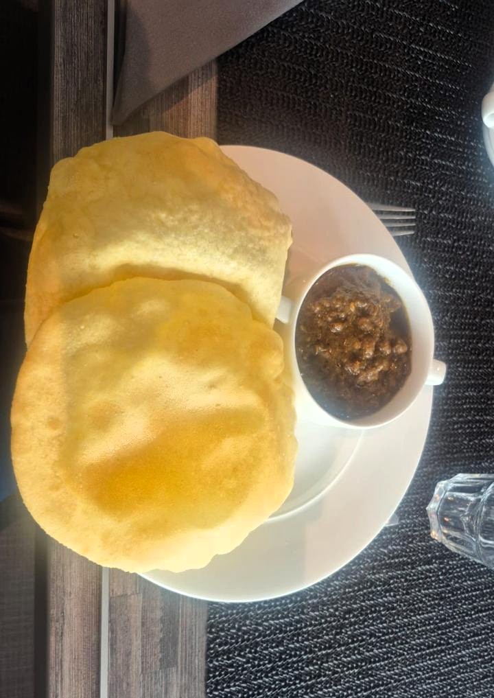
Our delight was unimaginable!
At 4:15 pm on Jan 16, Jodi Gaylord gave a presentation about the race to the South Pole between Ronald Amundsen, a Norwegian, and Robert Scott, an Englishman.
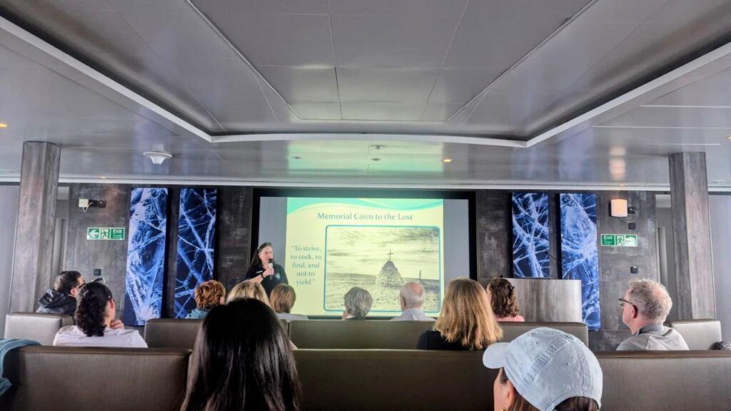
Amundsen reached the South Pole first in December 1911, a month before Scott. Scott and his teammates died on their return journey. Jodi narrated the story in a very engaging and interesting way.
Saturday, Jan 17: Day 10: Drake Passage Crossing
This was our second day on the Drake Passage as we made our way back to Ushuaia.
The seas were fairly calm, with no major turbulence. Unlike what we had read in blogs and seen in videos, the Drake Passage had been kind to us throughout the journey. We knew how lucky we were.

Around 1 pm, we passed Cape Horn (Isla de Hornos), the southernmost point of South America. It felt special to cross such a historic landmark, even from a distance.
Before the Panama Canal opened in 1914, sailors had to go all the way around Cape Horn at the southern tip of South America to travel from the Pacific Ocean to the Atlantic Ocean.
We also met Tyler from Oregon, who did not take photos in Antarctica. Instead, she remembered the scenes in her head and later drew them using crayons and watercolors.
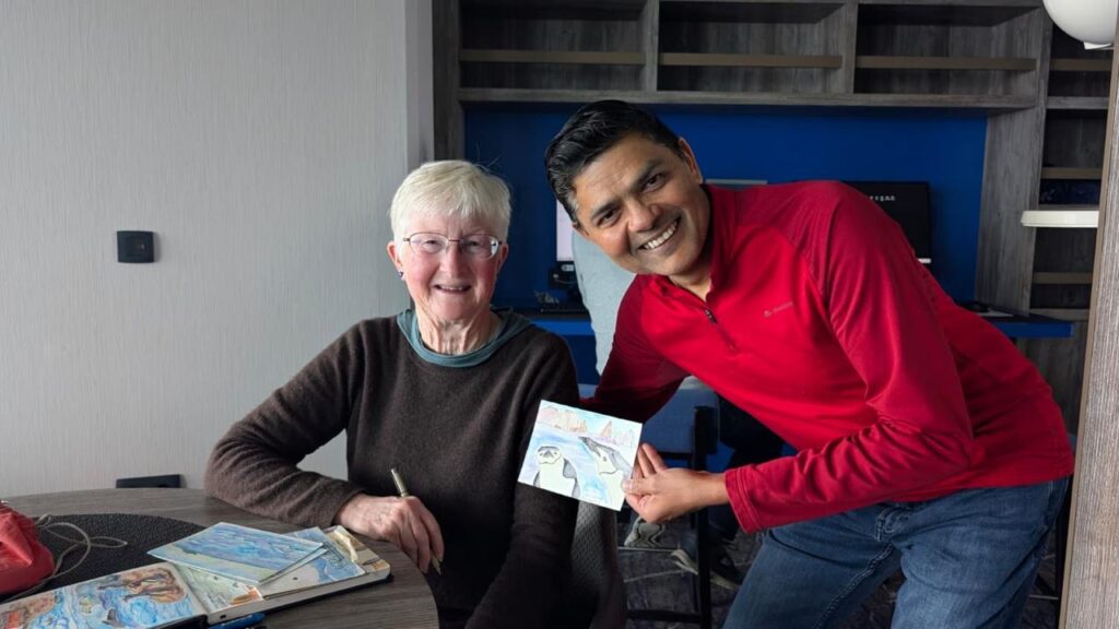
It was a lovely reminder that everyone experiences travel differently.
In the evening, we had our farewell dinner.
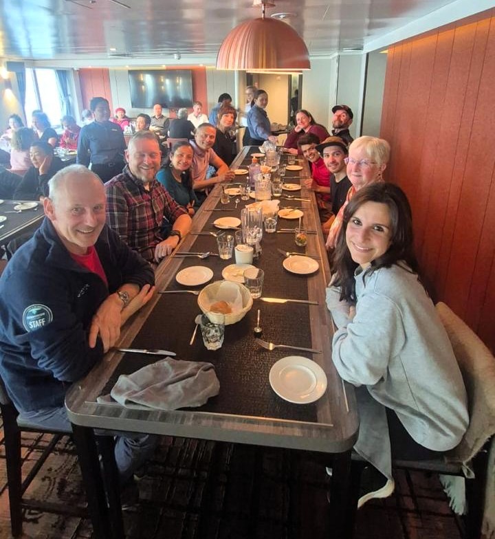
We got a chance to clap for the staff and truly appreciate them for everything they had done during the expedition. For dinner, we had Madras curry with rice and papad. This was our last dinner on the ship, and it felt both comforting and bittersweet
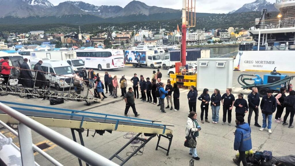
Sunday, Jan 18: Day 11: Disembarkation at Ushuaia, Argentina
The ship had docked at the Ushuaia port sometime during the early morning hours.
We woke up at 6 am, had breakfast, and took a bath before preparing to leave the ship.
We disembarked at 8:30 am. As we exited, the expedition team lined up to shake hands with us. It was a warm and personal farewell after days of shared experiences.
We left the ship with invaluable memories of our trip to Antarctica—penguins, whales, icebergs, polar landscapes, zodiac rides, kayaking, camping in the snow, the ice-cold polar plunge, the Drake Passage, and so much more.
Here are some observations I gathered during our Antarctica trip:
- The name Arctic comes from the Greek word arktos, meaning “bear.” In contrast, the word anta is synonymous with anti, which means “opposite”, translating Antarctica as “opposite bear” or “no bear”.
- Antarctica is protected by the treaty of 1959 initially signed by 12 nations and now 58 nations. It is open only for scientific exploration, but not for exploitation of natural resources or military purposes. No nation is allowed to have a claim on the land.
- Antarctica is a desert. It gets very little rainfall, only 6.5 inches per year on an average.
- Antarctica is a tall continent. Average altitude is 8,000 ft above sea level
- Lemaire Channel was one of the most beautiful journeys during the trip
- We were really lucky with Drake Passage, where we got mild (10 ft)waves during both passages, back and forth, compared to 40-50 ft waves that are often seen on the Drake passage.
Antarctica was definitely a trip of a lifetime!
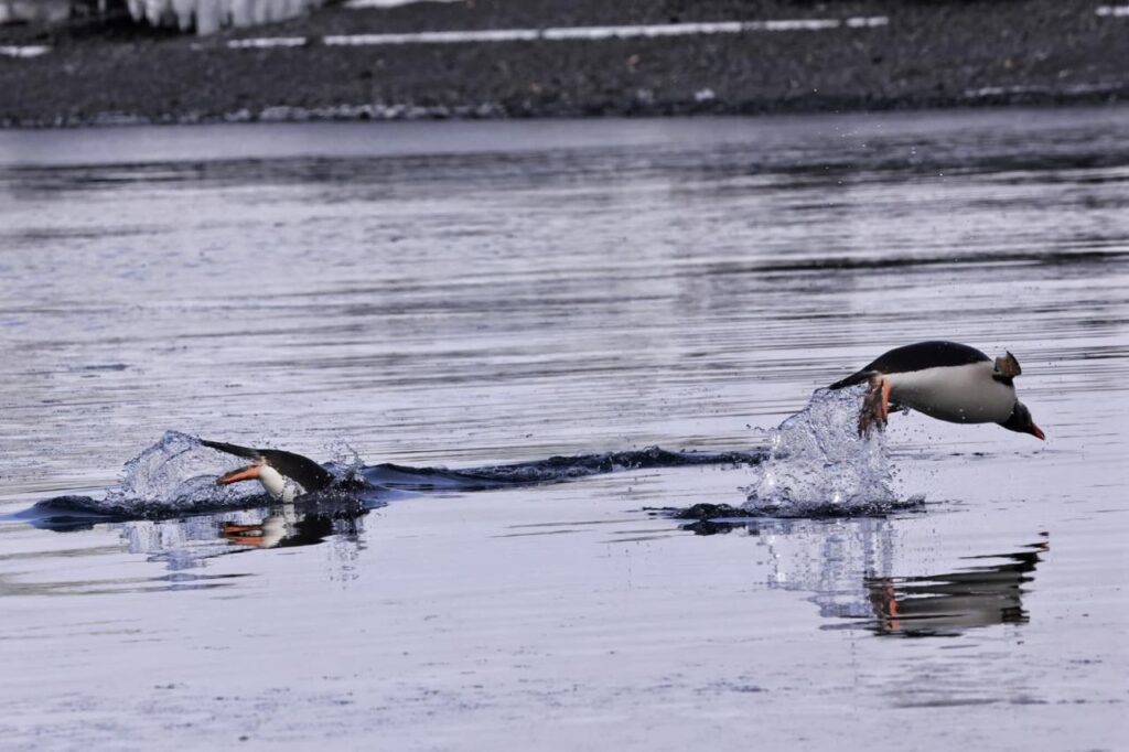
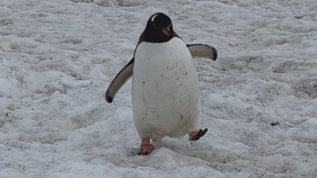
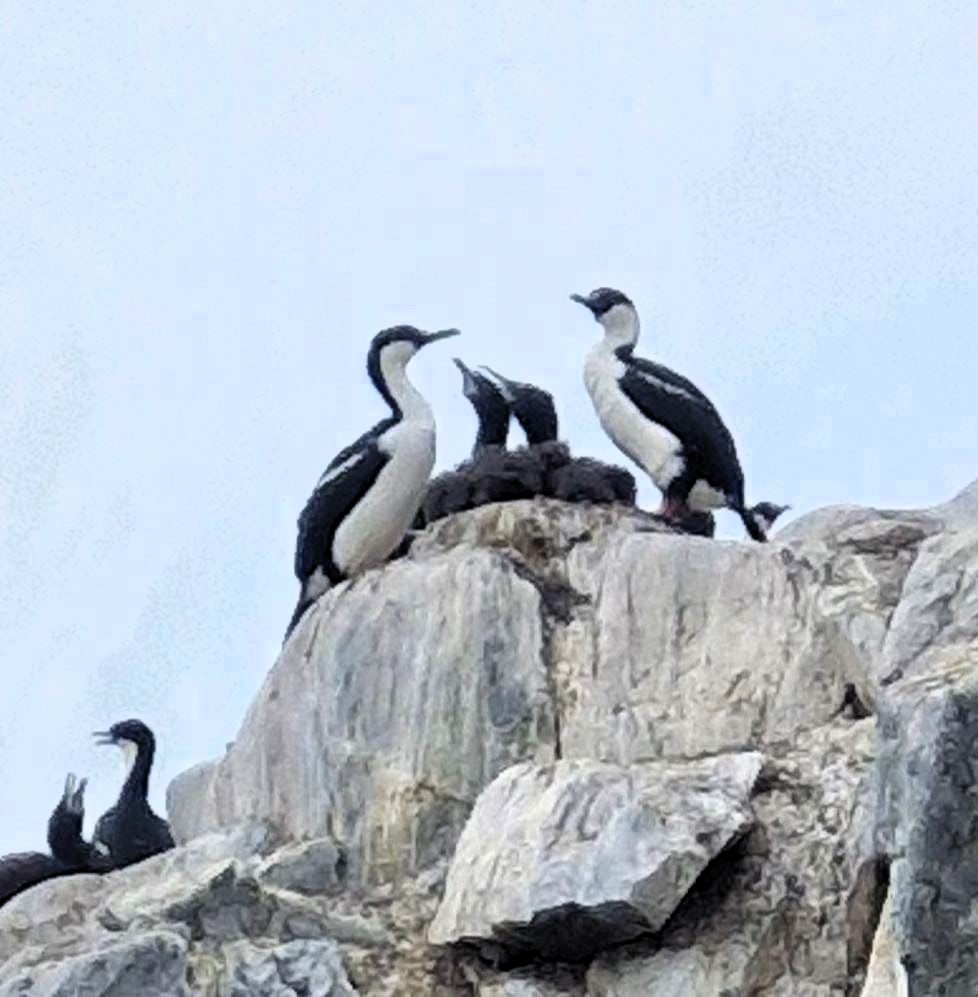
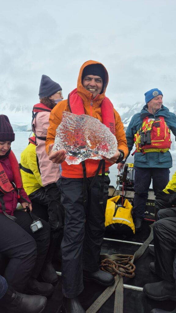
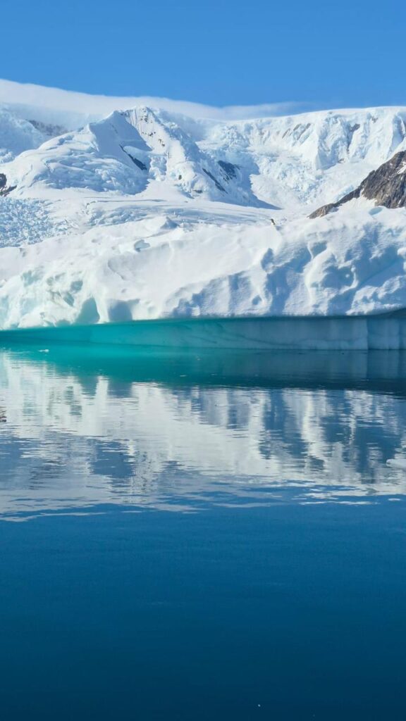
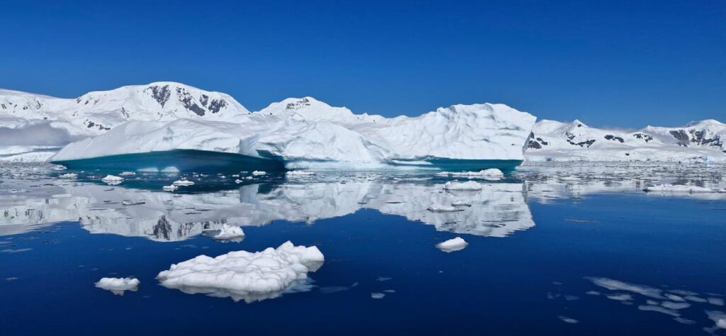
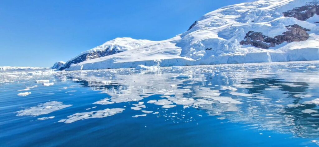
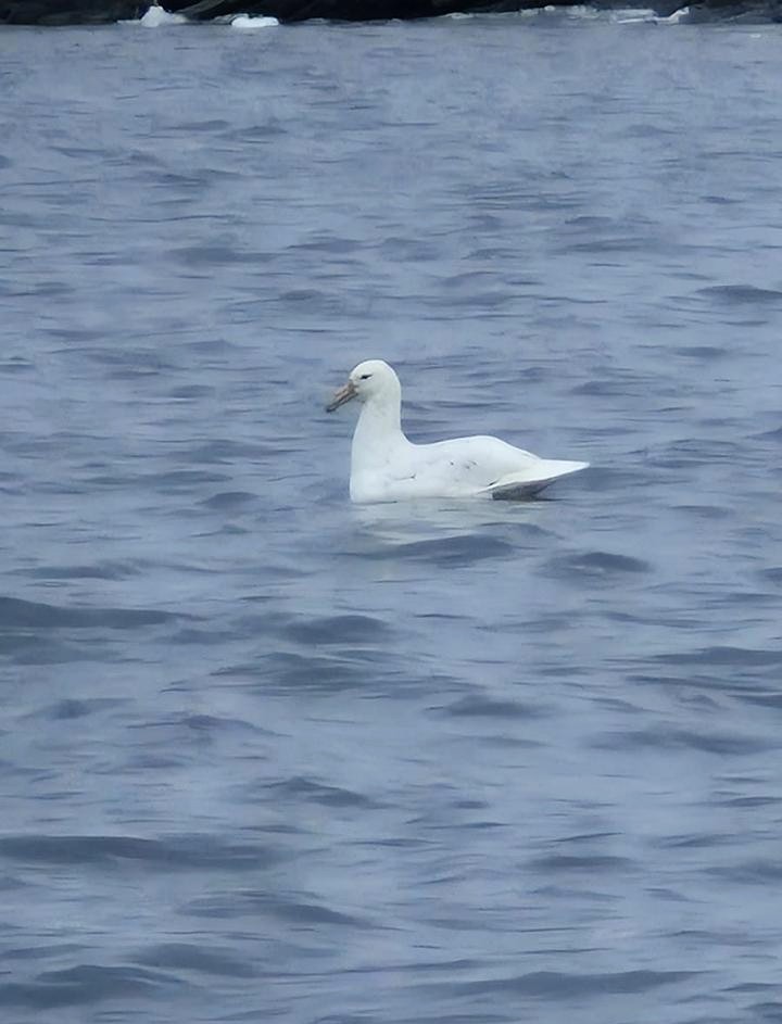
Here are a few more photographs capturing the wildlife and natural landscapes from the trip.
The infinite memories are in our heads, but we could not take enough pictures to do justice to what we witnessed and felt in the Antarctic. Here are some selected pictures that are the highlights of our experience.